Broom Hill

Hill, Mountain in Midlothian

Scotland

Broom Hill

Harperrig Reservoir and East Cairn Hill A frozen Harperrig Reservoir during what has otherwise been one of those horrible mild and stormy winters.
Harperrig Reservoir and East Cairn Hill Credit: Richard Webb

Broom Hill, located in Midlothian, Scotland, is a prominent hill in the area known for its scenic beauty and historical significance. Standing at an elevation of approximately 284 meters (932 feet), it offers breathtaking views of the surrounding countryside.

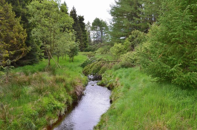
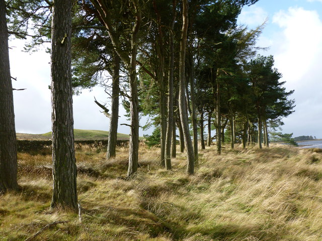
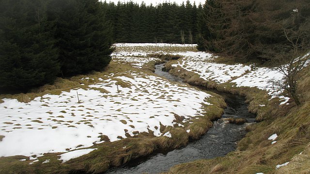
The hill is covered in lush green vegetation, primarily consisting of heather, grasses, and scattered trees. This makes it an ideal spot for nature lovers and hikers, who can enjoy exploring its diverse flora and fauna. Broom Hill is also home to various bird species, including buzzards and kestrels, making it a popular destination for birdwatching enthusiasts.

Historically, Broom Hill holds significance as it was once a site of an Iron Age hillfort, dating back to approximately 2000 years ago. The remains of the fort can still be seen today, with remnants of ancient earthworks and defensive ditches. These archaeological features provide valuable insights into the region's past and attract archaeology enthusiasts and historians.

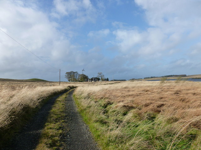
Accessible by a network of well-maintained footpaths, Broom Hill offers a range of recreational activities. Visitors can embark on leisurely walks or more challenging hikes, taking in the stunning panoramic views from the summit. The hill is also a great spot for picnics, allowing visitors to relax and soak in the natural beauty of the area.

Overall, Broom Hill is a captivating destination that combines natural splendor with a rich historical heritage. Its picturesque landscapes and ancient remains make it an attractive location for outdoor enthusiasts, history buffs, and those seeking a tranquil escape in the Midlothian region.

If you have any feedback on the listing, please let us know in the comments section below.

Broom Hill Images

Images are sourced within 2km of 55.829697/-3.4409267 or Grid Reference NT0960. Thanks to Geograph Open Source API. All images are credited.

Harperrig Reservoir and East Cairn Hill A frozen Harperrig Reservoir during what has otherwise been one of those horrible mild and stormy winters.
Harperrig Reservoir and East Cairn Hill
A frozen Harperrig Reservoir during what has otherwise been one of those horrible mild and stormy winters.
Baad Park Beside a frozen Harperrig Reservoir.
Baad Park
Beside a frozen Harperrig Reservoir.
The Water of Leith near West Cairns The headstreams on the slopes of West Cairn combine to become the Water of Leith near Colzium. It flows into Harperrig Reservoir and out to Balerno, from which it can be followed to Leith on the excellent footpath through Edinburgh.
The Water of Leith near West Cairns
The headstreams on the slopes of West Cairn combine to become the Water of Leith near Colzium. It flows into Harperrig Reservoir and out to Balerno, from which it can be followed to Leith on the excellent footpath through Edinburgh.
Looking north from West Cairn Hill Harperrig Reservoir and the flat expanse of moorland at Baad Park occupy the middle ground on this view from the north-east spur of the hill.
Looking north from West Cairn Hill
Harperrig Reservoir and the flat expanse of moorland at Baad Park occupy the middle ground on this view from the north-east spur of the hill.
Track to Baad Park This place name may derive from the Gaelic word 'bad' meaning thicket, tuft or clump.
Track to Baad Park
This place name may derive from the Gaelic word 'bad' meaning thicket, tuft or clump.
Scots pines by Harperrig Reservoir A plantation of mature trees near Baad Park.
Scots pines by Harperrig Reservoir
A plantation of mature trees near Baad Park.
Rainbow at Harperrig A view over the reservoir to the whitewashed farmhouse at Harperrig, in the Pentland Hills Regional Park.
Rainbow at Harperrig
A view over the reservoir to the whitewashed farmhouse at Harperrig, in the Pentland Hills Regional Park.
Disused Quarry, White Rig On the edge of the West Cairns Plantation, with East Cairns Hill in the background.
Disused Quarry, White Rig
On the edge of the West Cairns Plantation, with East Cairns Hill in the background.
East Burn, Colzium A rickerty bridge at the point where it enters the West Cairns Plantation
East Burn, Colzium
A rickerty bridge at the point where it enters the West Cairns Plantation
Tussocky fire break, West Cairns Plantation
West Cairns plantation from West Cairn Hill
New logging road, West Cairns Plantation Forest road, not yet shown on the maps. The road has been used to take two blocks of timber out of West Cairns Plantation, there is more there to be harvested in the next few years.
New logging road, West Cairns Plantation
Forest road, not yet shown on the maps. The road has been used to take two blocks of timber out of West Cairns Plantation, there is more there to be harvested in the next few years.
Water of Leith Far up the Water of Leith, now just a small burn north of Harperrig Reservoir.
Water of Leith
Far up the Water of Leith, now just a small burn north of Harperrig Reservoir.
New fence, Colzium A very new fence and gate with West Cairns Plantation in the background. Fencers will be busy now, not just on new ones like this, but repairing all the snow damaged ones from the winter now drawing to a close.
New fence, Colzium
A very new fence and gate with West Cairns Plantation in the background. Fencers will be busy now, not just on new ones like this, but repairing all the snow damaged ones from the winter now drawing to a close.
West Cairns Plantation In a clear felled block of West Cairns Plantation. View down a snow covered ride - one still containing deep wet snow accumulations as well as waist deep bogs.(at least waist deep - I did not touch the bottom)
West Cairns Plantation
In a clear felled block of West Cairns Plantation. View down a snow covered ride - one still containing deep wet snow accumulations as well as waist deep bogs.(at least waist deep - I did not touch the bottom)
East Burn A decaying bridge over the East Burn, Colzium. The bridge probably predates the planting of West Cairns Plantation. View in the opposite direction: <a href="https://www.geograph.org.uk/photo/106502">NT0958 : East Burn, Colzium</a>
East Burn
A decaying bridge over the East Burn, Colzium. The bridge probably predates the planting of West Cairns Plantation. View in the opposite direction: NT0958 : East Burn, Colzium
Ride, West Cairns Plantation Deep snow remains long after it had thawed on the surrounding moorland. As well as the snow, I managed to tread on some innocuous looking moss - much easier than the snow. A few steps later and the same moss patch had turned into at least a waist deep bog. You have been warned!
Ride, West Cairns Plantation
Deep snow remains long after it had thawed on the surrounding moorland. As well as the snow, I managed to tread on some innocuous looking moss - much easier than the snow. A few steps later and the same moss patch had turned into at least a waist deep bog. You have been warned!
Water of Leith, Colzium The defile carrying the Water of Leith has been used as a clay pigeon shooting venue, one of two in the Harperrig area.
Water of Leith, Colzium
The defile carrying the Water of Leith has been used as a clay pigeon shooting venue, one of two in the Harperrig area.
Show me another place!

Broom Hill is located at Grid Ref: NT0960 (Lat: 55.829697, Lng: -3.4409267)

Unitary Authority: West Lothian

Police Authority: The Lothians and Scottish Borders

What 3 Words

///conquest.fools.detergent. Near Kirknewton, West Lothian

Nearby Locations

Broom Hill

Related Wikis

Harperrig Reservoir

Harperrig Reservoir is a reservoir in West Lothian, Scotland, to the north of the Pentland Hills, four miles (6.4 km) south of Mid Calder. The Water of...
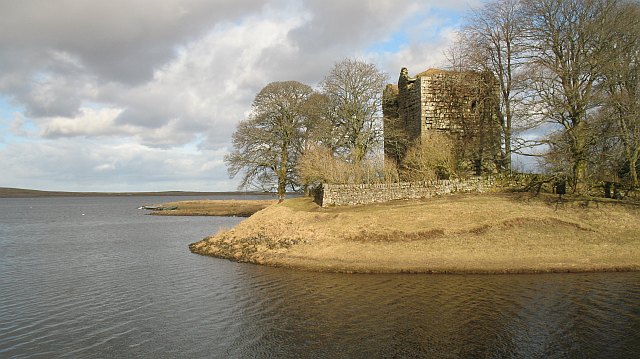
Cairns Castle

Cairns Castle is a ruined keep, dating from the 15th century. It is located on the northern slope of the Pentland Hills, around 6.5 miles (10.5 km) south...

West Cairn Hill

West Cairn Hill is a hill in the Pentland Hills range of Scotland. With a height of 562 m (1,844 ft), it is the fifth highest elevation and lies on the...

Cauldstane Slap

Cauldstane Slap is a pass located in the Pentland Hills of Scotland. It marks the border between the neighboring council areas of West Lothian and Scottish...

Nearby Amenities

Located within 500m of 55.829697,-3.4409267
The data included in this document is from www.openstreetmap.org. The data is made available under ODbL.

Have you been to Broom Hill?

Leave your review of Broom Hill below (or comments, questions and feedback).