Whitehope Knowe

Hill, Mountain in Dumfriesshire

Scotland

Whitehope Knowe

Hart Fell Summit A trig point marks the summit of Hart Fell at 808 metres.
Hart Fell Summit Credit: Robert Struthers

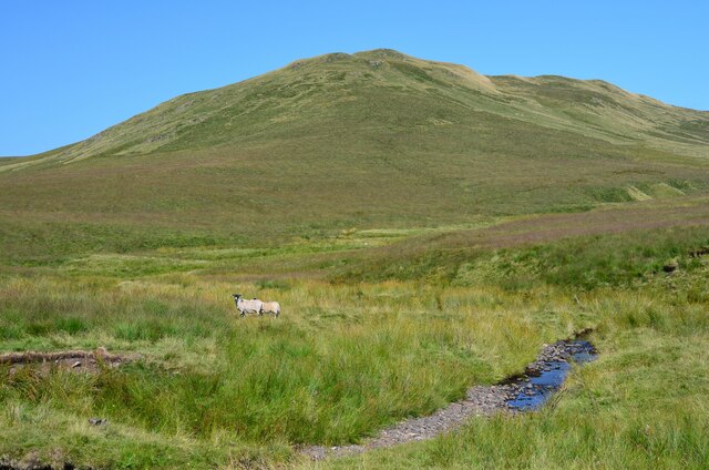
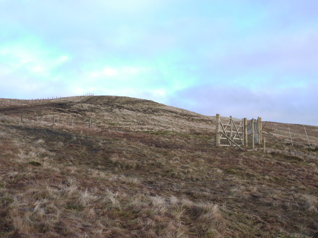
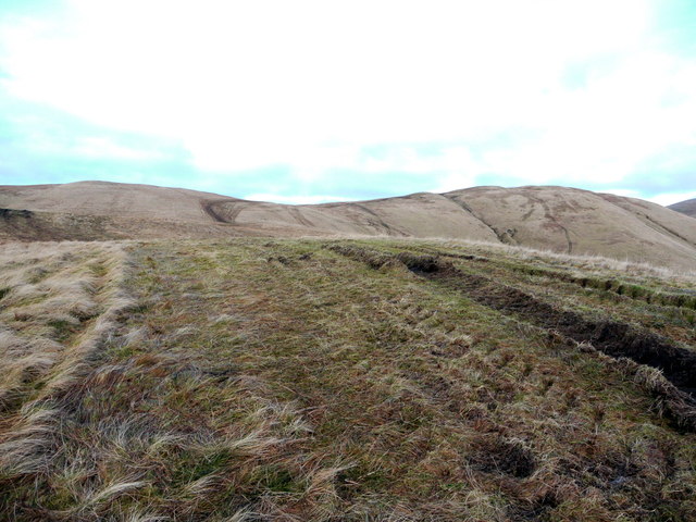
Whitehope Knowe is a prominent hill located in Dumfriesshire, Scotland. Situated within the Southern Uplands, it stands at an elevation of 417 meters (1,368 feet) above sea level. The hill is easily identifiable due to its rounded shape and picturesque scenery.

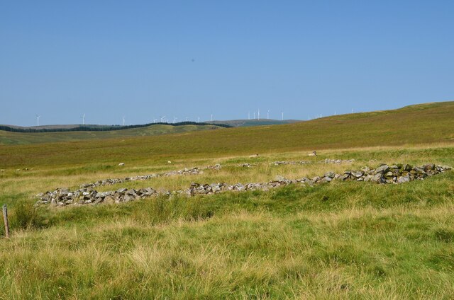
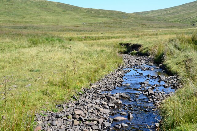
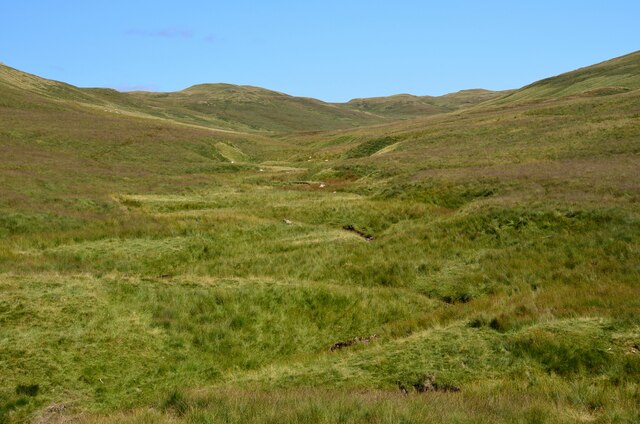
Covered in a mix of grassland and heather, Whitehope Knowe boasts a diverse range of flora and fauna, making it an attractive destination for nature enthusiasts. The hill provides habitat for various bird species, including skylarks and meadow pipits, as well as small mammals such as rabbits and hares.

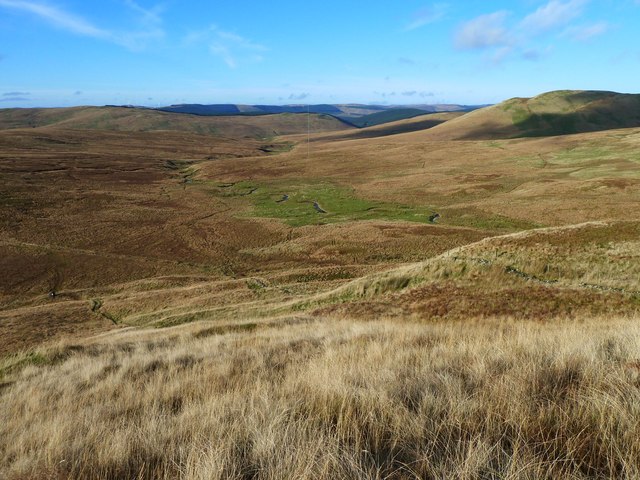
From the summit of Whitehope Knowe, visitors are rewarded with breathtaking panoramic views of the surrounding countryside. On a clear day, one can admire the rolling hills of Dumfriesshire, the lush farmland, and the distant peaks of the Galloway Forest Park.

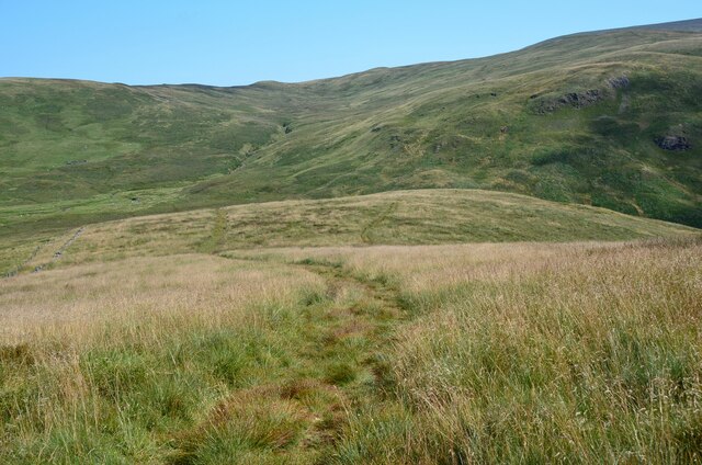
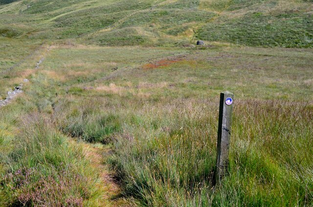
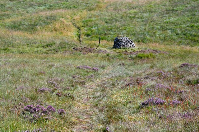
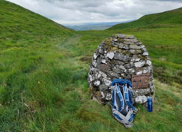
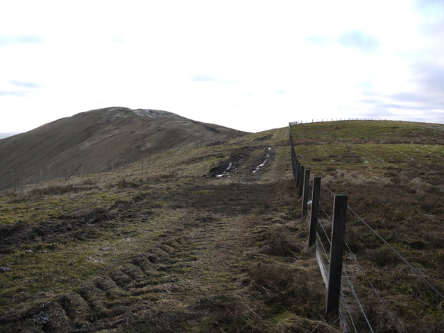
Whitehope Knowe is a popular destination for outdoor activities such as hillwalking and hiking. There are several well-marked trails that lead to the summit, offering different levels of difficulty to cater to various fitness levels. The hill is accessible year-round, although caution is advised during winter months when the weather conditions can be harsh and visibility may be limited.

Overall, Whitehope Knowe in Dumfriesshire is a charming hill that offers visitors the opportunity to immerse themselves in the natural beauty of the Scottish countryside. Whether seeking a peaceful walk or a challenging climb, this hill provides a memorable experience for all who venture to its summit.

If you have any feedback on the listing, please let us know in the comments section below.

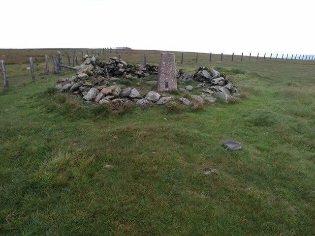
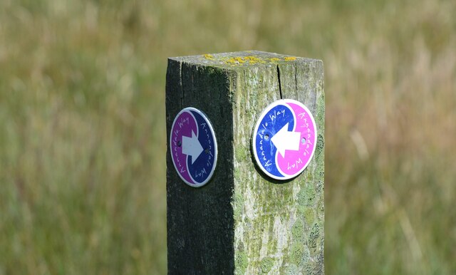
Whitehope Knowe Images

Images are sourced within 2km of 55.41448/-3.4261811 or Grid Reference NT0914. Thanks to Geograph Open Source API. All images are credited.

Hart Fell Summit A trig point marks the summit of Hart Fell at 808 metres.
Hart Fell Summit
A trig point marks the summit of Hart Fell at 808 metres.
Trig Point on Hart Fell The flat summit of Hart Fell looking towards Saddle Yold in the distance.
Trig Point on Hart Fell
The flat summit of Hart Fell looking towards Saddle Yold in the distance.
Towards Hart Fell summit Approaching the summit from the south.
Towards Hart Fell summit
Approaching the summit from the south.
East side of Chalk Rig Edge The path descends to the col where a cairn marks the source of the River Annan and the northern end of the Annandale Way. The hillside in the background has the highest of the headstreams of the River Tweed, in Whitehope Burn.
East side of Chalk Rig Edge
The path descends to the col where a cairn marks the source of the River Annan and the northern end of the Annandale Way. The hillside in the background has the highest of the headstreams of the River Tweed, in Whitehope Burn.
Annandale Way near the source of the River Annan The boggy area ahead is the source of the River Annan, marked by the cairn visible above centre. This is also on the E-W watershed of Scotland, since the Tweed rises in the hills immediately to the north, while the Annan flows south to the Solway Firth.
Annandale Way near the source of the River Annan
The boggy area ahead is the source of the River Annan, marked by the cairn visible above centre. This is also on the E-W watershed of Scotland, since the Tweed rises in the hills immediately to the north, while the Annan flows south to the Solway Firth.
Approaching the Annandale Way marker cairn This is the northern cairn on the Annandale Way, situated by the source of the River Annan. Curiously the Annan begins life as the Tweedhope Burn, yet the Tweed rises in the hills on the north side of this ridge, to flow northwards.

See <a href="https://www.geograph.org.uk/photo/6905607">NY1864 : End point of the Annandale Way</a> for the corresponding cairn on the Solway coast where the River Annan meets the sea.
Approaching the Annandale Way marker cairn
This is the northern cairn on the Annandale Way, situated by the source of the River Annan. Curiously the Annan begins life as the Tweedhope Burn, yet the Tweed rises in the hills on the north side of this ridge, to flow northwards. See NY1864 : End point of the Annandale Way for the corresponding cairn on the Solway coast where the River Annan meets the sea.
Northern end of the Annandale Way The northern end is on a loop of the route from Moffat, rising to the ridge above the Devil's Beef Tub for a fine 3km high-level walk to the cairn at this point marking the source of the River Annan. Descent is via Tweedhope to return to Moffat via Ericstane.
Northern end of the Annandale Way
The northern end is on a loop of the route from Moffat, rising to the ridge above the Devil's Beef Tub for a fine 3km high-level walk to the cairn at this point marking the source of the River Annan. Descent is via Tweedhope to return to Moffat via Ericstane.
Sheepfold by Whitehope Burn The remains of a drystone sheepfold contrasting with the turbines of the Clyde Wind Farm on the skyline.
Sheepfold by Whitehope Burn
The remains of a drystone sheepfold contrasting with the turbines of the Clyde Wind Farm on the skyline.
Whitehope Burn A contender for the source of the Tweed, as it rises significantly higher than the Tweed's Well about 3km to the west.
Whitehope Burn
A contender for the source of the Tweed, as it rises significantly higher than the Tweed's Well about 3km to the west.
The Crown of Scotland A fine name for one hill among many in the moorland N of Hart Fell, seen here across the Whitehope Burn.
The Crown of Scotland
A fine name for one hill among many in the moorland N of Hart Fell, seen here across the Whitehope Burn.
Valley of the Powskein Burn The burn drains the hillsides between Crown of Scotland and Garelet Hill to the Cor Water which becomes the Tweed.
Valley of the Powskein Burn
The burn drains the hillsides between Crown of Scotland and Garelet Hill to the Cor Water which becomes the Tweed.
Annandale Way Marker Cairn Situated below Spout Craig is the Annandale Way marker cairn.
Annandale Way Marker Cairn
Situated below Spout Craig is the Annandale Way marker cairn.
Looking South From Whitehope Heights Looking South From Whitehope Heights over an area of rewilding which is ongoing. Middlefield Knowe is the bump in the centre of the photograph.
Looking South From Whitehope Heights
Looking South From Whitehope Heights over an area of rewilding which is ongoing. Middlefield Knowe is the bump in the centre of the photograph.
Whitehope Burn from Spout Craig Descending from Spout Craig an anemometer can be seen near the burn.
Whitehope Burn from Spout Craig
Descending from Spout Craig an anemometer can be seen near the burn.
Fence and track on The Gyle The tractor tracks have been caused by vehicle access for the extensive deer-fencing to protect an area of new, and not yet planted, forestry.
Fence and track on The Gyle
The tractor tracks have been caused by vehicle access for the extensive deer-fencing to protect an area of new, and not yet planted, forestry.
New deer-fence on Whitehope Heights This fence protects a huge area of new forestry planting. The fenced area seems to extend over an area to the SW of Hartfell and the access tracks have disrupted some of the paths in the area marked by the OS.
New deer-fence on Whitehope Heights
This fence protects a huge area of new forestry planting. The fenced area seems to extend over an area to the SW of Hartfell and the access tracks have disrupted some of the paths in the area marked by the OS.
Looking up the south-west ridge of Whitehope Heights The tractor tracks have been caused by vehicle access for the extensive deer-fencing to protect an area of new, and not yet planted, forestry.
Looking up the south-west ridge of Whitehope Heights
The tractor tracks have been caused by vehicle access for the extensive deer-fencing to protect an area of new, and not yet planted, forestry.
New track on Cocklaw Knowe The track has been built for vehicle access for the extensive deer-fencing to protect an area of new, and not yet planted, forestry.
New track on Cocklaw Knowe
The track has been built for vehicle access for the extensive deer-fencing to protect an area of new, and not yet planted, forestry.
Show me another place!

Whitehope Knowe is located at Grid Ref: NT0914 (Lat: 55.41448, Lng: -3.4261811)

Unitary Authority: Dumfries and Galloway

Police Authority: Dumfries and Galloway

What 3 Words

///pioneered.former.among. Near Moffat, Dumfries & Galloway

Nearby Locations

Whitehope Knowe

Related Wikis

Hart Fell

Hart Fell is a hill in the Moffat Hills range, part of the Southern Uplands of Scotland. It lies north of the town of Moffat on the border with the Scottish...

Moffat Hills

The Moffat Hills are a range of hills in the Southern Uplands of Scotland. They form a roughly triangular shape with a west facing side, a north facing...

Devil's Beef Tub

The Devil's Beef Tub (Marquis of Annandale's Beef-Tub, Beef-Stand, MacCleran's Loup) is a deep, dramatic hollow in the hills north of the Scottish town...

Annanhead Hill

Annanhead Hill is a 478-metre (1,568 ft) summit in the Moffat Hills of Scotland. It lies on the boundary between the Scottish Borders and Dumfries and...

Nearby Amenities

Located within 500m of 55.41448,-3.4261811
Ford: yes
Lat/Long: 55.4151334/-3.4197978
The data included in this document is from www.openstreetmap.org. The data is made available under ODbL.

Have you been to Whitehope Knowe?

Leave your review of Whitehope Knowe below (or comments, questions and feedback).