White Ball Hill

Hill, Mountain in Somerset Somerset West and Taunton

England

White Ball Hill

Direction Sign – Signpost near White Ball in Sampford Arundel parish Located on the west side of a crossroads northeast of White Ball in Sampford Arundel parish. 4 arms and pyramid finial. See also <a title="https://www.geograph.org.uk/photo/2154974" href="https://www.geograph.org.uk/photo/2154974">Link</a>.

Milestone Society National ID: SO_ST1019A
Direction Sign – Signpost near White Ball in Sampford Arundel parish Credit: J Browne

White Ball Hill is a prominent hill located in Somerset, England. It is part of the Quantock Hills, a designated Area of Outstanding Natural Beauty. Rising to an elevation of 335 meters (1,100 feet), White Ball Hill offers breathtaking panoramic views of the surrounding countryside.

The hill is covered in a patchwork of grassland, heathland, and woodlands, providing a diverse habitat for a variety of flora and fauna. It is home to several species of birds, including buzzards, kestrels, and skylarks, which can often be spotted soaring above the slopes.

White Ball Hill is a popular destination for outdoor enthusiasts, offering numerous walking trails and bridleways that crisscross its slopes. The hill is also a favorite spot for paragliding and hang gliding due to its favorable wind conditions and open expanses.

At the summit of White Ball Hill, there is a large cairn, which marks the highest point of the hill. This spot is a popular viewpoint, allowing visitors to admire the stunning vistas of the surrounding countryside, including the Bristol Channel, the Quantock Hills, and the distant Exmoor National Park.

Access to White Ball Hill is relatively easy, with a car park located nearby and a network of footpaths leading up to the summit. The hill is also conveniently located close to the A358 road, making it easily accessible for visitors from Somerset and beyond.

Overall, White Ball Hill is a picturesque and accessible hill in Somerset, offering breathtaking views, diverse wildlife, and a range of outdoor activities for visitors to enjoy.

If you have any feedback on the listing, please let us know in the comments section below.

White Ball Hill Images

Images are sourced within 2km of 50.958591/-3.2920789 or Grid Reference ST0918. Thanks to Geograph Open Source API. All images are credited.

Direction Sign – Signpost near White Ball in Sampford Arundel parish Located on the west side of a crossroads northeast of White Ball in Sampford Arundel parish. 4 arms and pyramid finial. See also <a title="https://www.geograph.org.uk/photo/2154974" href="https://www.geograph.org.uk/photo/2154974">Link</a>.

Milestone Society National ID: SO_ST1019A
Direction Sign – Signpost near White Ball in Sampford Arundel parish
Located on the west side of a crossroads northeast of White Ball in Sampford Arundel parish. 4 arms and pyramid finial. See also Link. Milestone Society National ID: SO_ST1019A
Sampford Farm, Sampford Arundel
Railway bridge over the former A38
Sampford Arundel Primary School
Churchyard gates, Sampford Arundel Commemorate Queen Victoria's Diamond Jubilee 1897 <span class="nowrap"><a title="https://historicengland.org.uk/listing/the-list/list-entry/1344595?section=official-list-entry" rel="nofollow ugc noopener" href="https://historicengland.org.uk/listing/the-list/list-entry/1344595?section=official-list-entry">Link</a><img style="margin-left:2px;" alt="External link" title="External link - shift click to open in new window" src="https://s1.geograph.org.uk/img/external.png" width="10" height="10"/></span>
Churchyard gates, Sampford Arundel
Commemorate Queen Victoria's Diamond Jubilee 1897 LinkExternal link
War memorial, Sampford Arundel Erected in 1921 <span class="nowrap"><a title="https://historicengland.org.uk/listing/the-list/list-entry/1436144?section=official-list-entry" rel="nofollow ugc noopener" href="https://historicengland.org.uk/listing/the-list/list-entry/1436144?section=official-list-entry">Link</a><img style="margin-left:2px;" alt="External link" title="External link - shift click to open in new window" src="https://s1.geograph.org.uk/img/external.png" width="10" height="10"/></span>
War memorial, Sampford Arundel
Erected in 1921 LinkExternal link
Church of the Holy Cross, Sampford Arundel The tower dates from the fifteenth century, most of the rest was rebuilt in the 1870s <span class="nowrap"><a title="https://historicengland.org.uk/listing/the-list/list-entry/1178017?section=official-list-entry" rel="nofollow ugc noopener" href="https://historicengland.org.uk/listing/the-list/list-entry/1178017?section=official-list-entry">Link</a><img style="margin-left:2px;" alt="External link" title="External link - shift click to open in new window" src="https://s1.geograph.org.uk/img/external.png" width="10" height="10"/></span>
Church of the Holy Cross, Sampford Arundel
The tower dates from the fifteenth century, most of the rest was rebuilt in the 1870s LinkExternal link
The churchyard, Sampford Arundel
Barn at Sampford Arundel
Grass field near Beam Bridge
Abandoned route of the A38, Beam Bridge
Field off Lane End
Field off Lane End
Old Milestone east of Beam Bridge, against old Toll House Metal plate attached to stone post by the UC road, in parish of Sampford Arundel (Taunton Deane
District), Beam Bridge, beside old toll house, against rendered wall, on East side of road. Taunton roll top iron plate, erected by the Taunton turnpike trust in the 19th century. An earlier photograph can be found here <a title="https://www.geograph.org.uk/photo/6035573" href="https://www.geograph.org.uk/photo/6035573">Link</a>.

Inscription reads:-
TAUNTON
9
MILES 

Somerset HER listed. HER number: 37673 <span class="nowrap"><a title="https://www.heritagegateway.org.uk/Gateway/Results_Single.aspx?uid=37673&resourceID=100" rel="nofollow ugc noopener" href="https://www.heritagegateway.org.uk/Gateway/Results_Single.aspx?uid=37673&resourceID=100">Link</a><img style="margin-left:2px;" alt="External link" title="External link - shift click to open in new window" src="https://s1.geograph.org.uk/img/external.png" width="10" height="10"/></span>

Milestone Society National ID: SO_TAEX09
Old Milestone east of Beam Bridge, against old Toll House
Metal plate attached to stone post by the UC road, in parish of Sampford Arundel (Taunton Deane District), Beam Bridge, beside old toll house, against rendered wall, on East side of road. Taunton roll top iron plate, erected by the Taunton turnpike trust in the 19th century. An earlier photograph can be found here Link. Inscription reads:- TAUNTON 9 MILES Somerset HER listed. HER number: 37673 LinkExternal link Milestone Society National ID: SO_TAEX09
Old Milestone in Sampford Arundel parish, west of Beam Bridge Metal plate attached to concrete post by the UC road, in parish of SAMPFORD ARUNDEL (TAUNTON DEANE District), West of Beam Bridge, in bank, on West side of road. Wiveliscombe iron plate, erected by the Wiveliscombe turnpike trust in the 19th century.

Inscription reads:-
WIVELISCOMBE
6
MILES

Grade II listed.
List Entry Number: 1344594 <span class="nowrap"><a title="https://historicengland.org.uk/listing/the-list/list-entry/1344594" rel="nofollow ugc noopener" href="https://historicengland.org.uk/listing/the-list/list-entry/1344594">Link</a><img style="margin-left:2px;" alt="External link" title="External link - shift click to open in new window" src="https://s1.geograph.org.uk/img/external.png" width="10" height="10"/></span>

Milestone Society National ID: SO_WVSP06.
Old Milestone in Sampford Arundel parish, west of Beam Bridge
Metal plate attached to concrete post by the UC road, in parish of SAMPFORD ARUNDEL (TAUNTON DEANE District), West of Beam Bridge, in bank, on West side of road. Wiveliscombe iron plate, erected by the Wiveliscombe turnpike trust in the 19th century. Inscription reads:- WIVELISCOMBE 6 MILES Grade II listed. List Entry Number: 1344594 LinkExternal link Milestone Society National ID: SO_WVSP06.
Higher Greenham Road junction on Fisher's Hill.
Higher Greenham
Road junction on Fisher's Hill.
Greenham Barton
Greenham Barton
Minor road, to Higher Greenham
Lane at Greenham Barton
Show me another place!

White Ball Hill is located at Grid Ref: ST0918 (Lat: 50.958591, Lng: -3.2920789)

Administrative County: Somerset

District: Somerset West and Taunton

Police Authority: Avon and Somerset

What 3 Words

///trappings.page.jaunts. Near Uffculme, Devon

Nearby Locations

White Ball White Ball Hill

Related Wikis

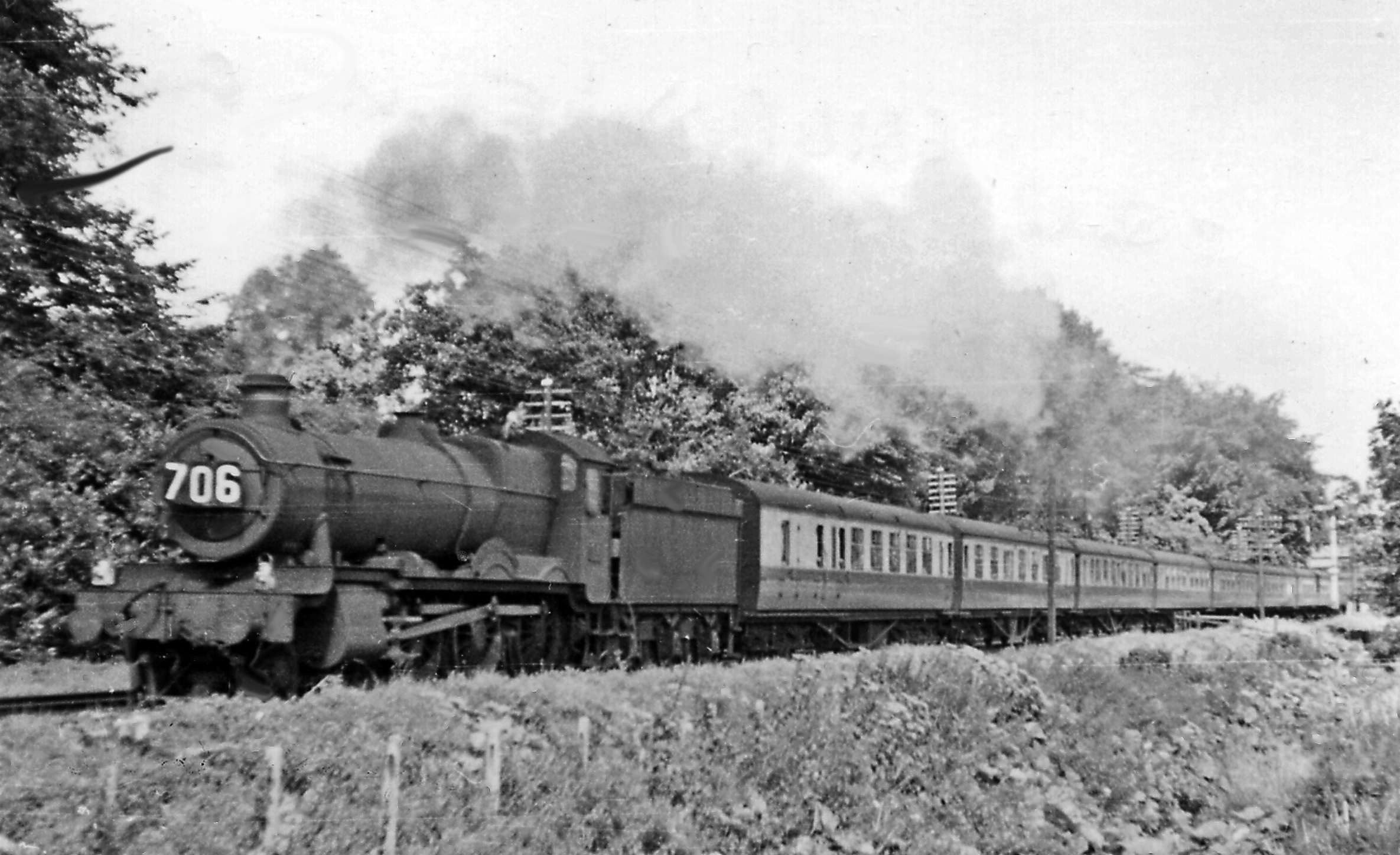
Wellington Bank, Somerset

Wellington Bank is a steep railway embankment and associated climb located on the Bristol to Exeter line, that climbs from just northeast of Wellington...
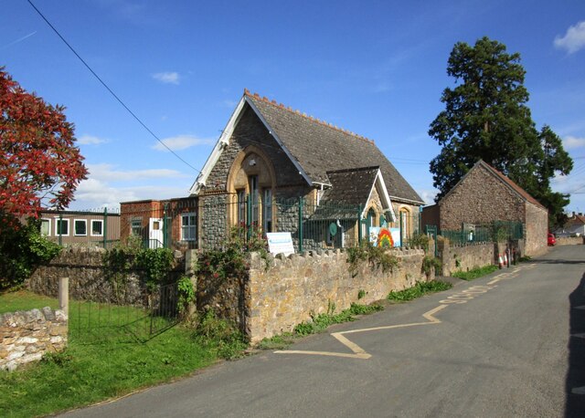
Sampford Arundel

Sampford Arundel is a village and civil parish in Somerset, England. It is situated near Wellington and 10 miles (16.1 km) south west of Taunton. The village...
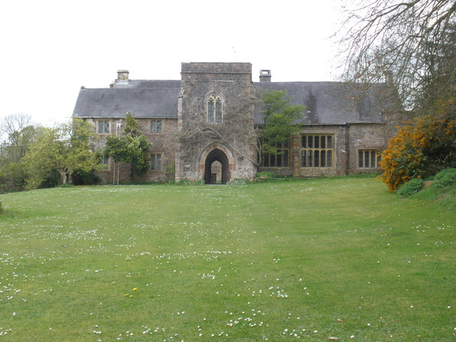
Greenham Barton

Greenham Barton is a 13th-century manor house in the civil parish of Stawley, Somerset, England (at Greenham, west of Wellington in Somerset). Built in...

Burlescombe

Burlescombe (, bur-LES-kəm) is a village and civil parish in the Mid Devon district of Devon, England. The parish is surrounded, clockwise from the north...

Greenham Hall

Greenham Hall is a country house at Wellington in Somerset. It was once the home of Admiral of the Fleet Sir John Kelly. It is a Grade II listed building...

Thorne St Margaret

Thorne St Margaret is a village in the civil parish of Wellington Without in the Taunton Deane district of Somerset, England. It is situated 3 miles west...

Church of St Margaret, Thorne St Margaret

The Anglican Church of St Margaret in Thorne St Margaret, Somerset, England was built in the 15th century. It is a Grade II* listed building. == History... ==

Canonsleigh Abbey

Canonsleigh Abbey was an Augustinian priory in the parish of Burlescombe, Devon. == History == It was founded in about 1170 by Walter de Claville, lord...

Nearby Amenities

Located within 500m of 50.958591,-3.2920789
White Ball Hill
Natural: peak
Lat/Long: 50.9558586/-3.2962439
Give Way
Lat/Long: 50.9580775/-3.2977626
Give Way
Lat/Long: 50.9580837/-3.2975674
Give Way
Lat/Long: 50.9592316/-3.2941546
Stop
Lat/Long: 50.9603446/-3.2973313
Give Way
Lat/Long: 50.9608514/-3.2906215
Give Way
Lat/Long: 50.9611957/-3.2897683
Give Way
Lat/Long: 50.9617395/-3.2876181
Power: pole
Lat/Long: 50.9613207/-3.2938653
Power: pole
Lat/Long: 50.9598763/-3.2940021
Power: pole
Lat/Long: 50.959165/-3.2986423
Power: pole
Lat/Long: 50.9625725/-3.2937473
Power: pole
Lat/Long: 50.9573894/-3.2960486
Power: pole
Lat/Long: 50.9592596/-3.2960433
Power: pole
Lat/Long: 50.959606/-3.295759
The data included in this document is from www.openstreetmap.org. The data is made available under ODbL.

Have you been to White Ball Hill?

Leave your review of White Ball Hill below (or comments, questions and feedback).