Archwood Hill

Hill, Mountain in Dumfriesshire

Scotland

Archwood Hill

A74(M) northbound
A74(M) northbound Credit: Alpin Stewart

Archwood Hill is a prominent natural landmark located in Dumfriesshire, Scotland. Standing at an elevation of approximately 492 feet (150 meters), it is considered a hill rather than a mountain. Situated in the southern part of the country, Archwood Hill is part of the beautiful and diverse Scottish landscape.

Covered in lush vegetation, Archwood Hill boasts a variety of flora and fauna, contributing to its natural beauty and ecological significance. The hill is particularly known for its dense woodland, which includes a mix of deciduous and coniferous trees, providing a habitat for numerous bird species and small mammals.

The summit of Archwood Hill offers stunning panoramic views of the surrounding countryside, showcasing the rolling hills and picturesque valleys that characterize Dumfriesshire. On clear days, it is possible to catch glimpses of nearby rivers and lochs that further enhance the area's scenic appeal.

Archwood Hill is a popular destination for outdoor enthusiasts, offering opportunities for hiking, walking, and exploring nature. Visitors can follow well-defined trails that wind their way through the hill, providing access to its various viewpoints and allowing for a closer look at the local wildlife.

Overall, Archwood Hill is a captivating natural feature in Dumfriesshire, offering both locals and tourists a chance to immerse themselves in the region's stunning landscapes and enjoy the tranquility and beauty that the area has to offer.

If you have any feedback on the listing, please let us know in the comments section below.

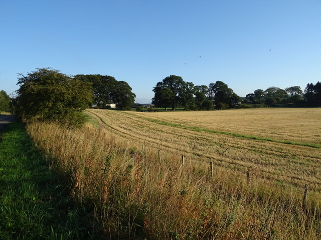
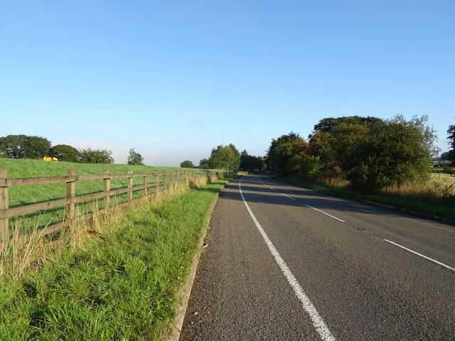
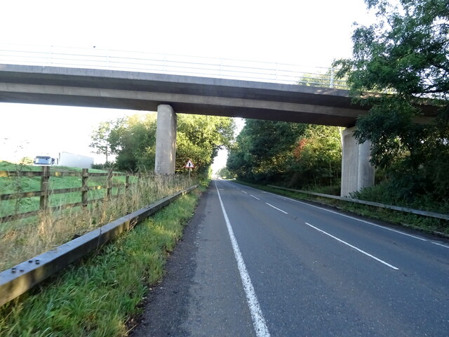
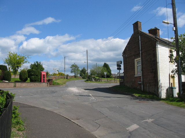
Archwood Hill Images

Images are sourced within 2km of 55.179979/-3.4302298 or Grid Reference NY0988. Thanks to Geograph Open Source API. All images are credited.

A74(M) northbound
A74(M) northbound
Birch woodland beside the A74(M) From the parallel B7076.
Birch woodland beside the A74(M)
From the parallel B7076.
B7076 towards Johnstonebridge Runs parallel to the A74(M) at this point.
B7076 towards Johnstonebridge
Runs parallel to the A74(M) at this point.
Stubble field, Dinwoodie Green
B7076 towards Johnstonebridge Runs parallel to the A74(M) at this point.
B7076 towards Johnstonebridge
Runs parallel to the A74(M) at this point.
Bridge over the B7076, Dinwoodie Green Towards Johnstonebridge.
Bridge over the B7076, Dinwoodie Green
Towards Johnstonebridge.
Roundabout on the B7076
National Cycle Route 74 Heading north towards Johnstonebridge.
National Cycle Route 74
Heading north towards Johnstonebridge.
Hangingshaw Cottages
B7076 towards Johnstonebridge Runs parallel to the A74(M) at this point.
B7076 towards Johnstonebridge
Runs parallel to the A74(M) at this point.
Arable land near Dinwoodie Mains 75% of the land of Dumfries and Galloway is given to agriculture
Arable land near Dinwoodie Mains
75% of the land of Dumfries and Galloway is given to agriculture
A74(M), southbound The A74(M) & M74  run over 80 miles from the M6 at the Scottish border near Gretna to the M8 at Glasgow. This is one of the two most important routeways into Scotland from the south. The last stretch of the M74 opened in 2011 (see <a title="https://www.geograph.org.uk/snippet/590" href="https://www.geograph.org.uk/snippet/590">Link</a> ).
Wikipedia: <span class="nowrap"><a title="http://en.wikipedia.org/wiki/A74(M)_and_M74_motorways" rel="nofollow ugc noopener" href="http://en.wikipedia.org/wiki/A74(M)_and_M74_motorways">Link</a><img style="margin-left:2px;" alt="External link" title="External link - shift click to open in new window" src="https://s1.geograph.org.uk/img/external.png" width="10" height="10"/></span>
A74(M), southbound
The A74(M) & M74 run over 80 miles from the M6 at the Scottish border near Gretna to the M8 at Glasgow. This is one of the two most important routeways into Scotland from the south. The last stretch of the M74 opened in 2011 (see Link ). Wikipedia: LinkExternal link
B7076 towards Lockerbie
B7076 towards Johnstonebridge
Bridge carrying a farm track over the M74 by Dinwoodie Green
Approaching Dinwoodie Green Access Bridge, A74(M) The A74(M) & M74  run over 80 miles from the M6 at the Scottish border near Gretna to the M8 at Glasgow. This is one of the two most important routeways into Scotland from the south. The last stretch of the M74 opened in 2011 (see <a title="https://www.geograph.org.uk/snippet/590" href="https://www.geograph.org.uk/snippet/590">Link</a> ).
Wikipedia: <span class="nowrap"><a title="http://en.wikipedia.org/wiki/A74(M)_and_M74_motorways" rel="nofollow ugc noopener" href="http://en.wikipedia.org/wiki/A74(M)_and_M74_motorways">Link</a><img style="margin-left:2px;" alt="External link" title="External link - shift click to open in new window" src="https://s1.geograph.org.uk/img/external.png" width="10" height="10"/></span>
Approaching Dinwoodie Green Access Bridge, A74(M)
The A74(M) & M74 run over 80 miles from the M6 at the Scottish border near Gretna to the M8 at Glasgow. This is one of the two most important routeways into Scotland from the south. The last stretch of the M74 opened in 2011 (see Link ). Wikipedia: LinkExternal link
Cattle grazing by the A74(M)
Farm track over A74(M) south at Dinwoodie Green
Show me another place!

Archwood Hill is located at Grid Ref: NY0988 (Lat: 55.179979, Lng: -3.4302298)

Unitary Authority: Dumfries and Galloway

Police Authority: Dumfries and Galloway

What 3 Words

///early.receiving.ballots. Near Johnstonebridge, Dumfries & Galloway

Related Wikis

Annandale Way

The Annandale Way is a 90-kilometre (56 mi) hiking trail in Scotland, which is officially designated by NatureScot as one of Scotland's Great Trails. It...

Corncockle Quarry

Corncockle Quarry was a large and historically important sandstone quarry near Templand in Dumfries and Galloway, Scotland. Stone from here was used in...

Templand

Templand is a village in Dumfriesshire, Scotland, located around 4.5 miles (7.2 km) northwest of Lockerbie. Templand was built during the Industrial Revolution...

Dinwoodie railway station

Dinwoodie railway station was a station which served the rural area around the settlement of Dinwoodie, 6 miles north of Lockerbie in Applegarth parish...

Nearby Amenities

Located within 500m of 55.179979,-3.4302298
Power: pole
Lat/Long: 55.1767929/-3.4250515
Power: pole
Lat/Long: 55.1775387/-3.4255718
Power: pole
Lat/Long: 55.1782638/-3.4260612
Power: pole
Lat/Long: 55.1789331/-3.4265017
Power: pole
Lat/Long: 55.1796097/-3.4269654
Power: pole
Lat/Long: 55.1802731/-3.4274213
Power: pole
Lat/Long: 55.1782918/-3.4249098
Power: pole
Lat/Long: 55.1807132/-3.4275933
Power: pole
Lat/Long: 55.1816104/-3.4271605
Power: pole
Lat/Long: 55.1823282/-3.4262229
Power: pole
Lat/Long: 55.1830724/-3.425293
The data included in this document is from www.openstreetmap.org. The data is made available under ODbL.

Have you been to Archwood Hill?

Leave your review of Archwood Hill below (or comments, questions and feedback).