Craigengar

Hill, Mountain in Peeblesshire

Scotland

Craigengar

Shooting hut below Fadden The hut and a nearby shed are at the end of the gravel track that comes up from the Slipperfield track. White Craig is in the background.
Shooting hut below Fadden Credit: Jim Barton

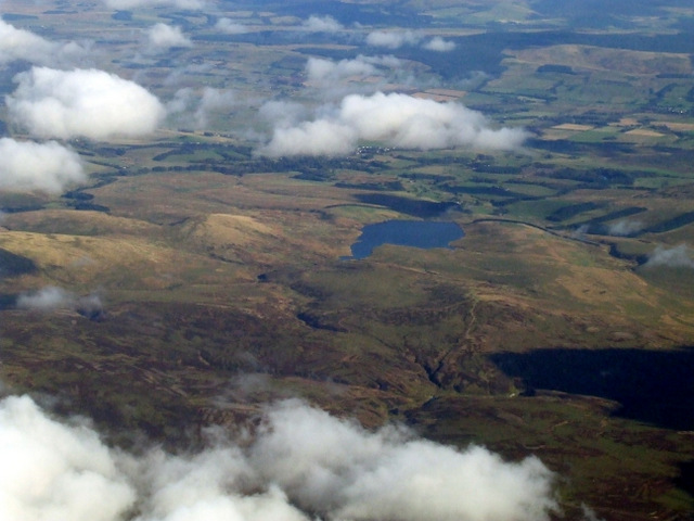
Craigengar is a striking hill located in Peeblesshire, a historic county in the Scottish Borders region of Scotland. It stands proudly at an elevation of 316 meters (1,037 feet) and offers breathtaking views of the surrounding landscape. The hill is situated approximately 5 miles southwest of the town of Peebles and is easily accessible by foot or by car.

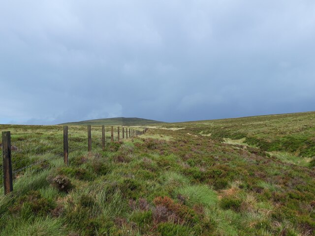
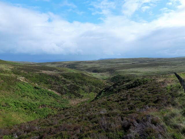
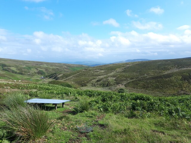
At the summit of Craigengar, visitors are rewarded with panoramic vistas that stretch as far as the eye can see. On a clear day, one can admire the rolling hills, lush green valleys, and the majestic peaks of the nearby Pentland Hills. The hill is covered in verdant grass and scattered with rocks, giving it a rugged yet serene appearance.

Craigengar is a popular destination for hikers and nature enthusiasts alike. Several well-marked trails wind their way up the hill, offering varying levels of difficulty to cater to different skill levels. The paths are surrounded by a diverse array of flora and fauna, including heather, gorse, and various species of birds.

The hill holds historical significance as well, with remnants of prehistoric settlements and ancient burial cairns found in the vicinity. These archaeological sites add an extra layer of intrigue to the already captivating landscape.

All in all, Craigengar is a must-visit destination for those seeking natural beauty, stunning views, and a touch of history. Whether you're an avid hiker or simply looking for a peaceful escape, this hill in Peeblesshire promises an unforgettable experience.

If you have any feedback on the listing, please let us know in the comments section below.

Craigengar Images

Images are sourced within 2km of 55.78051/-3.4522173 or Grid Reference NT0955. Thanks to Geograph Open Source API. All images are credited.

Shooting hut below Fadden The hut and a nearby shed are at the end of the gravel track that comes up from the Slipperfield track. White Craig is in the background.
Shooting hut below Fadden
The hut and a nearby shed are at the end of the gravel track that comes up from the Slipperfield track. White Craig is in the background.
Summit of Fadden West Water Reservoir and Mendick Hill seen from this rounded heathery summit.
Summit of Fadden
West Water Reservoir and Mendick Hill seen from this rounded heathery summit.
Unnamed cleuch near Fadden A small valley in the heather that runs east from the col between Fadden and Craigengar. Byrehope Mount is in the background.
Unnamed cleuch near Fadden
A small valley in the heather that runs east from the col between Fadden and Craigengar. Byrehope Mount is in the background.
Moorland drain below Craigengar The ground here around the head of Raven's Cleuch is rough peat moorland covered in places by deep heather.
Moorland drain below Craigengar
The ground here around the head of Raven's Cleuch is rough peat moorland covered in places by deep heather.
Raven's Cleuch (eastern), Craigengar There is Raven's Cleuch shown here meeting the Medwin Water at the dam, and a Ravens Cleugh (no apostrophe according to the 1:25,000 map!) only 1 km to the west. Millstone Rig is in between.
Raven's Cleuch (eastern), Craigengar
There is Raven's Cleuch shown here meeting the Medwin Water at the dam, and a Ravens Cleugh (no apostrophe according to the 1:25,000 map!) only 1 km to the west. Millstone Rig is in between.
Dam and pipeline, Medwin Water Water from the Medwin and Raven's Cleuch in the foreground is diverted into a pipeline that runs down the valley to go underground to West Water Reservoir.
Dam and pipeline, Medwin Water
Water from the Medwin and Raven's Cleuch in the foreground is diverted into a pipeline that runs down the valley to go underground to West Water Reservoir.
Medwin Water The burn upstream of the dam; see <a href="https://www.geograph.org.uk/photo/2119506">NT0853 : Medwin Burn</a> for the same view in October last year.
Medwin Water
The burn upstream of the dam; see NT0853 : Medwin Burn for the same view in October last year.
Pipeline intake and weir, Medwin Water Water is diverted into a pipeline near the building, with surplus running down the bed of the burn.
Pipeline intake and weir, Medwin Water
Water is diverted into a pipeline near the building, with surplus running down the bed of the burn.
West Water Reservoir from the air A few minutes after take-off from Edinburgh towards the southwest.
West Water Reservoir from the air
A few minutes after take-off from Edinburgh towards the southwest.
Rainbow at Wolf Craigs The Wolf Craigs are a group of small outcrops by the upper reaches of the Baddinsgill Burn.
Rainbow at Wolf Craigs
The Wolf Craigs are a group of small outcrops by the upper reaches of the Baddinsgill Burn.
Huts between Catstone and Fadden Near the top of an un-named burn draining into the West Water Reservoir.
Huts between Catstone and Fadden
Near the top of an un-named burn draining into the West Water Reservoir.
Un-named burn draining into the West Water Reservoir Taken just after a heavy shower of rain and hail, on an unusually cool and unsettled July day.
Un-named burn draining into the West Water Reservoir
Taken just after a heavy shower of rain and hail, on an unusually cool and unsettled July day.
View towards the main Pentland Hills from Craigengar Craigengar is much less visited than the distant hills closer to Edinburgh. One of several cairns on its summit plateau is visible here.
View towards the main Pentland Hills from Craigengar
Craigengar is much less visited than the distant hills closer to Edinburgh. One of several cairns on its summit plateau is visible here.
View from Craigengar summit shelter down fenceline Another shower is sweeping in on a changeable day of weather.
View from Craigengar summit shelter down fenceline
Another shower is sweeping in on a changeable day of weather.
Fenceline on moorland above Ravens Cleugh A shower has just swept through above Craigengar, on a cool and changeable early-July day.
Fenceline on moorland above Ravens Cleugh
A shower has just swept through above Craigengar, on a cool and changeable early-July day.
Ravens Cleugh A burn draining into the Medwin Water, at the south-western end of the Pentland Hills.
Ravens Cleugh
A burn draining into the Medwin Water, at the south-western end of the Pentland Hills.
View down the Medwin Water The building shown on the map, by the small dam, is visible in the middle distance.
View down the Medwin Water
The building shown on the map, by the small dam, is visible in the middle distance.
Fenceline on Byrehope Mount A relatively featureless hillside in the quieter end of the Pentland Hills.
Fenceline on Byrehope Mount
A relatively featureless hillside in the quieter end of the Pentland Hills.
Show me another place!

Craigengar is located at Grid Ref: NT0955 (Lat: 55.78051, Lng: -3.4522173)

Unitary Authority: The Scottish Borders

Police Authority: The Lothians and Scottish Borders

What 3 Words

///warm.down.heckler. Near West Linton, Scottish Borders

Nearby Locations

Craigengar

Related Wikis

Baddinsgill

Baddinsgill is a hamlet in the Scottish Borders area of Scotland. The Baddinsgill Reservoir is a few hundred metres north of the hamlet. == See also... ==

West Cairn Hill

West Cairn Hill is a hill in the Pentland Hills range of Scotland. With a height of 562 m (1,844 ft), it is the fifth highest elevation and lies on the...

West Water Reservoir

West Water Reservoir (sometimes Westwater Reservoir) is an artificial reservoir in the Pentland Hills, Scottish Borders, 3 kilometres (1.9 mi) west of...

Baddinsgill Reservoir

Baddinsgill Reservoir is a small reservoir in the Scottish Borders area of Scotland close to Carlops, West Linton, and the boundary with Midlothian. It...

Nearby Amenities

Located within 500m of 55.78051,-3.4522173
Created By: Potlatch 0.10f
Natural: peak
Lat/Long: 55.7811792/-3.4508605
The data included in this document is from www.openstreetmap.org. The data is made available under ODbL.

Have you been to Craigengar?

Leave your review of Craigengar below (or comments, questions and feedback).