Carterhope Rig

Hill, Mountain in Peeblesshire

Scotland

Carterhope Rig

Hills Reflected Fruid Reservoir acting like a mirror on the first day of meteorological spring.
Across the reservoir is Shiel Dod, while to the left are Macrule Hill and Ballaman Hill. A grand day to be out in Borders hills.
Hills Reflected Credit: Adam Ward

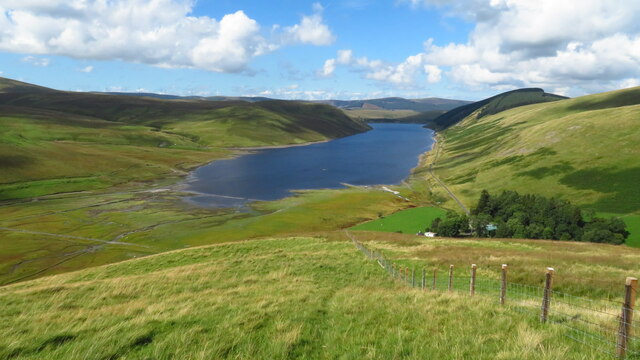
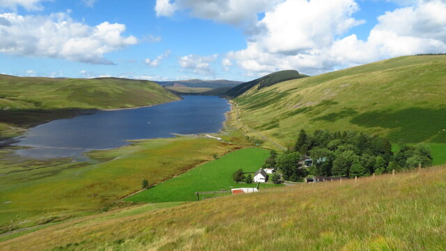
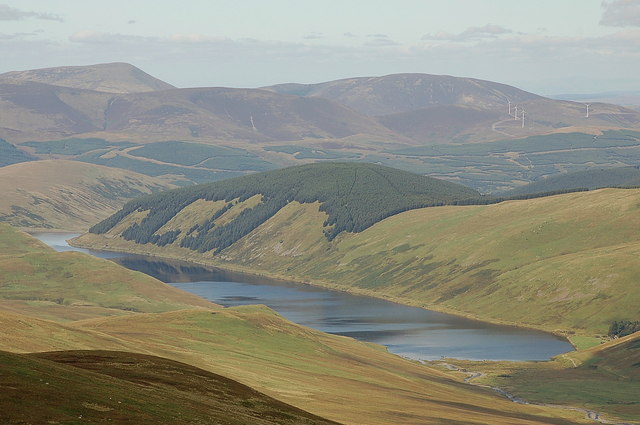
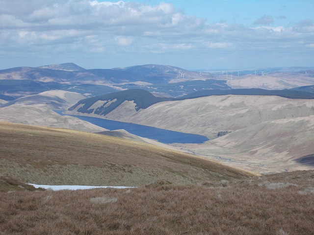
Carterhope Rig is a prominent hill located in Peeblesshire, Scotland. Situated in the picturesque Scottish Borders region, it forms part of the scenic Southern Uplands. The hill stands at an elevation of approximately 505 meters (1,657 feet) above sea level.

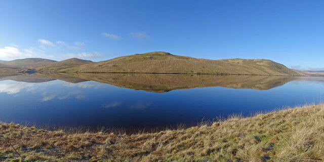
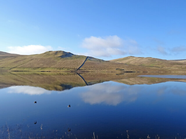
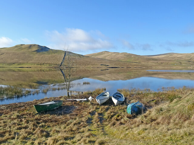
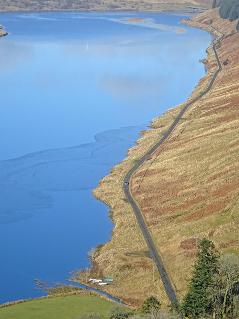
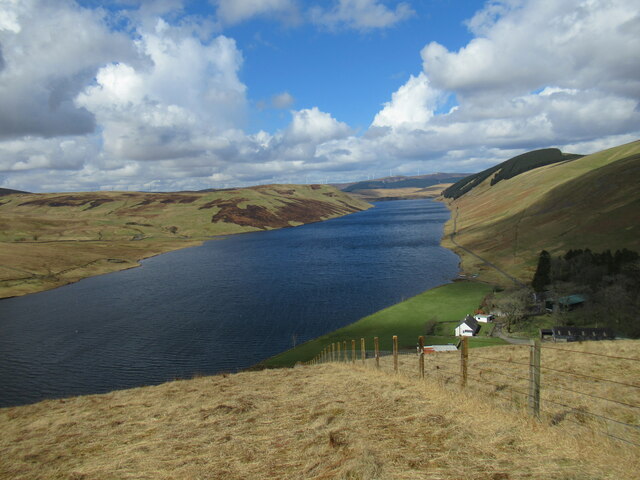
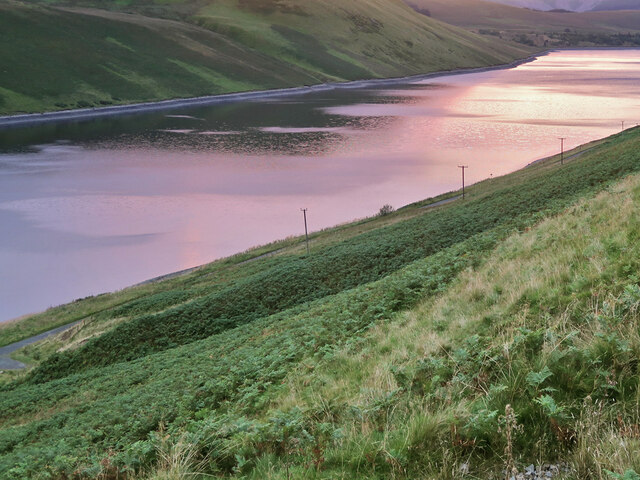
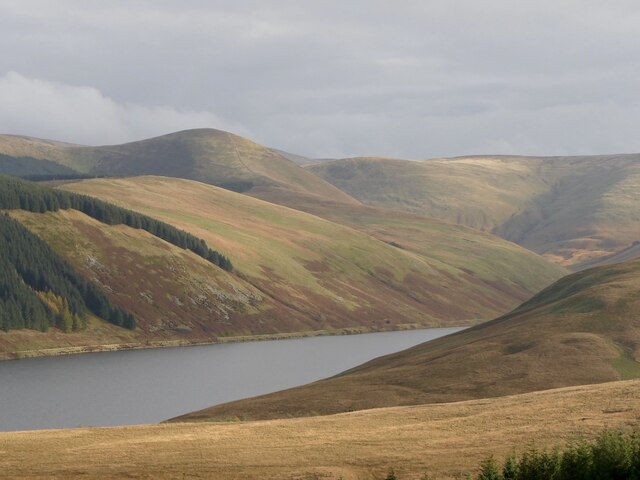
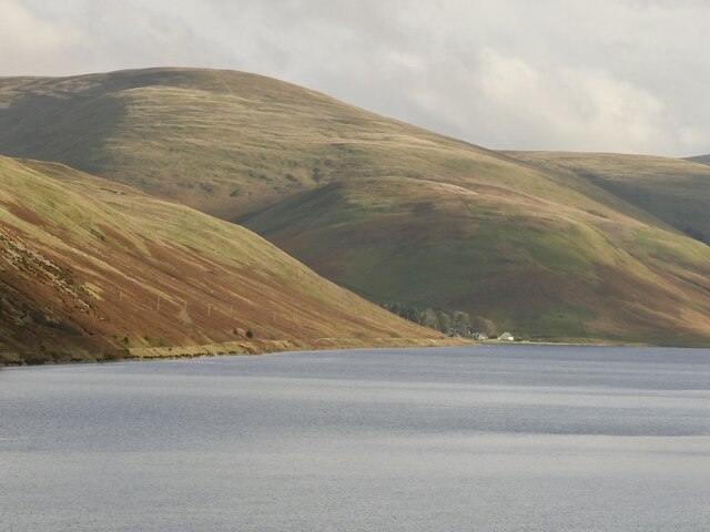
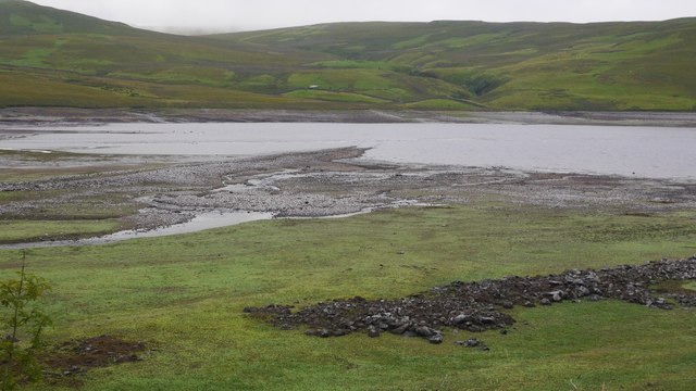
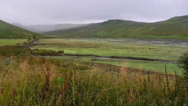
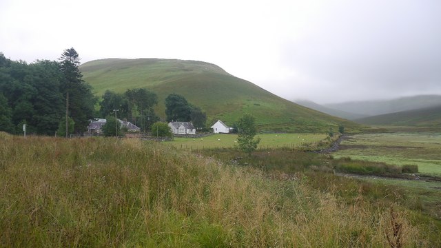
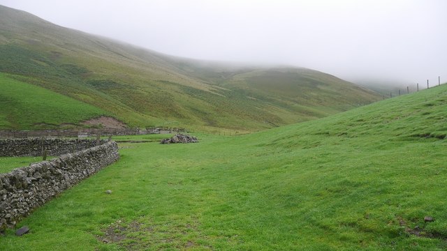
Carterhope Rig is known for its rugged yet beautiful landscape, offering breathtaking views of the surrounding countryside. The hill is covered with heather moorland, giving it a distinctive purple hue during the summer months. The terrain is characterized by rolling slopes and rocky outcrops, making it a popular destination for hikers and nature enthusiasts.

The hill is a haven for wildlife, with various bird species, including raptors like buzzards and kestrels, often seen soaring above its slopes. Visitors may also spot deer, hares, and other small mammals that inhabit the area.

Carterhope Rig is easily accessible, with a well-maintained footpath leading to its summit. On a clear day, the panoramic views from the top are truly awe-inspiring, encompassing the surrounding valleys, hills, and distant peaks.

Hikers and outdoor enthusiasts are advised to come prepared with suitable footwear and clothing, as the weather on the hill can change quickly, even during the summer. It is also recommended to bring provisions and water, as there are no facilities available on the hill itself.

Overall, Carterhope Rig offers a stunning natural experience, allowing visitors to immerse themselves in the tranquility of the Scottish countryside and enjoy the beauty of the Southern Uplands.

If you have any feedback on the listing, please let us know in the comments section below.

Carterhope Rig Images

Images are sourced within 2km of 55.448247/-3.4411704 or Grid Reference NT0818. Thanks to Geograph Open Source API. All images are credited.

Hills Reflected Fruid Reservoir acting like a mirror on the first day of meteorological spring.
Across the reservoir is Shiel Dod, while to the left are Macrule Hill and Ballaman Hill. A grand day to be out in Borders hills.
Hills Reflected
Fruid Reservoir acting like a mirror on the first day of meteorological spring. Across the reservoir is Shiel Dod, while to the left are Macrule Hill and Ballaman Hill. A grand day to be out in Borders hills.
Taking Flight Two geese have just taken flight after I surprised them at the edge of Fruid Reservoir. The hill to the left of the prominent wall is called Big Knock.
Taking Flight
Two geese have just taken flight after I surprised them at the edge of Fruid Reservoir. The hill to the left of the prominent wall is called Big Knock.
Boats by the Water Several dinghies are pulled up on the shores of Fruid Reservoir. The hills are reflected on the first day of spring.
Boats by the Water
Several dinghies are pulled up on the shores of Fruid Reservoir. The hills are reflected on the first day of spring.
The Long and Slightly Winding Road As viewed from Strawberry Hill you can see a car making its way along the nearly 2 miles of road from Fruid dam to the farm at the end of the road. The first day of spring and it is a glorious day to be out in the hills.
The Long and Slightly Winding Road
As viewed from Strawberry Hill you can see a car making its way along the nearly 2 miles of road from Fruid dam to the farm at the end of the road. The first day of spring and it is a glorious day to be out in the hills.
Fruid Reservoir viewed from Strawberry Hill The farm buildings at Fruid are visible below, with some of the turbines of the vast Clyde Wind Farm on the distant horizon.
Fruid Reservoir viewed from Strawberry Hill
The farm buildings at Fruid are visible below, with some of the turbines of the vast Clyde Wind Farm on the distant horizon.
Steep slope down to the Fruid Reservoir A view down to the reservoir at sunset.
Steep slope down to the Fruid Reservoir
A view down to the reservoir at sunset.
Fruid Reservoir and Erie Hill View from Glengonnor Hill towards the ridge between Games Hope and Fruid.
Fruid Reservoir and Erie Hill
View from Glengonnor Hill towards the ridge between Games Hope and Fruid.
Fruid The farm at the head of the reservoir. Other farms like Hawkshaw were destroyed.
Fruid
The farm at the head of the reservoir. Other farms like Hawkshaw were destroyed.
On Strawberry Hill - view to Fruid Reservoir
On Strawberry Hill - view to Fruid Reservoir & Farm
Forest edge, Brawns Dod Boundary between the Menzion Forest and sheep farming land at Fruid.
Forest edge, Brawns Dod
Boundary between the Menzion Forest and sheep farming land at Fruid.
Fruid Reservoir from Hart Fell Fruid Reservoir was created by damming the Fruid Water to provide an additional water supply for Edinburgh. It was opened in 1968. The prominent hill left of centre is Culter Fell and some of the Glenkerie wind turbines are on the right.
Fruid Reservoir from Hart Fell
Fruid Reservoir was created by damming the Fruid Water to provide an additional water supply for Edinburgh. It was opened in 1968. The prominent hill left of centre is Culter Fell and some of the Glenkerie wind turbines are on the right.
Fruid Reservoir from Hart Fell View of the reservoir from the lower slopes of the hill.
Fruid Reservoir from Hart Fell
View of the reservoir from the lower slopes of the hill.
Low water, Fruid Reservoir Fruid Reservoir in the dry Summer of 2018.  The reservoir opened in 1968 and covered three farms: Hawkshaw, Carterhope, Nether Fruid and the haughs along the Fruid Water.
Low water, Fruid Reservoir
Fruid Reservoir in the dry Summer of 2018. The reservoir opened in 1968 and covered three farms: Hawkshaw, Carterhope, Nether Fruid and the haughs along the Fruid Water.
The exposed head of Fruid Reservoir A long stretch of the Fruid Water was inundated by a dam in 1968. After a dry Summer the water level had dropped. It was raining as I took this.
The exposed head of Fruid Reservoir
A long stretch of the Fruid Water was inundated by a dam in 1968. After a dry Summer the water level had dropped. It was raining as I took this.
Fruid Farm and houses at the head of the Fruid Reservoir.
Fruid
Farm and houses at the head of the Fruid Reservoir.
Field, Fern Hope Improved grassland at Fruid, surrounded by steep grassy hills.
Field, Fern Hope
Improved grassland at Fruid, surrounded by steep grassy hills.
Fruid farm The farm lies at the foot of Fern Hope, seen here from Shiel Dod.
Fruid farm
The farm lies at the foot of Fern Hope, seen here from Shiel Dod.
Show me another place!

Carterhope Rig is located at Grid Ref: NT0818 (Lat: 55.448247, Lng: -3.4411704)

Unitary Authority: The Scottish Borders

Police Authority: The Lothians and Scottish Borders

What 3 Words

///ruffling.majoring.offstage. Near Moffat, Dumfries & Galloway

Nearby Locations

Carterhope Rig

Related Wikis

Fruid Reservoir

Fruid is a small reservoir in the Scottish Borders area of Scotland, UK, near Menzion. It is formed by damming the Fruid Water, and supplements the contents...

Fruid Water

Fruid Water is a river in the Scottish Borders area of Scotland. The valley it occupies has been dammed to form the Fruid Reservoir. The river is a tributary...

Hawkshaw, Scottish Borders

Hawkshaw is a pair of semi-detached houses on the River Tweed, two miles southwest of Tweedsmuir in the Scottish Borders. Historically part of Peeblesshire...

Moffat Hills

The Moffat Hills are a range of hills in the Southern Uplands of Scotland. They form a roughly triangular shape with a west facing side, a north facing...

Have you been to Carterhope Rig?

Leave your review of Carterhope Rig below (or comments, questions and feedback).