Aberedw Hill

Hill, Mountain in Radnorshire

Wales

Aberedw Hill

Llanfared The B6547 passing Llanfared.
Llanfared Credit: Peter McDermott

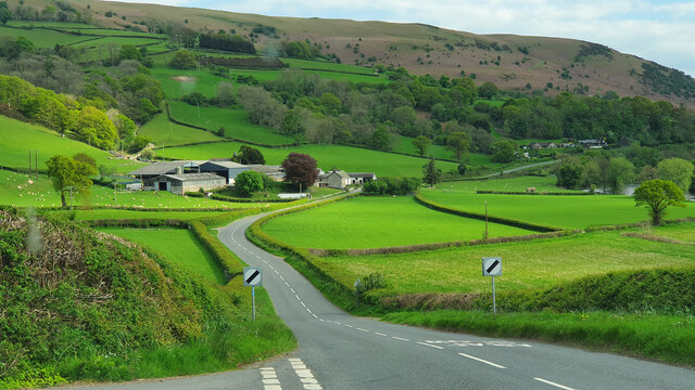
Aberedw Hill is located in Radnorshire, a county in the eastern part of Wales. It is a prominent hill that rises to an elevation of 396 meters (1,299 feet) above sea level. Situated near the village of Aberedw, the hill offers breathtaking views of the surrounding countryside.

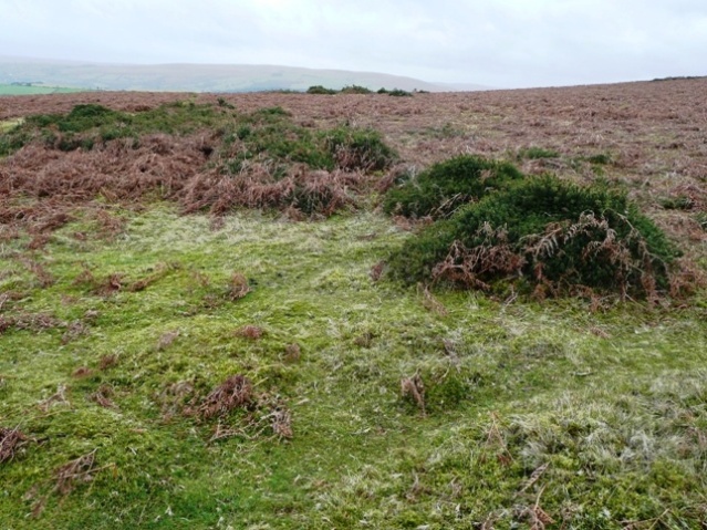
The terrain of Aberedw Hill is predominantly rocky and covered with grasses and heather, creating a picturesque landscape. It is a popular destination for hikers and nature enthusiasts who are drawn to its natural beauty and tranquility. The hill is crisscrossed by a network of footpaths and trails, allowing visitors to explore its diverse flora and fauna.

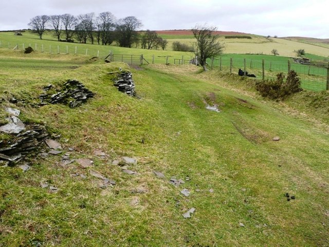
One of the notable features of Aberedw Hill is its historical significance. The area around the hill is dotted with ancient settlements and archaeological sites, including Bronze Age burial mounds and Iron Age hillforts. These remnants of the past add an extra layer of interest for those interested in history and archaeology.

The hill is also home to a variety of wildlife, with species such as rabbits, foxes, and birds of prey frequently spotted in the area. The diverse ecosystem of Aberedw Hill contributes to its ecological importance, making it an important habitat for many species.

Overall, Aberedw Hill is a captivating natural landmark that offers visitors a chance to immerse themselves in the beauty of the Welsh countryside while exploring its historical and ecological wonders.

If you have any feedback on the listing, please let us know in the comments section below.

Aberedw Hill Images

Images are sourced within 2km of 52.147654/-3.3394663 or Grid Reference SO0850. Thanks to Geograph Open Source API. All images are credited.

Llanfared The B6547 passing Llanfared.
Llanfared
The B6547 passing Llanfared.
Cefnhinog Farm on a January evening After some 7 to 8 hours walking on the surrounding hills I am glad to reach the valley bottom farms and cottages again.
Cefnhinog Farm on a January evening
After some 7 to 8 hours walking on the surrounding hills I am glad to reach the valley bottom farms and cottages again.
Access land above Blaenmilo-uchaf A tongue of access land south-east of Aberedw Hill covers the western half of this square.  This is moorland sheep grazing land with easy walking but very strong westerly winds.
Access land above Blaenmilo-uchaf
A tongue of access land south-east of Aberedw Hill covers the western half of this square. This is moorland sheep grazing land with easy walking but very strong westerly winds.
Path towards Aberedw Hill The open moorland in the next square can be seen on the horizon.  In this square, a footpath comes in from the left behind the retaining wall of an old drovers road, and continues to the left of the trees in the middle distance.  The drovers road is shown on the 1:25K maps but is not a public right of way.
Path towards Aberedw Hill
The open moorland in the next square can be seen on the horizon. In this square, a footpath comes in from the left behind the retaining wall of an old drovers road, and continues to the left of the trees in the middle distance. The drovers road is shown on the 1:25K maps but is not a public right of way.
398 metres high Looking north from the first high point of the Aberedw Hill access land.  This stone is marked at 398 metres, in an area of tumuli, with a small lake in the first dip of the moorland.
398 metres high
Looking north from the first high point of the Aberedw Hill access land. This stone is marked at 398 metres, in an area of tumuli, with a small lake in the first dip of the moorland.
Moorland pool On the open access moorland section this pool has formed in a shallow dip.  The ground around is surprisingly dry; presumably it runs off quickly into the pool.
Moorland pool
On the open access moorland section this pool has formed in a shallow dip. The ground around is surprisingly dry; presumably it runs off quickly into the pool.
Millennium stone The stone has probably been on this site for much longer but the plaque was attached for the Millennium.  It was attached jointly by the parishes of Aberedw and Rhulen although it sits firmly in the former.  The stone is seen in context here <a href="https://www.geograph.org.uk/photo/669163">SO0749 : 398 metres high</a>
Millennium stone
The stone has probably been on this site for much longer but the plaque was attached for the Millennium. It was attached jointly by the parishes of Aberedw and Rhulen although it sits firmly in the former. The stone is seen in context here SO0749 : 398 metres high
Just below the moorland A tongue of woodland descends towards Allt Goch from the boundary of the enclosed farmland (left) with the moorland (right).
Just below the moorland
A tongue of woodland descends towards Allt Goch from the boundary of the enclosed farmland (left) with the moorland (right).
Moorland above Allt Goch The open access moorland extends north from here for at least three miles, with clear tracks across.
Moorland above Allt Goch
The open access moorland extends north from here for at least three miles, with clear tracks across.
Clear route across the moors There are a number of footpaths across the moors that are clear to follow on the ground.
Clear route across the moors
There are a number of footpaths across the moors that are clear to follow on the ground.
Across the Milo The view is east, from the road down the valley, across the Milo Brook and towards the steep moorland beyond.
Across the Milo
The view is east, from the road down the valley, across the Milo Brook and towards the steep moorland beyond.
Down the Milo valley From the steep hillside on the western side of the valley, looking south-east towards the Allt Goch woodland on the equally steep eastern slope.
Down the Milo valley
From the steep hillside on the western side of the valley, looking south-east towards the Allt Goch woodland on the equally steep eastern slope.
Moorland above Blaenmilo This could be anywhere in the area, but the location is confirmed by GPS.
Moorland above Blaenmilo
This could be anywhere in the area, but the location is confirmed by GPS.
Moorland above Blaen-y-cwm The southern part of Aberedw Hill consists of vast areas of bracken-covered moorland like this.
Moorland above Blaen-y-cwm
The southern part of Aberedw Hill consists of vast areas of bracken-covered moorland like this.
Moorland pool This pool appears in the corner of four squares, according to the 1:25K map, and in this square according to the 1:50K map.  So here it is.  It is one of many natural pools in the Aberedw Hill area.
Moorland pool
This pool appears in the corner of four squares, according to the 1:25K map, and in this square according to the 1:50K map. So here it is. It is one of many natural pools in the Aberedw Hill area.
Parting of the ways? Although this is open access land, there are many clear paths that most walkers will tend to follow.  This is the path south from Aberedw Hill to the village of the same name.  Left or right, it doesn't matter they both lead to the same place.
Parting of the ways?
Although this is open access land, there are many clear paths that most walkers will tend to follow. This is the path south from Aberedw Hill to the village of the same name. Left or right, it doesn't matter they both lead to the same place.
Moorland pool and tumulus Both marked on the 1:25K map.  This is one of many natural pools in the area.  There are also a few tumuli, this one being the most prominent as it has a stone on top seen in close-up here [[[671753]].
Moorland pool and tumulus
Both marked on the 1:25K map. This is one of many natural pools in the area. There are also a few tumuli, this one being the most prominent as it has a stone on top seen in close-up here [[[671753]].
Descent towards Aberedw This gate marks the start of a gentle descent across sheep pasture and valley farmland towards Aberedw.  The next square starts about halfway to the sheep.
Descent towards Aberedw
This gate marks the start of a gentle descent across sheep pasture and valley farmland towards Aberedw. The next square starts about halfway to the sheep.
Show me another place!

Aberedw Hill is located at Grid Ref: SO0850 (Lat: 52.147654, Lng: -3.3394663)

Unitary Authority: Powys

Police Authority: Dyfed Powys

What 3 Words

///smuggled.rift.outermost. Near Builth Wells, Powys

Nearby Locations

Llyn Cawr Aberedw Hill

Related Wikis

Llanfaredd Halt railway station

Llanfaredd Halt railway station was an unstaffed railway station opened by the Great Western Railway on 7 May 1934 on the old Mid-Wales line between Builth...

District of Radnorshire

The District of Radnorshire (Welsh: Maesyfed) was one of three local government districts of the county of Powys, Wales, from 1974 until 1996. The district...

Mechain

Mechain was a medieval cantref in the Kingdom of Powys. This cantref has also been referred to as Y Fyrnwy (Vyrnwy). Mechain may owe its name to the River...

Aberedw railway station

Aberedw railway station served the village of Aberedw in Powys, Wales. Aberedw Castle was demolished to build the station and some of the stone from the...

Llanbadarn y Garreg

Llanbadarn-y-Garreg is a village in the community of Aberedw, Powys, Wales. It is 45.1 miles (72.6 km) from Cardiff and 141.9 miles (228.4 km) from London...
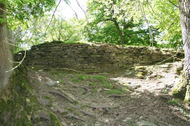
Aberedw Castle

The remains of Aberedw Castle, also known as 'Castle in Elfael Uwch Mynydd', are located at the small village of Aberedw in the county of Powys, Mid-Wales...

Aberedw

Aberedw is a village and community in Radnorshire, Powys, Wales. The community covers an area of 3,055 hectares (11.80 sq mi). Its population was 229,...

Llanelwedd

Llanelwedd [ɬanˈɛlwɛð] is a village and community near Builth Wells, in Powys, Wales. It lies within the historic boundaries of Radnorshire. Llanelwedd...

Nearby Amenities

Located within 500m of 52.147654,-3.3394663
Aberedw Hill
Name Cy: Bryn Aberedw
Natural: peak
Source: npe
Lat/Long: 52.1475791/-3.3395612
Ford: yes
Lat/Long: 52.1446046/-3.3382696
The data included in this document is from www.openstreetmap.org. The data is made available under ODbL.

Have you been to Aberedw Hill?

Leave your review of Aberedw Hill below (or comments, questions and feedback).