Allt Lwyd

Hill, Mountain in Brecknockshire

Wales

Allt Lwyd

Capel Glyn Collwng Veteran Yew A veteran Yew sits in the corner of the churchyard of the now ruinous Church.
Capel Glyn Collwng Veteran Yew Credit: paul wood

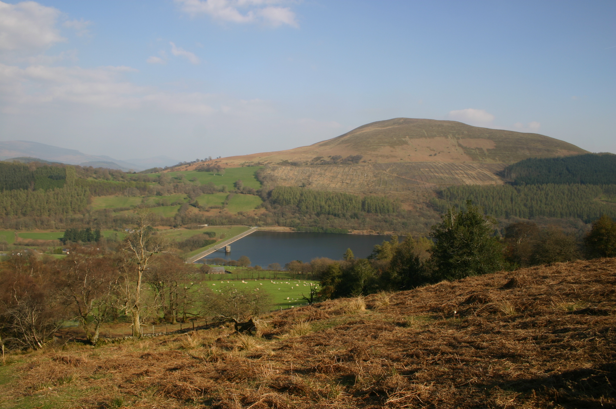
Allt Lwyd is a prominent hill located in the county of Brecknockshire in Wales. Standing at an elevation of approximately 1,358 feet (414 meters), it is classified as a hill rather than a mountain. It is situated near the village of Libanus, just a few miles west of the Brecon Beacons National Park.

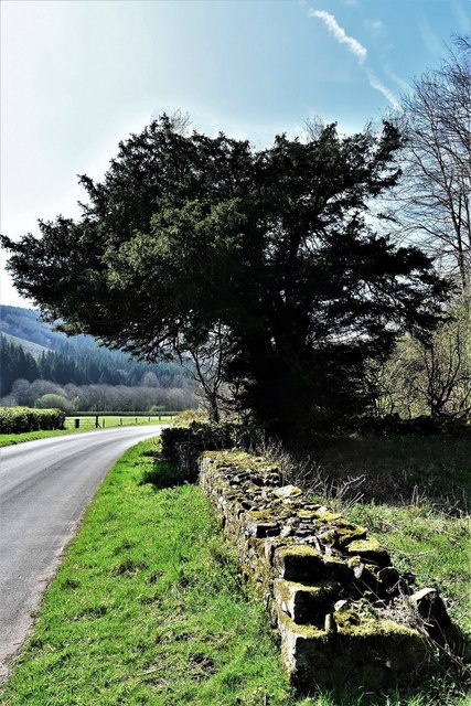
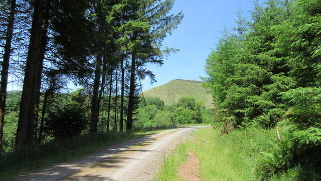
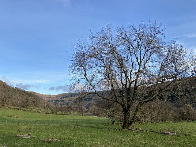
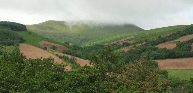
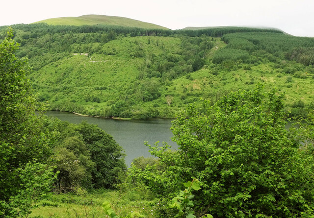
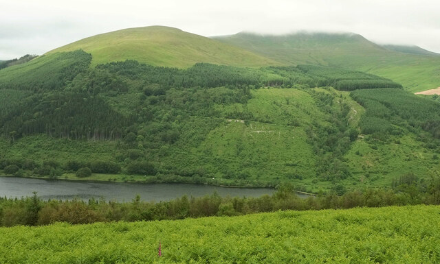
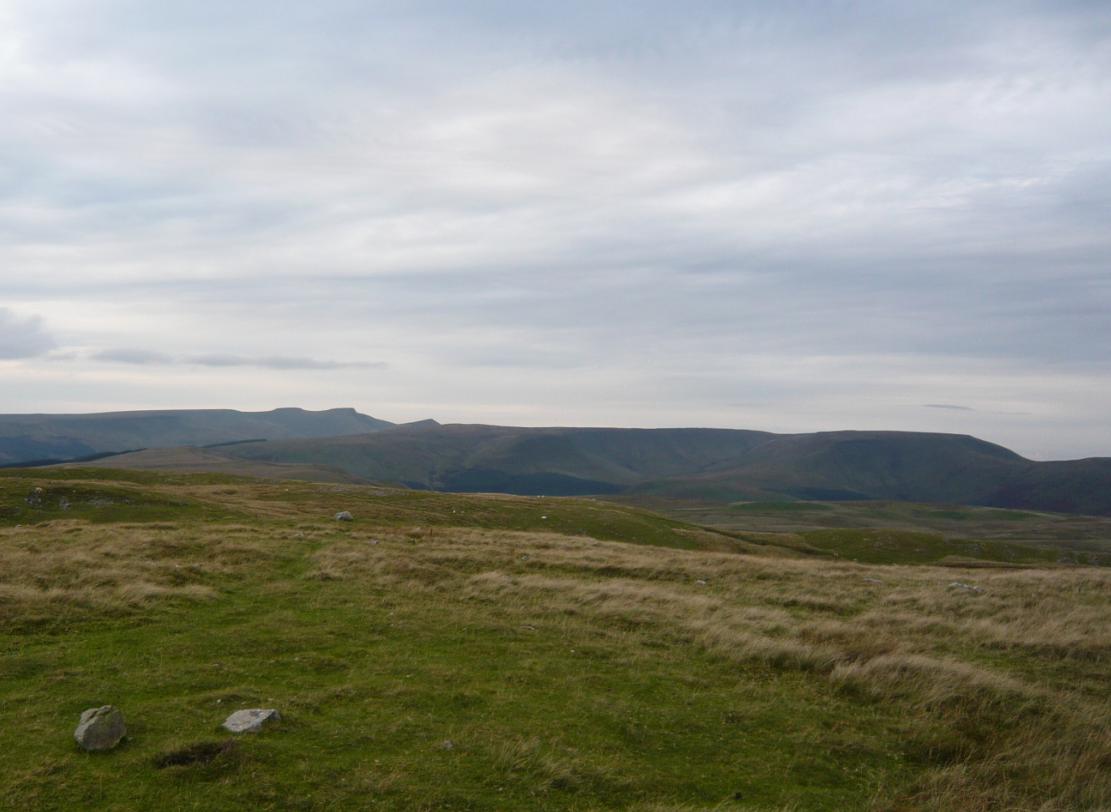
The hill is known for its breathtaking views of the surrounding countryside. From its summit, visitors can enjoy panoramic vistas of the rolling hills, lush valleys, and distant peaks of the Brecon Beacons. On clear days, it is even possible to see as far as the Black Mountains and the Bristol Channel.

Allt Lwyd is a popular destination for hikers and nature enthusiasts. Several well-marked trails lead to the summit, offering a range of difficulty levels to cater to different abilities. The paths wind through diverse landscapes, including open moorland, wooded areas, and rocky outcrops, providing opportunities to spot local wildlife such as red kites, buzzards, and mountain ponies.

The hill is also steeped in history and folklore. It is said to have been a site of ancient burial grounds and was once used as a beacon hill, where signal fires were lit to warn of impending danger. Today, remnants of these ancient structures can still be seen, adding an air of mystery and intrigue to the area.

Overall, Allt Lwyd is a captivating natural landmark that offers both stunning scenery and a glimpse into the rich history of Brecknockshire.

If you have any feedback on the listing, please let us know in the comments section below.

Allt Lwyd Images

Images are sourced within 2km of 51.861121/-3.3393599 or Grid Reference SO0718. Thanks to Geograph Open Source API. All images are credited.

Capel Glyn Collwng Veteran Yew A veteran Yew sits in the corner of the churchyard of the now ruinous Church.
Capel Glyn Collwng Veteran Yew
A veteran Yew sits in the corner of the churchyard of the now ruinous Church.
Gwalciau'r Cwm from Talybont Forest
Solitary tree Tree at the head of Glyn Collwn above Talybont reservoir.
Solitary tree
Tree at the head of Glyn Collwn above Talybont reservoir.
Cwm Tarthwynni The valley descends from Craig y Fan, partly cloud-covered, to the Talybont Reservoir. Viewed here from the Taff Trail across the lake.
Cwm Tarthwynni
The valley descends from Craig y Fan, partly cloud-covered, to the Talybont Reservoir. Viewed here from the Taff Trail across the lake.
Across the Talybont Reservoir (2) With Allt Lwyd the summit left of centre at 654 metres, and Talybont Forest clothing the slopes. The flat summit of Craig y Fan, over a hundred metres higher, is still under cloud.
Across the Talybont Reservoir (2)
With Allt Lwyd the summit left of centre at 654 metres, and Talybont Forest clothing the slopes. The flat summit of Craig y Fan, over a hundred metres higher, is still under cloud.
Allt Lwyd A similar view across Talybont Reservoir to <a href="https://www.geograph.org.uk/photo/7210379">SO1018 : View from Bryn Melyn</a>, but from higher up the path across Bryn Melyn.
Allt Lwyd
A similar view across Talybont Reservoir to SO1018 : View from Bryn Melyn, but from higher up the path across Bryn Melyn.
Traffic jam by Talybont Reservoir A flock of sheep holds up the traffic on the lane up the Caerfanell valley.
Traffic jam by Talybont Reservoir
A flock of sheep holds up the traffic on the lane up the Caerfanell valley.
Glyn Collwyn in Winter As the Caerfanell enters the Talybont Reservoir, it has the appearance of a lower course river, despite its altitude (still ~190m asl). It has a meandering profile with occasional braiding and sits on a floodplain. Because it flows over a porous substrate a substantial volume of water flows underground, which means it is prone to drying up when the water level falls in the reservoir <a href="https://www.geograph.org.uk/photo/2427276">SO0817 : Summer Glyn Collwyn</a>.
Glyn Collwyn in Winter
As the Caerfanell enters the Talybont Reservoir, it has the appearance of a lower course river, despite its altitude (still ~190m asl). It has a meandering profile with occasional braiding and sits on a floodplain. Because it flows over a porous substrate a substantial volume of water flows underground, which means it is prone to drying up when the water level falls in the reservoir SO0817 : Summer Glyn Collwyn.
Summer Glyn Collwyn The Caerfanell regularly dries up during droughts because it flows through porous sediment. <a href="https://www.geograph.org.uk/photo/2427268">SO0817 : Glyn Collwyn in Winter</a>
Summer Glyn Collwyn
The Caerfanell regularly dries up during droughts because it flows through porous sediment. SO0817 : Glyn Collwyn in Winter
View to Allt Lwyd from Craig y Fan Glorious upland shapes, hues, falls of the landscape that compels your eye to rove.
View to Allt Lwyd from Craig y Fan
Glorious upland shapes, hues, falls of the landscape that compels your eye to rove.
Gwalciau'r Cwm On a wonderfully hazy, warm day in spring.
Gwalciau'r Cwm
On a wonderfully hazy, warm day in spring.
Steep ravine near Gwalciau'r Cwm I'm not wandering down there.
Steep ravine near Gwalciau'r Cwm
I'm not wandering down there.
View from Gwalciau'r Cwm The landscape is big; sheep offer some idea of scale. Yes, those white dots are munching nibblers.
View from Gwalciau'r Cwm
The landscape is big; sheep offer some idea of scale. Yes, those white dots are munching nibblers.
Cairn on Gwalciau'r Cwm The cairn is sited just above an interesting rock outcrop.
Cairn on Gwalciau'r Cwm
The cairn is sited just above an interesting rock outcrop.
Cairn and rock outcrop on Gwalciau'r Cwm Now that's what I call an interesting rock formation.
Cairn and rock outcrop on Gwalciau'r Cwm
Now that's what I call an interesting rock formation.
View up to Cwar y Gigfran from below Gwalciau'r Cwm Two walkers are dots on the skyline as they walk across towards the Wellington memorial end of the ridge.
View up to Cwar y Gigfran from below Gwalciau'r Cwm
Two walkers are dots on the skyline as they walk across towards the Wellington memorial end of the ridge.
View to Gwalciau'r Cwm from the Caerfanell valley Glorious upland walking on a sunny, warm spring day. The turf is springy but dry, following little rainfall and the breezes are light and balmy.
View to Gwalciau'r Cwm from the Caerfanell valley
Glorious upland walking on a sunny, warm spring day. The turf is springy but dry, following little rainfall and the breezes are light and balmy.
Show me another place!

Allt Lwyd is located at Grid Ref: SO0718 (Lat: 51.861121, Lng: -3.3393599)

Unitary Authority: Powys

Police Authority: Dyfed Powys

What 3 Words

///alongside.blip.fresh. Near Llangynidr, Powys

Nearby Locations

Talybont Forest Allt Lwyd

Related Wikis

Talybont Reservoir

Talybont Reservoir (Welsh: Cronfa Ddŵr Tal-y-bont) is the largest stillwater reservoir in the central Brecon Beacons at 318 acres (1.29 km2). Talybont...

Waun Rydd

Waun Rydd is a mountain in the Brecon Beacons National Park, in southern Powys, Wales. Its height is 769 m (2,523 ft) and it tops a large boggy plateau...

Pentir Rhiw railway station

Pentir Rhiw railway station (alternatively, Pant-y-rhiw railway station) was a station adjacent to Talybont Reservoir in Powys, Wales. The station was...

Bwlch y Ddwyallt

Bwlch y Ddwyallt is the name commonly applied to the high point of the plateau of Gwaun Cerrig Llwydion in the eastern part of the Brecon Beacons in south...

Tor y Foel

Tor y Foel is a hill in the Brecon Beacons National Park in the county of Powys in Wales. It is located on the eastern flank of Talybont Reservoir, and...

Aber Village

Aber Village or Aber Clydach is a hamlet within the Brecon Beacons National Park in Powys, Wales. It is centred on the minor road which runs south from...

Torpantau railway station

Torpantau railway station is a station in the Welsh county of Brecknockshire (now in Powys), and the northern terminus of the narrow gauge Brecon Mountain...

Caerfanell

The Caerfanell is a river which rises in the central section of the Brecon Beacons National Park in Powys, Wales. It rises as Blaen Caerfanell on the plateau...

Nearby Amenities

Located within 500m of 51.861121,-3.3393599
Allt Lwyd
Ele: 653
Natural: peak
Wikidata: Q4733303
Wikipedia: en:Allt Lwyd
Lat/Long: 51.8612227/-3.339215
The data included in this document is from www.openstreetmap.org. The data is made available under ODbL.

Have you been to Allt Lwyd?

Leave your review of Allt Lwyd below (or comments, questions and feedback).