Gallows Knowe

Hill, Mountain in Peeblesshire

Scotland

Gallows Knowe

Gallow Law Looking northwest from the A72 east of Skirling.
Gallow Law Credit: M J Richardson

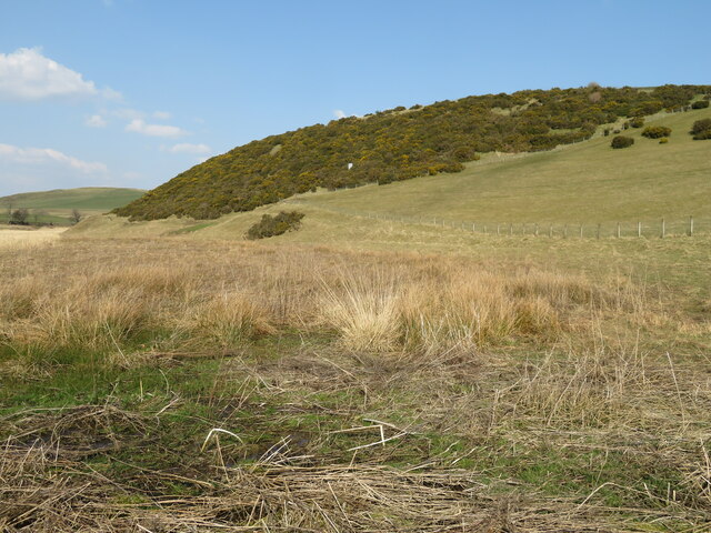
Gallows Knowe is a prominent hill located in Peeblesshire, Scotland. Rising to a height of approximately 539 meters (1,768 feet), it is part of the wider Southern Uplands range. Situated in the heart of the Scottish Borders, this picturesque hill offers breathtaking views of the surrounding countryside.

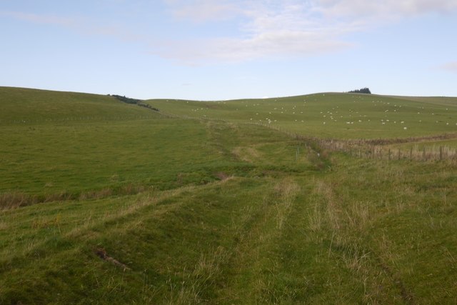
Covered in a mixture of grasses, heather, and scattered trees, Gallows Knowe is a popular destination for hikers, nature enthusiasts, and outdoor enthusiasts alike. The hill's relatively gentle slopes make it accessible to a wide range of visitors, from casual walkers to experienced climbers.

At the summit of Gallows Knowe, visitors are rewarded with panoramic vistas that stretch across the rolling hills and valleys of Peeblesshire. On a clear day, it is even possible to catch glimpses of the nearby Tweed Valley and the distant Cairngorms National Park.

The hill takes its name from the historical use of gallows, which were once erected on the site during the medieval period. These gallows were used to execute criminals, and the hill became known as Gallows Knowe as a result.

In addition to its natural beauty, Gallows Knowe is also home to a variety of wildlife. Birdwatchers can spot a range of species, including red grouse, skylarks, and the occasional golden eagle. The hillside also supports a diverse array of plant life, including heather, bilberry, and wild thyme.

Overall, Gallows Knowe offers visitors the opportunity to immerse themselves in the stunning landscapes of Peeblesshire, while also providing a glimpse into the area's historical past.

If you have any feedback on the listing, please let us know in the comments section below.

Gallows Knowe Images

Images are sourced within 2km of 55.632938/-3.4651476 or Grid Reference NT0738. Thanks to Geograph Open Source API. All images are credited.

Gallow Law Looking northwest from the A72 east of Skirling.
Gallow Law
Looking northwest from the A72 east of Skirling.
Candy Burn ford and footbridge The boundary between the Scottish Borders [this side] and South Lanarkshire [across the burn]. On the road from Skirling and Cambwell to the main A702 Biggar to Edinburgh road.
Candy Burn ford and footbridge
The boundary between the Scottish Borders [this side] and South Lanarkshire [across the burn]. On the road from Skirling and Cambwell to the main A702 Biggar to Edinburgh road.
Hillside Gorse at Cambwell The hill slopes down to Candy Burn.
Hillside Gorse at Cambwell
The hill slopes down to Candy Burn.
Ford and footbridge near Cambwell
Ford, Cambwell Looking westwards
Ford, Cambwell
Looking westwards
Gallow Law Prominent hill above Skirling, not quite as imposing from this angle. The slopes were being grazed by cattle.
Gallow Law
Prominent hill above Skirling, not quite as imposing from this angle. The slopes were being grazed by cattle.
Cambwell Looking across the hidden A702 to a minor road and Cambwell. Gallow Law above Skirling in the background, with the distant Broughton Heights.
Cambwell
Looking across the hidden A702 to a minor road and Cambwell. Gallow Law above Skirling in the background, with the distant Broughton Heights.
Old Drove Road above Skirling A typical Borders hill scene from valley to moorland or forested summit areas.
Old Drove Road above Skirling
A typical Borders hill scene from valley to moorland or forested summit areas.
Old Drove Road to Candyburn A green track through hill pastures to Candyburn (or Candy Mill).
Old Drove Road to Candyburn
A green track through hill pastures to Candyburn (or Candy Mill).
Drove Road crossing the Wedding Burn The green track to Candyburn crossing the Wedding Burn by a hill pasture dotted with grazing ewes.
Drove Road crossing the Wedding Burn
The green track to Candyburn crossing the Wedding Burn by a hill pasture dotted with grazing ewes.
Old drove road between Skirling and Candy Mill The course of an old drove road, used for driving sheep and cattle to Skirling Fair (held four times per year in the 18th Century) - the track is clear here but peters out to the north of the Wedding Burn.
Old drove road between Skirling and Candy Mill
The course of an old drove road, used for driving sheep and cattle to Skirling Fair (held four times per year in the 18th Century) - the track is clear here but peters out to the north of the Wedding Burn.
The Old Drove Road Between Skirling and Candymill.
The Old Drove Road
Between Skirling and Candymill.
The Old Drove Road A green lane between Skirling and Candymill. Here it crosses the Wedding Burn.
The Old Drove Road
A green lane between Skirling and Candymill. Here it crosses the Wedding Burn.
Gallow Law Hill above Skirling.
Gallow Law
Hill above Skirling.
The Old Drove Road Towards Skirling.
The Old Drove Road
Towards Skirling.
Skirling A commuter town at the north end of Tweeddale with a beautiful village square at its heart.
Skirling
A commuter town at the north end of Tweeddale with a beautiful village square at its heart.
Road to Broughton, and Spittal Burn Council boundary with Scottish Borders
Road to Broughton, and Spittal Burn
Council boundary with Scottish Borders
Bend in the road to Broughton Minor road from Biggar to Broughton
Bend in the road to Broughton
Minor road from Biggar to Broughton
Show me another place!

Gallows Knowe is located at Grid Ref: NT0738 (Lat: 55.632938, Lng: -3.4651476)

Unitary Authority: The Scottish Borders

Police Authority: The Lothians and Scottish Borders

What 3 Words

///uptown.heavy.overture. Near Biggar, South Lanarkshire

Nearby Locations

Gallows Knowe

Related Wikis

Skirling

Skirling is a parish, community council area and village in Peeblesshire in the Scottish Borders situated 2+1⁄2 miles east of Biggar in Lanarkshire. Biggar...

Biggar, South Lanarkshire

Biggar (Scottish Gaelic: Bigear [ˈpikʲəɾ]) is a town and former burgh in South Lanarkshire, Scotland, in the Southern Uplands near the River Clyde on...

Brownsbank

Brownsbank (Brounsbank in Scots) is a cottage close to the small settlement of Candymill to the north of Biggar in Scotland. It is best known as the former...

Kello Hospital

Kello Hospital is a health facility in John's Loan, Biggar, South Lanarkshire, Scotland. It is managed by NHS Lanarkshire. == History == The facility,...

Nearby Amenities

Located within 500m of 55.632938,-3.4651476
Skirling
Name Sco: Skerlin
Place: village
Population: 194
Wikidata: Q28448202
Wikipedia: en:Skirling
Lat/Long: 55.6364108/-3.4685044
Bus Stop
Village Green
Bus: yes
Local Ref: AT
Naptan AtcoCode: 69001064
Naptan Bearing: S
Naptan CommonName: Village Green
Naptan Indicator: at
Naptan Landmark: Village Green
Naptan NaptanCode: 72726852
Naptan Street: A72
Operator: Scottish Borders Council
Public Transport: platform
Ref: 69001064
Shelter: yes
Source: NaPTAN
Lat/Long: 55.6366082/-3.4687685
Power: pole
Source: local knowledge
Lat/Long: 55.6346063/-3.462424
Post Box
Ref: ML12 19
Source: survey
Lat/Long: 55.6366456/-3.4687282
Power: pole
Lat/Long: 55.6366892/-3.4608585
Power: pole
Lat/Long: 55.6366522/-3.4623435
Power: pole
Lat/Long: 55.6366021/-3.4636592
Power: pole
Lat/Long: 55.6361424/-3.464334
Power: pole
Lat/Long: 55.6356968/-3.4650089
Power: pole
Lat/Long: 55.6355616/-3.4652065
Power: pole
Lat/Long: 55.6350069/-3.4660263
Power: pole
Lat/Long: 55.634423/-3.4669189
Power: pole
Lat/Long: 55.6338367/-3.4677904
Power: pole
Lat/Long: 55.6333376/-3.4688671
Power: pole
Lat/Long: 55.6328325/-3.4699629
Power: pole
Lat/Long: 55.6321674/-3.470388
Power: pole
Lat/Long: 55.6314796/-3.470828
Power: pole
Lat/Long: 55.6309267/-3.4711665
Power: pole
Lat/Long: 55.6364755/-3.4659247
Power: pole
Lat/Long: 55.6313745/-3.472203
Power: pole
Lat/Long: 55.6349124/-3.4716387
Power: pole
Lat/Long: 55.6351367/-3.4711678
Material: wood
Power: pole
Lat/Long: 55.6354286/-3.4706023
Material: wood
Power: pole
Lat/Long: 55.6353883/-3.4700767
Material: wood
Power: pole
Lat/Long: 55.635348/-3.4695532
Power: pole
Lat/Long: 55.6348101/-3.4629803
Power: pole
Lat/Long: 55.6353112/-3.4643477
The data included in this document is from www.openstreetmap.org. The data is made available under ODbL.

Have you been to Gallows Knowe?

Leave your review of Gallows Knowe below (or comments, questions and feedback).