Allt Forgan

Hill, Mountain in Brecknockshire

Wales

Allt Forgan

Odd notice under an old railway bridge Spotted under an old railway bridge on the Taff Trail near Torpantau. I presume this was part of some sort of training course; certainly, I didn't take it seriously enough to go and look for a distressed hiker. Perhaps I should have.
Odd notice under an old railway bridge Credit: John Winder

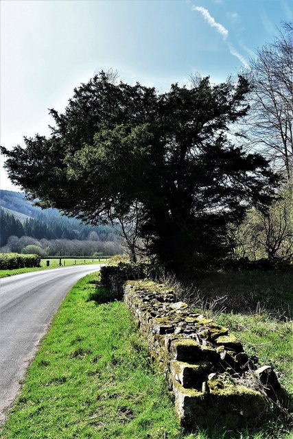
Allt Forgan is a prominent hill located in the county of Brecknockshire, Wales. It is situated in the southeastern part of the county, near the border with Monmouthshire. With an elevation of approximately 470 meters (1,542 feet), it is considered a notable mountain within the region.

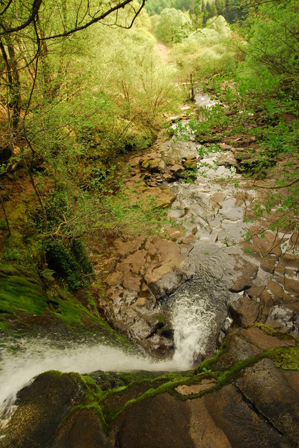
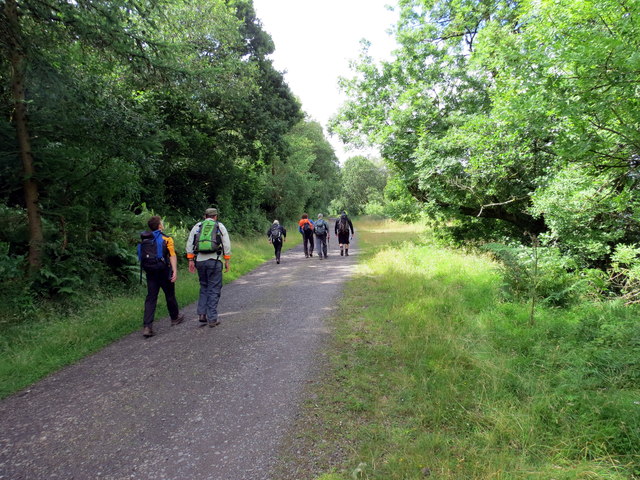
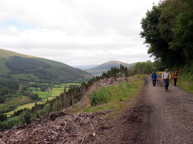
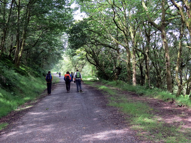
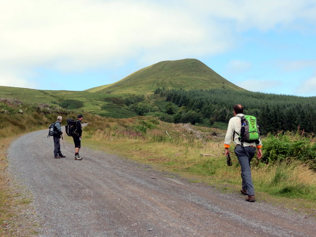
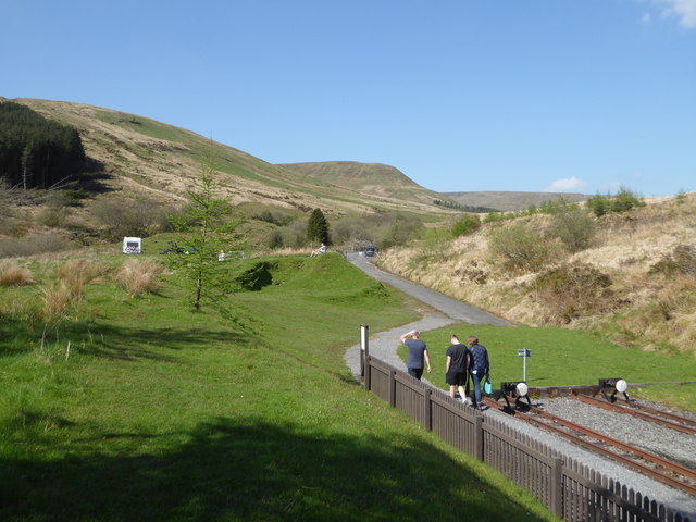
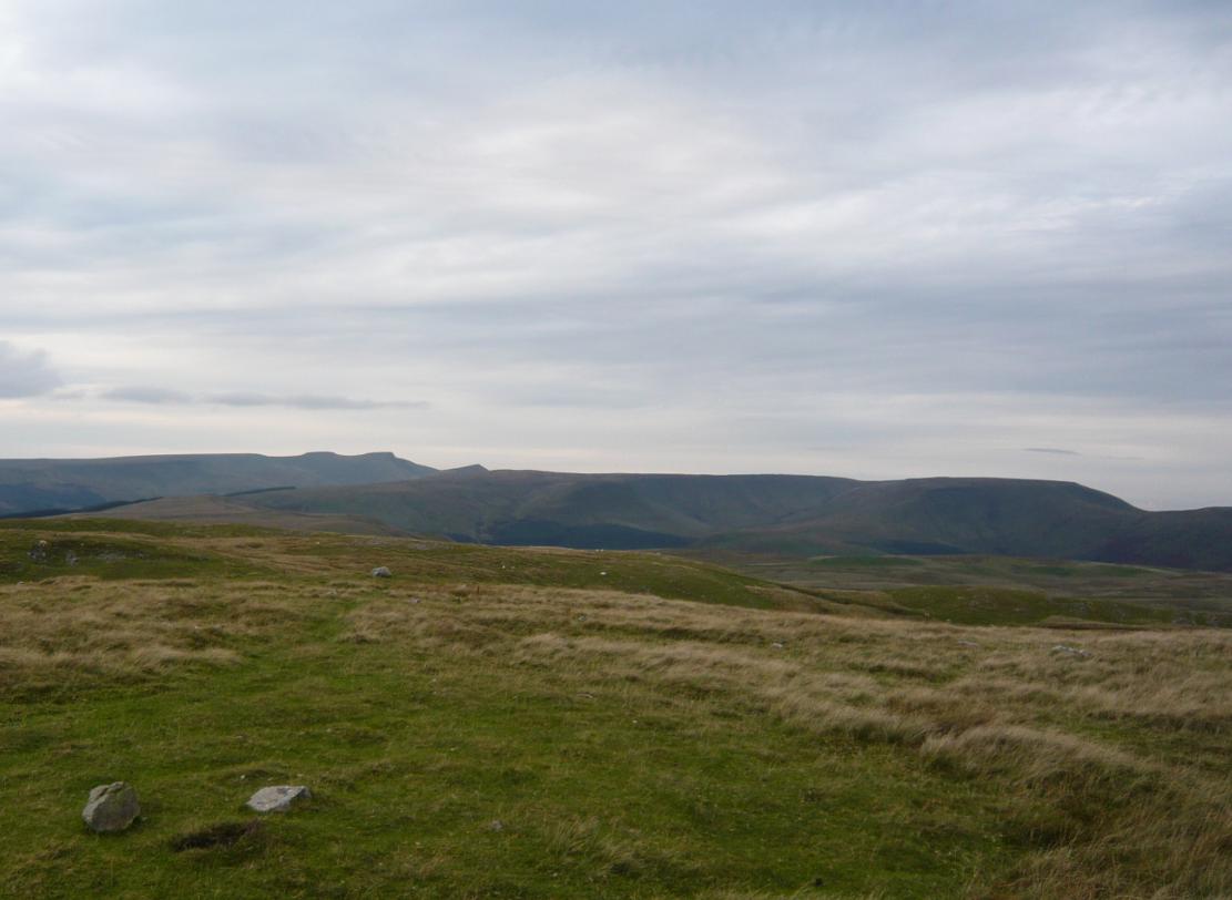
The hill offers stunning panoramic views of the surrounding countryside, making it a popular destination for hikers, nature enthusiasts, and photographers. Its location within the Brecon Beacons National Park further enhances its appeal, as it is surrounded by a beautiful and diverse natural landscape.

Allt Forgan is predominantly composed of sedimentary rocks, including sandstone and mudstone. These geological formations contribute to the hill's distinctive appearance and provide a unique habitat for a variety of plant and animal species.

The hill is accessible via several footpaths and trails, allowing visitors to explore its slopes and reach the summit. The ascent is moderate, making it suitable for individuals of different fitness levels. Along the way, hikers may encounter wildlife such as sheep, birds, and small mammals, adding to the charm of the experience.

Allt Forgan is also known for its historical significance, with traces of ancient settlements and burial cairns found in the vicinity. These remnants serve as a reminder of the hill's rich cultural heritage and provide insight into the lives of past communities in the area.

Overall, Allt Forgan offers a captivating blend of natural beauty, recreational opportunities, and historical intrigue, making it an excellent destination for those seeking an enriching outdoor experience in Brecknockshire.

If you have any feedback on the listing, please let us know in the comments section below.

Allt Forgan Images

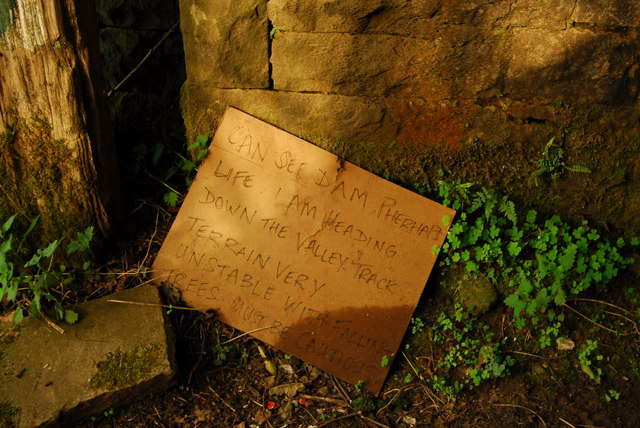
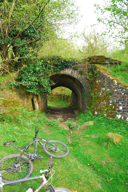
Images are sourced within 2km of 51.851242/-3.3579992 or Grid Reference SO0617. Thanks to Geograph Open Source API. All images are credited.

Odd notice under an old railway bridge Spotted under an old railway bridge on the Taff Trail near Torpantau. I presume this was part of some sort of training course; certainly, I didn't take it seriously enough to go and look for a distressed hiker. Perhaps I should have.
Odd notice under an old railway bridge
Spotted under an old railway bridge on the Taff Trail near Torpantau. I presume this was part of some sort of training course; certainly, I didn't take it seriously enough to go and look for a distressed hiker. Perhaps I should have.
Old railway bridge on the Taff Trail The bridge once carried the line from Brecon to Merthyr Tydfil, opened in the 1860s and closed completely in 1964. Near here was Torpantau Tunnel, the highest railway tunnel in the UK. At the other end of the tunnel, the narrow gauge Brecon Mountain Railway occupies about five mile of the trackbed.
We found a very odd notice here, see <a href="https://www.geograph.org.uk/photo/4957738">SO0716 : Odd notice under an old railway bridge</a> for more ...
Old railway bridge on the Taff Trail
The bridge once carried the line from Brecon to Merthyr Tydfil, opened in the 1860s and closed completely in 1964. Near here was Torpantau Tunnel, the highest railway tunnel in the UK. At the other end of the tunnel, the narrow gauge Brecon Mountain Railway occupies about five mile of the trackbed. We found a very odd notice here, see SO0716 : Odd notice under an old railway bridge for more ...
Keep away from the edge! Looking down a waterfall near Torpantau. My mother would have had kittens if she could have seen me taking this!
Keep away from the edge!
Looking down a waterfall near Torpantau. My mother would have had kittens if she could have seen me taking this!
Ordnance Survey Pivot This OS pivot can be found on the culvert SW side of the road. It marks a point 367.705m above mean sea level.
Ordnance Survey Pivot
This OS pivot can be found on the culvert SW side of the road. It marks a point 367.705m above mean sea level.
Ffordd y Bannau / Beacons Way Cerddwyr yn dilyn Ffordd y Bannau / Ffordd Taf.

Walkers following the Beacons Way / Taff Trail.
Ffordd y Bannau / Beacons Way
Cerddwyr yn dilyn Ffordd y Bannau / Ffordd Taf. Walkers following the Beacons Way / Taff Trail.
Tuag at Flaen y Glyn / Towards Blaen y Glyn Cerddwyr yn dilyn Ffordd y Bannau / Ffordd Taf i gyfeiriad Blaen y Glyn.

Walkers following the Beacons Way / Taff Trail in the direction of Blaen y Glyn (trans. head of the valley).
Tuag at Flaen y Glyn / Towards Blaen y Glyn
Cerddwyr yn dilyn Ffordd y Bannau / Ffordd Taf i gyfeiriad Blaen y Glyn. Walkers following the Beacons Way / Taff Trail in the direction of Blaen y Glyn (trans. head of the valley).
Blaen y Glyn Cerddwyr ym Mlaen y Glyn. Y fan yn y pellter yw Graig y Fan Ddu.

Walkers at Blaen y Cwm (trans. head of the valley). The peak in the distance is 
Craig y Fan Ddu (trans. hill of the black peak).
Blaen y Glyn
Cerddwyr ym Mlaen y Glyn. Y fan yn y pellter yw Graig y Fan Ddu. Walkers at Blaen y Cwm (trans. head of the valley). The peak in the distance is Craig y Fan Ddu (trans. hill of the black peak).
Craig y Fan Ddu Cerddwyr yn dringo Craig y Fan Ddu.

Walkers ascending Craig y Fan Ddu (trans. hill of the black peak).
Craig y Fan Ddu
Cerddwyr yn dringo Craig y Fan Ddu. Walkers ascending Craig y Fan Ddu (trans. hill of the black peak).
Ger Blaen Caerfanell          / Near Blaen Caerfannell Cerddwyr yn agosau at nant o'r enw Blaen Caerfannell.

Walkers approaching a stream known as Blaen Caerefanell (trans. source of the Caerfannell stream).
Ger Blaen Caerfanell / Near Blaen Caerfannell
Cerddwyr yn agosau at nant o'r enw Blaen Caerfannell. Walkers approaching a stream known as Blaen Caerefanell (trans. source of the Caerfannell stream).
Path heading up to Craig y Fan Ddu From Nant Bwrefwr the path heading up to Craig y Fan Ddu
Path heading up to Craig y Fan Ddu
From Nant Bwrefwr the path heading up to Craig y Fan Ddu
Blaen y Glyn Waterfall Waterfall at Blaen y Glyn.
Blaen y Glyn Waterfall
Waterfall at Blaen y Glyn.
Capel Glyn Collwng Veteran Yew A veteran Yew sits in the corner of the churchyard of the now ruinous Church.
Capel Glyn Collwng Veteran Yew
A veteran Yew sits in the corner of the churchyard of the now ruinous Church.
Brecon Mountain Railway - end of the line Torpantau looking towards the Brecon Beacons. The former standard gauge line has now been replaced with a narrow gauge line from Pant to Torpantau.
Brecon Mountain Railway - end of the line
Torpantau looking towards the Brecon Beacons. The former standard gauge line has now been replaced with a narrow gauge line from Pant to Torpantau.
Taf Fechan Forest [2] Brecon Beacons (Central) Forest resource plan unit (DU09) amounts to 2335 hectares comprising 8 distinct forest blocks; Talybont, Coety, Taf Fechan, Buckland, Dyffryn Crawnon, Llanddetty, Treberfedd and Cwm Glaisfer. It is managed by Cyfoeth Naturiol Cymru / Natural Resources Wales.
Taf Fechan Forest [2]
Brecon Beacons (Central) Forest resource plan unit (DU09) amounts to 2335 hectares comprising 8 distinct forest blocks; Talybont, Coety, Taf Fechan, Buckland, Dyffryn Crawnon, Llanddetty, Treberfedd and Cwm Glaisfer. It is managed by Cyfoeth Naturiol Cymru / Natural Resources Wales.
Pont Blaen-y-Glyn Bridge over the river Caerfanell.
Pont Blaen-y-Glyn
Bridge over the river Caerfanell.
Brecon Mountain Railway at Torpantau Newly restored locomotive No. 1 'Santa Teresa' is seen at the Torpantau terminus of the Brecon Mountain Railway. The locomotive, a Baldwin 2-6-2 built in 1897, spent most of its working life in Brazil.
Brecon Mountain Railway at Torpantau
Newly restored locomotive No. 1 'Santa Teresa' is seen at the Torpantau terminus of the Brecon Mountain Railway. The locomotive, a Baldwin 2-6-2 built in 1897, spent most of its working life in Brazil.
Step Down Stream One of the waterfalls in the River Caerfanell valley, taken from the east bank.
A public footpath runs beyond a fence, on the west bank, linking two car parks. With kissing gates, stiles at certain points, and a footbridge across it.
This waterfall is in the wooded section, others exists up in the more open area.
From where the river originates flows down the valley to the Talybont Reservoir
Step Down Stream
One of the waterfalls in the River Caerfanell valley, taken from the east bank. A public footpath runs beyond a fence, on the west bank, linking two car parks. With kissing gates, stiles at certain points, and a footbridge across it. This waterfall is in the wooded section, others exists up in the more open area. From where the river originates flows down the valley to the Talybont Reservoir
Show me another place!

Allt Forgan is located at Grid Ref: SO0617 (Lat: 51.851242, Lng: -3.3579992)

Unitary Authority: Powys

Police Authority: Dyfed Powys

What 3 Words

///scores.chilling.bloom. Near Llangynidr, Powys

Nearby Locations

Allt Forgan

Related Wikis

Torpantau railway station

Torpantau railway station is a station in the Welsh county of Brecknockshire (now in Powys), and the northern terminus of the narrow gauge Brecon Mountain...

Bwlch y Ddwyallt

Bwlch y Ddwyallt is the name commonly applied to the high point of the plateau of Gwaun Cerrig Llwydion in the eastern part of the Brecon Beacons in south...

Waun Rydd

Waun Rydd is a mountain in the Brecon Beacons National Park, in southern Powys, Wales. Its height is 769 m (2,523 ft) and it tops a large boggy plateau...

Dolygaer railway station

Dolygaer railway station (alternatively, Dol-y-gaer railway station) was a station serving the hamlet of Dol-y-gaer and the area adjacent to Pen-twyn Reservoir...

Talybont Reservoir

Talybont Reservoir (Welsh: Cronfa Ddŵr Tal-y-bont) is the largest stillwater reservoir in the central Brecon Beacons at 318 acres (1.29 km2). Talybont...

Pentir Rhiw railway station

Pentir Rhiw railway station (alternatively, Pant-y-rhiw railway station) was a station adjacent to Talybont Reservoir in Powys, Wales. The station was...

Mid Glamorgan

Mid Glamorgan (Welsh: Morgannwg Ganol) is a preserved county of Wales. From 1974 until 1996 it was also an administrative county with a county council...

Fan y Big

Fan y Big (Welsh pronunciation: [van ə ˈbiːg]) is a subsidiary summit of Waun Rydd in the Brecon Beacons National Park, in southern Powys, Wales. It is...

Nearby Amenities

Located within 500m of 51.851242,-3.3579992
Allt Forgan
Ele: 513
Natural: peak
Lat/Long: 51.8515618/-3.3588835
The data included in this document is from www.openstreetmap.org. The data is made available under ODbL.

Have you been to Allt Forgan?

Leave your review of Allt Forgan below (or comments, questions and feedback).