Horsell Birch

Settlement in Surrey Woking

England

Horsell Birch

Track off Carthouse Lane A track leading south off Carthouse Lane.
Track off Carthouse Lane Credit: Oscar

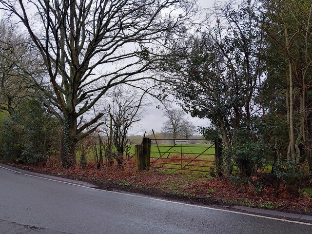
Horsell Birch is a picturesque village located in the county of Surrey, England. Situated just three miles south of the town of Woking, it forms a part of the Woking Borough Council area. The village is nestled within a tranquil and idyllic rural setting, surrounded by rolling hills, woodlands, and open fields.

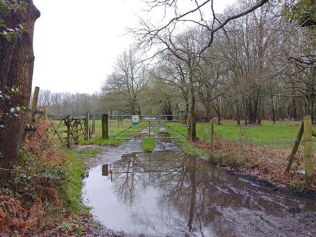
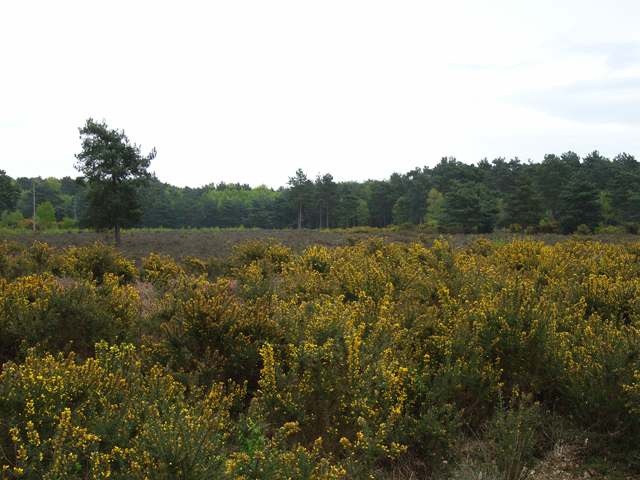
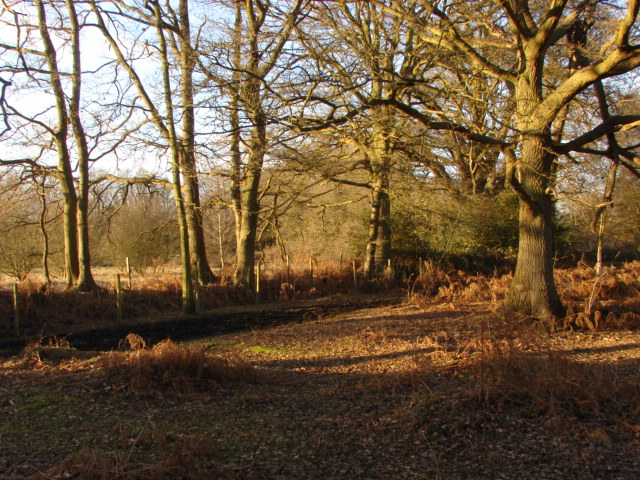
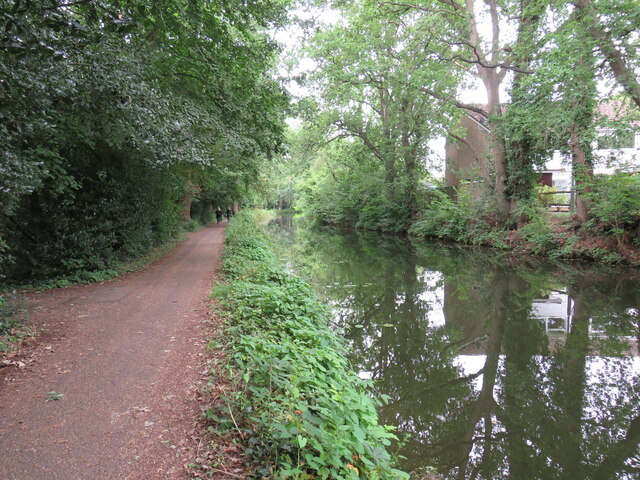
Horsell Birch is renowned for its natural beauty and offers an abundance of outdoor recreational opportunities. The area is predominantly characterized by its vast birch woodland, which provides a serene environment for walking, hiking, and birdwatching. The village is also home to the Horsell Common, a designated Site of Special Scientific Interest, which boasts a diverse range of flora and fauna.

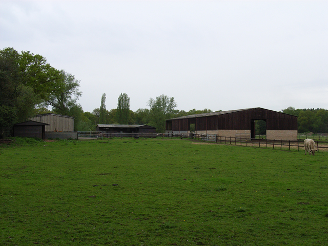
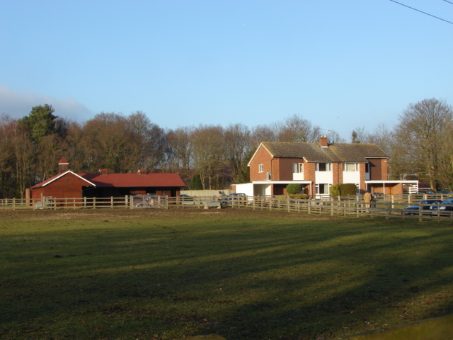
The village itself exudes a charming and welcoming atmosphere, with a mix of traditional and modern architecture. The local community is close-knit and fosters a strong sense of pride in their village. Horsell Birch is dotted with charming cottages, a picturesque church, and a number of local amenities, including a village hall and a small convenience store.

In terms of transport links, Horsell Birch benefits from excellent connectivity. The nearby Woking train station provides easy access to central London and other major cities, while the M25 motorway is within a short driving distance.

Overall, Horsell Birch offers a perfect blend of rural tranquility and convenient access to nearby urban centers, making it an attractive place to live or visit for those seeking a peaceful retreat within easy reach of amenities.

If you have any feedback on the listing, please let us know in the comments section below.

Horsell Birch Images

Images are sourced within 2km of 51.321673/-0.5950332 or Grid Reference SU9859. Thanks to Geograph Open Source API. All images are credited.

Track off Carthouse Lane A track leading south off Carthouse Lane.
Track off Carthouse Lane
A track leading south off Carthouse Lane.
Gate on Carthouse Lane A gate to the north of Carthouse Lane, leading to a field.
Gate on Carthouse Lane
A gate to the north of Carthouse Lane, leading to a field.
Carthouse Lane A lane between Chobham Road and a roundabout serving Littlewick Road, Horsell Birch and Kestrel Way.
Carthouse Lane
A lane between Chobham Road and a roundabout serving Littlewick Road, Horsell Birch and Kestrel Way.
Bullock and barns, near Coxhill Green The barns are beside The Bourne.
Bullock and barns, near Coxhill Green
The barns are beside The Bourne.
Horsell Common From the northern edge of the common, on the footpath from Coxhill Green.
Horsell Common
From the northern edge of the common, on the footpath from Coxhill Green.
Horsell Common Oak Trees on the northern edge of Horsell Common by the light of late winter sun.
Horsell Common
Oak Trees on the northern edge of Horsell Common by the light of late winter sun.
Millbrook Animal sheds
Millbrook
Animal sheds
Millbrook Buildings at Millbrook
Millbrook
Buildings at Millbrook
Chobham Fields near the Millbrook Animal Centre
Chobham
Fields near the Millbrook Animal Centre
Horsell Common The recently cleared area east of Horsell Common Road. The object is to create an open corridor between the western section along Littlewick Road and the main body of the common. It may look like the Somme at the moment but in 2 to 3 years the area will have regrown. I will endeavour to take a comparison shot in the due process of time.
Horsell Common
The recently cleared area east of Horsell Common Road. The object is to create an open corridor between the western section along Littlewick Road and the main body of the common. It may look like the Somme at the moment but in 2 to 3 years the area will have regrown. I will endeavour to take a comparison shot in the due process of time.
Horsell Common The main track running south towards Littlewick Road from Coxhill Green
Horsell Common
The main track running south towards Littlewick Road from Coxhill Green
River Bourne, Coxhill Green The River Bourne from the bridge on Deep Pool Lane.
River Bourne, Coxhill Green
The River Bourne from the bridge on Deep Pool Lane.
Deep Pool Farm The Green outside Deep Pool Farm in Coxhill Green.
Deep Pool Farm
The Green outside Deep Pool Farm in Coxhill Green.
Horsell Common Scots pine wood on the northern edge of the Grasslands area of Horsell Common. As with all pine woods there is no understorey due to the shade and the poisoning effect of the fallen pine needles. The Scots Pine is one of the archetypal trees of lowland heath as it is able to grow in the poor soil of these areas.
Horsell Common
Scots pine wood on the northern edge of the Grasslands area of Horsell Common. As with all pine woods there is no understorey due to the shade and the poisoning effect of the fallen pine needles. The Scots Pine is one of the archetypal trees of lowland heath as it is able to grow in the poor soil of these areas.
RSPCA, Millbrook The dog kennels at the RSPCA centre, Millbrook near Chobham.
RSPCA, Millbrook
The dog kennels at the RSPCA centre, Millbrook near Chobham.
Small bridge near Bunyan's Lane bridleway Bridge made from old railway sleepers, spanning a ditch next to one of the access tracks at Chobham Golf Club.
Small bridge near Bunyan's Lane bridleway
Bridge made from old railway sleepers, spanning a ditch next to one of the access tracks at Chobham Golf Club.
Basingstoke Canal, Woking View  of the canal near Parley Drive Bridge looking towards Woking
Basingstoke Canal, Woking
View of the canal near Parley Drive Bridge looking towards Woking
Basingstoke Canal Woking View looking east towards Arthur's Bridge. It carries Bridge Barn Lane over the canal.
Basingstoke Canal Woking
View looking east towards Arthur's Bridge. It carries Bridge Barn Lane over the canal.
Show me another place!

Horsell Birch is located at Grid Ref: SU9859 (Lat: 51.321673, Lng: -0.5950332)

Administrative County: Surrey

District: Woking

Police Authority: Surrey

What 3 Words

///wake.rider.topic. Near Knaphill, Surrey

Related Wikis

St Andrew's Church, Goldsworth Park

St. Andrew's Church is the parish church of Goldsworth Park, a district of Woking, Surrey, England. The church paid for and sponsors the secular local...

Inkerman Barracks

Inkerman Barracks was a military establishment on Raglan Terrace, Knaphill, Surrey, England. == History == The facilities on the 65-acre site were originally...

The Winston Churchill School, Woking

The Winston Churchill School is a comprehensive, secondary school in Woking, England. The school was established in 1967. It is near Knaphill, Bisley,...

Goldsworth Park

Goldsworth Park is a large housing estate to the north-west of Woking in Surrey, England. It was named after the nearby Goldsworth area which was a large...

St John's, Woking

St Johns and Hook Heath is a suburban ward in Surrey consisting of two settlements founded in the 19th century in the medieval parish of Woking. The two...

Woking Crematorium

Woking Crematorium is a crematorium in Woking, a large town in the west of Surrey, England. Established in 1878, it was the first custom-built crematorium...

St John's Church, Woking

St John's Church is located in St John's, Woking, England. The church is in the parish of St John's, Diocese of Guildford, which in turn is in the Province...

Mizens Railway

Mizens Railway is a 7ΒΌ inch gauge miniature railway located in a 10-acre site near Woking in Surrey, England. The railway comprises three routes, the...

Nearby Amenities

Located within 500m of 51.321673,-0.5950332
Crossing
Crossing: unmarked
Kerb: lowered
Sloped Curb: yes
Source: Surrey Air Survey
Lat/Long: 51.3199399/-0.5968459
Crossing
Crossing: unmarked
Kerb: lowered
Sloped Curb: yes
Lat/Long: 51.3179543/-0.5918107
Traffic Signals
Traffic Signals Direction: backward
Lat/Long: 51.3181411/-0.5927404
Post Box
Collection Plate: CP1
Collection Times: Mo-Fr 16:45; Sa 10:45
Last Check: 2019-04-03
Last Checked: 2021-06-07
Operator: Royal Mail
Post Box Type: pillar
Ref: GU21 98
Royal Cypher: GR
Royal Cypher Wikidata: Q33102273
Source: survey
Lat/Long: 51.3178312/-0.5953702
Bus Stop
Brockhill
Naptan AtcoCode: 40004404145A
Naptan Bearing: NW
Naptan CommonName: Brockhill
Naptan Indicator: Opp
Naptan Landmark: Brockhill
Naptan NaptanCode: suradada
Naptan PlusbusZoneRef: WOKING
Naptan Street: Clifton Way
Public Transport: platform
Source: naptan_import
Lat/Long: 51.318278/-0.5941835
Mini Roundabout
Direction: clockwise
Lat/Long: 51.3196616/-0.5891621
Bicycle Parking
Bicycle Parking: stands
Capacity: 20
Covered: no
Lat/Long: 51.3186332/-0.5902681
Recycling
Recycling Beverage Cartons: yes
Recycling Books: yes
Recycling Cardboard: yes
Recycling Cds: yes
Recycling Clothes: yes
Recycling Dvds: yes
Recycling Paper: yes
Recycling Shoes: yes
Recycling Type: container
Lat/Long: 51.3179848/-0.5911144
Crossing
Crossing: unmarked
Kerb: lowered
Sloped Curb: yes
Lat/Long: 51.3223078/-0.5887653
Bus Stop
Hawkswell Close
Naptan AtcoCode: 40004404144B
Naptan Bearing: N
Naptan CommonName: Hawkswell Close
Naptan Indicator: Just after
Naptan Landmark: Hawkswell Close
Naptan NaptanCode: surgdwga
Naptan PlusbusZoneRef: WOKING
Naptan Street: Kirkland Avenue
Public Transport: platform
Source: naptan_import
Lat/Long: 51.3220203/-0.5974266
Noexit: yes
Lat/Long: 51.3225796/-0.6009879
Telephone
Booth: KX100
Covered: booth
Last Check: 2018-07-21
Operator: BT
Payment Coins: yes
Payment Credit Cards: yes
Payment Debit Cards: yes
Lat/Long: 51.3227312/-0.5979152
Crossing
Crossing: traffic_signals
Crossing Ref: pelican
Kerb: lowered
Sloped Curb: yes
Lat/Long: 51.3229688/-0.5981287
Bus Stop
Tregarth Place
Bench: yes
Bin: no
Lit: yes
Naptan AtcoCode: 40004404243B
Naptan Bearing: S
Naptan CommonName: Tregarth Place
Naptan Indicator: Just after
Naptan Landmark: Clifton Way
Naptan NaptanCode: surgmtwd
Naptan PlusbusZoneRef: WOKING
Naptan Street: Kirkland Avenue
Public Transport: platform
Shelter: yes
Source: naptan_import
Tactile Paving: no
Lat/Long: 51.3202764/-0.5965407
Bus Stop
Tregarth Place
Bench: yes
Bin: no
Lit: yes
Naptan AtcoCode: 40004404243A
Naptan Bearing: N
Naptan CommonName: Tregarth Place
Naptan Indicator: Just Before
Naptan Landmark: Clifton Way
Naptan NaptanCode: surgtama
Naptan PlusbusZoneRef: WOKING
Naptan Street: Kirkland Avenue
Public Transport: platform
Shelter: yes
Source: naptan_import
Tactile Paving: no
Lat/Long: 51.3202844/-0.5967027
Turning Circle
Lat/Long: 51.319884/-0.5947841
Crossing
Crossing: unmarked
Kerb: lowered
Sloped Curb: yes
Lat/Long: 51.3204544/-0.5933691
Crossing
Crossing: unmarked
Kerb: lowered
Sloped Curb: yes
Lat/Long: 51.3250246/-0.599314
Pharmacy
Boots
Brand Wikidata: Q6123139
Dispensing: yes
Last Check: 2018-12-10
Opening Hours: Mo-Fr 09:00-18:30; Sa 09:00-17:30; Su off
Lat/Long: 51.3187856/-0.5902044
Beacon House
Addr City: Woking
Addr Housename: Goldsworth Park Centre
Addr Housenumber: 7
Addr Postcode: GU21 3LG
Addr Street: Denton Way
Opening Hours: Mo-Fr 09:00-17:45; Sa 09:00-17:00; Su,PH off
Phone: +44 1483 772124
Shop: dry_cleaning;shoe_repair
Lat/Long: 51.3187951/-0.5900496
Post Box
Collection Plate: CP8
Collection Times: Mo-Fr 17:15; Sa 12:30
Last Check: 2021-06-07
Operator: Royal Mail
Post Box Type: pillar
Ref: GU21 140
Royal Cypher: EIIR
Royal Cypher Wikidata: Q33102113
Source: survey
Lat/Long: 51.3187505/-0.5900039
Addr City: Woking
Addr Postcode: GU21 3QD
Lat/Long: 51.3182628/-0.5944436
Crossing
Crossing: unmarked
Kerb: lowered
Sloped Curb: yes
Lat/Long: 51.322236/-0.5885324
Bus Stop
Denton Way
Bench: no
Bin: no
Lit: yes
Naptan AtcoCode: 40004404104B
Naptan Bearing: NE
Naptan CommonName: Denton Way
Naptan Indicator: NE-bound
Naptan Landmark: Denton Way
Naptan NaptanCode: surgdpjw
Naptan PlusbusZoneRef: WOKING
Naptan Street: Denton Way
Public Transport: platform
Shelter: no
Source: naptan_import
Tactile Paving: no
Lat/Long: 51.3173128/-0.5965247
Bus Stop
Hawkswell Close
Naptan AtcoCode: 40004404144A
Naptan Bearing: S
Naptan CommonName: Hawkswell Close
Naptan Indicator: Opp
Naptan Landmark: Hawkswell Close
Naptan NaptanCode: surgdwdw
Naptan PlusbusZoneRef: WOKING
Naptan Street: Kirkland Avenue
Naptan Verified: no
Public Transport: platform
Source: naptan_import
Lat/Long: 51.3217047/-0.5970388
Bus Stop
Brockhill
Naptan AtcoCode: 40004404145B
Naptan Bearing: SE
Naptan CommonName: Brockhill
Naptan Indicator: adj
Naptan Landmark: Brockhill
Naptan NaptanCode: suradadg
Naptan PlusbusZoneRef: WOKING
Naptan Street: Clifton Way
Public Transport: platform
Source: naptan_import
Lat/Long: 51.3187157/-0.5941645
Entrance: yes
Lat/Long: 51.3187108/-0.5906896
Crossing
Crossing: uncontrolled
Crossing Ref: zebra
Lat/Long: 51.3183688/-0.5905136
Crossing
Crossing: unmarked
Kerb: lowered
Sloped Curb: yes
Lat/Long: 51.3235269/-0.6009041
Crossing
Crossing: unmarked
Kerb: lowered
Sloped Curb: yes
Lat/Long: 51.3181205/-0.5922325
Crossing
Crossing: unmarked
Kerb: lowered
Sloped Curb: yes
Lat/Long: 51.3181383/-0.5923156
Crossing
Crossing: unmarked
Kerb: lowered
Sloped Curb: yes
Lat/Long: 51.3235665/-0.5996142
Crossing
Crossing: unmarked
Kerb: lowered
Sloped Curb: yes
Lat/Long: 51.3236008/-0.6012743
Crossing
Crossing: unmarked
Kerb: lowered
Sloped Curb: yes
Lat/Long: 51.3173142/-0.59609
Crossing
Crossing: unmarked
Kerb: lowered
Sloped Curb: yes
Lat/Long: 51.3181124/-0.593123
Crossing
Crossing: unmarked
Kerb: lowered
Sloped Curb: yes
Lat/Long: 51.3177009/-0.5957486
Crossing
Crossing: unmarked
Kerb: lowered
Sloped Curb: yes
Lat/Long: 51.318213/-0.5940799
Crossing
Crossing: unmarked
Kerb: lowered
Sloped Curb: yes
Lat/Long: 51.3193861/-0.5946356
Crossing
Crossing: unmarked
Kerb: lowered
Sloped Curb: yes
Source: Surrey Air Survey
Lat/Long: 51.319511/-0.5986406
Crossing
Crossing: unmarked
Kerb: lowered
Sloped Curb: yes
Source: Surrey Air Survey
Lat/Long: 51.3196629/-0.5978044
Crossing
Crossing: unmarked
Kerb: lowered
Sloped Curb: yes
Lat/Long: 51.3199258/-0.5957481
Crossing
Crossing: unmarked
Kerb: lowered
Sloped Curb: yes
Lat/Long: 51.3200183/-0.596631
Crossing
Crossing: unmarked
Kerb: lowered
Sloped Curb: yes
Lat/Long: 51.3212778/-0.5967205
Crossing
Crossing: unmarked
Kerb: lowered
Sloped Curb: yes
Lat/Long: 51.3216415/-0.597221
Crossing
Crossing: unmarked
Kerb: lowered
Sloped Curb: yes
Lat/Long: 51.3236875/-0.5970116
Crossing
Crossing: unmarked
Kerb: lowered
Sloped Curb: yes
Lat/Long: 51.3232781/-0.5983647
Barrier: height_restrictor
Maxheight: 2.1
Lat/Long: 51.3237771/-0.5943649
Goldsworth Park
Place: neighbourhood
Wikidata: Q5580362
Lat/Long: 51.3190272/-0.5944554
Crossing
Crossing: unmarked
Kerb: lowered
Sloped Curb: yes
Lat/Long: 51.3181117/-0.5942247
Crossing
Crossing: traffic_signals
Crossing Ref: pelican
Kerb: lowered
Sloped Curb: yes
Lat/Long: 51.3181333/-0.5926795
Traffic Signals
Traffic Signals Direction: forward
Lat/Long: 51.3181238/-0.5926047
Crossing
Crossing: unmarked
Kerb: lowered
Sloped Curb: yes
Lat/Long: 51.3231183/-0.5889755
Barrier: bollard
Lat/Long: 51.3249366/-0.5987525
Crossing
Crossing: unmarked
Kerb: lowered
Sloped Curb: yes
Source: Surrey Air Survey
Lat/Long: 51.3194057/-0.5986121
Traffic Signals
Source: Surrey-Air_Survey
Traffic Signals Direction: backward
Lat/Long: 51.3229178/-0.5980461
Crossing
Crossing: unmarked
Kerb: lowered
Sloped Curb: yes
Lat/Long: 51.3222846/-0.5974882
Traffic Signals
Source: Surrey-Air_Survey
Traffic Signals Direction: forward
Lat/Long: 51.3230059/-0.5981896
Crossing
Crossing: unmarked
Kerb: lowered
Sloped Curb: yes
Lat/Long: 51.3237149/-0.5944545
Traffic Calming: rumble_strip
Lat/Long: 51.3225767/-0.5884053
Traffic Calming: rumble_strip
Lat/Long: 51.3222586/-0.5885636
Traffic Calming: rumble_strip
Lat/Long: 51.3223122/-0.5887245
Barrier: bollard
Lat/Long: 51.318588/-0.590221
Generator Method: photovoltaic
Generator Output Electricity: yes
Generator Source: solar
Generator Type: solar_photovoltaic_panel
Location: roof
Power: generator
Lat/Long: 51.3219229/-0.6018689
Generator Method: photovoltaic
Generator Output Electricity: yes
Generator Source: solar
Generator Type: solar_photovoltaic_panel
Location: roof
Power: generator
Lat/Long: 51.3206556/-0.5923149
Generator Method: photovoltaic
Generator Output Electricity: yes
Generator Source: solar
Generator Type: solar_photovoltaic_panel
Location: roof
Power: generator
Lat/Long: 51.3191855/-0.592787
Generator Method: photovoltaic
Generator Output Electricity: yes
Generator Source: solar
Generator Type: solar_photovoltaic_panel
Location: roof
Power: generator
Lat/Long: 51.3188234/-0.5929828
Generator Method: photovoltaic
Generator Output Electricity: yes
Generator Source: solar
Generator Type: solar_photovoltaic_panel
Location: roof
Power: generator
Lat/Long: 51.3188704/-0.5935487
Generator Method: photovoltaic
Generator Output Electricity: yes
Generator Source: solar
Generator Type: solar_photovoltaic_panel
Location: roof
Power: generator
Lat/Long: 51.3189307/-0.5938679
Generator Method: photovoltaic
Generator Output Electricity: yes
Generator Source: solar
Generator Type: solar_photovoltaic_panel
Location: roof
Power: generator
Lat/Long: 51.3188067/-0.5940047
Generator Method: photovoltaic
Generator Output Electricity: yes
Generator Source: solar
Generator Type: solar_photovoltaic_panel
Location: roof
Power: generator
Lat/Long: 51.3187648/-0.593892
Generator Method: photovoltaic
Generator Output Electricity: yes
Generator Source: solar
Generator Type: solar_photovoltaic_panel
Location: roof
Power: generator
Lat/Long: 51.3186659/-0.593082
Generator Method: photovoltaic
Generator Output Electricity: yes
Generator Source: solar
Generator Type: solar_photovoltaic_panel
Location: roof
Power: generator
Lat/Long: 51.3185619/-0.5932376
Generator Method: photovoltaic
Generator Output Electricity: yes
Generator Source: solar
Generator Type: solar_photovoltaic_panel
Location: roof
Power: generator
Lat/Long: 51.3184295/-0.5934092
Generator Method: photovoltaic
Generator Output Electricity: yes
Generator Source: solar
Generator Type: solar_photovoltaic_panel
Location: roof
Power: generator
Lat/Long: 51.3183541/-0.5936855
Generator Method: photovoltaic
Generator Output Electricity: yes
Generator Source: solar
Generator Type: solar_photovoltaic_panel
Location: roof
Power: generator
Lat/Long: 51.3184295/-0.5938867
Generator Method: photovoltaic
Generator Output Electricity: yes
Generator Source: solar
Generator Type: solar_photovoltaic_panel
Location: roof
Power: generator
Lat/Long: 51.3176349/-0.5940959
Generator Method: photovoltaic
Generator Output Electricity: yes
Generator Source: solar
Generator Type: solar_photovoltaic_panel
Location: roof
Power: generator
Lat/Long: 51.317935/-0.5940127
Generator Method: photovoltaic
Generator Output Electricity: yes
Generator Source: solar
Generator Type: solar_photovoltaic_panel
Location: roof
Power: generator
Lat/Long: 51.3209942/-0.5883935
Generator Method: photovoltaic
Generator Output Electricity: yes
Generator Source: solar
Generator Type: solar_photovoltaic_panel
Location: roof
Power: generator
Lat/Long: 51.3178428/-0.5964777
Post Office
Goldsworth Park Post Office
Addr City: Woking
Addr Housenumber: 5
Addr Postcode: GU21 3LG
Addr Street: Denton Way
Brand: Post Office
Brand Wikidata: Q1783168
Description: This post office is inside the McColl's convenience store.
Operator: Post Office Ltd
Ref Pol Id: 2588
Source: receipt from visit
Lat/Long: 51.3188068/-0.5898439
Bench
Lat/Long: 51.3186909/-0.5901891
Barrier: height_restrictor
Maxheight: 2.1
Lat/Long: 51.3238066/-0.5932783
Leisure: playground
Lat/Long: 51.3186729/-0.590125
Cafe
Quackers Cafe
Lat/Long: 51.3230062/-0.5936169
The data included in this document is from www.openstreetmap.org. The data is made available under ODbL.

Have you been to Horsell Birch?

Leave your review of Horsell Birch below (or comments, questions and feedback).