Blàr Achaidh

Hill, Mountain in Perthshire

Scotland

Blàr Achaidh

Road in Glenn Fearnach Allt Fearnach to the left. The picture is taken after passing a gate just beyond Crannach.
Road in Glenn Fearnach Credit: Aleks Scholz

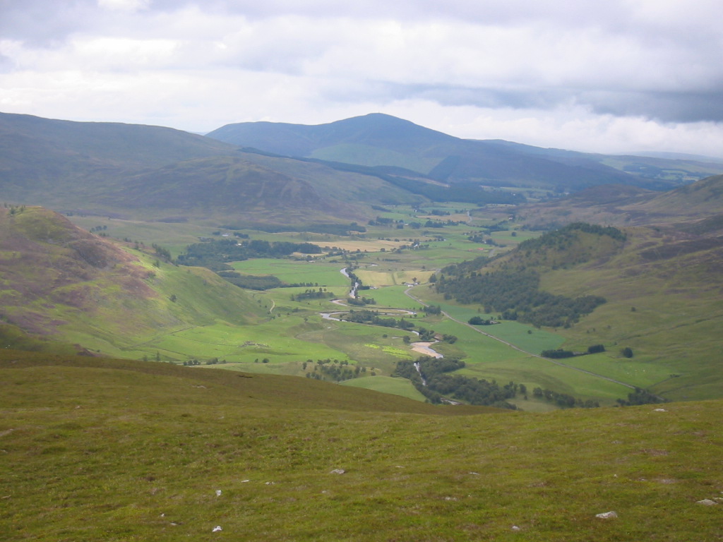
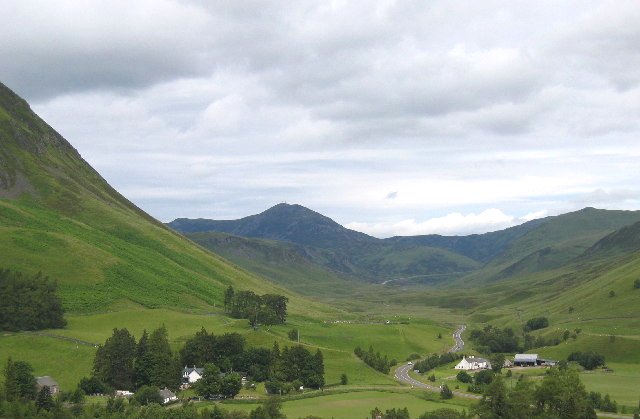
Blàr Achaidh, located in Perthshire, Scotland, is a prominent hill/mountain with a rich history and natural beauty. With an elevation of approximately 1,703 feet (519 meters), it offers breathtaking views of the surrounding landscape.

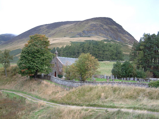
Blàr Achaidh is situated within the Loch Rannoch and Glen Lyon National Scenic Area, making it a popular destination for hikers, nature enthusiasts, and photographers. The mountain is characterized by its distinctive conical shape, covered in heather and grasses that change color with the seasons. This creates a stunning visual display, especially during the autumn when the hills are ablaze with vibrant hues.

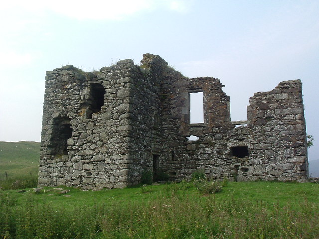
The hill/mountain has a fascinating historical significance as well. It was once a vital location for the ancient Celts, who used it as a sacred site for rituals and gatherings. Today, remnants of old settlements, cairns, and stone circles can still be found on the hill, providing a glimpse into its past.

The ascent to the summit of Blàr Achaidh is rewarding, offering panoramic views of the surrounding countryside, including the nearby Loch Rannoch and Glen Lyon. On a clear day, one can even catch a glimpse of the distant Ben Nevis, the highest mountain in the British Isles.

Blàr Achaidh is easily accessible, with well-marked trails and paths leading to its summit. However, it is important for visitors to come prepared with suitable clothing, sturdy footwear, and navigation tools, as the weather conditions can change rapidly, and the terrain can be challenging in some areas.

Overall, Blàr Achaidh is a remarkable hill/mountain that combines natural beauty, historical significance, and breathtaking vistas, making it a must-visit destination for those exploring the Perthshire region.

If you have any feedback on the listing, please let us know in the comments section below.

Blàr Achaidh Images

Images are sourced within 2km of 56.783517/-3.5328188 or Grid Reference NO0666. Thanks to Geograph Open Source API. All images are credited.

Road in Glenn Fearnach Allt Fearnach to the left. The picture is taken after passing a gate just beyond Crannach.
Road in Glenn Fearnach
Allt Fearnach to the left. The picture is taken after passing a gate just beyond Crannach.
Frozen Loch Crannach
Forest track, Calamanach Wood A view back down the track among the trees planted in 1988.
Forest track, Calamanach Wood
A view back down the track among the trees planted in 1988.
Upper gate, Calamanach Wood On the Cateran Trail; a notice on the gate states 'Greengate - footpath to Glenshee'.
Upper gate, Calamanach Wood
On the Cateran Trail; a notice on the gate states 'Greengate - footpath to Glenshee'.
Deer at Faire na Paitig Two red deer were grazing as I approached along the outside of the fence bounding Calamanach Wood.
Deer at Faire na Paitig
Two red deer were grazing as I approached along the outside of the fence bounding Calamanach Wood.
Stone circle at Faire na Paitig I approached the location shown on my 1:50,000 map expecting to see a circle to rival Stonehenge, but in reality it comprised these 4 stones low in the heather about 2m diameter overall.
Stone circle at Faire na Paitig
I approached the location shown on my 1:50,000 map expecting to see a circle to rival Stonehenge, but in reality it comprised these 4 stones low in the heather about 2m diameter overall.
Cateran Trail below Elrig The track heads N then NE to cross An Lairig before descending to Spittal of Glenshee.
Cateran Trail below Elrig
The track heads N then NE to cross An Lairig before descending to Spittal of Glenshee.
Cateran Trail waymark The trail waymark has been carved into the steps up to the gate through the deer fence at the top edge of Calamanach Wood.
Cateran Trail waymark
The trail waymark has been carved into the steps up to the gate through the deer fence at the top edge of Calamanach Wood.
Frogspawn at 450m Frogspawn on a puddle in the track at a height of 450m below Elrig.
Frogspawn at 450m
Frogspawn on a puddle in the track at a height of 450m below Elrig.
Glen of the Allt Doire nan Eun Wide heathery hillsides are  on each side of this moorland burn, with a number of hut circles shown on the 1:25,000 map.
Glen of the Allt Doire nan Eun
Wide heathery hillsides are on each side of this moorland burn, with a number of hut circles shown on the 1:25,000 map.
The Cateran Trail and Creag an Dubh Shluic The Allt Doire nan Eun is close to the track just S of the Upper Lunch Hut, with Creag an Dubh Shluic forming the skyline.
The Cateran Trail and Creag an Dubh Shluic
The Allt Doire nan Eun is close to the track just S of the Upper Lunch Hut, with Creag an Dubh Shluic forming the skyline.
Track junction near Upper Lunch Hut The track shown here is a loop out to the E which rejoins the Cateran Trail S of Calamanach Wood.
Track junction near Upper Lunch Hut
The track shown here is a loop out to the E which rejoins the Cateran Trail S of Calamanach Wood.
Upper Lunch Hut below Creag Bhreac The notice on the door reads 'Footpath walkers are welcome to take shelter' - an enlightened attitude by the Dirnanean Estate. The Visitors' Book has entries from far and wide including Mexico and New Zealand.
Upper Lunch Hut below Creag Bhreac
The notice on the door reads 'Footpath walkers are welcome to take shelter' - an enlightened attitude by the Dirnanean Estate. The Visitors' Book has entries from far and wide including Mexico and New Zealand.
Inside the Lunch Hut In the Visitors' Book is an extract from Queen Victoria's Scottish Diaries describing her journey by pony from Enochdhu to Spittal of Glenshee on Friday 13th October 1863. Let's hope the modern day visitors repay the trust of the estate in keeping the hut open by leaving it as they find it.
Inside the Lunch Hut
In the Visitors' Book is an extract from Queen Victoria's Scottish Diaries describing her journey by pony from Enochdhu to Spittal of Glenshee on Friday 13th October 1863. Let's hope the modern day visitors repay the trust of the estate in keeping the hut open by leaving it as they find it.
Looking southwards along the Cateran Trail The roof of the Lunch Hut can be seen above centre with the summit of Elrig beyond.
Looking southwards along the Cateran Trail
The roof of the Lunch Hut can be seen above centre with the summit of Elrig beyond.
Summit cairn, Creag Bhreac A view up the S ridge to the summit of Ben Earb.
Summit cairn, Creag Bhreac
A view up the S ridge to the summit of Ben Earb.
Elrig from Creag Bhreac A view down to the third summit, Elrig, on the ridge running S from Ben Earb.
Elrig from Creag Bhreac
A view down to the third summit, Elrig, on the ridge running S from Ben Earb.
Muirburn in the distance over Calamanach Wood Smoke from burning heather showing up below a showery sky, seen over the ridge above the plantation.
Muirburn in the distance over Calamanach Wood
Smoke from burning heather showing up below a showery sky, seen over the ridge above the plantation.
Show me another place!

Blàr Achaidh is located at Grid Ref: NO0666 (Lat: 56.783517, Lng: -3.5328188)

Unitary Authority: Perth and Kinross

Police Authority: Tayside

What 3 Words

///costly.pans.pills. Near Pitlochry, Perth & Kinross

Nearby Locations

Blàr Achaidh

Related Wikis

Dirnanean House

Dirnanean House is part of a private, traditional Highland estate located near Enochdhu in Moulin parish, Blairgowrie, Perth and Kinross, Scotland, 10...

Kindrogan House

Kindrogan House is located near Enochdhu, Blairgowrie, Perth and Kinross in Moulin parish, at the head of Strath Ardle, 7 miles (11 km) ENE of Pitlochry...

Balvarran

Balvarran is an old laird's house and estate in Strathardle, Perth and Kinross. It is situated to the east of the River Ardle, a mile east of Enochdhu...

Shee Water

The Shee Water (Scottish Gaelic: Sìdh / Uisge Sìdh) is a river in the highland portion of eastern Perth and Kinross, Scotland. The Allt a' Ghlinne Bhig...

Spittal of Glenshee

The Spittal of Glenshee (Scottish Gaelic: Spideal Ghlinn Sìdh, pronounced [ˈspitʲəl̪ˠ ʝliːɲ ˈʃiːʝ]) lies at the head of Glenshee in the highlands of eastern...

Whitefield Castle

Whitefield Castle is a ruined L-plan tower-house on the hill above the village of Kirkmichael, in Strathardle, Perth and Kinross, Scotland. == History... ==

Glen Shee

Glen Shee (Scottish Gaelic: Gleann Sith) is a glen in eastern Perthshire, Scotland. Shee Water flows through the glen. The head of the glen, where Gleann...

Ben Gulabin

Ben Gulabin (806 m) is a mountain in the Mounth area of the Grampian Mountains in Scotland. It is located on the eastern side of the main A93 road between...

Have you been to Blàr Achaidh?

Leave your review of Blàr Achaidh below (or comments, questions and feedback).