Hainshaw Hill

Hill, Mountain in Midlothian

Scotland

Hainshaw Hill

West Water Reservoir from the air Viewed over Harrows Law from a Prague bound flight from Edinburgh.
West Water Reservoir from the air Credit: Thomas Nugent

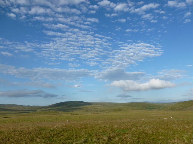
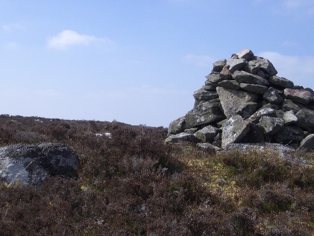
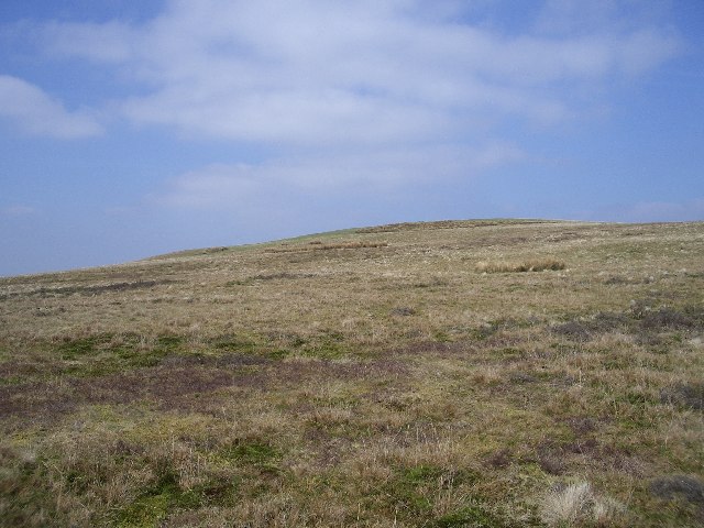
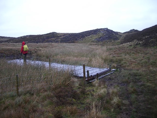
Hainshaw Hill is a prominent hill located in the Midlothian region of Scotland. It is a part of the Moorfoot Hills, which form an impressive range in the southern part of Midlothian. Standing at a height of approximately 424 meters (1,391 feet), Hainshaw Hill offers breathtaking panoramic views of the surrounding countryside.

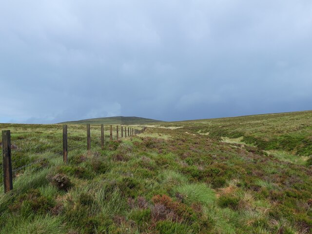
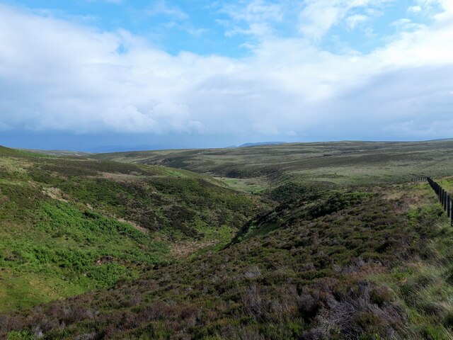
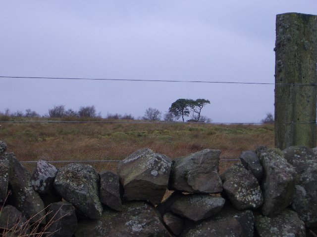
The hill is characterized by its gently sloping sides and is covered in heather and grass, giving it a beautiful green hue during the warmer months. It is a popular destination for hikers and nature enthusiasts, offering various walking trails that cater to different levels of difficulty.

At the summit of Hainshaw Hill, walkers are rewarded with stunning vistas of the Midlothian countryside, with views stretching as far as the Pentland Hills to the northwest and the Lammermuir Hills to the southeast. On a clear day, it is even possible to catch a glimpse of the distant Firth of Forth.

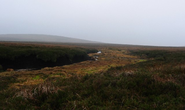
The hill is home to a diverse range of flora and fauna, including heather, mosses, and various bird species. It is also believed to have historical significance, with ancient remains and artifacts discovered in the vicinity.

Hainshaw Hill provides a peaceful and tranquil escape from the hustle and bustle of daily life. Whether it is for a leisurely stroll or a challenging hike, this hill offers a memorable experience for all who visit.

If you have any feedback on the listing, please let us know in the comments section below.

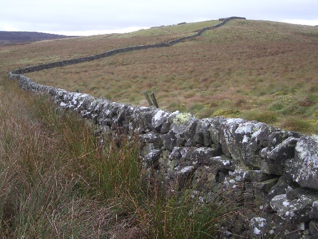
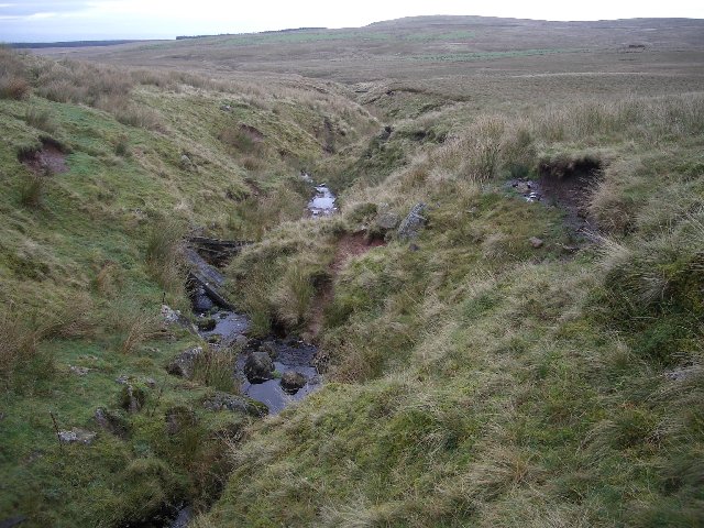
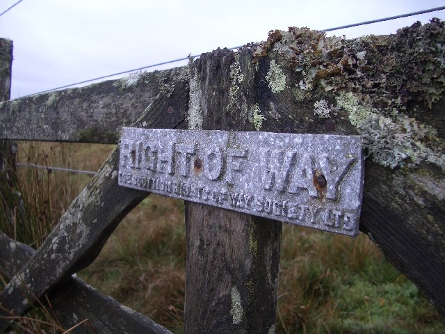
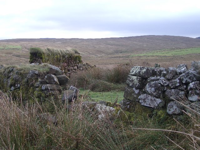
Hainshaw Hill Images

Images are sourced within 2km of 55.777564/-3.4932909 or Grid Reference NT0654. Thanks to Geograph Open Source API. All images are credited.

West Water Reservoir from the air Viewed over Harrows Law from a Prague bound flight from Edinburgh.
West Water Reservoir from the air
Viewed over Harrows Law from a Prague bound flight from Edinburgh.
Long Pond on Adder Burn This pond is one of two (the other is far smaller and a short distance downstream) not marked on the newest freely available online OS map from the early 1960s. I reckon it must have been dammed for shooting purposes as it's in the right area for it - not far NorthWest of here is a smallish fenced-off shooting 'estate', that may or may not still be operational. There is a hard slightly overgrown track leading from there to the spot at which this picture was taken.
It would be a nice peaceful place to pitch a tent, though there was no obvious sigh of life in the water, just a few small birds flying out of the heather as I approached.
Long Pond on Adder Burn
This pond is one of two (the other is far smaller and a short distance downstream) not marked on the newest freely available online OS map from the early 1960s. I reckon it must have been dammed for shooting purposes as it's in the right area for it - not far NorthWest of here is a smallish fenced-off shooting 'estate', that may or may not still be operational. There is a hard slightly overgrown track leading from there to the spot at which this picture was taken. It would be a nice peaceful place to pitch a tent, though there was no obvious sigh of life in the water, just a few small birds flying out of the heather as I approached.
Black Birn A 'birn' is either something to do with a clarinet mouthpiece, an old Scots contraction of 'burden', or a stem of heather left after the rest of the plant has disappeared due to muirburning. The heather gets burnt in order to promote new growth: this is said to provide more nourishment than the older heathers - some of which get left for shelter - to the grouse in gameshooting areas. It obviously must be the third meaning that gives this small flat-topped hill its name. The Dictionaries of the Scots Language website is often a handy resource for getting to the bottom of old topographical names in Central Scotland..
It is rather hard to determine exactly where the top of the hill is, and I notice it has crossed grid-squares within the last 60 years. The surface is a mix of heather, grass and large round clumps of bouncy moss, and the hill behind the lone conifer is Harrow's Law.
Black Birn
A 'birn' is either something to do with a clarinet mouthpiece, an old Scots contraction of 'burden', or a stem of heather left after the rest of the plant has disappeared due to muirburning. The heather gets burnt in order to promote new growth: this is said to provide more nourishment than the older heathers - some of which get left for shelter - to the grouse in gameshooting areas. It obviously must be the third meaning that gives this small flat-topped hill its name. The Dictionaries of the Scots Language website is often a handy resource for getting to the bottom of old topographical names in Central Scotland.. It is rather hard to determine exactly where the top of the hill is, and I notice it has crossed grid-squares within the last 60 years. The surface is a mix of heather, grass and large round clumps of bouncy moss, and the hill behind the lone conifer is Harrow's Law.
Altocumulus clouds over Craigengar Some striking altocumulus (I think) clouds over rolling moorland at the south-western end of the Pentland Hills.
Altocumulus clouds over Craigengar
Some striking altocumulus (I think) clouds over rolling moorland at the south-western end of the Pentland Hills.
Fenceline on moorland above Ravens Cleugh A shower has just swept through above Craigengar, on a cool and changeable early-July day.
Fenceline on moorland above Ravens Cleugh
A shower has just swept through above Craigengar, on a cool and changeable early-July day.
Ravens Cleugh A burn draining into the Medwin Water, at the south-western end of the Pentland Hills.
Ravens Cleugh
A burn draining into the Medwin Water, at the south-western end of the Pentland Hills.
Moorland near Tarbrax It has to be admitted that this is not a very interesting photo. But that is what it is like in this square!
Moorland near Tarbrax
It has to be admitted that this is not a very interesting photo. But that is what it is like in this square!
Bog, below Darlees Rig. The southern Pentlands are covered in blanket bog. Here the peat has been eroded away into bare banks of peat and a burn flows from one marshy patch to another. The area is used as a grouse moor and also supports a few sheep.
Bog, below Darlees Rig.
The southern Pentlands are covered in blanket bog. Here the peat has been eroded away into bare banks of peat and a burn flows from one marshy patch to another. The area is used as a grouse moor and also supports a few sheep.
White Craig cairn This is the cairn on White Craig, the 434m top 1km north-east of Darlees Rig.
White Craig cairn
This is the cairn on White Craig, the 434m top 1km north-east of Darlees Rig.
Darlees Rig Trig Point Looking west from the Darlees Rig trig point to some of the cairns on the ridge.
Darlees Rig Trig Point
Looking west from the Darlees Rig trig point to some of the cairns on the ridge.
Henshaw Hill This is a view of the rather uninspiring eastern slopes of Henshaw Hill.  The surrounding countryside is mainly rough bog and heather.
Henshaw Hill
This is a view of the rather uninspiring eastern slopes of Henshaw Hill. The surrounding countryside is mainly rough bog and heather.
Dry-stane dyke Looking over the wall from the Crosswood/Garvald path to the small plantation at the north end of Henshaw Hill.
Dry-stane dyke
Looking over the wall from the Crosswood/Garvald path to the small plantation at the north end of Henshaw Hill.
Old railway carriage An old railway carriage now in use as a shepherds shed.  The small bridge is one of several on this section of the Crosswood to Garvald path crossing the southwest end of the Pentlands.  Apart from the bridges this section of the path is virtually undetectable as is the case with many other sections of this route.
Old railway carriage
An old railway carriage now in use as a shepherds shed. The small bridge is one of several on this section of the Crosswood to Garvald path crossing the southwest end of the Pentlands. Apart from the bridges this section of the path is virtually undetectable as is the case with many other sections of this route.
Bawdy Knowes A well maintained stone wall leads to the shallow summit of Bawdy Knowes.  The Pentland Hills have a few good place names like this.
Bawdy Knowes
A well maintained stone wall leads to the shallow summit of Bawdy Knowes. The Pentland Hills have a few good place names like this.
Small Burn This burn is marked as "Small Burn" on the map, and is indeed, quite small!
Small Burn
This burn is marked as "Small Burn" on the map, and is indeed, quite small!
Right of Way An old Right of Way sign on the Crosswood to Garvald path ("route" would be more accurate as the path is largely non-existent).
Right of Way
An old Right of Way sign on the Crosswood to Garvald path ("route" would be more accurate as the path is largely non-existent).
Old sheepfold Looking east to where the Crosswood burn passes by Rowantree Jaw.
Old sheepfold
Looking east to where the Crosswood burn passes by Rowantree Jaw.
Bridge over wet ground A surprise bridge and lucky find.  This small valley between Bawdy Knowes and The Pike is virtually impassable without getting wet feet on a wet day.
Bridge over wet ground
A surprise bridge and lucky find. This small valley between Bawdy Knowes and The Pike is virtually impassable without getting wet feet on a wet day.
Show me another place!

Hainshaw Hill is located at Grid Ref: NT0654 (Lat: 55.777564, Lng: -3.4932909)

Unitary Authority: West Lothian

Police Authority: The Lothians and Scottish Borders

What 3 Words

///goose.casually.irony. Near West Linton, Scottish Borders

Nearby Locations

Henshaw Hill Hainshaw Hill

Related Wikis

Tarbrax

Tarbrax (Scottish Gaelic: "An Tòrr Breac" - meaning "the speckled tor") is a small village in the Parish of Carnwath, South Lanarkshire, Scotland. It...

Cobbinshaw Reservoir

Cobbinshaw Reservoir is a reservoir in West Lothian, Scotland. It is situated near the Pentland Hills, 5 km south of West Calder. The 310-acre (1.3 km2...

West Cairn Hill

West Cairn Hill is a hill in the Pentland Hills range of Scotland. With a height of 562 m (1,844 ft), it is the fifth highest elevation and lies on the...

West Water Reservoir

West Water Reservoir (sometimes Westwater Reservoir) is an artificial reservoir in the Pentland Hills, Scottish Borders, 3 kilometres (1.9 mi) west of...

Nearby Amenities

Located within 500m of 55.777564,-3.4932909
Henshaw Hill
Natural: peak
Wikidata: Q24661192
Lat/Long: 55.774597/-3.4986305
The data included in this document is from www.openstreetmap.org. The data is made available under ODbL.

Have you been to Hainshaw Hill?

Leave your review of Hainshaw Hill below (or comments, questions and feedback).