Venn Ottery Hill

Hill, Mountain in Devon East Devon

England

Venn Ottery Hill

Lane at Metcombe
Lane at Metcombe Credit: David Smith

Venn Ottery Hill is located in the county of Devon, England. Situated in the eastern part of the county, it is a prominent hill and forms part of the East Devon Area of Outstanding Natural Beauty. With an elevation of approximately 222 meters (728 feet), it is often referred to as a hill rather than a mountain.

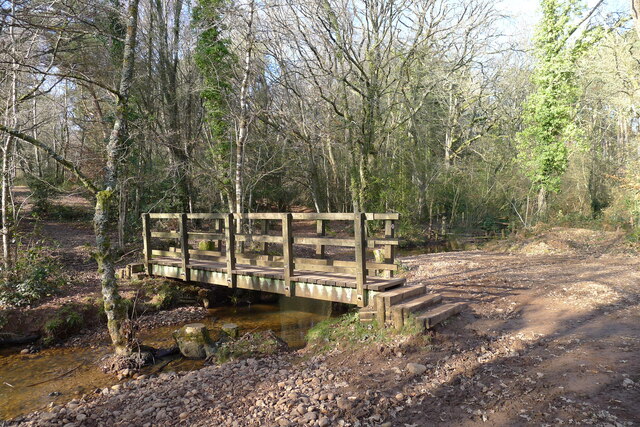
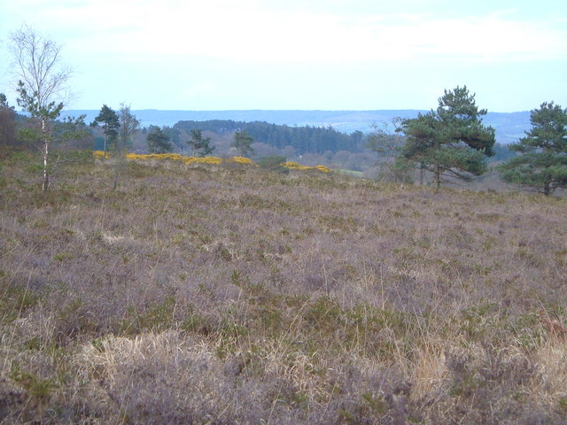
The hill is known for its picturesque countryside and stunning panoramic views. Its location provides visitors with an opportunity to appreciate the beauty of the surrounding landscape, including rolling hills, lush green fields, and charming villages. On a clear day, it is said that the views from the summit stretch as far as the nearby Jurassic Coastline.

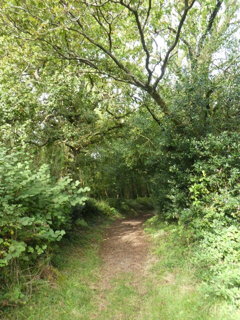
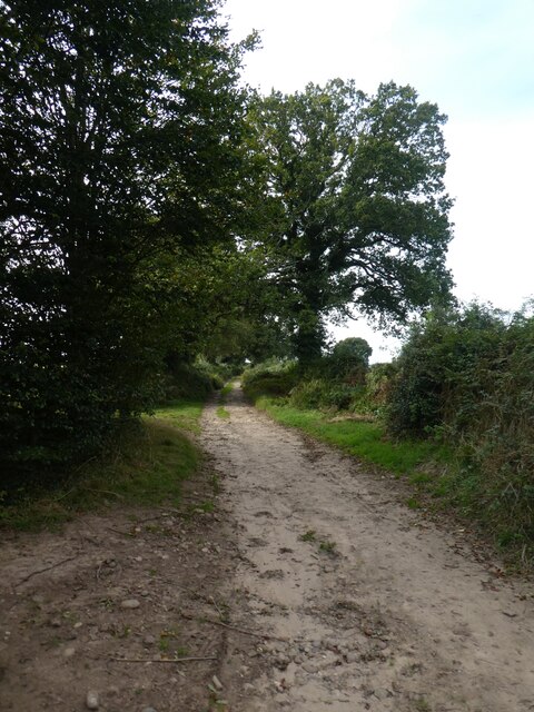
Venn Ottery Hill is popular among walkers and hikers due to its well-maintained footpaths and bridleways. These routes allow visitors to explore the hill and its surroundings, offering a chance to immerse themselves in nature and enjoy the tranquility of the area.

The hill is also home to a variety of wildlife, including birds such as skylarks and buzzards, as well as small mammals like rabbits and foxes. This makes it an ideal spot for birdwatching and wildlife enthusiasts.

Overall, Venn Ottery Hill is a beautiful natural landmark that offers visitors a chance to experience the stunning scenery and diverse wildlife of Devon. Whether it's for a leisurely stroll or a more challenging hike, this hill provides a memorable experience for anyone seeking to connect with nature.

If you have any feedback on the listing, please let us know in the comments section below.

Venn Ottery Hill Images

Images are sourced within 2km of 50.714314/-3.3274323 or Grid Reference SY0691. Thanks to Geograph Open Source API. All images are credited.

Lane at Metcombe
Lane at Metcombe
Footpath north of Venn Ottery
Track north of Venn Ottery
Plant nursery and parish noticeboard, Venn Ottery
Tree nursery, Venn Ottery The neat rows of trees on the slope are part of the tree nursery
Tree nursery, Venn Ottery
The neat rows of trees on the slope are part of the tree nursery
Aylesbeare Common Trig Point Flush Bracket S3901
Track across Aylesbeare Common This common, another of the Pebblebed Heaths, is managed by the RSPB with the  chance to see rarer birds like the Dartford warbler and nightjar <span class="nowrap"><a title="https://www.rspb.org.uk/reserves-and-events/reserves-a-z/aylesbeare-common" rel="nofollow ugc noopener" href="https://www.rspb.org.uk/reserves-and-events/reserves-a-z/aylesbeare-common">Link</a><img style="margin-left:2px;" alt="External link" title="External link - shift click to open in new window" src="https://s1.geograph.org.uk/img/external.png" width="10" height="10"/></span>
Track across Aylesbeare Common
This common, another of the Pebblebed Heaths, is managed by the RSPB with the chance to see rarer birds like the Dartford warbler and nightjar LinkExternal link
The East Devon Way entering Harpford Common The seventh, and final Pebblebed Heath common crossed by the East Devon Way
The East Devon Way entering Harpford Common
The seventh, and final Pebblebed Heath common crossed by the East Devon Way
Footbridge on the northern boundary of Harpford Common Taking the East Devon Way over a tributary of the River Otter
Footbridge on the northern boundary of Harpford Common
Taking the East Devon Way over a tributary of the River Otter
Footpath approaching Court Barn, Southerton
View north from the hill above Newton Poppleford
Power lines in a field Broad Oak Road, West Hill.
Power lines in a field
Broad Oak Road, West Hill.
Nature reserve track
Easy Devon Way Sign
Easy Devon Way Sign
Aylesbeare Common RSPB Sign
Joney's Cross Car Park The car parks at this and other Pebblebed Heath sites have been improved since being condemned as "little better than bomb site"s <span class="nowrap"><a title="https://www.devonlive.com/news/devon-news/car-parks-little-better-bomb-6138560" rel="nofollow ugc noopener" href="https://www.devonlive.com/news/devon-news/car-parks-little-better-bomb-6138560">Link</a><img style="margin-left:2px;" alt="External link" title="External link - shift click to open in new window" src="https://s1.geograph.org.uk/img/external.png" width="10" height="10"/></span>
Joney's Cross Car Park
The car parks at this and other Pebblebed Heath sites have been improved since being condemned as "little better than bomb site"s LinkExternal link
A pond in a field Podgers pit junction.
Close to the B3180 and Harp Lane.
A pond in a field
Podgers pit junction. Close to the B3180 and Harp Lane.
Harp Lane junction Linked to the B3180 at the strangely named Podgers Pit.
Harp Lane junction
Linked to the B3180 at the strangely named Podgers Pit.
Show me another place!

Venn Ottery Hill is located at Grid Ref: SY0691 (Lat: 50.714314, Lng: -3.3274323)

Administrative County: Devon

District: East Devon

Police Authority: Devon and Cornwall

What 3 Words

///wiggles.civil.outlooks. Near Newton Poppleford, Devon

Related Wikis

Fire Beacon Hill

Fire Beacon Hill is a Local Nature Reserve in East Devon, England. It is registered as Common land and known as Harpford Common. Sidmouth Town Council...

Venn Ottery

Venn Ottery, historically also spelt Fen Ottery, is a small village and former civil parish, now in the parish of Newton Poppleford and Harpford, in the...

Aylesbeare Common

Aylesbeare Common is a protected area in Devon, England. It is composed largely of heathland and woodland, interspersed with a few streams and ponds....

Nutwalls

Nutwalls is a hamlet in Devon, England. It is located 9 miles (14 km) south-east of Exeter, close to Aylesbeare. Two cottages built in the 18th century...

Nearby Amenities

Located within 500m of 50.714314,-3.3274323
Material: wood
Power: pole
Lat/Long: 50.711362/-3.3226982
Material: wood
Power: pole
Lat/Long: 50.7113768/-3.3242852
Material: wood
Power: pole
Lat/Long: 50.7117889/-3.3255321
Material: wood
Power: pole
Lat/Long: 50.7138358/-3.3288936
Material: wood
Power: pole
Lat/Long: 50.714488/-3.3299822
Material: wood
Power: pole
Lat/Long: 50.7146266/-3.3317294
Material: wood
Power: pole
Lat/Long: 50.7147194/-3.3329841
Material: wood
Power: pole
Lat/Long: 50.7148233/-3.3342174
Bench
Lat/Long: 50.7169212/-3.3241903
Tourism: viewpoint
Lat/Long: 50.7169187/-3.3241
The data included in this document is from www.openstreetmap.org. The data is made available under ODbL.

Have you been to Venn Ottery Hill?

Leave your review of Venn Ottery Hill below (or comments, questions and feedback).