Badenhay Rig

Hill, Mountain in Peeblesshire

Scotland

Badenhay Rig

Sheepfold by the Powskein Burn An old sheepfold east of the remains of Earlshaugh farm.
Sheepfold by the Powskein Burn Credit: Jim Barton

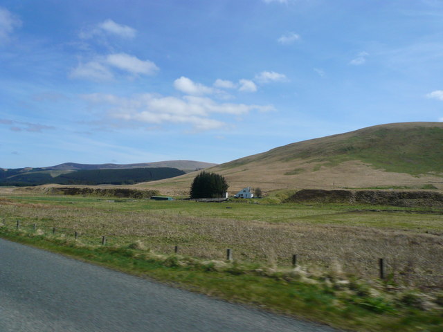
Badenhay Rig is a prominent hill located in Peeblesshire, a historic county in the Scottish Borders region of Scotland. Standing at an elevation of approximately 457 meters (1,499 feet), it is a notable feature in the local landscape and offers stunning views of the surrounding countryside.

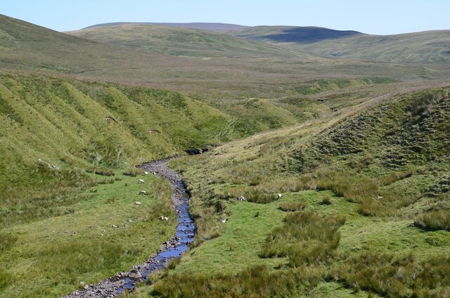
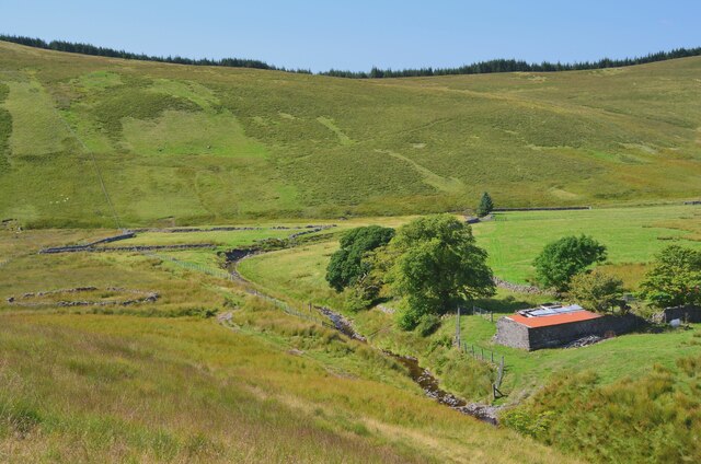
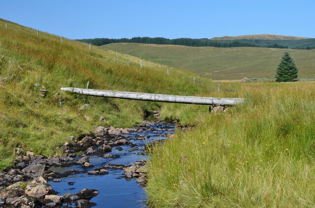
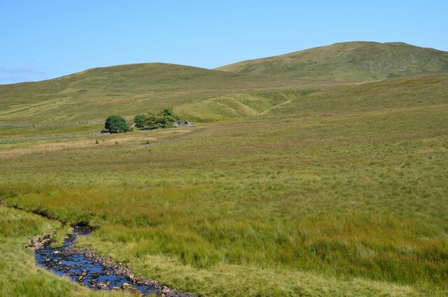
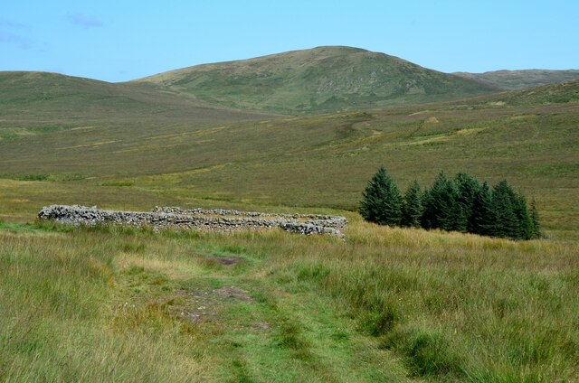
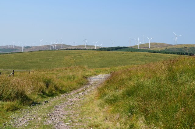
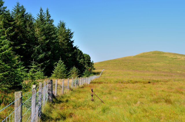
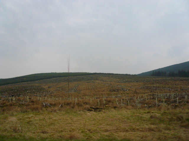
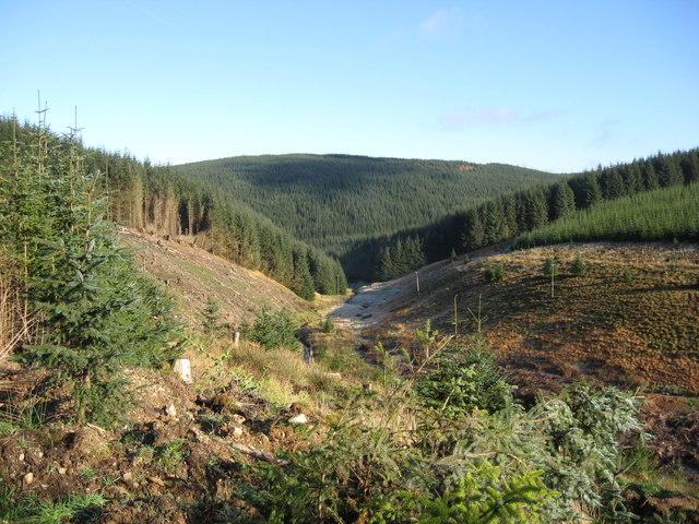
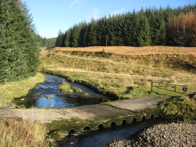
The hill is part of the Moorfoot Hills range, known for their rolling hills, heather-covered slopes, and diverse wildlife. Badenhay Rig is situated towards the eastern end of this range, making it a popular destination for hikers and nature enthusiasts.

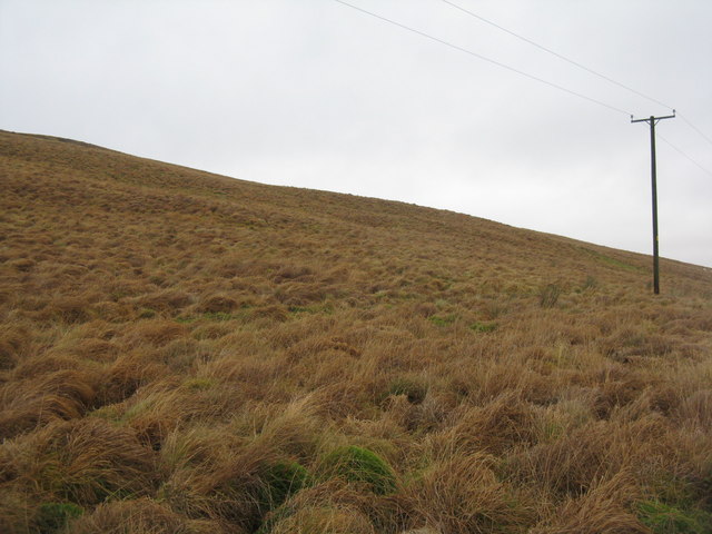
The ascent to Badenhay Rig can be challenging, with steep sections and uneven terrain, but the reward is worth the effort. At the summit, visitors are treated to panoramic vistas that stretch across the surrounding valleys, hills, and even as far as the distant peaks of the Southern Uplands.

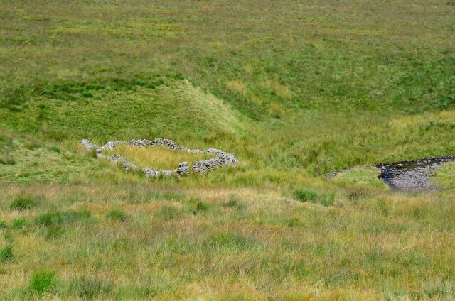
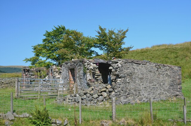
The hill is also home to a variety of plant and animal species, including heather, bilberry, and red grouse, which can often be spotted darting among the heathland. The area is rich in archaeological remains, with traces of ancient settlements and hill forts dotting the landscape.

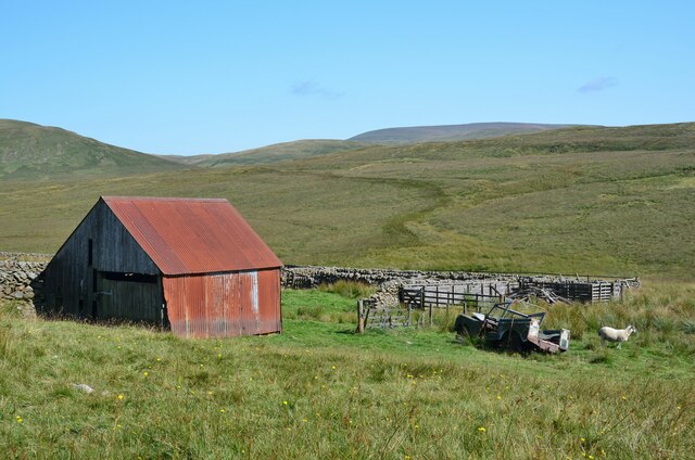
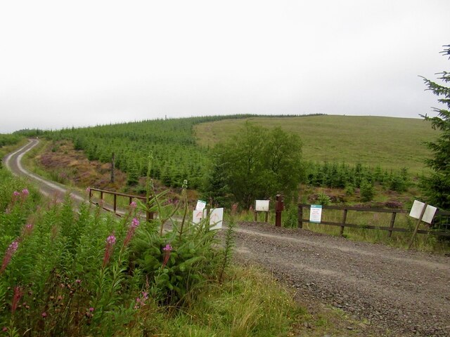
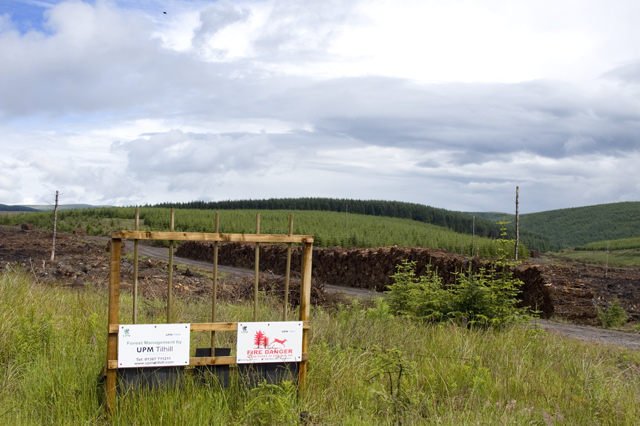
For those looking to explore Badenhay Rig, there are several walking routes and trails that lead to the summit, offering different levels of difficulty and distance. The hill is easily accessible from nearby towns such as Peebles and Innerleithen, making it a popular destination for both locals and tourists seeking a tranquil escape in the Scottish countryside.

If you have any feedback on the listing, please let us know in the comments section below.

Badenhay Rig Images

Images are sourced within 2km of 55.426146/-3.4893986 or Grid Reference NT0515. Thanks to Geograph Open Source API. All images are credited.

Sheepfold by the Powskein Burn An old sheepfold east of the remains of Earlshaugh farm.
Sheepfold by the Powskein Burn
An old sheepfold east of the remains of Earlshaugh farm.
The Powskein Burn near Earlshaugh The Powskein Burn upstream of the ruined farm at Earlshaugh.
The Powskein Burn near Earlshaugh
The Powskein Burn upstream of the ruined farm at Earlshaugh.
Farmland and ruins at Earlshaugh Improved fields in the valley of the Cor Water with the remains of the former farmhouse now covered by corrugated iron sheeting. 

Earlshaugh and Tweedshaws were the farms highest in Upper Tweeddale before reaching the boundary with Dumfriesshire. (Source: 'Andrew Lorimer's Life and Times in the Upper Tweed Valley' compiled by Margaret Railton (Tuckwell Press 2002)).
Farmland and ruins at Earlshaugh
Improved fields in the valley of the Cor Water with the remains of the former farmhouse now covered by corrugated iron sheeting. Earlshaugh and Tweedshaws were the farms highest in Upper Tweeddale before reaching the boundary with Dumfriesshire. (Source: 'Andrew Lorimer's Life and Times in the Upper Tweed Valley' compiled by Margaret Railton (Tuckwell Press 2002)).
The ruins of Earlshaugh farm Apparently once a substantial farmhouse, now decaying at this remote spot at the head of the Cor Water.
The ruins of Earlshaugh farm
Apparently once a substantial farmhouse, now decaying at this remote spot at the head of the Cor Water.
Log bridge over the Cor Water The low water level made for an easy crossing by the adjacent ford.
Log bridge over the Cor Water
The low water level made for an easy crossing by the adjacent ford.
Earlshaugh from the Cor Water The isolated setting of the former farm below the Crown of Scotland that forms the skyline.
Earlshaugh from the Cor Water
The isolated setting of the former farm below the Crown of Scotland that forms the skyline.
Old barn and sheep pens, Foal Burn Situated by the track from Tweedshaws to Earlshaugh; the drystone walls have survived better than the barn and the old Land Rover.
Old barn and sheep pens, Foal Burn
Situated by the track from Tweedshaws to Earlshaugh; the drystone walls have survived better than the barn and the old Land Rover.
Sheepfold and the Crown of Scotland On the track between Earlshaugh and Tweedshaws, this upland valley has an air of remoteness even though the busy A701 is only 2km to the west.
Sheepfold and the Crown of Scotland
On the track between Earlshaugh and Tweedshaws, this upland valley has an air of remoteness even though the busy A701 is only 2km to the west.
Track on Corse Dod The track from Earlshaugh crossing the ridge on the way to Tweedshaws. Part of the Clyde Wind Farm is on the skyline.
Track on Corse Dod
The track from Earlshaugh crossing the ridge on the way to Tweedshaws. Part of the Clyde Wind Farm is on the skyline.
Plantation edge, Annanhead Hill Looking north to Corse Dod.
Plantation edge, Annanhead Hill
Looking north to Corse Dod.
Bog Hill Lanarkshire, Peeblesshire and Dumfiesshire meet in the foreground. Almost all land in the area is forested.
Bog Hill
Lanarkshire, Peeblesshire and Dumfiesshire meet in the foreground. Almost all land in the area is forested.
An Evening View of the Fir Forests near the Devil’s Beef Tub on A701 Huge swathes of pink rose bay willow herb enhanced our views as we drove along the A701 from Moffat in the early evening.
An Evening View of the Fir Forests near the Devil’s Beef Tub on A701
Huge swathes of pink rose bay willow herb enhanced our views as we drove along the A701 from Moffat in the early evening.
Tweed's Well
Tweed's Well
Cleared Plantation - Smid Hope
Forestry Operations
Forestry Operations
River Tweed in its Infancy Tweed near its source. Dropping down between Tweedhopefoot Rig and Badenhay Rig and soon to be joined by the Cor Water.
River Tweed in its Infancy
Tweed near its source. Dropping down between Tweedhopefoot Rig and Badenhay Rig and soon to be joined by the Cor Water.
Ford over the Cor Water This ford is near to Tweedhopefoot and crosses above where Tweed and Cor Water
meet.
Ford over the Cor Water
This ford is near to Tweedhopefoot and crosses above where Tweed and Cor Water meet.
Bog Hill Grass moorland on the appropriately named hill. Looking west from the lay-by at the 'Source of the River Tweed'.
Bog Hill
Grass moorland on the appropriately named hill. Looking west from the lay-by at the 'Source of the River Tweed'.
Show me another place!

Badenhay Rig is located at Grid Ref: NT0515 (Lat: 55.426146, Lng: -3.4893986)

Unitary Authority: The Scottish Borders

Police Authority: The Lothians and Scottish Borders

What 3 Words

///presuming.dove.flotation. Near Moffat, Dumfries & Galloway

Nearby Locations

Badenhay Rig

Related Wikis

Annanhead Hill

Annanhead Hill is a 478-metre (1,568 ft) summit in the Moffat Hills of Scotland. It lies on the boundary between the Scottish Borders and Dumfries and...

Devil's Beef Tub

The Devil's Beef Tub (Marquis of Annandale's Beef-Tub, Beef-Stand, MacCleran's Loup) is a deep, dramatic hollow in the hills north of the Scottish town...

Fruid Reservoir

Fruid is a small reservoir in the Scottish Borders area of Scotland, UK, near Menzion. It is formed by damming the Fruid Water, and supplements the contents...

Crown of Scotland (hill)

The Crown of Scotland is a hill in the Scottish Borders, Scotland. At a relatively small elevation from the surrounding peaks, it is situated to the north...

Have you been to Badenhay Rig?

Leave your review of Badenhay Rig below (or comments, questions and feedback).