Archie's Hill

Hill, Mountain in Dumfriesshire

Scotland

Archie's Hill

A74(M) southbound
A74(M) southbound Credit: Alex McGregor

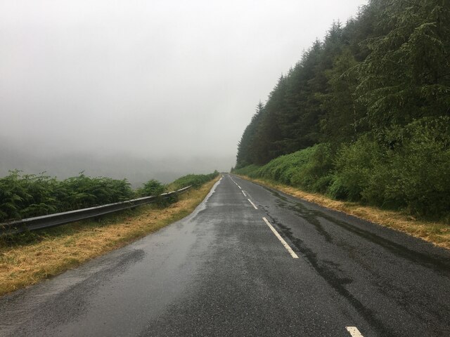
Archie's Hill is a prominent hill located in Dumfriesshire, Scotland. Situated near the village of Kettleholm, it forms part of the rolling Southern Uplands landscape that characterizes the region. The hill stands at an elevation of approximately 350 meters (1,150 feet) above sea level, offering stunning panoramic views of the surrounding countryside.

Known for its distinctive shape and gentle slopes, Archie's Hill is a popular destination for hikers and nature enthusiasts. Its accessible trails and well-maintained paths make it an ideal spot for outdoor activities such as walking, jogging, and picnicking. The hill's summit provides a vantage point to admire the picturesque beauty of the Dumfriesshire countryside, with its vast expanses of green fields, meandering rivers, and distant mountains.

Archie's Hill is also noteworthy for its rich biodiversity. The hill is home to a variety of plant and animal species, making it a valuable habitat for wildlife. Birdwatchers can spot numerous avian species, including buzzards, kestrels, and various songbirds, while those with an interest in flora can find an array of wildflowers and native plants during the warmer months.

The hill derives its name from the local folklore surrounding a legendary figure named Archie, whose stories have been passed down through generations. Archie's Hill serves as a reminder of the region's cultural heritage and offers visitors an opportunity to connect with the history and natural beauty of Dumfriesshire.

If you have any feedback on the listing, please let us know in the comments section below.

Archie's Hill Images

Images are sourced within 2km of 55.37955/-3.4923976 or Grid Reference NT0510. Thanks to Geograph Open Source API. All images are credited.

A74(M) southbound
A74(M) southbound
Network Rail access to the West Coast Main Line Off the B7076.
Network Rail access to the West Coast Main Line
Off the B7076.
National Cycle Route 74 B7076 towards Crawford.
National Cycle Route 74
B7076 towards Crawford.
Woodland beside the B7076
Moffat Water Community Hall
View across Evan Water towards Greenhill Dod The road is the A74(M).
View across Evan Water towards Greenhill Dod
The road is the A74(M).
March Burn and grassland near the A701
B719 at Greenhillstairs
Wet day at Ericstane Rain and low cloud at the farm in Upper Annandale. The track continues to Corehead below the Devil's Beef Tub.
Wet day at Ericstane
Rain and low cloud at the farm in Upper Annandale. The track continues to Corehead below the Devil's Beef Tub.
Track to Corehead The bumpy track for the final stretch to Corehead; the dramatic slopes of the Devil's Beef Tub are invisible today in very low cloud.
Track to Corehead
The bumpy track for the final stretch to Corehead; the dramatic slopes of the Devil's Beef Tub are invisible today in very low cloud.
A74(M), southbound The A74(M) & M74  run over 80 miles from the M6 at the Scottish border near Gretna to the M8 at Glasgow. This is one of the two most important routeways into Scotland from the south. The last stretch of the M74 opened in 2011 (see <a title="https://www.geograph.org.uk/snippet/590" href="https://www.geograph.org.uk/snippet/590">Link</a> ).
Wikipedia: <span class="nowrap"><a title="http://en.wikipedia.org/wiki/A74(M)_and_M74_motorways" rel="nofollow ugc noopener" href="http://en.wikipedia.org/wiki/A74(M)_and_M74_motorways">Link</a><img style="margin-left:2px;" alt="External link" title="External link - shift click to open in new window" src="https://s1.geograph.org.uk/img/external.png" width="10" height="10"/></span>
A74(M), southbound
The A74(M) & M74 run over 80 miles from the M6 at the Scottish border near Gretna to the M8 at Glasgow. This is one of the two most important routeways into Scotland from the south. The last stretch of the M74 opened in 2011 (see Link ). Wikipedia: LinkExternal link
Greenhillstairs Bridge Bridge carrying the B719 over the A74(M) motorway.
Greenhillstairs Bridge
Bridge carrying the B719 over the A74(M) motorway.
Greenhillstairs Bridge crosses the A74(M)
Annandale Way on Ericstane Hill The Annandale Way <span class="nowrap"><a title="http://www.annandaleway.org" rel="nofollow ugc noopener" href="http://www.annandaleway.org">Link</a><img style="margin-left:2px;" alt="External link" title="External link - shift click to open in new window" src="https://s1.geograph.org.uk/img/external.png" width="10" height="10"/></span> is a new 88km long-distance path which tracks the River Annan from source to sea. At this point, near the northern end, it follows the old road from Tweedsmuir over to Annandale. The modern A701 road can be seen in the middle distance. Much of the area has been forested.
Annandale Way on Ericstane Hill
The Annandale Way LinkExternal link is a new 88km long-distance path which tracks the River Annan from source to sea. At this point, near the northern end, it follows the old road from Tweedsmuir over to Annandale. The modern A701 road can be seen in the middle distance. Much of the area has been forested.
Annandale Way above Ericstane The Annandale Way <span class="nowrap"><a title="http://www.annandaleway.org" rel="nofollow ugc noopener" href="http://www.annandaleway.org">Link</a><img style="margin-left:2px;" alt="External link" title="External link - shift click to open in new window" src="https://s1.geograph.org.uk/img/external.png" width="10" height="10"/></span> is a new 88km long-distance path which tracks the River Annan from source to sea. At this point, near the northern end, it follows the old road from Tweedsmuir over to Annandale. This view is taken looking northwards, with the hills enclosing the Devil's Beeftub seen on the horizon.
Annandale Way above Ericstane
The Annandale Way LinkExternal link is a new 88km long-distance path which tracks the River Annan from source to sea. At this point, near the northern end, it follows the old road from Tweedsmuir over to Annandale. This view is taken looking northwards, with the hills enclosing the Devil's Beeftub seen on the horizon.
Annandale Way above Ericstane The Annandale Way <span class="nowrap"><a title="http://www.annandaleway.org" rel="nofollow ugc noopener" href="http://www.annandaleway.org">Link</a><img style="margin-left:2px;" alt="External link" title="External link - shift click to open in new window" src="https://s1.geograph.org.uk/img/external.png" width="10" height="10"/></span> is a new 88km long-distance path which tracks the River Annan from source to sea. At this point, near the northern end, it follows the old road from Tweedsmuir over to Annandale. This view is taken just below the crossing with the modern A701 road looking across the head of Annandale. Hart Fell (<a href="https://www.geograph.org.uk/gridref/NT1113">NT1113</a>) on the horizon.
Annandale Way above Ericstane
The Annandale Way LinkExternal link is a new 88km long-distance path which tracks the River Annan from source to sea. At this point, near the northern end, it follows the old road from Tweedsmuir over to Annandale. This view is taken just below the crossing with the modern A701 road looking across the head of Annandale. Hart Fell (NT1113) on the horizon.
Upper Annandale Looking across Upper Annandale from the old road. The tributary valleys opposite are the Lochan Burn (to the left) and Auchencat Burn. Swatte Fell (<a href="https://www.geograph.org.uk/gridref/NT1111">NT1111</a>) beyond.
Upper Annandale
Looking across Upper Annandale from the old road. The tributary valleys opposite are the Lochan Burn (to the left) and Auchencat Burn. Swatte Fell (NT1111) beyond.
Show me another place!

Archie's Hill is located at Grid Ref: NT0510 (Lat: 55.37955, Lng: -3.4923976)

Unitary Authority: Dumfries and Galloway

Police Authority: Dumfries and Galloway

What 3 Words

///streaks.weeknight.magically. Near Moffat, Dumfries & Galloway

Related Wikis

Greenhillstairs

Greenhillstairs is the steep B719 road north of Moffat in Dumfries and Galloway, Scotland. The road, about 3 miles long, leaves the A701 Moffat to Edinburgh...

Crown of Scotland (hill)

The Crown of Scotland is a hill in the Scottish Borders, Scotland. At a relatively small elevation from the surrounding peaks, it is situated to the north...

Devil's Beef Tub

The Devil's Beef Tub (Marquis of Annandale's Beef-Tub, Beef-Stand, MacCleran's Loup) is a deep, dramatic hollow in the hills north of the Scottish town...

Annanhead Hill

Annanhead Hill is a 478-metre (1,568 ft) summit in the Moffat Hills of Scotland. It lies on the boundary between the Scottish Borders and Dumfries and...

Nearby Amenities

Located within 500m of 55.37955,-3.4923976
Power: pole
Lat/Long: 55.3764193/-3.4972984
Power: pole
Lat/Long: 55.3764815/-3.4960124
The data included in this document is from www.openstreetmap.org. The data is made available under ODbL.

Have you been to Archie's Hill?

Leave your review of Archie's Hill below (or comments, questions and feedback).