Banc y Dolau

Hill, Mountain in Radnorshire

Wales

Banc y Dolau

Looking across Borfa to Glan-yr-afon
Looking across Borfa to Glan-yr-afon Credit: David Medcalf

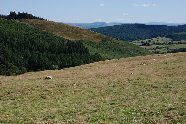
Banc y Dolau is a prominent hill located in Radnorshire, Wales. With an elevation of 487 meters (1,598 feet), it stands as one of the highest points in the region, offering spectacular panoramic views of the surrounding countryside.

Situated near the village of Llanbister, Banc y Dolau is part of the Cambrian Mountains range, known for its rugged terrain and natural beauty. The hill is characterized by its gently sloping sides and a distinct summit with a rocky outcrop, making it a popular destination for hikers and nature enthusiasts.

The ascent to the top of Banc y Dolau can be challenging, but the effort is rewarded with breathtaking vistas of rolling hills, meandering rivers, and lush valleys. On a clear day, it is possible to see as far as the Brecon Beacons National Park to the south and Snowdonia National Park to the north.

The hill is also home to a diverse range of flora and fauna, including heather, gorse, and numerous bird species. It provides a habitat for various wildlife, such as rabbits, foxes, and even the occasional red kite soaring gracefully overhead.

Banc y Dolau is a place where visitors can escape the hustle and bustle of everyday life and immerse themselves in the tranquility of the Welsh countryside. Its natural beauty and stunning views make it an ideal destination for outdoor enthusiasts and those seeking a peaceful retreat in nature.

If you have any feedback on the listing, please let us know in the comments section below.

Banc y Dolau Images

Images are sourced within 2km of 52.378856/-3.3892793 or Grid Reference SO0576. Thanks to Geograph Open Source API. All images are credited.

Looking across Borfa to Glan-yr-afon
Newhouse farm
Newhouse farm
Forest on Brondre-fawr Hill
Farmland looking towards Upper Nant-hir
Unfinished business Sadly it looks as if the project to restore this house at Ffordd-las has serious problems - there is a new roof, and new double-glazed windows, but it's all falling into disrepair.
Unfinished business
Sadly it looks as if the project to restore this house at Ffordd-las has serious problems - there is a new roof, and new double-glazed windows, but it's all falling into disrepair.
Across the fields to Rock House
Farmland below Banc y Dolau Mixed grazing in a sheltered valley, which may soon be overshadowed by yet another mid-Wales windfarm.
Farmland below Banc y Dolau
Mixed grazing in a sheltered valley, which may soon be overshadowed by yet another mid-Wales windfarm.
Road heading for Castle Bank The right-hand side rut is deep in places and needs watching when driving. Things look worse beyond the wreck of a gate. Only the latest maps show this road as surfaced.
Road heading for Castle Bank
The right-hand side rut is deep in places and needs watching when driving. Things look worse beyond the wreck of a gate. Only the latest maps show this road as surfaced.
Northern approach to Red Lion Surfaced to just past the house. The forestry here has been cleared and recently replanted.
Northern approach to Red Lion
Surfaced to just past the house. The forestry here has been cleared and recently replanted.
Diverging tracks south of Red Lion The left-hand one goes to New Well, and appears to be a public road. The right-hand one is a forestry road which for a bit is also a public footpath.
Diverging tracks south of Red Lion
The left-hand one goes to New Well, and appears to be a public road. The right-hand one is a forestry road which for a bit is also a public footpath.
Rough grazing near David's Well With forestry on Brondre-fawr Hill in the distance.
Rough grazing near David's Well
With forestry on Brondre-fawr Hill in the distance.
Field on Borfa Rather poor-looking grazing land.
Field on Borfa
Rather poor-looking grazing land.
Forestry at Brondre-fawr There is extensive forestry in the area, but this section is currently being felled.
Forestry at Brondre-fawr
There is extensive forestry in the area, but this section is currently being felled.
Tilted strata A small roadside quarry, obviously used for taking small quantities of hardcore for farm use. The exposure is of steeply-dipping Silurian sandstones with interbedded mudstones, giving a striped appearance. At the top of the section, there is a weathered zone where the bedding has broken down, and the outcrop is surmounted by deposits of reddish boulder clay which is also somewhat stratified. A very satisfying outcrop!
Tilted strata
A small roadside quarry, obviously used for taking small quantities of hardcore for farm use. The exposure is of steeply-dipping Silurian sandstones with interbedded mudstones, giving a striped appearance. At the top of the section, there is a weathered zone where the bedding has broken down, and the outcrop is surmounted by deposits of reddish boulder clay which is also somewhat stratified. A very satisfying outcrop!
Not quite the footpath This rather tussocky way through is the best way through given the footpath to the south doesn't appear to exist on the ground.
Not quite the footpath
This rather tussocky way through is the best way through given the footpath to the south doesn't appear to exist on the ground.
Derelict house
Derelict house
Crychell Brook just downstream of the confluence Getting through here was a challenge. The footpath doesn't seem to exist, there's no bridge so I had to wade through, and there were two dead sheep just upstream, providing a delightful aroma.
Crychell Brook just downstream of the confluence
Getting through here was a challenge. The footpath doesn't seem to exist, there's no bridge so I had to wade through, and there were two dead sheep just upstream, providing a delightful aroma.
New Well farmhouse
New Well farmhouse
Show me another place!

Banc y Dolau is located at Grid Ref: SO0576 (Lat: 52.378856, Lng: -3.3892793)

Unitary Authority: Powys

Police Authority: Dyfed Powys

What 3 Words

///greet.trusts.voting. Near Mochdre, Powys

Nearby Locations

Banc y Dolau Red Lion Hill

Related Wikis

Red Lion Hill

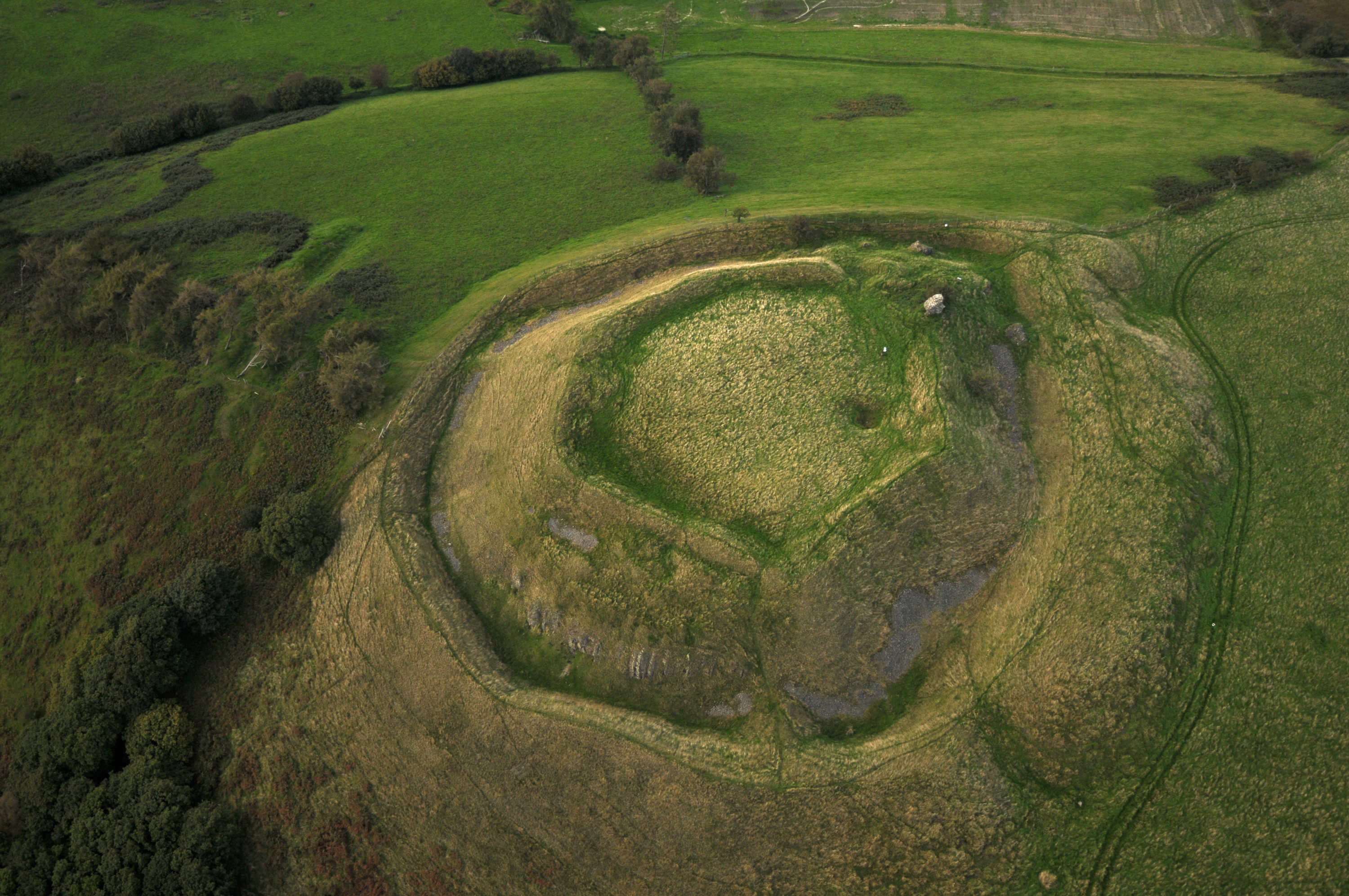
Red Lion Hill (Welsh: Bryn Llew Goch) or Banc y Dolau is a hill in Powys, Wales, with a summit 484.6 metres (1,590 ft) above sea level. It is located in...

Tinboeth Castle

Tinboeth Castle (Welsh: Castell Dinbod) was a medieval castle situated midway between Llanbister and Llanbadarn Fynydd in Wales, on a bend in the River...

Llanbadarn Fynydd

Llanbadarn Fynydd (meaning Church of Padarn in the mountain) is a village and community in Radnorshire, Powys, Wales, and is 63 miles (101 km) from Cardiff...

St Anno's Church, Llananno

The Church of St Anno in Llananno, Powys, Wales, is a redundant church dating from the 14th century. Its medieval rood screen is considered "one of the...

Nearby Amenities

Located within 500m of 52.378856,-3.3892793
Building: yes
Lat/Long: 52.3777228/-3.3935428
The data included in this document is from www.openstreetmap.org. The data is made available under ODbL.

Have you been to Banc y Dolau?

Leave your review of Banc y Dolau below (or comments, questions and feedback).