Flecket Hill

Hill, Mountain in Peeblesshire

Scotland

Flecket Hill

Path to Annanhead Hill The information board describes the Borders Forest Trust's Corehead project to restore habitat by replanting the slopes with native woodland - see <span class="nowrap"><a title="https://bordersforesttrust.org/wild-heart/corehead" rel="nofollow ugc noopener" href="https://bordersforesttrust.org/wild-heart/corehead">Link</a><img style="margin-left:2px;" alt="External link" title="External link - shift click to open in new window" src="https://s1.geograph.org.uk/img/external.png" width="10" height="10"/></span>.

The path is part of the Annandale Way loop up from Moffat to the highest point on Chalk Rig Edge and the source of the River Annan.
Path to Annanhead Hill Credit: Jim Barton

Flecket Hill is a prominent hill located in Peeblesshire, Scotland. It is situated approximately 3 miles south of Peebles town, in the southern part of the county. Rising to an elevation of around 1,214 feet (370 meters), it is considered a prominent landmark in the region.

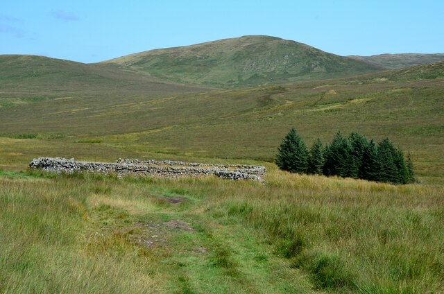
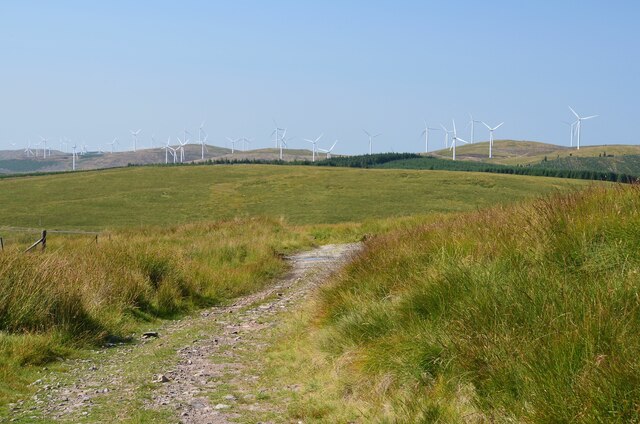
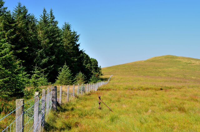
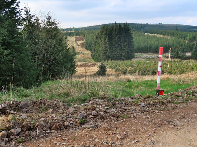
The hill offers stunning panoramic views of the surrounding countryside, making it a popular destination for hikers, nature enthusiasts, and photographers. Its location within the scenic Scottish Borders provides visitors with a picturesque backdrop of rolling hills, lush green valleys, and charming Scottish countryside.

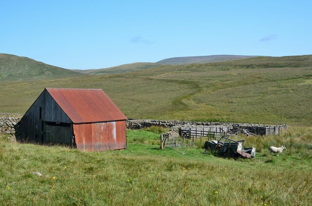
Flecket Hill is known for its diverse flora and fauna, with heather-covered slopes and a variety of wildflowers dotting the landscape. The hill is home to several species of birds, including buzzards, kestrels, and owls, making it a haven for birdwatching enthusiasts.

For those seeking outdoor adventures, Flecket Hill offers a range of walking and hiking trails suitable for all abilities. The paths wind through forests, across open moorland, and up to the summit, rewarding climbers with breathtaking views at the top.

Due to its close proximity to Peebles, visitors can easily access the hill by car or on foot. Peebles itself is a bustling town with various amenities, including accommodation options, restaurants, and shops, making it a convenient base for exploring Flecket Hill and the surrounding area.

Overall, Flecket Hill is a natural gem in Peeblesshire, offering visitors a chance to immerse themselves in the beauty of the Scottish countryside and enjoy outdoor adventures in a tranquil setting.

If you have any feedback on the listing, please let us know in the comments section below.

Flecket Hill Images

Images are sourced within 2km of 55.408201/-3.5017699 or Grid Reference NT0513. Thanks to Geograph Open Source API. All images are credited.

Path to Annanhead Hill The information board describes the Borders Forest Trust's Corehead project to restore habitat by replanting the slopes with native woodland - see <span class="nowrap"><a title="https://bordersforesttrust.org/wild-heart/corehead" rel="nofollow ugc noopener" href="https://bordersforesttrust.org/wild-heart/corehead">Link</a><img style="margin-left:2px;" alt="External link" title="External link - shift click to open in new window" src="https://s1.geograph.org.uk/img/external.png" width="10" height="10"/></span>.

The path is part of the Annandale Way loop up from Moffat to the highest point on Chalk Rig Edge and the source of the River Annan.
Path to Annanhead Hill
The information board describes the Borders Forest Trust's Corehead project to restore habitat by replanting the slopes with native woodland - see LinkExternal link. The path is part of the Annandale Way loop up from Moffat to the highest point on Chalk Rig Edge and the source of the River Annan.
Devil's Beef Tub from Annanhead Hill The deep-cut bowl of the Devil's Beef Tub continues round to the right in this view towards Upper Annandale with the A701 road rounding the shoulder of Ericstane Hill above a steep 150m slope below.
Devil's Beef Tub from Annanhead Hill
The deep-cut bowl of the Devil's Beef Tub continues round to the right in this view towards Upper Annandale with the A701 road rounding the shoulder of Ericstane Hill above a steep 150m slope below.
Great Hill and Strait Step The steep west side of Great Hill is well seen from Annanhead Hill. The Strait Step is the precarious-looking path traversing the face, on a route connecting the former farm at Earlshaugh with Corehead in the valley below.
Great Hill and Strait Step
The steep west side of Great Hill is well seen from Annanhead Hill. The Strait Step is the precarious-looking path traversing the face, on a route connecting the former farm at Earlshaugh with Corehead in the valley below.
Forestry at Annanhead Moss The A701 road between Edinburgh and Dumfries is in the foreground, seen from Annanhead Hill.
Forestry at Annanhead Moss
The A701 road between Edinburgh and Dumfries is in the foreground, seen from Annanhead Hill.
Viewpoint bench, Annanhead Hill (2) A clear sunny day on which to enjoy the extensive views from the highest parts of the Annandale Way. The bench is inscribed 'Annandale Way Viewpoints'.

Compare with <a href="https://www.geograph.org.uk/photo/4162483">NT0513 : Viewpoint bench, Annanhead Hill</a>.
Viewpoint bench, Annanhead Hill (2)
A clear sunny day on which to enjoy the extensive views from the highest parts of the Annandale Way. The bench is inscribed 'Annandale Way Viewpoints'. Compare with NT0513 : Viewpoint bench, Annanhead Hill.
Descending Peat Knowe On the ridge eastwards towards the notch at the start of the Strait Step pass.
Descending Peat Knowe
On the ridge eastwards towards the notch at the start of the Strait Step pass.
Fence on Great Hill The Annandale Way follows the fence skirting to the north of the 466m summit of Great Hill.
Fence on Great Hill
The Annandale Way follows the fence skirting to the north of the 466m summit of Great Hill.
Old barn and sheep pens, Foal Burn Situated by the track from Tweedshaws to Earlshaugh; the drystone walls have survived better than the barn and the old Land Rover.
Old barn and sheep pens, Foal Burn
Situated by the track from Tweedshaws to Earlshaugh; the drystone walls have survived better than the barn and the old Land Rover.
Sheepfold and the Crown of Scotland On the track between Earlshaugh and Tweedshaws, this upland valley has an air of remoteness even though the busy A701 is only 2km to the west.
Sheepfold and the Crown of Scotland
On the track between Earlshaugh and Tweedshaws, this upland valley has an air of remoteness even though the busy A701 is only 2km to the west.
Track on Corse Dod The track from Earlshaugh crossing the ridge on the way to Tweedshaws. Part of the Clyde Wind Farm is on the skyline.
Track on Corse Dod
The track from Earlshaugh crossing the ridge on the way to Tweedshaws. Part of the Clyde Wind Farm is on the skyline.
Northern side of Annanhead Hill Rolling grassy moorland here is a contrast with the steep drop down to the Devil's Beef Tub on the southern side of the ridge. The summit trig pillar is just visible on the skyline.
Northern side of Annanhead Hill
Rolling grassy moorland here is a contrast with the steep drop down to the Devil's Beef Tub on the southern side of the ridge. The summit trig pillar is just visible on the skyline.
Plantation edge, Annanhead Hill Looking north to Corse Dod.
Plantation edge, Annanhead Hill
Looking north to Corse Dod.
Annanhead Hill Trig Point Flush Bracket S5678
Footpath marker Annandale Way
The Devil's Beef Tub
Forest at Divoty Knowes The post marks the route of a high pressure gas pipeline.
Forest at Divoty Knowes
The post marks the route of a high pressure gas pipeline.
Clear felled forest on Raecleuch Rig Looking towards Tinny Bank and the A74(M) with the Clyde Windfarm turbines in the distance.
Clear felled forest on Raecleuch Rig
Looking towards Tinny Bank and the A74(M) with the Clyde Windfarm turbines in the distance.
Forest track at Divoty Knowes The white post marks the route of a high pressure gas pipeline.
Forest track at Divoty Knowes
The white post marks the route of a high pressure gas pipeline.
Show me another place!

Flecket Hill is located at Grid Ref: NT0513 (Lat: 55.408201, Lng: -3.5017699)

Unitary Authority: The Scottish Borders

Police Authority: The Lothians and Scottish Borders

What 3 Words

///overpower.casual.scream. Near Moffat, Dumfries & Galloway

Related Wikis

Annanhead Hill

Annanhead Hill is a 478-metre (1,568 ft) summit in the Moffat Hills of Scotland. It lies on the boundary between the Scottish Borders and Dumfries and...

Devil's Beef Tub

The Devil's Beef Tub (Marquis of Annandale's Beef-Tub, Beef-Stand, MacCleran's Loup) is a deep, dramatic hollow in the hills north of the Scottish town...

Crown of Scotland (hill)

The Crown of Scotland is a hill in the Scottish Borders, Scotland. At a relatively small elevation from the surrounding peaks, it is situated to the north...

Greenhillstairs

Greenhillstairs is the steep B719 road north of Moffat in Dumfries and Galloway, Scotland. The road, about 3 miles long, leaves the A701 Moffat to Edinburgh...
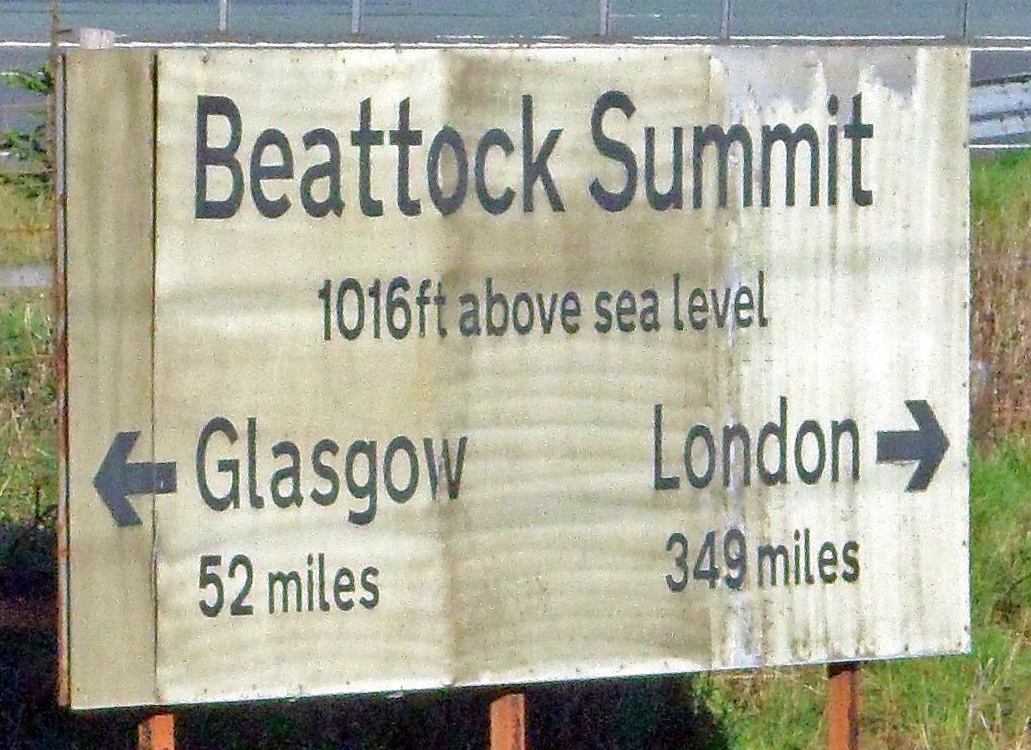
Beattock Summit

Beattock Summit is the highest point of the West Coast Main Line (WCML) railway and of the A74(M) motorway as they cross between Dumfries and Galloway...

Hart Fell

Hart Fell is a hill in the Moffat Hills range, part of the Southern Uplands of Scotland. It lies north of the town of Moffat on the border with the Scottish...

Fruid Reservoir

Fruid is a small reservoir in the Scottish Borders area of Scotland, UK, near Menzion. It is formed by damming the Fruid Water, and supplements the contents...

Moffat Hills

The Moffat Hills are a range of hills in the Southern Uplands of Scotland. They form a roughly triangular shape with a west facing side, a north facing...

Related Videos

Wild camp above Moffat / naturehike mongar 2

Took off for a cracking camp on great hill which is onto of the devils beef tub over looking Moffat. Chilly but lovely. Great to get out ...

Wake up in the morning to this 👌 #wildcamping #devilsbeeftub

waking up in the morning to this view. doesn't get much better than being up in the devils beef tub for a camp. amazing camp up in ...

Starlapse on a snowy camp | forclaz tarptent

amazing starlapse taken on an insta360 one RS on the devils beef tub, near moffat. lovely snowy camp, using the forclaz tarptent ...

Nearby Amenities

Located within 500m of 55.408201,-3.5017699
Flecket Hill
Ele: 463
Graham: no
Munro: no
Natural: peak
Lat/Long: 55.4080954/-3.5012561
Power: pole
Lat/Long: 55.4113971/-3.505953
Power: pole
Lat/Long: 55.410715/-3.5051703
Power: pole
Lat/Long: 55.4100065/-3.5043813
Power: pole
Lat/Long: 55.409089/-3.5036388
The data included in this document is from www.openstreetmap.org. The data is made available under ODbL.

Have you been to Flecket Hill?

Leave your review of Flecket Hill below (or comments, questions and feedback).