West Down Beacon

Hill, Mountain in Devon East Devon

England

West Down Beacon

Straight Point from Babbacombe With Devon Cliffs Holiday Park to the left, and the low Triassic sandstone cliffs of Straight Point centre and right. Behind are the cliffs of The Floors.
Straight Point from Babbacombe Credit: Derek Harper

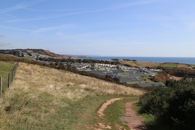
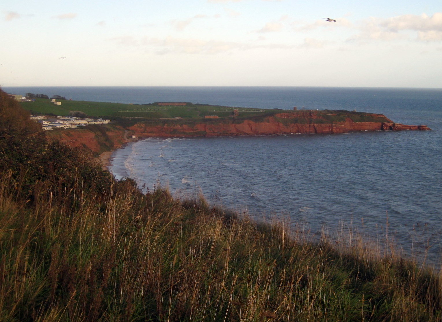
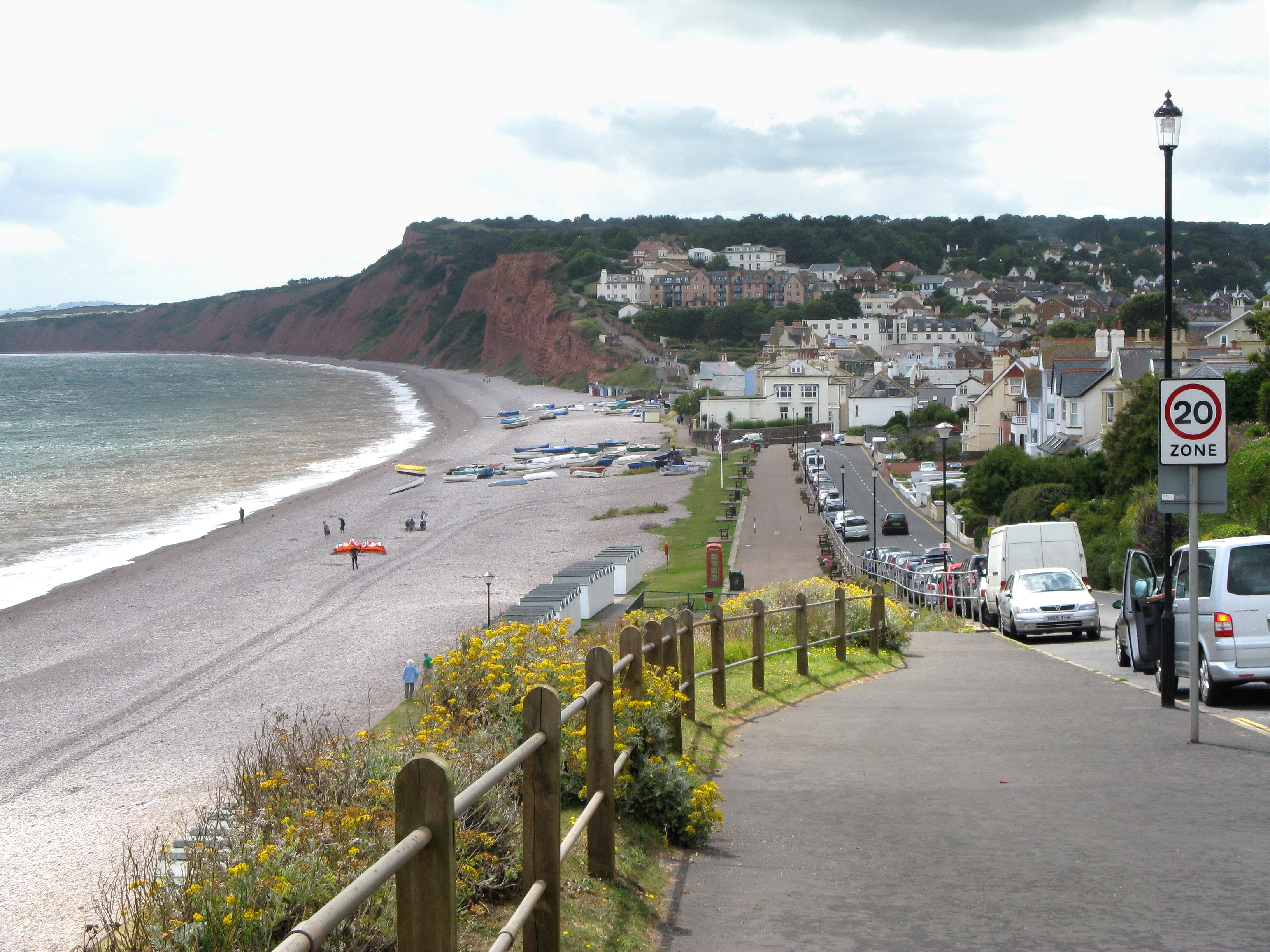
West Down Beacon is a prominent hill located in the county of Devon, England. It stands at an elevation of 314 meters (1,030 feet) above sea level, making it one of the highest points in the region. Situated near the village of West Down, the beacon offers stunning panoramic views of the surrounding countryside, including the rolling hills of Exmoor National Park to the north and the Bristol Channel to the west.

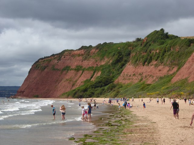
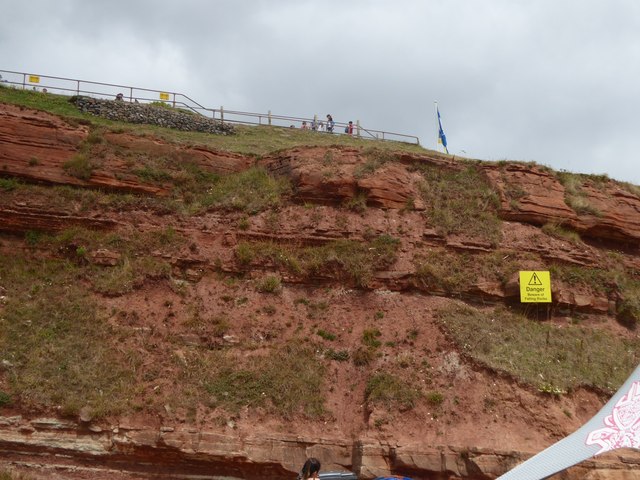
Covered in lush green vegetation, West Down Beacon is a popular destination for outdoor enthusiasts and nature lovers. The hill is part of the South West Coast Path, a long-distance trail that stretches along the entire coastline of the South West of England. Hikers and walkers can enjoy the picturesque route, taking in the breathtaking scenery and enjoying the fresh air.

At the summit of West Down Beacon, there is a trig point, which serves as a reference point for mapping and surveying. The beacon is also home to a number of communication masts, including television and radio transmitters. These structures add to the hill's distinctive profile and can be seen from miles around.

West Down Beacon is easily accessible by road, with parking available nearby. It provides a peaceful and tranquil setting, offering visitors a chance to escape the hustle and bustle of everyday life and immerse themselves in the natural beauty of the Devon countryside.

If you have any feedback on the listing, please let us know in the comments section below.

West Down Beacon Images

Images are sourced within 2km of 50.621954/-3.3508699 or Grid Reference SY0481. Thanks to Geograph Open Source API. All images are credited.

Straight Point from Babbacombe With Devon Cliffs Holiday Park to the left, and the low Triassic sandstone cliffs of Straight Point centre and right. Behind are the cliffs of The Floors.
Straight Point from Babbacombe
With Devon Cliffs Holiday Park to the left, and the low Triassic sandstone cliffs of Straight Point centre and right. Behind are the cliffs of The Floors.
Sandy Bay beach (Exmouth)  Sandy Bay beach at Exmouth a blue flag winner beach and home to Devon Cliffs Holiday Park
Sandy Bay beach (Exmouth)
Sandy Bay beach at Exmouth a blue flag winner beach and home to Devon Cliffs Holiday Park
Straight Point from Sandy Bay, Littleham
The beach at Sandy Bay Looking towards the headland at Orcombe; the beach is crowded with holidaymakers from the nearby caravan site
The beach at Sandy Bay
Looking towards the headland at Orcombe; the beach is crowded with holidaymakers from the nearby caravan site
Cliffs at Sandy Bay The sandstone has numerous layers of varying hardness; the sign warns against trying to approach (or climb) the soft stone cliff
Cliffs at Sandy Bay
The sandstone has numerous layers of varying hardness; the sign warns against trying to approach (or climb) the soft stone cliff
Sandy Bay Looking to the sandstone cliffs of Straight Point, which is topped by a military rifle range.
Sandy Bay
Looking to the sandstone cliffs of Straight Point, which is topped by a military rifle range.
High Land of Orcombe View across Sandy Bay Exmouth
High Land of Orcombe
View across Sandy Bay Exmouth
Devon Cliffs holiday resort Large coastal holiday resort located between Exmouth and Budleigh Salterton. One of the largest caravan parks in Europe.
Devon Cliffs holiday resort
Large coastal holiday resort located between Exmouth and Budleigh Salterton. One of the largest caravan parks in Europe.
Littleham Cove and Straight Point
Coast east of Exmouth A detail of <a href="https://www.geograph.org.uk/photo/6305969">SX9677 : View towards Exnouth</a>, with tall sandstone cliffs at the High Land of Orcombe, succeeded by Sandy Bay and the low-lying Straight Point on the right.
Coast east of Exmouth
A detail of SX9677 : View towards Exnouth, with tall sandstone cliffs at the High Land of Orcombe, succeeded by Sandy Bay and the low-lying Straight Point on the right.
Sandy Bay & Straight Point near Exmouth
Sandy Bay caravan park next to the coast path
Sandy Bay beach from the coast path
MoD Firing Range, Straight Point, from the coast path
Coastal footpath passing Straight Point Rifle Range
Sandy Bay Holiday Park The coastal footpath passes between the caravans and the coast.
Sandy Bay Holiday Park
The coastal footpath passes between the caravans and the coast.
Rocks at Straight Point The man was fishing, the two children were climbing on the seaweed-covered rocks
Rocks at Straight Point
The man was fishing, the two children were climbing on the seaweed-covered rocks
Strata in the cliffs at Sandy Bay
Show me another place!

West Down Beacon is located at Grid Ref: SY0481 (Lat: 50.621954, Lng: -3.3508699)

Administrative County: Devon

District: East Devon

Police Authority: Devon and Cornwall

What 3 Words

///challenge.fast.pulse. Near Budleigh Salterton, Devon

Nearby Locations

West Down Beacon West Down

Related Wikis

Otter Cove

Otter Cove is a small secluded cove on the south coast of Devon, England, between the coastal towns of Exmouth and Budleigh Salterton. It is part of the...

Littleham, Exmouth

Littleham is an area of Exmouth and former civil parish, now in the parish of Exmouth, in the East Devon district, in the county of Devon, England. It...

St Margaret and St Andrew's Church, Littleham, Exmouth

St Margaret and St Andrew's Church, Littleham, Exmouth is a Grade II* listed parish church in the Church of England in Littleham, Exmouth. == History... ==

Sandy Bay, Devon

Sandy Bay is a secluded bay with a sand beach, about 1.6 kilometres (0.99 mi) long, in Exmouth, Devon, England. It is a sandy beach with rock pools at...

Straight Point

Straight Point is a coastal region, forming a headland, between Exmouth and Budleigh Salterton in Devon on the south coast of England. == Location == Straight...

Budleigh Salterton railway station

Budleigh Salterton railway station is a closed railway station that served the town of Budleigh Salterton in Devon, England. It was opened by the London...

Budleigh Salterton A.F.C.

Budleigh Salterton Association Football Club is a football club based in Budleigh Salterton, Devon, England. They are currently members of the Devon League...

Budleigh Salterton

Budleigh Salterton is a seaside town on the coast in East Devon, England, 15 miles (24 km) south-east of Exeter. It lies within the East Devon Area of...

Nearby Amenities

Located within 500m of 50.621954,-3.3508699
Source: PGS
Lat/Long: 50.6192917/-3.3511901
Source: PGS
Lat/Long: 50.6194056/-3.3508116
Source: PGS
Lat/Long: 50.6196958/-3.3501794
Source: PGS
Lat/Long: 50.6201947/-3.3488488
Source: PGS
Lat/Long: 50.6203261/-3.3486113
Source: PGS
Lat/Long: 50.6208899/-3.346989
Source: PGS
Lat/Long: 50.6212347/-3.346205
Source: PGS
Lat/Long: 50.6216113/-3.3451204
Source: PGS
Lat/Long: 50.6218733/-3.344342
Source: PGS
Lat/Long: 50.6181884/-3.3545423
Source: PGS
Lat/Long: 50.6184618/-3.3538836
Source: PGS
Lat/Long: 50.6187477/-3.3531473
Source: PGS
Lat/Long: 50.619054/-3.3526163
Barrier: kissing_gate
Bicycle: yes
Foot: yes
Lat/Long: 50.6214368/-3.351373
West Down Beacon
Ele: 129
Man Made: survey_point
Material: concrete
Survey Point Purpose: both
Survey Point Structure: pillar
Lat/Long: 50.6219423/-3.3508797
Budleigh Salterton
Natural: beach
Nudism: yes
Url: http://www.naturistholiday.info/UK/1240/Budleigh_Salterton.aspx
Lat/Long: 50.6205262/-3.3488559
Source: PGS
Lat/Long: 50.6193221/-3.3518476
Barrier: stile
Lat/Long: 50.6231935/-3.3521052
Bench
Backrest: yes
Lat/Long: 50.6232609/-3.3443043
Bench
Backrest: yes
Lat/Long: 50.6219182/-3.3511412
Direction: West
Tourism: viewpoint
Lat/Long: 50.6219048/-3.3510019
Bench
Backrest: yes
Lat/Long: 50.6218127/-3.350572
Bench
Backrest: yes
Survey Date: 2023-02-19
Lat/Long: 50.6219449/-3.3509657
Bench
Backrest: yes
Survey Date: 2023-02-19
Lat/Long: 50.6218959/-3.3507002
The data included in this document is from www.openstreetmap.org. The data is made available under ODbL.

Have you been to West Down Beacon?

Leave your review of West Down Beacon below (or comments, questions and feedback).