Barns of Bynack

Hill, Mountain in Banffshire

Scotland

Barns of Bynack

Bynack More
Bynack More Credit: Steven Brown

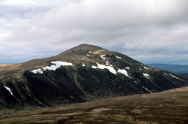
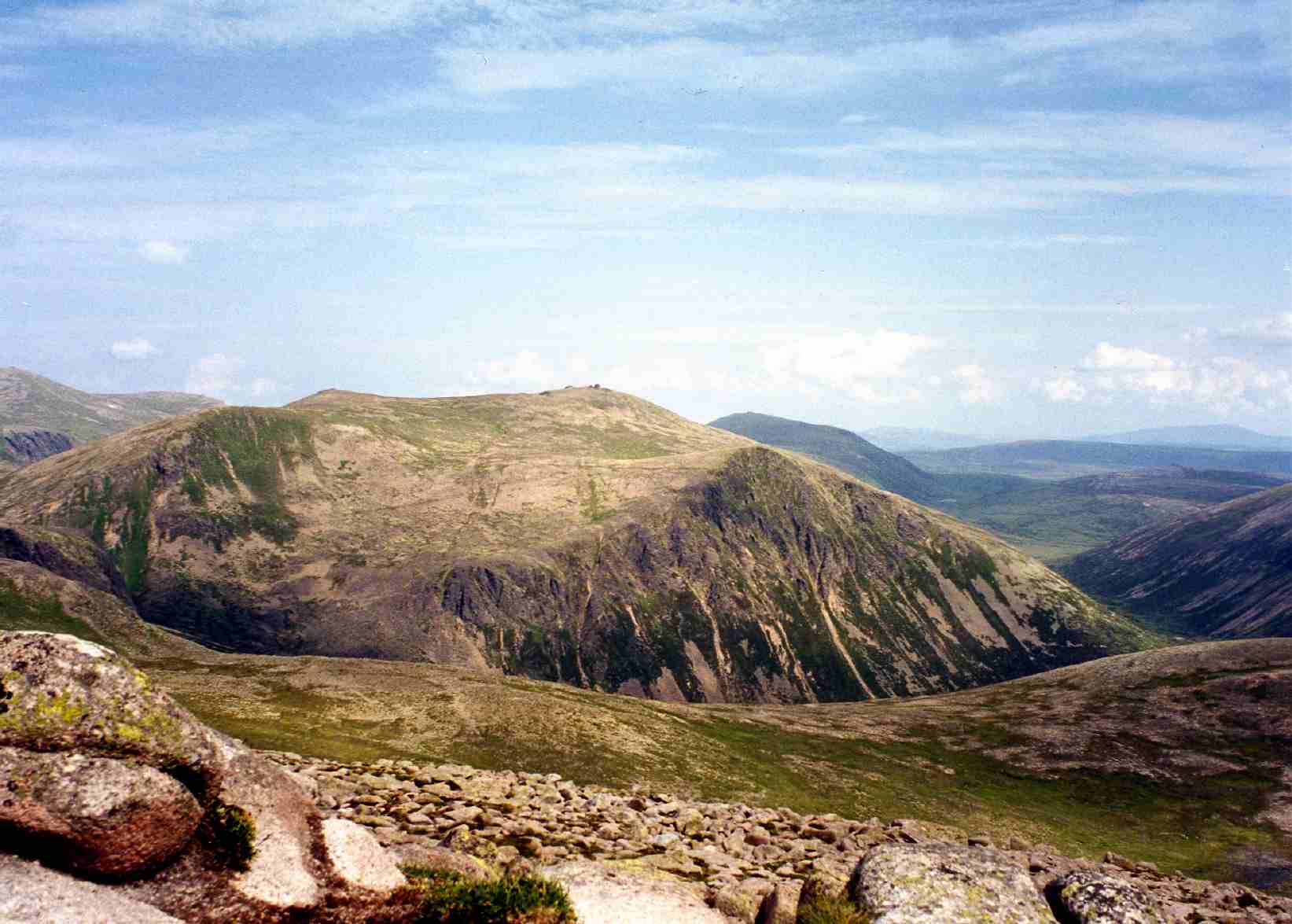
Barns of Bynack is a prominent hill located in Banffshire, Scotland. Sitting at an elevation of approximately 1,091 meters (3,579 feet), it is considered one of the notable mountains in the region. The hill is part of the Cairngorms National Park, known for its stunning natural beauty and diverse wildlife.

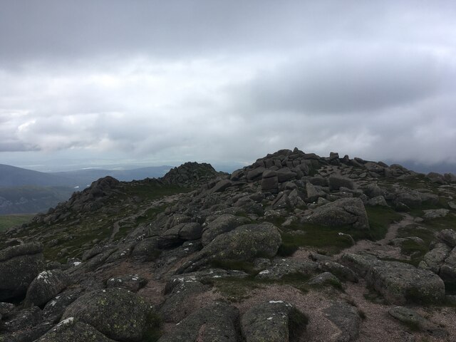
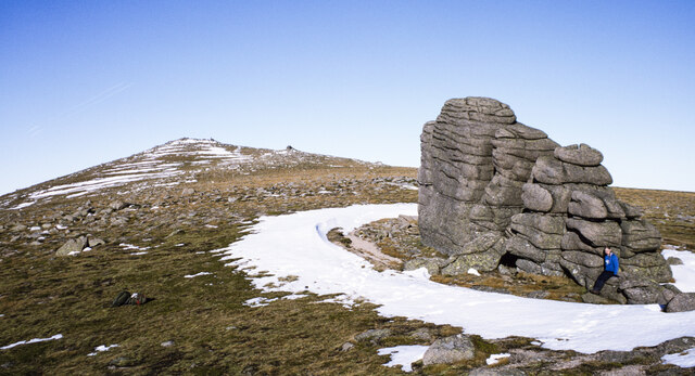
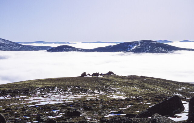
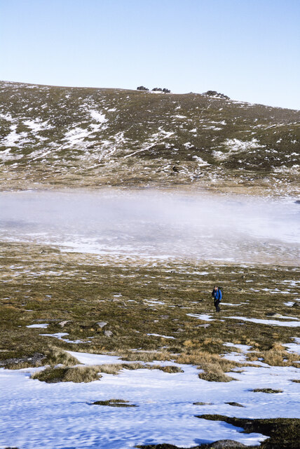
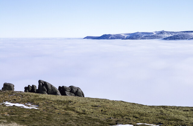
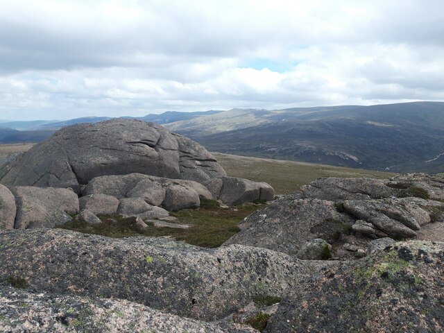
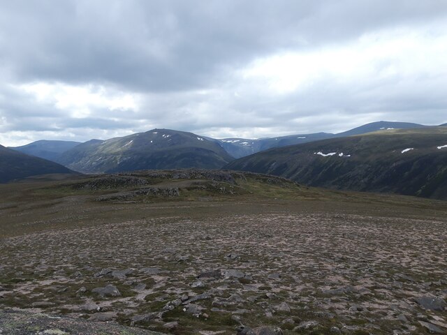
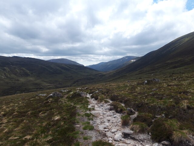
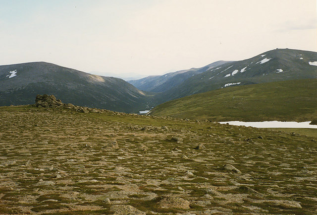
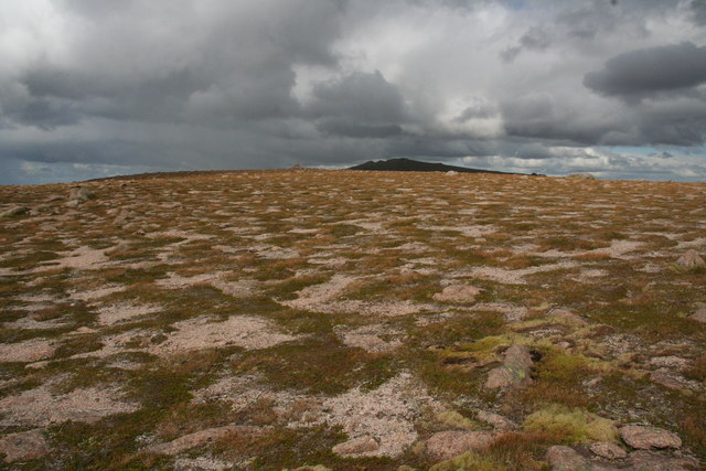
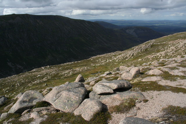
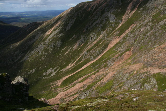
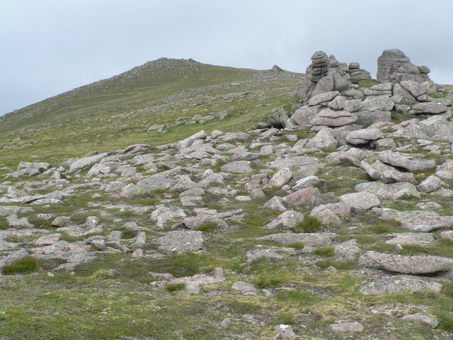
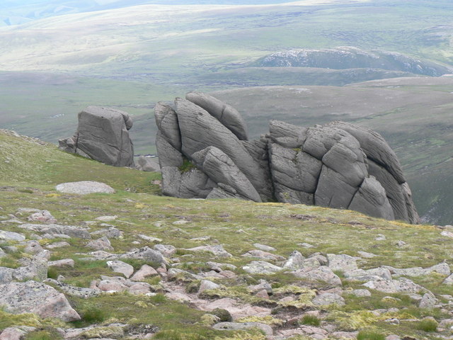
Barns of Bynack offers breathtaking views of the surrounding landscape, with its distinct shape and prominent position making it a popular destination for both experienced hikers and nature enthusiasts. The hill is characterized by its rocky terrain and steep slopes, adding to the challenge and allure for outdoor adventurers.

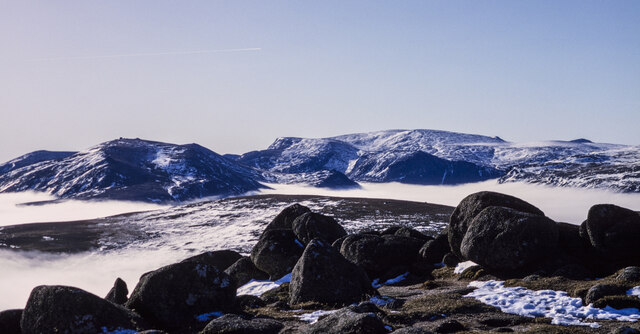
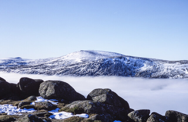
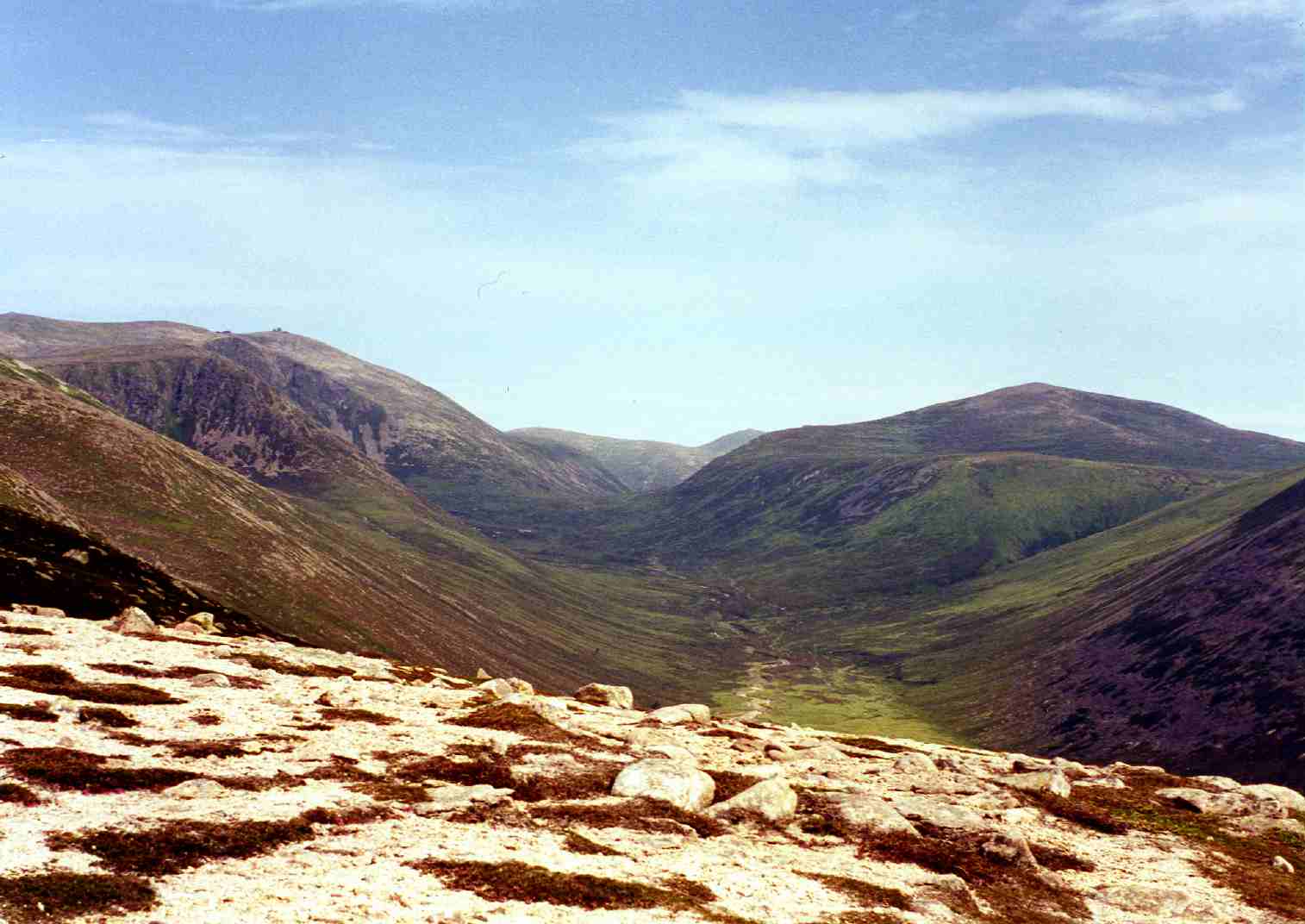
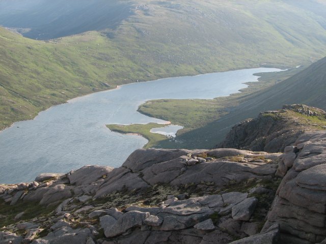
The summit of Barns of Bynack provides panoramic views of the surrounding Cairngorms mountain range, including the majestic Cairngorm peak itself. On clear days, visitors can also catch glimpses of other notable Scottish landmarks, such as Loch Morlich and the famous Lairig Ghru pass.

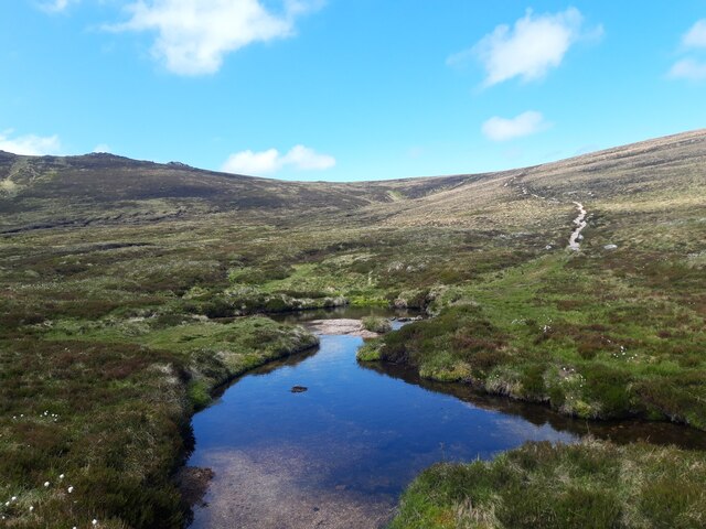
The hill is home to a variety of flora and fauna, with heather, moss, and grasses covering its slopes. Birdwatchers may be fortunate enough to spot golden eagles soaring through the skies, while red deer and mountain hares are frequently encountered along the lower slopes.

Visitors to Barns of Bynack are advised to come prepared with appropriate gear, as the weather conditions can change rapidly. The hill can be accessed from several different starting points, with various trails available to cater to different fitness levels and preferences.

Overall, Barns of Bynack offers a captivating experience for those seeking to explore the natural wonders of Banffshire, with its scenic beauty, diverse wildlife, and challenging terrain making it a must-visit destination for outdoor enthusiasts.

If you have any feedback on the listing, please let us know in the comments section below.

Barns of Bynack Images

Images are sourced within 2km of 57.133345/-3.5787773 or Grid Reference NJ0405. Thanks to Geograph Open Source API. All images are credited.

Bynack More
Bynack More
Rounded boulders at summit area of Bynack More Scattered snow remnants among the boulders and along the rounded ridge to the south of the mountain's summit.
There's a cloud inversion in place filling the valley beyond with mist and farther away, the mountains Beinn Mheadhoin (left), and Ben Macdui.
Rounded boulders at summit area of Bynack More
Scattered snow remnants among the boulders and along the rounded ridge to the south of the mountain's summit. There's a cloud inversion in place filling the valley beyond with mist and farther away, the mountains Beinn Mheadhoin (left), and Ben Macdui.
Rounded boulders at summit area of Bynack More - 2 Granite boulders at the summit area of Bynack More with the mist of a cloud inversion filling the void below.
Beyond the mist is Cairn Gorm, scattered with snow remnants.
Rounded boulders at summit area of Bynack More - 2
Granite boulders at the summit area of Bynack More with the mist of a cloud inversion filling the void below. Beyond the mist is Cairn Gorm, scattered with snow remnants.
Mountain walker at Little Barns of Bynack A pause on the way to the summit of Bynack More  from one of the mountains remarkable rock outcrops. The summit is ahead in the image, to the north.
Mountain walker at Little Barns of Bynack
A pause on the way to the summit of Bynack More from one of the mountains remarkable rock outcrops. The summit is ahead in the image, to the north.
South ridge of Bynack More The broad south ridge of the mountain with the Little Barns of Bynack prominent against the mist of a splendid temperature inversion.
Beyond the mist and rising above it are Beinn a' Chaorainn Beag and Beinn a' Chaorainn.
South ridge of Bynack More
The broad south ridge of the mountain with the Little Barns of Bynack prominent against the mist of a splendid temperature inversion. Beyond the mist and rising above it are Beinn a' Chaorainn Beag and Beinn a' Chaorainn.
Col between A' Chòinneach and Bynack More A mountain walker climbing for A' Chòinneach with the col between it and Bynack More partly obscured by mist.
The Little Barns of Bynack are seen in the distance on the south ridge of Bynack More.
Col between A' Chòinneach and Bynack More
A mountain walker climbing for A' Chòinneach with the col between it and Bynack More partly obscured by mist. The Little Barns of Bynack are seen in the distance on the south ridge of Bynack More.
Barns of Bynack with temperature inversion The remarkable rocks known as the Barns of Bynack protrude from the grassy slope on the eastern side of the south ridge of Bynack More: the view point is the Little Barns of Bynack which sit astride the ridge.
Ben Avon with its similar rock tors can be seen in the distance beyond the sea of mist.
Barns of Bynack with temperature inversion
The remarkable rocks known as the Barns of Bynack protrude from the grassy slope on the eastern side of the south ridge of Bynack More: the view point is the Little Barns of Bynack which sit astride the ridge. Ben Avon with its similar rock tors can be seen in the distance beyond the sea of mist.
Summit tor on Creag Mhòr Looking towards mountainsides on the opposite side of Glen Avon.
Summit tor on Creag Mhòr
Looking towards mountainsides on the opposite side of Glen Avon.
Creag Mhòr summit plateau The 895 metre-high Creag Mhòr is dwarfed by the higher Cairngorm peaks, some of which are visible in the distance here.
Creag Mhòr summit plateau
The 895 metre-high Creag Mhòr is dwarfed by the higher Cairngorm peaks, some of which are visible in the distance here.
Descending into the Corrie of the Barns This corrie takes its name from the Barns of Bynack, massive granite tors situated about 300 metres above the corrie floor, on the plateau of Bynack More.
Descending into the Corrie of the Barns
This corrie takes its name from the Barns of Bynack, massive granite tors situated about 300 metres above the corrie floor, on the plateau of Bynack More.
Ford in Coire Odhar Coire Odhar ('the dun-coloured corrie') lies on the north-eastern side of Bynack More.
Ford in Coire Odhar
Coire Odhar ('the dun-coloured corrie') lies on the north-eastern side of Bynack More.
Barns of Bynack on Bynack More Viewed from summit of Beinn a' Chaorainn Bheag some 4 km away. The south west slopes of Creag Mhòr in the foreground with Loch Dagrum just visible. 
The mountain was identified for me by Richard Webb via 'Speculative Upload' he says the giveaway is the array of big tors, i.e. the barns. Nigel Brown pointed out Loch Dagrum.
Barns of Bynack on Bynack More
Viewed from summit of Beinn a' Chaorainn Bheag some 4 km away. The south west slopes of Creag Mhòr in the foreground with Loch Dagrum just visible. The mountain was identified for me by Richard Webb via 'Speculative Upload' he says the giveaway is the array of big tors, i.e. the barns. Nigel Brown pointed out Loch Dagrum.
View south from Bynack More Taken on the south ridge near the Little Barns of Bynack, looking towards the Lairig an Laoigh, with Beinn a' Chaorainn on the left and Beinn Mheadhoin on the right.
View south from Bynack More
Taken on the south ridge near the Little Barns of Bynack, looking towards the Lairig an Laoigh, with Beinn a' Chaorainn on the left and Beinn Mheadhoin on the right.
Patterned ground on A'Choinneach This patterning is caused by wind and frost weakening and removing vegetation, leaving granite gravel patches. The vegetation is mostly crowberry (mat-forming), three-leaved rush (turning brown as it's past summer) and the light green racomitrium moss round the stones on the right. It's all easily damaged by further trampling, grazing,etc, but the prognosis is fair. This used to be a Munro summit, but must receive fewer visits now it's been relieved of that responsibility.
Patterned ground on A'Choinneach
This patterning is caused by wind and frost weakening and removing vegetation, leaving granite gravel patches. The vegetation is mostly crowberry (mat-forming), three-leaved rush (turning brown as it's past summer) and the light green racomitrium moss round the stones on the right. It's all easily damaged by further trampling, grazing,etc, but the prognosis is fair. This used to be a Munro summit, but must receive fewer visits now it's been relieved of that responsibility.
Upper slopes of Strath Nethy The best way to see Strath Nethy is from its upper slopes. I know, having walked along its lower slopes! The gentle gradients of the plateau give way first to this relic of a shallow valley, which was probably water-worn, then suddenly to the steep glacially-eroded rock basin of the glen itself. The close proximity of these different erosion types in the Cairngorms have given rise to a proposal from the UK governemnt that it be declared a UNESCO World Heritage Site.
Upper slopes of Strath Nethy
The best way to see Strath Nethy is from its upper slopes. I know, having walked along its lower slopes! The gentle gradients of the plateau give way first to this relic of a shallow valley, which was probably water-worn, then suddenly to the steep glacially-eroded rock basin of the glen itself. The close proximity of these different erosion types in the Cairngorms have given rise to a proposal from the UK governemnt that it be declared a UNESCO World Heritage Site.
Gullies in Coire Dheirg These are some of the most eroded slopes of Bynack More. This kind of erosion sometimes points to over-grazing, which may have been historically the case, but deer numbers have been reduced and there are no sheep or goats. So this could be a relic feature. Once this kind of thing gets going, it takes a long time to repair, especially with more heavy summer rainfall events.
It's not a new feature - Coire Dheirg means red corrie, so it was clearly known to those who named the hills.
Gullies in Coire Dheirg
These are some of the most eroded slopes of Bynack More. This kind of erosion sometimes points to over-grazing, which may have been historically the case, but deer numbers have been reduced and there are no sheep or goats. So this could be a relic feature. Once this kind of thing gets going, it takes a long time to repair, especially with more heavy summer rainfall events. It's not a new feature - Coire Dheirg means red corrie, so it was clearly known to those who named the hills.
Little Barns of Bynack Rock formations in The Cairngorm mountains
Little Barns of Bynack
Rock formations in The Cairngorm mountains
Barns of Bynack Rock formations in The Cairngorms
Barns of Bynack
Rock formations in The Cairngorms
Show me another place!

Barns of Bynack is located at Grid Ref: NJ0405 (Lat: 57.133345, Lng: -3.5787773)

Unitary Authority: Moray

Police Authority: North East

What 3 Words

///nametag.votes.guard. Near Aviemore, Highland

Nearby Locations

Barns of Bynack

Related Wikis

Bynack More

Bynack More (Scottish Gaelic: A' Bheithneag Mhòr or Beinn Bheithneag) is a Scottish Mountain that is situated in the Cairngorms range, 16 kilometres east...

Cairn Gorm

Cairn Gorm (Scottish Gaelic: An Càrn Gorm) is a mountain in the Scottish Highlands. It is part of the Cairngorms range and wider Grampian Mountains. With...

Beinn a' Chaorainn (Cairngorms)

Beinn a' Chaorainn is a Scottish mountain in the heart of the Cairngorms range. It is quite a remote hill, being located roughly 19 kilometres south east...

Loch A'an

Loch A'an is a remote freshwater loch set deep within the central Cairngorms plateau, in the Cairngorms National Park, located in the eastern Highlands...

Cairngorm Lochs

Cairngorm Lochs is a protected wetland area in the Cairngorms, in the Grampian and Highland regions of Scotland. With a total area of 173 hectares, it...

Beinn Mheadhoin (Cairngorms)

Beinn Mheadhoin or Beinn Meadhain (Scottish Gaelic for 'middle mountain') is a mountain in the Highlands of Scotland. It is a Munro with a height of 1...

Cairngorm Mountain Railway

The Cairngorm Mountain Railway, which opened in 2001, is the highest railway in the United Kingdom. The two-kilometre long funicular ascends the northern...

Lairig an Laoigh

The Lairig an Laoigh ( LAR-ig ən LOO-ee; Scottish Gaelic: Làirig Laoigh) is a mountain pass through the Highlands of Scotland. In speech and sometimes...

Nearby Amenities

Located within 500m of 57.133345,-3.5787773
Ele: 1004
Lat/Long: 57.1312243/-3.5836272
The data included in this document is from www.openstreetmap.org. The data is made available under ODbL.

Have you been to Barns of Bynack?

Leave your review of Barns of Bynack below (or comments, questions and feedback).