Cow Hill

Hill, Mountain in Fife

Scotland

Cow Hill

Field near Pow Farm Silage harvesting was taking place nearby and this field had just had a crop of grass taken off it.
Field near Pow Farm Credit: Richard Webb

Cow Hill is a prominent hill located in the county of Fife, Scotland. Situated near the town of Kelty, it forms part of the southern range of the Ochil Hills. With a height of approximately 392 meters (1,286 feet), it offers stunning panoramic views of the surrounding landscape and is a popular destination for hikers and nature enthusiasts.

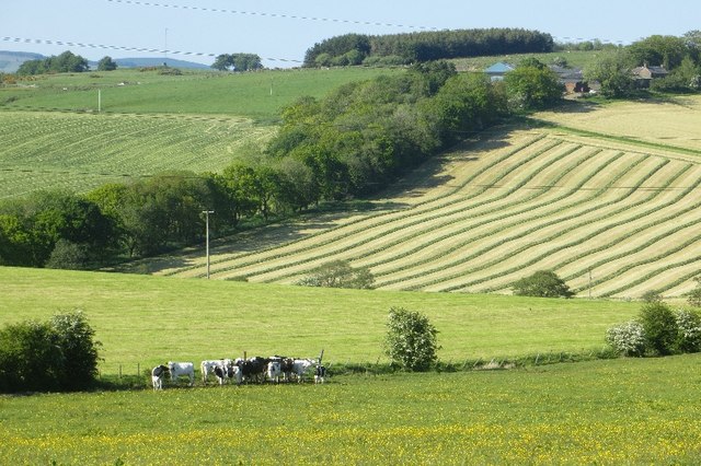
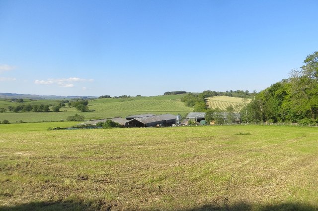
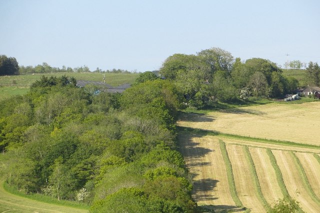
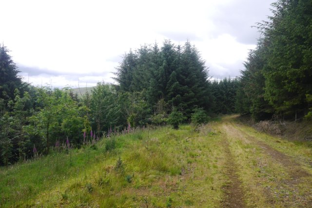
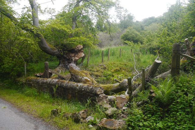
The hill is characterized by its gentle slopes and undulating terrain, covered in a mix of grasses, heather, and scattered trees. It is home to a diverse range of plant and animal species, including various birds, insects, and small mammals. The surrounding area is predominantly rural, with farmland and scattered settlements dotting the landscape.

The ascent to the summit of Cow Hill is relatively easy, with a well-defined path leading to the top. From there, visitors are rewarded with breathtaking vistas that stretch across the Fife countryside, encompassing rolling hills, meandering rivers, and distant coastal views.

Due to its accessibility and natural beauty, Cow Hill attracts a steady flow of visitors throughout the year. The hill provides ample opportunities for outdoor activities such as walking, picnicking, and photography. It also serves as a peaceful retreat for those seeking tranquility and a connection with nature.

Overall, Cow Hill in Fife offers a picturesque and serene setting, providing both locals and tourists with a chance to appreciate the natural splendor of the region.

If you have any feedback on the listing, please let us know in the comments section below.

Cow Hill Images

Images are sourced within 2km of 56.15521/-3.5583368 or Grid Reference NT0396. Thanks to Geograph Open Source API. All images are credited.

Field near Pow Farm Silage harvesting was taking place nearby and this field had just had a crop of grass taken off it.
Field near Pow Farm
Silage harvesting was taking place nearby and this field had just had a crop of grass taken off it.
Field beside the A823 Grassland by Pow Farm under the Cleish Hills.
Field beside the A823
Grassland by Pow Farm under the Cleish Hills.
Cut grass, Pow Grass cut for silage.
Cut grass, Pow
Grass cut for silage.
Cow in a wood The dyke between this strip wood and the pasture beyond is not cowproof.
Cow in a wood
The dyke between this strip wood and the pasture beyond is not cowproof.
Pow Pow Farm.  The field had just had a crop of silage taken off it as Winter feed for its herd of dairy cattle.
Pow
Pow Farm. The field had just had a crop of silage taken off it as Winter feed for its herd of dairy cattle.
Mown grass Fields in various stages of silage harvesting above Pow.
Mown grass
Fields in various stages of silage harvesting above Pow.
A823 passes Pow A quick shot while returning from the field on the right which was in the last square for a personal hectad.  I needed to shift as I was getting some concerned attention from the house behind me. Fortunately I had no numberplate.
A823 passes Pow
A quick shot while returning from the field on the right which was in the last square for a personal hectad. I needed to shift as I was getting some concerned attention from the house behind me. Fortunately I had no numberplate.
Field near Hallcroft Grass destined for silage on the southern slopes of Cult Hill.
Field near Hallcroft
Grass destined for silage on the southern slopes of Cult Hill.
Hallcroft A view of Cult Hill.
Hallcroft
A view of Cult Hill.
Old Milepost by the A823, Hill End, Saline parish H type by the A823, in parish of Saline (Fife District), Hill End, North of Hill End.

Inscription reads:-
: {arrow} / DUNFERMLINE / 8 MILES : : {arrow} / RUMBLING / BRIDGE / 2½ MILES :

Grade C(S) listed. Number: LB45592
<span class="nowrap"><a title="http://portal.historicenvironment.scot/designation/LB45592" rel="nofollow ugc noopener" href="http://portal.historicenvironment.scot/designation/LB45592">Link</a><img style="margin-left:2px;" alt="External link" title="External link - shift click to open in new window" src="https://s1.geograph.org.uk/img/external.png" width="10" height="10"/></span>

Surveyed

Milestone Society National ID: FF_DFRB08
Old Milepost by the A823, Hill End, Saline parish
H type by the A823, in parish of Saline (Fife District), Hill End, North of Hill End. Inscription reads:- : {arrow} / DUNFERMLINE / 8 MILES : : {arrow} / RUMBLING / BRIDGE / 2½ MILES : Grade C(S) listed. Number: LB45592 LinkExternal link Surveyed Milestone Society National ID: FF_DFRB08
Old Milepost by the A823, south of Powmill, Saline parish H type Milepost by the A823, in parish of Saline (Fife District), South of Powmill, just South of the county boundary with Clackmannanshire.

Inscription reads:-
: {arrow->} / DUNFERMLINE / 9 MILES : : {<-arrow} / RUMBLING / BRIDGE / 1 ½ MILES :

Grade C(S) listed.
Reference: LB45592 <span class="nowrap"><a title="http://portal.historicenvironment.scot/designation/LB45592" rel="nofollow ugc noopener" href="http://portal.historicenvironment.scot/designation/LB45592">Link</a><img style="margin-left:2px;" alt="External link" title="External link - shift click to open in new window" src="https://s1.geograph.org.uk/img/external.png" width="10" height="10"/></span>

Surveyed

Milestone Society National ID: FF_DFRB09
Old Milepost by the A823, south of Powmill, Saline parish
H type Milepost by the A823, in parish of Saline (Fife District), South of Powmill, just South of the county boundary with Clackmannanshire. Inscription reads:- : {arrow->} / DUNFERMLINE / 9 MILES : : {<-arrow} / RUMBLING / BRIDGE / 1 ½ MILES : Grade C(S) listed. Reference: LB45592 LinkExternal link Surveyed Milestone Society National ID: FF_DFRB09
Fence, Wether Hill A ride beside the fence gives an easy route onto the open area surrounding the summit of Wether Hill.
Fence, Wether Hill
A ride beside the fence gives an easy route onto the open area surrounding the summit of Wether Hill.
Road on Wether Hill
Road on Wether Hill
Summit, Wether Hill Unplanted with conifers and a fine viewpoint.  It was covered in dead grass with lots of vole runs which were being inspected by a hovering kestrel. Why dead grass?  Perhaps drought damage, but other Cleish summits were green.
Summit, Wether Hill
Unplanted with conifers and a fine viewpoint. It was covered in dead grass with lots of vole runs which were being inspected by a hovering kestrel. Why dead grass? Perhaps drought damage, but other Cleish summits were green.
Open area, Wether Hill Lots of dead grass and vole runs.  The open area is larger than shown by the Ordnance Survey.
Open area, Wether Hill
Lots of dead grass and vole runs. The open area is larger than shown by the Ordnance Survey.
Cattle, Hill End Fields below Wether Hill.
Cattle, Hill End
Fields below Wether Hill.
Meadowhead Hill The northern side of the Cleish Hills.
Meadowhead Hill
The northern side of the Cleish Hills.
A battered beech Beside St Margaret&amp;#039;s Burn, the Kinross-shire / Fife march.
A battered beech
Beside St Margaret's Burn, the Kinross-shire / Fife march.
Show me another place!

Cow Hill is located at Grid Ref: NT0396 (Lat: 56.15521, Lng: -3.5583368)

Unitary Authority: Fife

Police Authority: Fife

What 3 Words

///bakers.trash.sharpness. Near Saline, Fife

Nearby Locations

Cow Hill

Related Wikis

Powmill

Powmill is a village in Perth and Kinross, Scotland. It lies at the junction of the A823 and A977 roads at the southwest of the region, approximately 5...

Aldie Castle

Aldie Castle is an historic building east of Crook of Devon, Perth and Kinross, Scotland. It is a Category A listed building. This three storey tower house...

Rumbling Bridge railway station

Rumbling Bridge railway station served the village of Rumbling Bridge, Kinross-shire, Scotland from 1863 to 1964 on the Devon Valley Railway. == History... ==

Rumbling Bridge

Rumbling Bridge is a small village built on both side of a gorge of the River Devon, which formed the boundary between the historic counties of Perthshire...

Crook of Devon

Crook of Devon is a village within the parish of Fossoway in Kinross-shire about six miles (ten kilometres) west of Kinross on the A977 road. Its name...

Crook of Devon railway station

Crook of Devon railway station served the village of Crook of Devon, Kinross-shire, Scotland, from 1863 to 1964 on the Devon Valley Railway. == History... ==

Cauldron Linn (River Devon)

Cauldron Linn, or Caldron Linn, is a waterfall on the River Devon on the border between Clackmannanshire and Perth and Kinross in Scotland. == Location... ==

Tullibole Castle

Tullibole Castle is a 17th-century castle in Crook of Devon, a village in Perth and Kinross. It was built by John Halliday in 1608 and is currently owned...

Nearby Amenities

Located within 500m of 56.15521,-3.5583368
Power: tower
Lat/Long: 56.1555904/-3.5573377
Power: tower
Lat/Long: 56.1548687/-3.5624353
Power: tower
Lat/Long: 56.1563077/-3.5520956
Power: pole
Lat/Long: 56.1513124/-3.5549456
Power: pole
Lat/Long: 56.1519717/-3.5553435
Power: pole
Lat/Long: 56.1526504/-3.5557867
Power: pole
Lat/Long: 56.1533405/-3.5562236
Power: pole
Lat/Long: 56.1540284/-3.5562175
Power: pole
Lat/Long: 56.1546111/-3.5562298
Power: pole
Lat/Long: 56.1551629/-3.5562339
Power: pole
Lat/Long: 56.155612/-3.5569642
Power: pole
Lat/Long: 56.1560952/-3.5576596
Power: pole
Lat/Long: 56.1564791/-3.5586135
Power: pole
Lat/Long: 56.1570172/-3.5594772
Power: pole
Lat/Long: 56.1573497/-3.5600208
Power: pole
Lat/Long: 56.1562106/-3.5596741
Power: pole
Lat/Long: 56.1559456/-3.5606999
Power: pole
Lat/Long: 56.1556759/-3.5617933
Power: pole
Lat/Long: 56.1554154/-3.5627923
The data included in this document is from www.openstreetmap.org. The data is made available under ODbL.

Have you been to Cow Hill?

Leave your review of Cow Hill below (or comments, questions and feedback).