Birnam Hill

Hill, Mountain in Perthshire

Scotland

Birnam Hill

Tourist information on A9 The A9 is a strategic link between the Highlands of Scotland and the Central Belt. It runs 279 miles from junction 5 of the M9 at Polmont to Scrabster. Originally it ran from Edinburgh.
<span class="nowrap"><a title="https://www.sabre-roads.org.uk/wiki/index.php?title=A9" rel="nofollow ugc noopener" href="https://www.sabre-roads.org.uk/wiki/index.php?title=A9">Link</a><img style="margin-left:2px;" alt="External link" title="External link - shift click to open in new window" src="https://s1.geograph.org.uk/img/external.png" width="10" height="10"/></span>
Tourist information on A9 Credit: N Chadwick

Birnam Hill is a prominent landmark located in Perthshire, Scotland. Rising to a height of 404 meters (1,325 feet), it is classified as a hill rather than a mountain. Birnam Hill is part of the wider Birnam Wood, which is renowned for its association with William Shakespeare's play, Macbeth.

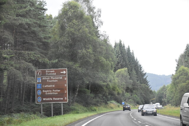
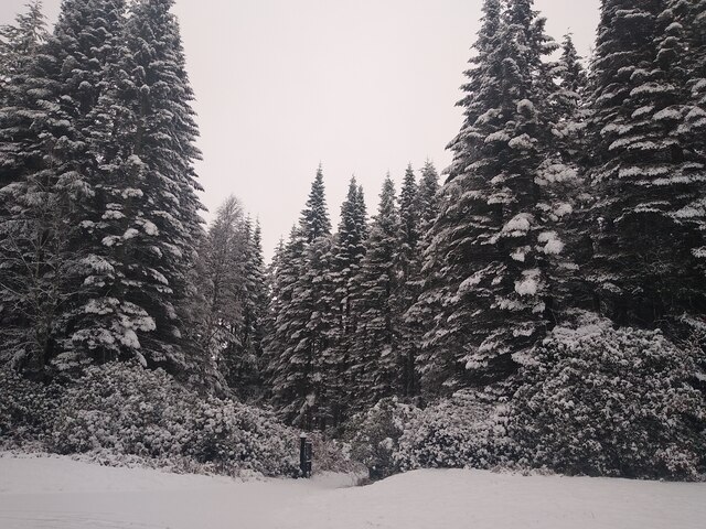
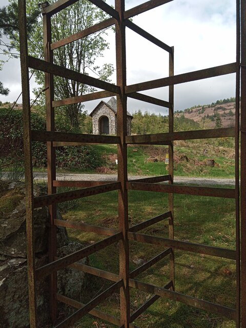
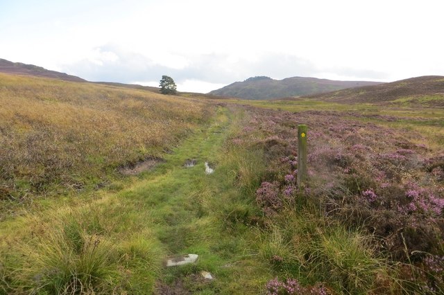
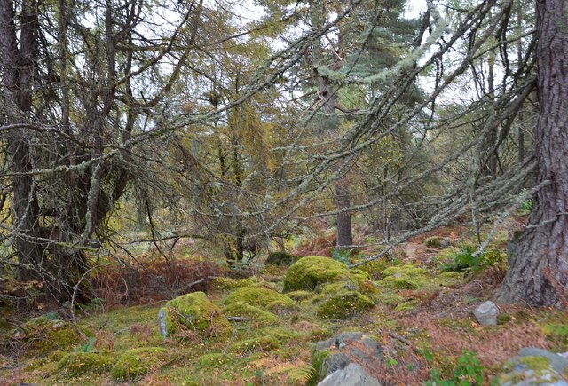
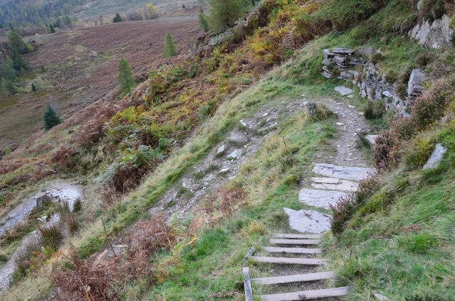
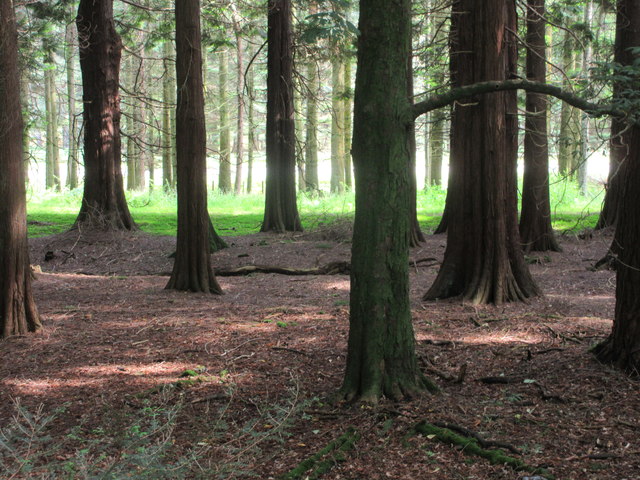
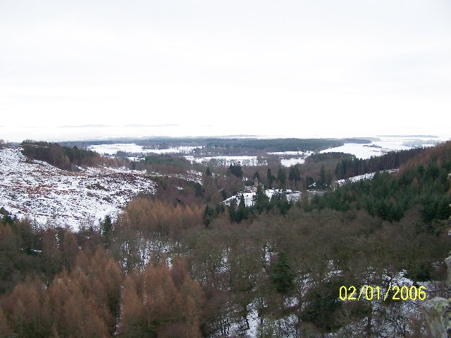
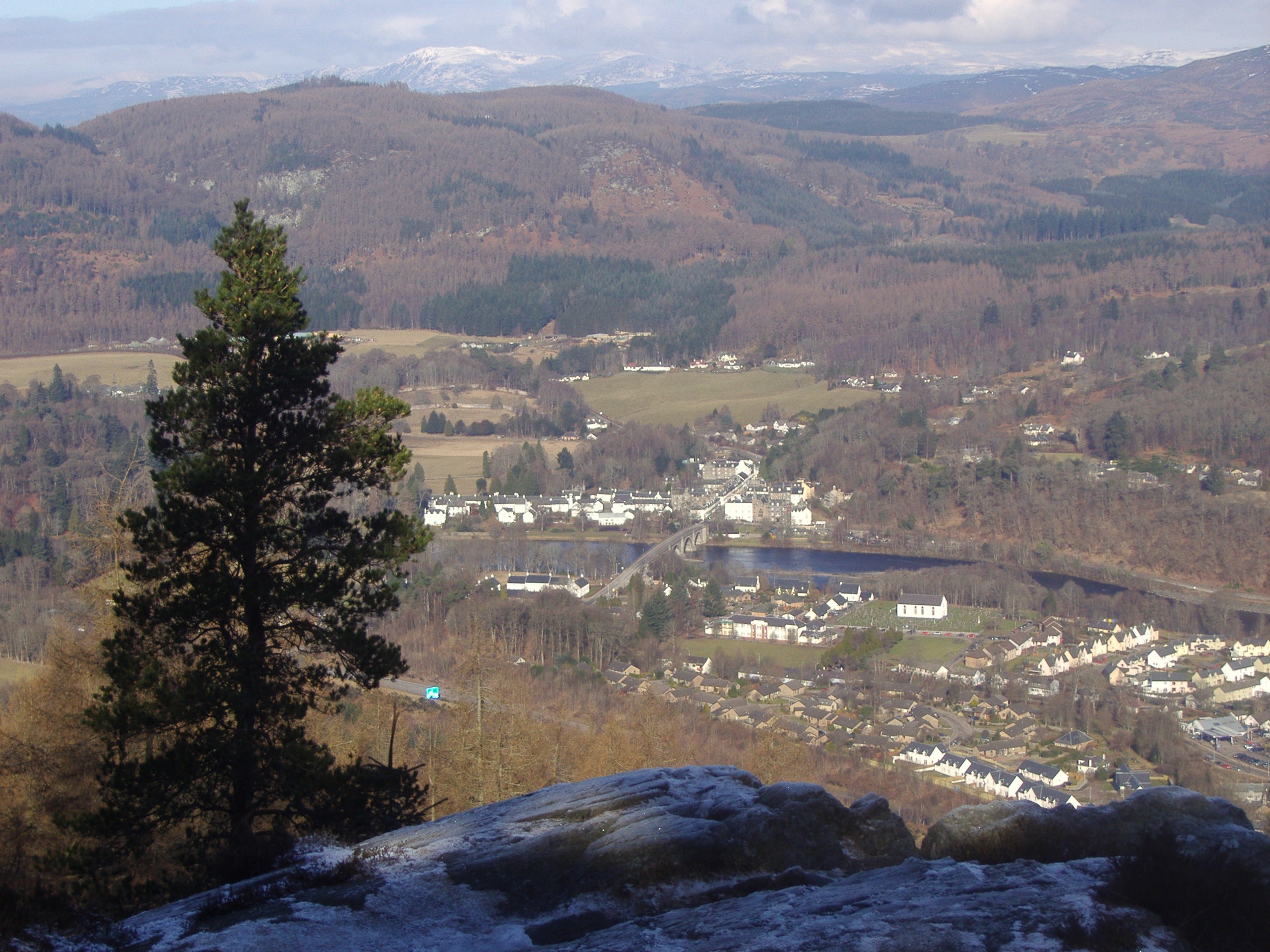
Situated near the town of Dunkeld, Birnam Hill offers breathtaking panoramic views of the surrounding Perthshire countryside. The hill is covered in a mixture of woodland, heather, and grass, providing a diverse habitat for flora and fauna. Visitors can explore the hill via well-maintained paths that lead through the enchanting Birnam Wood, famous for its ancient oak trees.

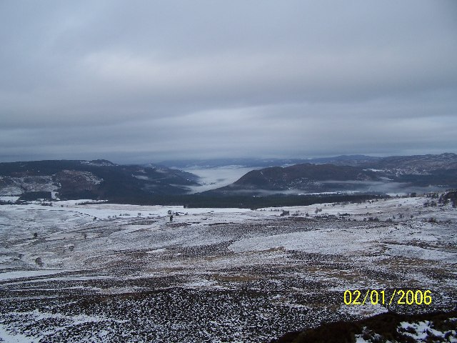
Birnam Hill is a popular destination for outdoor enthusiasts, hikers, and nature lovers. Its accessible location and moderate level of difficulty make it suitable for individuals of various fitness levels. The summit provides a rewarding vista, allowing visitors to appreciate the beauty of the River Tay, the town of Dunkeld, and the surrounding hills and valleys.

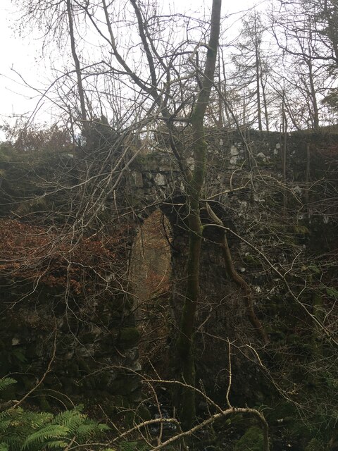
Aside from its natural beauty, Birnam Hill also holds historical significance. It is said that Birnam Wood served as a hiding place for the Jacobites during the 18th-century rebellion. The remnants of an Iron Age fort can also be found on the hill, adding an archaeological aspect to its allure.

Overall, Birnam Hill is a captivating destination that offers a blend of natural splendor, historical intrigue, and recreational opportunities, making it a must-visit location in Perthshire, Scotland.

If you have any feedback on the listing, please let us know in the comments section below.

Birnam Hill Images

Images are sourced within 2km of 56.546442/-3.5778107 or Grid Reference NO0340. Thanks to Geograph Open Source API. All images are credited.

Tourist information on A9 The A9 is a strategic link between the Highlands of Scotland and the Central Belt. It runs 279 miles from junction 5 of the M9 at Polmont to Scrabster. Originally it ran from Edinburgh.
<span class="nowrap"><a title="https://www.sabre-roads.org.uk/wiki/index.php?title=A9" rel="nofollow ugc noopener" href="https://www.sabre-roads.org.uk/wiki/index.php?title=A9">Link</a><img style="margin-left:2px;" alt="External link" title="External link - shift click to open in new window" src="https://s1.geograph.org.uk/img/external.png" width="10" height="10"/></span>
Tourist information on A9
The A9 is a strategic link between the Highlands of Scotland and the Central Belt. It runs 279 miles from junction 5 of the M9 at Polmont to Scrabster. Originally it ran from Edinburgh. LinkExternal link
Stair Bridge
Stair Bridge
A9, Birnam Wood The A9 is a strategic link between the Highlands of Scotland and the Central Belt. Running for 273 miles, it is the longest road in Scotland and the fifth-longest A-road in the United Kingdom. Historically it was the main road between Edinburgh and John o' Groats but its importance has been eclipsed somewhat in the south by the A90 across the Forth Road Bridge and the M90 motorway, which now links Edinburgh more directly with Perth, and the M9, which is now the main road between Edinburgh and Bridge of Allan.
A9, Birnam Wood
The A9 is a strategic link between the Highlands of Scotland and the Central Belt. Running for 273 miles, it is the longest road in Scotland and the fifth-longest A-road in the United Kingdom. Historically it was the main road between Edinburgh and John o' Groats but its importance has been eclipsed somewhat in the south by the A90 across the Forth Road Bridge and the M90 motorway, which now links Edinburgh more directly with Perth, and the M9, which is now the main road between Edinburgh and Bridge of Allan.
Snow covered forest at the A9 Photographed from the car, through the open window, while sitting in very slow moving traffic.
Snow covered forest at the A9
Photographed from the car, through the open window, while sitting in very slow moving traffic.
A Very Rural Turnstile No one expects the Spanish Inquisition . . . or to pech to the top of a rocky crag and have to negotiate a turnstile. Neatly in the frame is the Buffalo Hut, a very stylish bothy so called by locals as it sits in the park on the slope of Birnam Hill where Sir William Drummond Stewart kept a small herd of American Bison. Souvenirs of his adventures with the Mountain Men across the Great Plains and into the Rockies in the 1830s.
A Very Rural Turnstile
No one expects the Spanish Inquisition . . . or to pech to the top of a rocky crag and have to negotiate a turnstile. Neatly in the frame is the Buffalo Hut, a very stylish bothy so called by locals as it sits in the park on the slope of Birnam Hill where Sir William Drummond Stewart kept a small herd of American Bison. Souvenirs of his adventures with the Mountain Men across the Great Plains and into the Rockies in the 1830s.
Glen Garr path The path passes to the west of Obney Hill on its way to Bankfoot.
Glen Garr path
The path passes to the west of Obney Hill on its way to Bankfoot.
Perth and Kinross : The A9 Looking along the A9.
Perth and Kinross : The A9
Looking along the A9.
A9, Strath Tay Heading south east through woodland.
A9, Strath Tay
Heading south east through woodland.
Path junction, Birnam Hill path The left-hand path heads SE to the Pass of Birnam.
Path junction, Birnam Hill path
The left-hand path heads SE to the Pass of Birnam.
Birnam Wood Moss and lichen in the woodland to the east of King's Seat.
Birnam Wood
Moss and lichen in the woodland to the east of King's Seat.
Looking east from Stair Bridge Rohallion Loch is to the right of the turreted roof of Rohallion Lodge.
Looking east from Stair Bridge
Rohallion Loch is to the right of the turreted roof of Rohallion Lodge.
Path to King's Seat, Birnam Hill Here the path swings N and heads towards the summit.
Path to King's Seat, Birnam Hill
Here the path swings N and heads towards the summit.
Birnam Hill path south of King's Seat This well-made path approaches steeper ground in heather moor with scattered trees.
Birnam Hill path south of King's Seat
This well-made path approaches steeper ground in heather moor with scattered trees.
Zigzags on the Birnam Hill path A couple of stone seats have been built into the side of the path here.
Zigzags on the Birnam Hill path
A couple of stone seats have been built into the side of the path here.
Birnam Wood Birnam Wood viewed from the B867 towards the A9 in the sunlight.
Birnam Wood
Birnam Wood viewed from the B867 towards the A9 in the sunlight.
Ruthvens Dam
Ruthvens Dam
Strath Tay Looking north from Obney Hill towards the Strath Tay valley as it leaves Dunkeld.
Strath Tay
Looking north from Obney Hill towards the Strath Tay valley as it leaves Dunkeld.
Birnam Wood and Rohallion Lodge Picture taken from Stair Bridge in Birnam Wood looking WSW.  Rohallion Lodge right of centre with Birnam Wood left and foreground.
Birnam Wood and Rohallion Lodge
Picture taken from Stair Bridge in Birnam Wood looking WSW. Rohallion Lodge right of centre with Birnam Wood left and foreground.
Show me another place!

Birnam Hill is located at Grid Ref: NO0340 (Lat: 56.546442, Lng: -3.5778107)

Unitary Authority: Perth and Kinross

Police Authority: Tayside

What 3 Words

///weep.towels.safest. Near Bankfoot, Perth & Kinross

Related Wikis

River Braan

The River Braan (Scottish Gaelic: Breamhainn) is a tributary of the River Tay in Scotland. Within the county of Perth and Kinross, it flows 11 miles...

Dunkeld & Birnam railway station

Dunkeld & Birnam railway station serves the town of Dunkeld and village of Birnam in Perth and Kinross, Scotland. It is located on the Highland Main Line...

Birnam, Perth and Kinross

Birnam is a village in Perth and Kinross, Scotland. It is located 12 miles (19 km) north of Perth on the A9 road, the main tourist route through Perthshire...

Perth Road drill hall, Birnam

The Perth Road drill hall is a former military installation on Perth Road in Birnam, Perth and Kinross, Scotland. == History == The building was designed...

Birnam Arts

Birnam Arts is a multipurpose arts centre in Birnam, Perthshire, central Scotland. It is also known as the Birnam Arts and Conference Centre, and was originally...
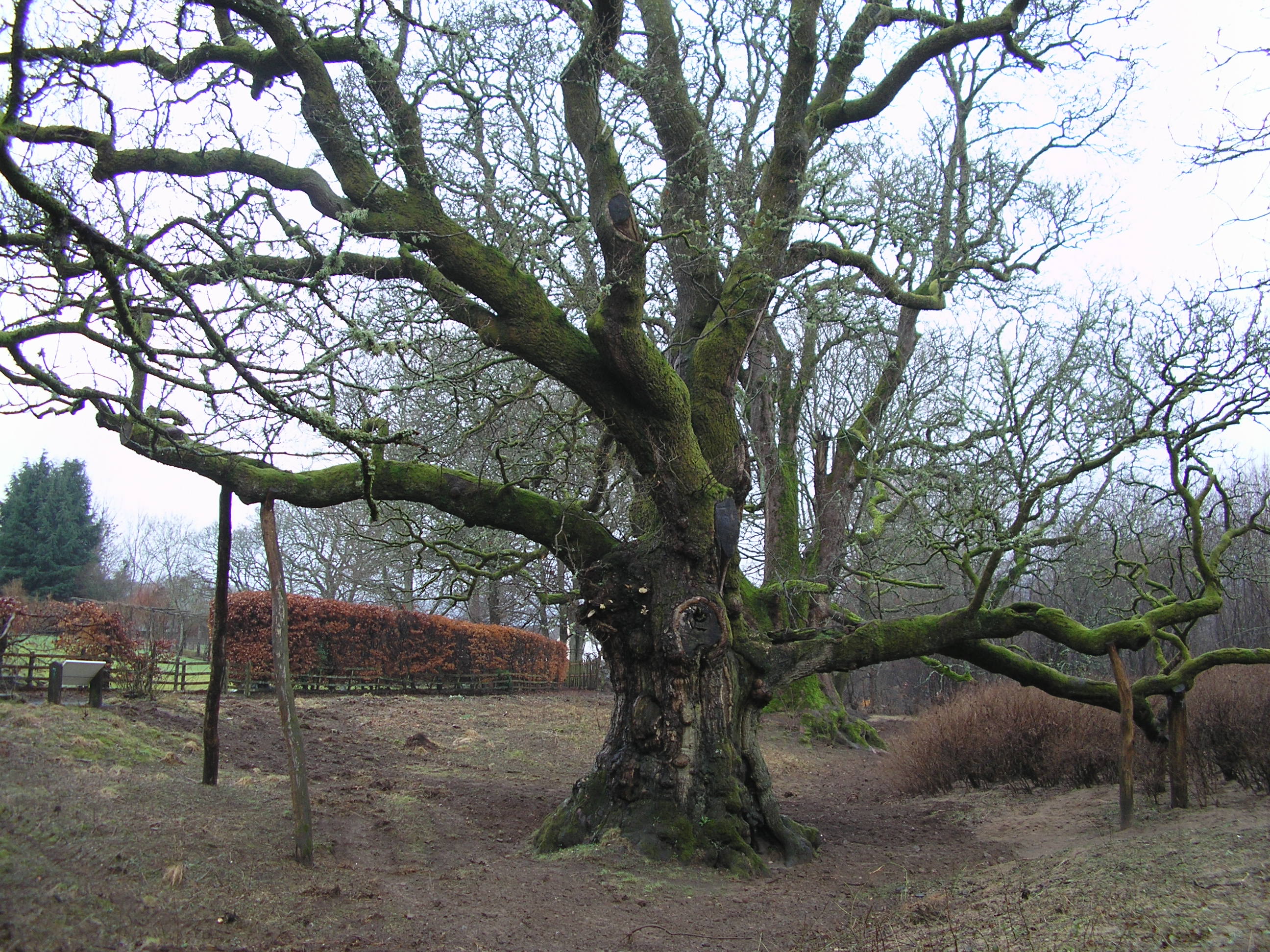
Birnam Oak

The Birnam Oak is an example of Sessile oak (Quercus petraea) at Birnam, Perth and Kinross, Scotland (grid reference NO032421). Sometimes known as Macbeth...
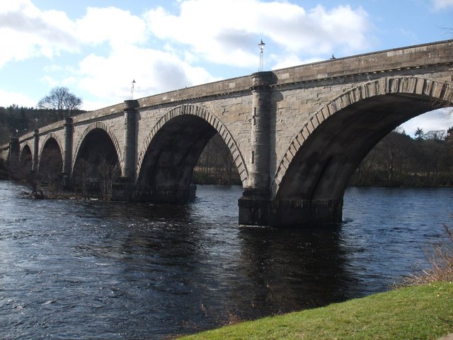
Dunkeld Bridge

Dunkeld Bridge is a seven-arch bridge crossing the River Tay at Dunkeld, Perth and Kinross, Scotland. It carries the pedestrian and vehicle traffic of...

Dunkeld

Dunkeld (, Scots: Dunkell, from Scottish Gaelic: Dùn Chailleann, "fort of the Caledonians") is a town in Perth and Kinross, Scotland. The location of a...

Nearby Amenities

Located within 500m of 56.546442,-3.5778107
Birnam Hill (King's Seat)
Corbett: no
Ele: 404
Graham: no
Marilyn: yes
Munro: no
Natural: peak
Prominence: 171
Tourism: viewpoint
Lat/Long: 56.5435587/-3.575807
Tourism: viewpoint
Lat/Long: 56.5495315/-3.5777209
Information: guidepost
Tourism: information
Lat/Long: 56.5434795/-3.5758705
Ele: 397
Natural: peak
Lat/Long: 56.5430847/-3.5752504
The data included in this document is from www.openstreetmap.org. The data is made available under ODbL.

Have you been to Birnam Hill?

Leave your review of Birnam Hill below (or comments, questions and feedback).