Blaeberry Hill
Hill, Mountain in Perthshire
Scotland
Blaeberry Hill

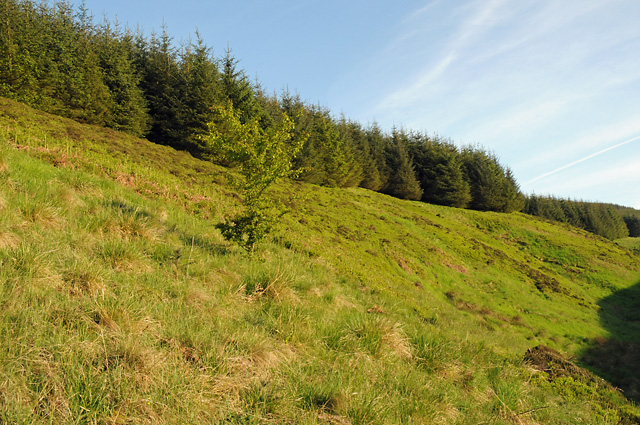
Blaeberry Hill, located in Perthshire, Scotland, is a magnificent hill/mountain that stands at an elevation of approximately 450 meters (1,476 feet) above sea level. It is part of the stunning Scottish Highlands, known for its breathtaking landscapes and picturesque views. Blaeberry Hill is situated near the village of Dunkeld, offering visitors a peaceful retreat surrounded by natural beauty.
The hill is characterized by its rolling green slopes, adorned with heather, grasses, and the occasional wildflowers. It is a popular destination for outdoor enthusiasts, hikers, and nature lovers who are drawn to its tranquil atmosphere and stunning vistas. The ascent to the summit can be challenging but rewarding, providing panoramic views of the surrounding countryside, including the River Tay and the nearby Grampian Mountains.
Blaeberry Hill is home to a diverse range of flora and fauna, with various species of birds, mammals, and plants inhabiting its slopes. It offers a habitat for wildlife such as red deer, mountain hares, and various bird species, making it a favored spot for birdwatchers and wildlife enthusiasts.
The hill is easily accessible, with designated paths and trails leading to the summit, making it suitable for both experienced hikers and those seeking a more leisurely stroll. Visitors to Blaeberry Hill can expect a peaceful and serene experience, surrounded by the beauty of Scotland's natural landscape.
If you have any feedback on the listing, please let us know in the comments section below.
Blaeberry Hill Images
Images are sourced within 2km of 56.272813/-3.5669442 or Grid Reference NO0310. Thanks to Geograph Open Source API. All images are credited.


Blaeberry Hill is located at Grid Ref: NO0310 (Lat: 56.272813, Lng: -3.5669442)
Unitary Authority: Perth and Kinross
Police Authority: Tayside
What 3 Words
///remaining.number.hobble. Near Auchterarder, Perth & Kinross
Nearby Locations
Related Wikis

Ochil and South Perthshire (UK Parliament constituency)
Ochil and South Perthshire is a county constituency of the House of Commons of the Parliament of the United Kingdom. It elects one Member of Parliament...

Innerdouny Hill
Innerdouny Hill (497 m) is a hill in the Ochil Hills of Perth and Kinross, Scotland. It is located northwest of the town of Kinross. The second highest...

Dunning, Perth and Kinross
Dunning is a small village in Perth and Kinross in Scotland with a population of about 1,000. The village centres around the 12th–13th century former parish...

Dupplin Cross
The Dupplin Cross is a carved, monumental Pictish stone, which dates from around 800 AD. It was first recorded by Thomas Pennant in 1769, on a hillside...
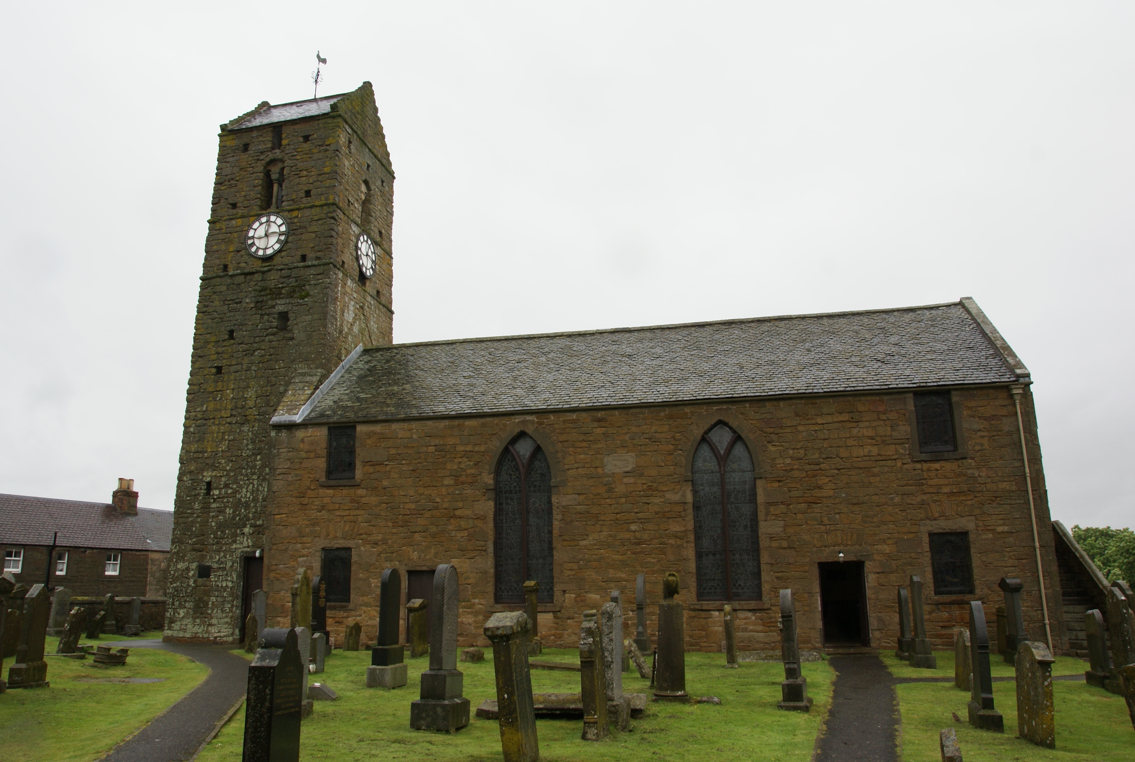
St Serf's Church, Dunning
St Serf's Church in the Scottish village of Dunning, Perth and Kinross is a Category A listed building largely dating to the early 19th century, but incorporating...

Invermay
Invermay ( ) is a diffuse settlement in Perth and Kinross, Scotland. It is situated approximately 2 km southeast of Forteviot on the Water of May, some...
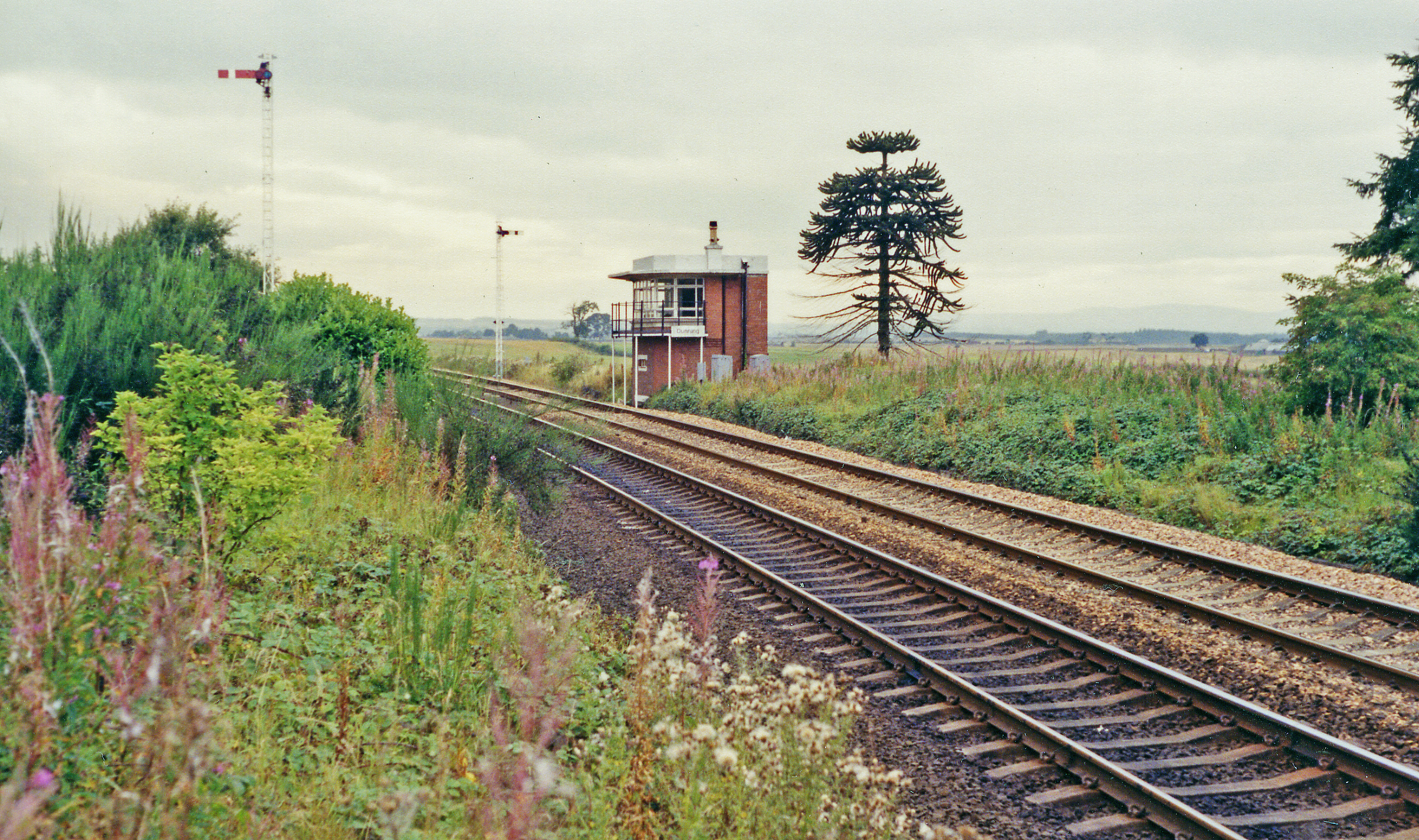
Dunning railway station
Dunning railway station served the village of Dunning, Perth and Kinross, Scotland from 1848 to 1956 on the Scottish Central Railway. == History == The...

A823 road
The A823 is a road in Scotland which goes from south of Crieff to Dunfermline. It joins onto the A823(M) and the A822 which runs to Crieff.
Nearby Amenities
Located within 500m of 56.272813,-3.5669442Have you been to Blaeberry Hill?
Leave your review of Blaeberry Hill below (or comments, questions and feedback).