Horner's Green

Settlement in Suffolk Babergh

England

Horner's Green

Stone Street, Suffolk Stone Street is a small hamlet lying south of the village of Boxford. Along the street are some interesting houses, including this fine timber-framed house on the right of the picture.
Stone Street, Suffolk Credit: Robert Edwards

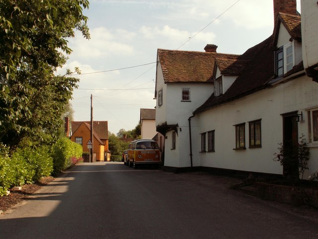
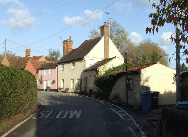
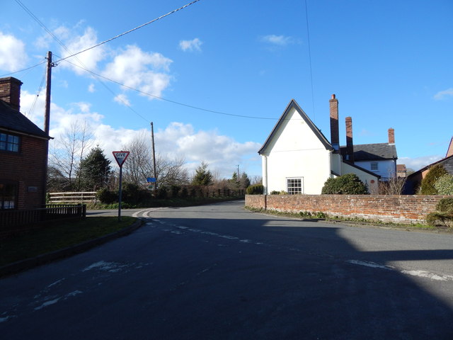
Horner's Green is a picturesque village situated in the county of Suffolk, England. Nestled in the heart of the Suffolk countryside, this quaint hamlet offers a peaceful and idyllic setting for its residents and visitors alike.

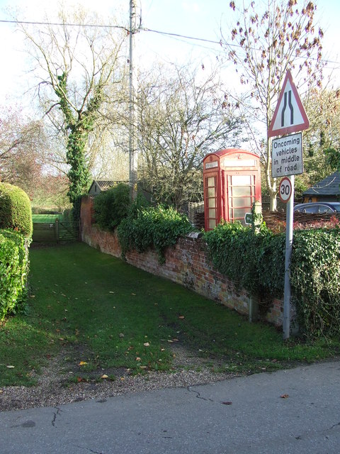
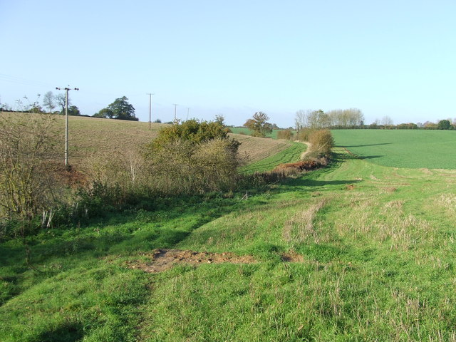
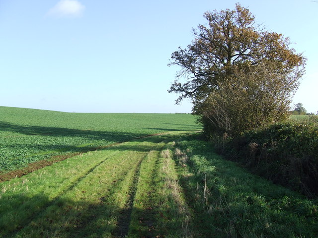
Surrounded by rolling green hills and lush farmland, Horner's Green boasts a truly picturesque landscape. The area is known for its stunning natural beauty, with its scenic walking trails and charming rural scenery attracting outdoor enthusiasts and nature lovers. The village is also home to a variety of wildlife, including birds, deer, and rabbits, adding to its appeal for nature enthusiasts.

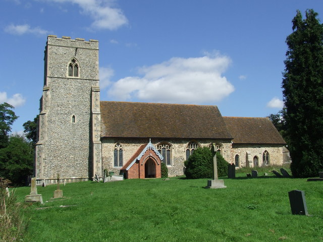
Despite its small size, Horner's Green has a strong sense of community. The villagers take great pride in their close-knit community, and events such as village fetes, local markets, and seasonal celebrations bring the residents together. The village pub, which dates back to the 17th century, serves as a popular gathering spot for locals and visitors alike, offering a warm and friendly atmosphere.

Historically, Horner's Green has deep roots in the agricultural industry, with farming playing a crucial role in the village's economy. While the farming tradition continues, the village has also seen a rise in tourism, with visitors drawn to its scenic beauty and tranquil ambiance.

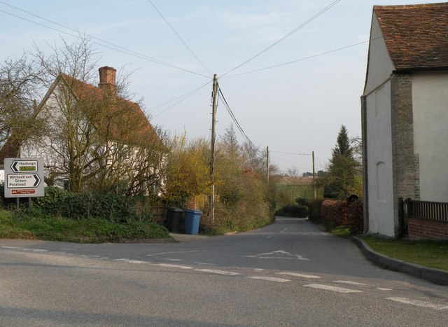
Access to Horner's Green is convenient, with major roads connecting it to nearby towns and cities. The village is also within a short driving distance of other popular attractions in Suffolk, making it an ideal base for exploring the wider region.

Overall, Horner's Green offers a serene and charming escape from the hustle and bustle of city life. Its natural beauty, strong community spirit, and rich agricultural heritage make it a truly special place to visit or call home.

If you have any feedback on the listing, please let us know in the comments section below.

Horner's Green Images

Images are sourced within 2km of 52.038216/0.862726 or Grid Reference TL9641. Thanks to Geograph Open Source API. All images are credited.

Stone Street, Suffolk Stone Street is a small hamlet lying south of the village of Boxford. Along the street are some interesting houses, including this fine timber-framed house on the right of the picture.
Stone Street, Suffolk
Stone Street is a small hamlet lying south of the village of Boxford. Along the street are some interesting houses, including this fine timber-framed house on the right of the picture.
The road to Whitestreet Green This is the view from Hadleigh Road in a hamlet called Calais Street.
The road to Whitestreet Green
This is the view from Hadleigh Road in a hamlet called Calais Street.
Stone Street Stone Street, Suffolk.
Stone Street
Stone Street, Suffolk.
Telephone Box And Footpath Telephone box and footpath at Stone Street, Suffolk.
Telephone Box And Footpath
Telephone box and footpath at Stone Street, Suffolk.
Footpath Footpath looking west near to Boxford, Suffolk.
Footpath
Footpath looking west near to Boxford, Suffolk.
Green Path Footpath looking east near to Boxford, Suffolk.
Green Path
Footpath looking east near to Boxford, Suffolk.
Calais Street junction Calais Street is a hamlet in the civil parish of Boxford in Babergh, Suffolk, England. There is currently no street called "Calais Street"; it is a settlement. It was marked on a 19th-century map as Callis Street.
<span class="nowrap"><a title="http://visionofbritain.org.uk/maps/?layer=europe&xMin=3377073.08281&yMin=2821356.37736&xMax=3414073.08281&yMax=2858356.37736" rel="nofollow ugc noopener" href="http://visionofbritain.org.uk/maps/?layer=europe&xMin=3377073.08281&yMin=2821356.37736&xMax=3414073.08281&yMax=2858356.37736">Link</a><img style="margin-left:2px;" alt="External link" title="External link - shift click to open in new window" src="https://s1.geograph.org.uk/img/external.png" width="10" height="10"/></span>. There are also streets called Calais Street in Hadleigh and London and Leicester.
Calais Street junction
Calais Street is a hamlet in the civil parish of Boxford in Babergh, Suffolk, England. There is currently no street called "Calais Street"; it is a settlement. It was marked on a 19th-century map as Callis Street. LinkExternal link. There are also streets called Calais Street in Hadleigh and London and Leicester.
Signs at junction at Calais Street The "A1071" sign is incorrect, the A1071 isn't a primary (green) road, it's a non-primary road (white, or red on maps).
Signs at junction at Calais Street
The "A1071" sign is incorrect, the A1071 isn't a primary (green) road, it's a non-primary road (white, or red on maps).
Calais Street looking towards Hadleigh Calais Street is a hamlet in the civil parish of Boxford in Babergh, Suffolk, England. There is currently no street called "Calais Street"; it is a settlement. It was marked on a 19th-century map as Callis Street.
<span class="nowrap"><a title="http://visionofbritain.org.uk/maps/?layer=europe&xMin=3377073.08281&yMin=2821356.37736&xMax=3414073.08281&yMax=2858356.37736" rel="nofollow ugc noopener" href="http://visionofbritain.org.uk/maps/?layer=europe&xMin=3377073.08281&yMin=2821356.37736&xMax=3414073.08281&yMax=2858356.37736">Link</a><img style="margin-left:2px;" alt="External link" title="External link - shift click to open in new window" src="https://s1.geograph.org.uk/img/external.png" width="10" height="10"/></span>. There are also streets called Calais Street in Hadleigh and London and Leicester.
Calais Street looking towards Hadleigh
Calais Street is a hamlet in the civil parish of Boxford in Babergh, Suffolk, England. There is currently no street called "Calais Street"; it is a settlement. It was marked on a 19th-century map as Callis Street. LinkExternal link. There are also streets called Calais Street in Hadleigh and London and Leicester.
Hadleigh Road, Calais Street Calais Street is a hamlet in the civil parish of Boxford in Babergh, Suffolk, England. There is currently no street called "Calais Street"; it is a settlement. It was marked on a 19th-century map as Callis Street.
<span class="nowrap"><a title="http://visionofbritain.org.uk/maps/?layer=europe&xMin=3377073.08281&yMin=2821356.37736&xMax=3414073.08281&yMax=2858356.37736" rel="nofollow ugc noopener" href="http://visionofbritain.org.uk/maps/?layer=europe&xMin=3377073.08281&yMin=2821356.37736&xMax=3414073.08281&yMax=2858356.37736">Link</a><img style="margin-left:2px;" alt="External link" title="External link - shift click to open in new window" src="https://s1.geograph.org.uk/img/external.png" width="10" height="10"/></span>. There are also streets called Calais Street in Hadleigh and London and Leicester.
Hadleigh Road, Calais Street
Calais Street is a hamlet in the civil parish of Boxford in Babergh, Suffolk, England. There is currently no street called "Calais Street"; it is a settlement. It was marked on a 19th-century map as Callis Street. LinkExternal link. There are also streets called Calais Street in Hadleigh and London and Leicester.
Calais Street looking towards Stone Street The road to Stone Street is Wash Lane.
Calais Street looking towards Stone Street
The road to Stone Street is Wash Lane.
Calais Street looking towards Whitestreet Green See <a title="https://www.geograph.org.uk/photo/2324248" href="https://www.geograph.org.uk/photo/2324248">Link</a> for an alternative view.
Calais Street looking towards Whitestreet Green
See Link for an alternative view.
Looking towards Calais Street junction Looking towards Calais Street junction <a title="https://www.geograph.org.uk/photo/3859880" href="https://www.geograph.org.uk/photo/3859880">Link</a> from Boxford direction.
Looking towards Calais Street junction
Looking towards Calais Street junction Link from Boxford direction.
Field at Calais Street A field at Calais Street with pylons in the distance.
Field at Calais Street
A field at Calais Street with pylons in the distance.
Field at Calais Street Field at Calais Street. Further out than <a title="https://www.geograph.org.uk/photo/3860506" href="https://www.geograph.org.uk/photo/3860506">Link</a>.
Field at Calais Street
Field at Calais Street. Further out than Link.
Prim Rose in Calais Street The scientific name is "Primulaceae" <span class="nowrap"><a title="http://www.luontoportti.com/suomi/en/kukkakasvit/?c=Primulaceae" rel="nofollow ugc noopener" href="http://www.luontoportti.com/suomi/en/kukkakasvit/?c=Primulaceae">Link</a><img style="margin-left:2px;" alt="External link" title="External link - shift click to open in new window" src="https://s1.geograph.org.uk/img/external.png" width="10" height="10"/></span>.
Prim Rose in Calais Street
The scientific name is "Primulaceae" LinkExternal link.
Looking towards Hadleigh, in Calais Street This is Hadleigh Road (which used to be the A1071, or at least the equivalent of, if this number was used before the bypass, as the A1071 was made out of many different roads).
Looking towards Hadleigh, in Calais Street
This is Hadleigh Road (which used to be the A1071, or at least the equivalent of, if this number was used before the bypass, as the A1071 was made out of many different roads).
Fir trees in Calais Street Calais Street is a hamlet in the civil parish of Boxford in Babergh, Suffolk, England. There is currently no street called "Calais Street"; it is a settlement. It was marked on a 19th-century map as Callis Street.
<span class="nowrap"><a title="http://visionofbritain.org.uk/maps/?layer=europe&xMin=3377073.08281&yMin=2821356.37736&xMax=3414073.08281&yMax=2858356.37736" rel="nofollow ugc noopener" href="http://visionofbritain.org.uk/maps/?layer=europe&xMin=3377073.08281&yMin=2821356.37736&xMax=3414073.08281&yMax=2858356.37736">Link</a><img style="margin-left:2px;" alt="External link" title="External link - shift click to open in new window" src="https://s1.geograph.org.uk/img/external.png" width="10" height="10"/></span>. There are also streets called Calais Street in Hadleigh and London and Leicester.
Fir trees in Calais Street
Calais Street is a hamlet in the civil parish of Boxford in Babergh, Suffolk, England. There is currently no street called "Calais Street"; it is a settlement. It was marked on a 19th-century map as Callis Street. LinkExternal link. There are also streets called Calais Street in Hadleigh and London and Leicester.
Show me another place!

Horner's Green is located at Grid Ref: TL9641 (Lat: 52.038216, Lng: 0.862726)

Administrative County: Suffolk

District: Babergh

Police Authority: Suffolk

What 3 Words

///monkey.instincts.inventors. Near Hadleigh, Suffolk

Nearby Locations

Groton Horner's Green

Related Wikis

Groton, Suffolk

Groton is a village and civil parish in the Babergh district, Suffolk, England, located around a mile north of the A1071 between Hadleigh and Sudbury....

Boxford, Suffolk

Boxford is a village and civil parish in the Babergh district of Suffolk, England. Located around six miles east of Sudbury straddling the River Box and...

Groton Wood

Groton Wood is a 20.2-hectare (50-acre) biological Site of Special Scientific Interest north-east of Groton in Suffolk. It is owned and managed by the...

Edwardstone

Edwardstone is a village and civil parish in the Babergh district, in the county of Suffolk, England. The parish contains the hamlets of Mill Green, Priory...

Nearby Amenities

Located within 500m of 52.038216,0.862726
Power: pole
Lat/Long: 52.0371764/0.8598439
Power: pole
Lat/Long: 52.0371534/0.8562899
Power: pole
Lat/Long: 52.0372243/0.8678851
Power: pole
Lat/Long: 52.0371814/0.8616409
Power: pole
Lat/Long: 52.0371896/0.8634568
Power: pole
Lat/Long: 52.0372309/0.8698539
Power: pole
Lat/Long: 52.0371647/0.8580666
Power: pole
Lat/Long: 52.0372197/0.865998
The data included in this document is from www.openstreetmap.org. The data is made available under ODbL.

Have you been to Horner's Green?

Leave your review of Horner's Green below (or comments, questions and feedback).