Mount Hill

Hill, Mountain in Lanarkshire

Scotland

Mount Hill

A74(M), southbound The A74(M) & M74  run over 80 miles from the M6 at the Scottish border near Gretna to the M8 at Glasgow. This is one of the two most important routeways into Scotland from the south. The last stretch of the M74 opened in 2011 (see <a title="https://www.geograph.org.uk/snippet/590" href="https://www.geograph.org.uk/snippet/590">Link</a> ).
Wikipedia: <span class="nowrap"><a title="http://en.wikipedia.org/wiki/A74(M)_and_M74_motorways" rel="nofollow ugc noopener" href="http://en.wikipedia.org/wiki/A74(M)_and_M74_motorways">Link</a><img style="margin-left:2px;" alt="External link" title="External link - shift click to open in new window" src="https://s1.geograph.org.uk/img/external.png" width="10" height="10"/></span>
A74(M), southbound Credit: N Chadwick

Mount Hill is a prominent landmark located in the county of Lanarkshire, Scotland. Despite its name, it is not classified as a mountain but rather a hill due to its relatively modest height. It stands at an elevation of approximately 387 meters (1,270 feet) above sea level and is situated in the southern part of Lanarkshire, near the town of Carluke.

Mount Hill is known for its distinctive conical shape, which provides panoramic views of the surrounding countryside. Its summit offers breathtaking vistas of the Clyde Valley, with its rolling hills, fertile farmland, and meandering River Clyde. On a clear day, visitors can also catch glimpses of the nearby Tinto Hill and the beautiful South Lanarkshire countryside.

The hill is a popular destination for outdoor enthusiasts, attracting hikers, walkers, and nature lovers. Many well-maintained trails lead to the summit, providing varying levels of difficulty to cater to different abilities. The ascent can be challenging in some parts, but the effort is rewarded with stunning views at the top. The hill's diverse vegetation and wildlife, including birds of prey and wildflowers, add to its natural beauty.

In addition to its recreational appeal, Mount Hill also holds historical significance. It is believed to have been a site of human occupation dating back to prehistoric times, with ancient artifacts and remains discovered in the vicinity. The hill's rich history and natural allure make it a must-visit destination for those exploring the Lanarkshire region.

If you have any feedback on the listing, please let us know in the comments section below.

Mount Hill Images

Images are sourced within 2km of 55.369134/-3.5430989 or Grid Reference NT0209. Thanks to Geograph Open Source API. All images are credited.
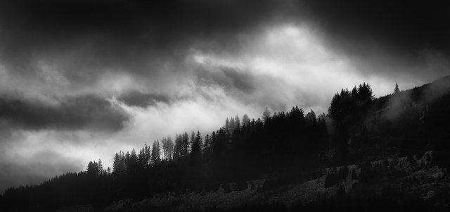
A74(M), southbound The A74(M) & M74  run over 80 miles from the M6 at the Scottish border near Gretna to the M8 at Glasgow. This is one of the two most important routeways into Scotland from the south. The last stretch of the M74 opened in 2011 (see <a title="https://www.geograph.org.uk/snippet/590" href="https://www.geograph.org.uk/snippet/590">Link</a> ).
Wikipedia: <span class="nowrap"><a title="http://en.wikipedia.org/wiki/A74(M)_and_M74_motorways" rel="nofollow ugc noopener" href="http://en.wikipedia.org/wiki/A74(M)_and_M74_motorways">Link</a><img style="margin-left:2px;" alt="External link" title="External link - shift click to open in new window" src="https://s1.geograph.org.uk/img/external.png" width="10" height="10"/></span>
A74(M), southbound
The A74(M) & M74 run over 80 miles from the M6 at the Scottish border near Gretna to the M8 at Glasgow. This is one of the two most important routeways into Scotland from the south. The last stretch of the M74 opened in 2011 (see Link ). Wikipedia: LinkExternal link
Greskine Forest and the A74(M) A view through the forest from a very overgrown forest track. Looking down to the A74(M) and the Greenhillstairs road.
Greskine Forest and the A74(M)
A view through the forest from a very overgrown forest track. Looking down to the A74(M) and the Greenhillstairs road.
View from Harthope Bank Looking down the steep slope to the WCML railway, the B7076 road and the A74(M) motorway.
View from Harthope Bank
Looking down the steep slope to the WCML railway, the B7076 road and the A74(M) motorway.
Pylon below Sight Knowe
Pylon below Trinkland Knowes
A74(M) northbound near Harthope
A74 (M) northbound
A74 (M) northbound
The A74(M) from the air The sweeping bend at Harthope, with Campland Hill in the foreground.
The A74(M) from the air
The sweeping bend at Harthope, with Campland Hill in the foreground.
The A74(M) from the air Raecleugh Farm is in the centre of the photo.
The A74(M) from the air
Raecleugh Farm is in the centre of the photo.
The A74(M) at Greenhillstairs With the B7076 [the old A74] running parallel, and the Evan Water between them. The bridge on the left carries the B719, which cuts across to Annandale and the A701, which is the bright green beyond the forestry.
The A74(M) at Greenhillstairs
With the B7076 [the old A74] running parallel, and the Evan Water between them. The bridge on the left carries the B719, which cuts across to Annandale and the A701, which is the bright green beyond the forestry.
Dumfries And Galloway : The A74(M) Looking along the A74(M).
Dumfries And Galloway : The A74(M)
Looking along the A74(M).
Dumfries And Galloway : The A74(M) Looking along the A74(M).
Dumfries And Galloway : The A74(M)
Looking along the A74(M).
The Scots Guardsman Check it out on my Flickr page.

<span class="nowrap"><a title="https://flic.kr/p/SW25M5" rel="nofollow ugc noopener" href="https://flic.kr/p/SW25M5">Link</a><img style="margin-left:2px;" alt="External link" title="External link - shift click to open in new window" src="https://s1.geograph.org.uk/img/external.png" width="10" height="10"/></span>
The Scots Guardsman
Check it out on my Flickr page. LinkExternal link
Greskin Forest Greskine Forest
Check it out on my Flickr page.
<span class="nowrap"><a title="https://flic.kr/p/T6xXt1" rel="nofollow ugc noopener" href="https://flic.kr/p/T6xXt1">Link</a><img style="margin-left:2px;" alt="External link" title="External link - shift click to open in new window" src="https://s1.geograph.org.uk/img/external.png" width="10" height="10"/></span>
The Greskine Forest at Greenhillstairs north of Beattock, Dumfries & Galloway, Scotland.
Greskin Forest
Greskine Forest Check it out on my Flickr page. LinkExternal link The Greskine Forest at Greenhillstairs north of Beattock, Dumfries & Galloway, Scotland.
Sunlight on Woodland near Trinkland Knowes The river is Evan Water.
Sunlight on Woodland near Trinkland Knowes
The river is Evan Water.
SWC300 heading for Beattock near Sight Knowe New route SWC3oo (South West Coastal) a circular route in South West Scotland.
SWC300 heading for Beattock near Sight Knowe
New route SWC3oo (South West Coastal) a circular route in South West Scotland.
SWC300 heading towards Abington New route SWC3oo (South West Coastal) a circular route in South West Scotland.
SWC300 heading towards Abington
New route SWC3oo (South West Coastal) a circular route in South West Scotland.
Gate to Farmland/Woodland
Show me another place!

Mount Hill is located at Grid Ref: NT0209 (Lat: 55.369134, Lng: -3.5430989)

Unitary Authority: Dumfries and Galloway

Police Authority: Dumfries and Galloway

What 3 Words

///ultra.tens.speared. Near Moffat, Dumfries & Galloway

Nearby Locations

Mount Hill

Related Wikis

Greenhillstairs

Greenhillstairs is the steep B719 road north of Moffat in Dumfries and Galloway, Scotland. The road, about 3 miles long, leaves the A701 Moffat to Edinburgh...
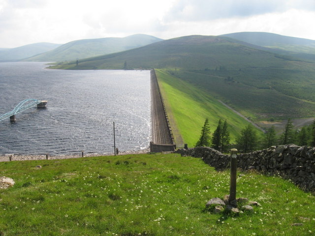
Daer Reservoir

Daer Reservoir is a man-made waterbody created by the damming of the Daer Water, a tributary of the River Clyde in the Southern Uplands of Scotland. It...

Crown of Scotland (hill)

The Crown of Scotland is a hill in the Scottish Borders, Scotland. At a relatively small elevation from the surrounding peaks, it is situated to the north...

Annanhead Hill

Annanhead Hill is a 478-metre (1,568 ft) summit in the Moffat Hills of Scotland. It lies on the boundary between the Scottish Borders and Dumfries and...

Nearby Amenities

Located within 500m of 55.369134,-3.5430989
Mosshope Bank
Ele: 520
Natural: peak
Lat/Long: 55.368695/-3.5487917
The data included in this document is from www.openstreetmap.org. The data is made available under ODbL.

Have you been to Mount Hill?

Leave your review of Mount Hill below (or comments, questions and feedback).