Duncan's Hill

Hill, Mountain in Perthshire

Scotland

Duncan's Hill

Tonguey Faulds The Water of Mey and lots of spiky trees.
Tonguey Faulds Credit: Richard Webb

Duncan's Hill is a prominent hill located in the picturesque region of Perthshire, Scotland. Situated near the village of Dunkeld, this hill offers breathtaking views and is highly regarded by both locals and tourists for its natural beauty.

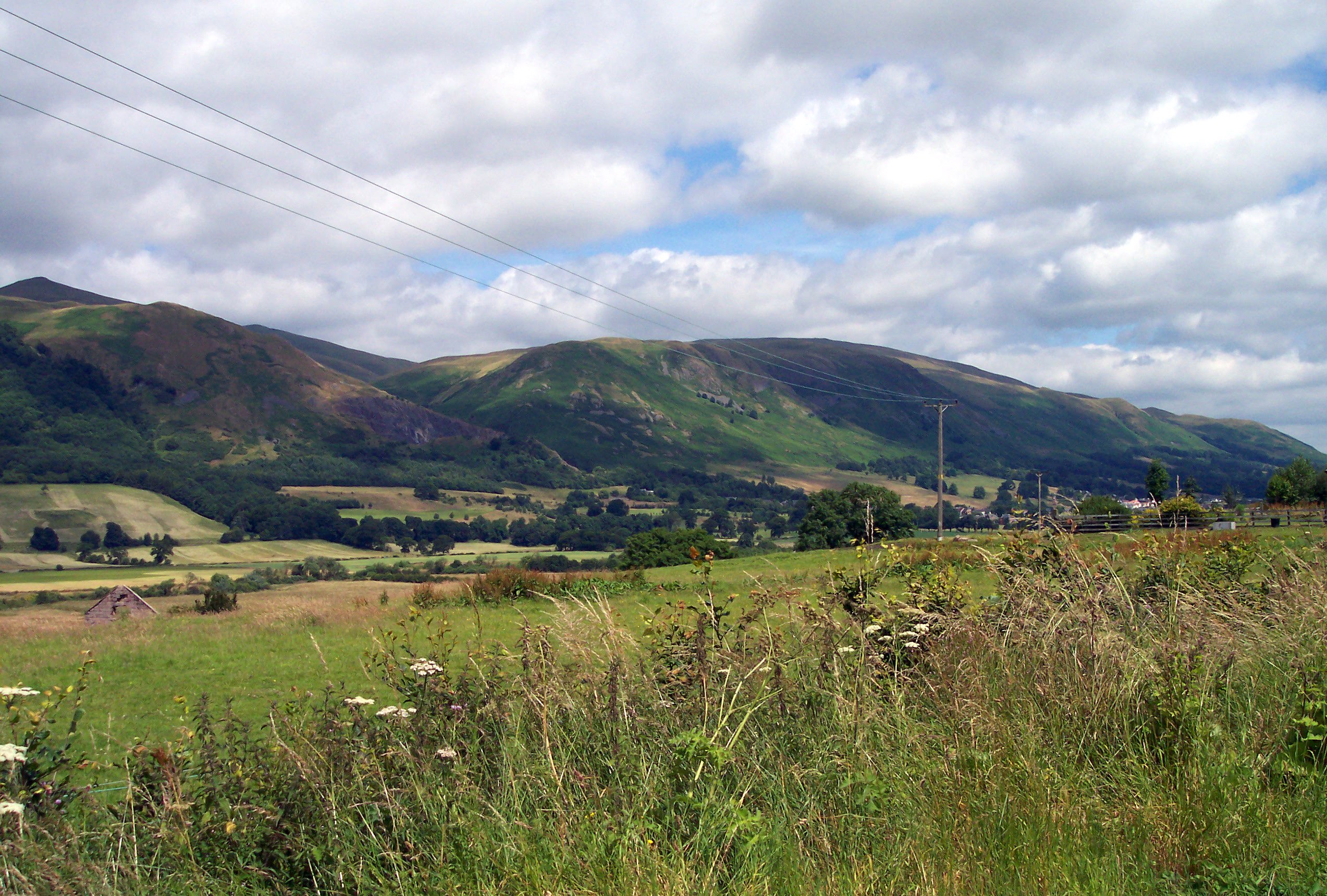
Rising to an elevation of approximately 350 meters (1148 feet), Duncan's Hill is a part of the Grampian Mountains, which stretch across the central and northeastern regions of Scotland. Its distinctive conical shape and lush greenery make it a distinguishable landmark in the area.

The hill is easily accessible by foot, with several well-marked trails leading to the summit. Hikers and outdoor enthusiasts are drawn to Duncan's Hill for its relatively moderate difficulty level, making it suitable for individuals of various fitness levels. Along the way, visitors can admire the diverse flora and fauna that thrive in this natural habitat, including heather, wildflowers, and various bird species.

At the summit, one is rewarded with panoramic views of the surrounding countryside, including the River Tay and the iconic Dunkeld Cathedral. On clear days, the vistas extend as far as the Cairngorms National Park, providing a stunning backdrop to the hill's already captivating scenery.

Duncan's Hill also holds historical significance, as it is believed to have been a site of ancient settlements. Archaeological evidence suggests that it was once used as a defensive structure during the Iron Age, further adding to its cultural value.

Overall, Duncan's Hill offers a serene and captivating experience for nature lovers and history enthusiasts alike, providing a perfect escape into the natural wonders of Perthshire.

If you have any feedback on the listing, please let us know in the comments section below.

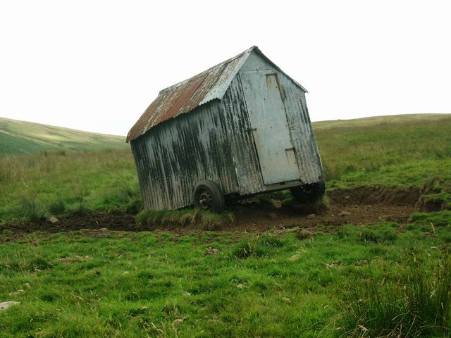
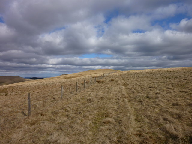
Duncan's Hill Images

Images are sourced within 2km of 56.261662/-3.6131152 or Grid Reference NO0008. Thanks to Geograph Open Source API. All images are credited.

Tonguey Faulds The Water of Mey and lots of spiky trees.
Tonguey Faulds
The Water of Mey and lots of spiky trees.
New road above Dunning Almost all the remaining moorland on the north side of the Ochil Hills above Dunning has been planted with conifers. There is a network of new roads too, their exit is on the Dunning Glen road at Knowes.
New road above Dunning
Almost all the remaining moorland on the north side of the Ochil Hills above Dunning has been planted with conifers. There is a network of new roads too, their exit is on the Dunning Glen road at Knowes.
Young trees above Dunning A new conifer plantation covering most of the former moorland between the older Rossie forest and the Dunning Glen road.
Young trees above Dunning
A new conifer plantation covering most of the former moorland between the older Rossie forest and the Dunning Glen road.
Holiday caravan to let?
Moorland tracks north of Corb Law
Forest edge below Simpleside Hill
Green Law Approaching Green Law. The fenceline was followed from the gate at high the high point on the Auchterarder/Glendevon right of way.
Green Law
Approaching Green Law. The fenceline was followed from the gate at high the high point on the Auchterarder/Glendevon right of way.
Track closed by Coulshill Farm This is disappointing. A track runs west from the B934 through Corb Glen. At Coulshill Farm this sign indicates that it isn't possible to pass through the farmyard to reach the road to Auchterarder.

There is a right of way on the other side of the Coul Burn, but on this day it was too deep to cross without getting seriously wet.

Fortunately this is a rare exception. Most farms in Scotland allow access through the farmyard to reach tracks beyond.
Track closed by Coulshill Farm
This is disappointing. A track runs west from the B934 through Corb Glen. At Coulshill Farm this sign indicates that it isn't possible to pass through the farmyard to reach the road to Auchterarder. There is a right of way on the other side of the Coul Burn, but on this day it was too deep to cross without getting seriously wet. Fortunately this is a rare exception. Most farms in Scotland allow access through the farmyard to reach tracks beyond.
View towards John's Hill A view over Craig Meed towards John's Hill in the eastern Ochil Hills. Land use here is agricultural, with sheep and cattle much in evidence. This area is traversed by an ancient right of way running from the vicinity of Corb Bridge to Auchterarder, for more details see: 

<span class="nowrap"><a title="http://www.perthshire.co.uk/index.asp?pg=391" rel="nofollow ugc noopener" href="http://www.perthshire.co.uk/index.asp?pg=391">Link</a><img style="margin-left:2px;" alt="External link" title="External link - shift click to open in new window" src="https://s1.geograph.org.uk/img/external.png" width="10" height="10"/></span>
View towards John's Hill
A view over Craig Meed towards John's Hill in the eastern Ochil Hills. Land use here is agricultural, with sheep and cattle much in evidence. This area is traversed by an ancient right of way running from the vicinity of Corb Bridge to Auchterarder, for more details see: LinkExternal link
Track to Coulshill A view towards the farm at Coulshill, viewed from a track running through the Corb Glen to Auchterarder.
Track to Coulshill
A view towards the farm at Coulshill, viewed from a track running through the Corb Glen to Auchterarder.
View towards Strathearn A view over the course of the Coul Burn towards Strathearn, with bright November sunshine lighting the Ochil Hills. This image was taken from the right of way running from Glen Devon to Auchterarder via Borland Glen.
View towards Strathearn
A view over the course of the Coul Burn towards Strathearn, with bright November sunshine lighting the Ochil Hills. This image was taken from the right of way running from Glen Devon to Auchterarder via Borland Glen.
Sim's Hill from Green Law John's Hill is to the left (NNE) of Sim's Hill
Sim's Hill from Green Law
John's Hill is to the left (NNE) of Sim's Hill
Abandoned vehicle on Green Law This is one of two abandoned vehicles on the south side of the Green Law to Sim's Hill ridge; to what purpose?
Abandoned vehicle on Green Law
This is one of two abandoned vehicles on the south side of the Green Law to Sim's Hill ridge; to what purpose?
Heathery Knowe Felled and replanted woodland.
Heathery Knowe
Felled and replanted woodland.
Cap Law Felled area from the Dunning Road.
Cap Law
Felled area from the Dunning Road.
Blair's Den Ochil reentrant revealed by clear felling.
Blair's Den
Ochil reentrant revealed by clear felling.
Fanny Hill Buried in conifers.
Fanny Hill
Buried in conifers.
Sim's Hill Looking up the Lamb Burn.
Sim's Hill
Looking up the Lamb Burn.
Show me another place!

Duncan's Hill is located at Grid Ref: NO0008 (Lat: 56.261662, Lng: -3.6131152)

Unitary Authority: Perth and Kinross

Police Authority: Tayside

What 3 Words

///starring.toned.typed. Near Auchterarder, Perth & Kinross

Related Wikis

Innerdouny Hill

Innerdouny Hill (497 m) is a hill in the Ochil Hills of Perth and Kinross, Scotland. It is located northwest of the town of Kinross. The second highest...

Glendevon Castle

Glendevon Castle is a collection of conjoined structures dating from the 15th century. The property is now (2022) semi-derelict. It lies on a private road...

A823 road

The A823 is a road in Scotland which goes from south of Crieff to Dunfermline. It joins onto the A823(M) and the A822 which runs to Crieff.

Ochil and South Perthshire (UK Parliament constituency)

Ochil and South Perthshire is a county constituency of the House of Commons of the Parliament of the United Kingdom. It elects one Member of Parliament...

Strathdevon

Strathdevon is the strath of the River Devon in Clackmannanshire, Scotland. Strathdevon is associated with the parish of Muckhart and was up until 1971...

Ochil Hills

The Ochil Hills ( ; Scottish Gaelic: Monadh Ochail is a range of hills in Scotland north of the Forth valley bordered by the cities of Stirling, Perth...

Auchterarder railway station

Auchterarder railway station served the village of Auchterarder near Gleneagles in the Scottish county of Perth and Kinross. == History == Opened by the...

Dunning, Perth and Kinross

Dunning is a small village in Perth and Kinross in Scotland with a population of about 1,000. The village centres around the 12th–13th century former parish...

Nearby Amenities

Located within 500m of 56.261662,-3.6131152
Corb Law
Ele: 475
Natural: peak
Source: NPE
Lat/Long: 56.2644153/-3.6103597
Perk Hill
Natural: peak
Lat/Long: 56.2602071/-3.6136737
The data included in this document is from www.openstreetmap.org. The data is made available under ODbL.

Have you been to Duncan's Hill?

Leave your review of Duncan's Hill below (or comments, questions and feedback).