Turf Hill

Hill, Mountain in Perthshire

Scotland

Turf Hill

Flooded ground, Meadowbank A wetland popular with greylag geese.
Flooded ground, Meadowbank Credit: Richard Webb

The requested URL returned error: 429 Too Many Requests

If you have any feedback on the listing, please let us know in the comments section below.
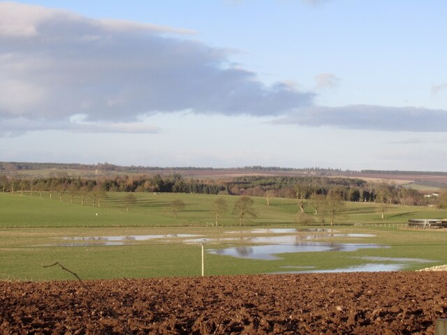
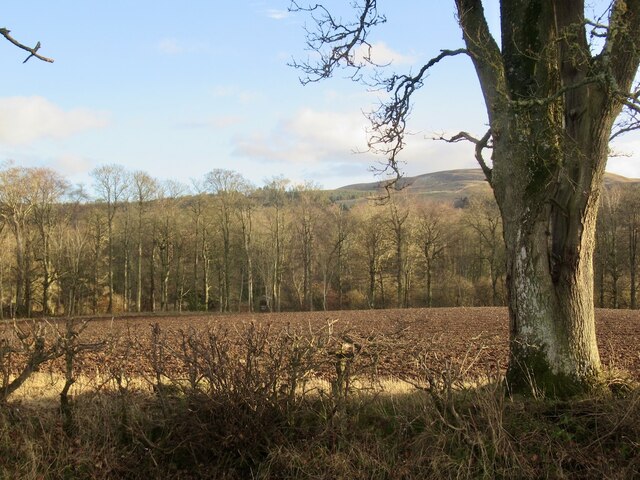
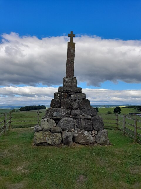
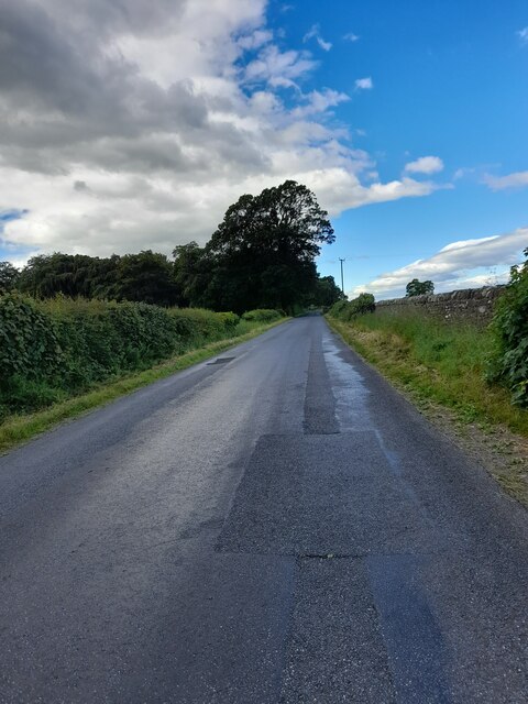
Turf Hill Images

Images are sourced within 2km of 56.298288/-3.6192641 or Grid Reference NN9912. Thanks to Geograph Open Source API. All images are credited.

Flooded ground, Meadowbank A wetland popular with greylag geese.
Flooded ground, Meadowbank
A wetland popular with greylag geese.
Ploughed field, Keltie
Maggie Wall Monument
Head of the Lawbank Burn A marshy area surrounded by recently planted conifers.
Head of the Lawbank Burn
A marshy area surrounded by recently planted conifers.
A newly planted forest above the Scores Burn The moorland around Black Hill of Kippen and the Scores Burn has been planted with conifers. The new woodland appeared on the Ordnance Survey 1:50,000 map in the week after this visit.
A newly planted forest above the Scores Burn
The moorland around Black Hill of Kippen and the Scores Burn has been planted with conifers. The new woodland appeared on the Ordnance Survey 1:50,000 map in the week after this visit.
Lawbank Burn View past newly planted conifers
Lawbank Burn
View past newly planted conifers
A young plantation Most of the remaining moorland above Dunning has gone, planted with conifers. The Ochils have been the scene of a lot of conifer planting in recent years. The maps are just beginning to catch up.
A young plantation
Most of the remaining moorland above Dunning has gone, planted with conifers. The Ochils have been the scene of a lot of conifer planting in recent years. The maps are just beginning to catch up.
Road end, Piperstones Hill The end of a newly built forest road.
Road end, Piperstones Hill
The end of a newly built forest road.
Besides the Thorter Burn A new conifer plantation covering most of the former moorland between the older Rossie forest and the Dunning Glen road.
Besides the Thorter Burn
A new conifer plantation covering most of the former moorland between the older Rossie forest and the Dunning Glen road.
The glen of the Scores Burn Now forested.
The glen of the Scores Burn
Now forested.
Young conifers above the Scores Burn A new conifer plantation covering most of the former moorland between the older Rossie forest and the Dunning Glen road.
Young conifers above the Scores Burn
A new conifer plantation covering most of the former moorland between the older Rossie forest and the Dunning Glen road.
New road and plantation near Dunning A new conifer plantation covering most of the former moorland between the older Rossie forest and the Dunning Glen road.
New road and plantation near Dunning
A new conifer plantation covering most of the former moorland between the older Rossie forest and the Dunning Glen road.
Maggie Wall Memorial
Looking into the glen of the Scores Burn
Edge of forestry above Baadhead
Baadhead Farm The house and buildings now appear to be unused.
Baadhead Farm
The house and buildings now appear to be unused.
Wester Keltie
Wester Keltie
Show me another place!

Turf Hill is located at Grid Ref: NN9912 (Lat: 56.298288, Lng: -3.6192641)

Unitary Authority: Perth and Kinross

Police Authority: Tayside

What 3 Words

///eternity.outwards.saves. Near Auchterarder, Perth & Kinross

Related Wikis

Dunning, Perth and Kinross

Dunning is a small village in Perth and Kinross in Scotland with a population of about 1,000. The village centres around the 12th–13th century former parish...
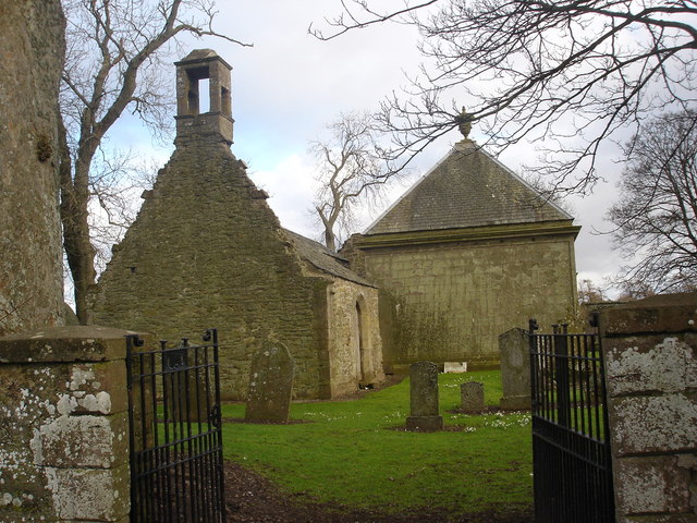
Dupplin Cross

The Dupplin Cross is a carved, monumental Pictish stone, which dates from around 800 AD. It was first recorded by Thomas Pennant in 1769, on a hillside...

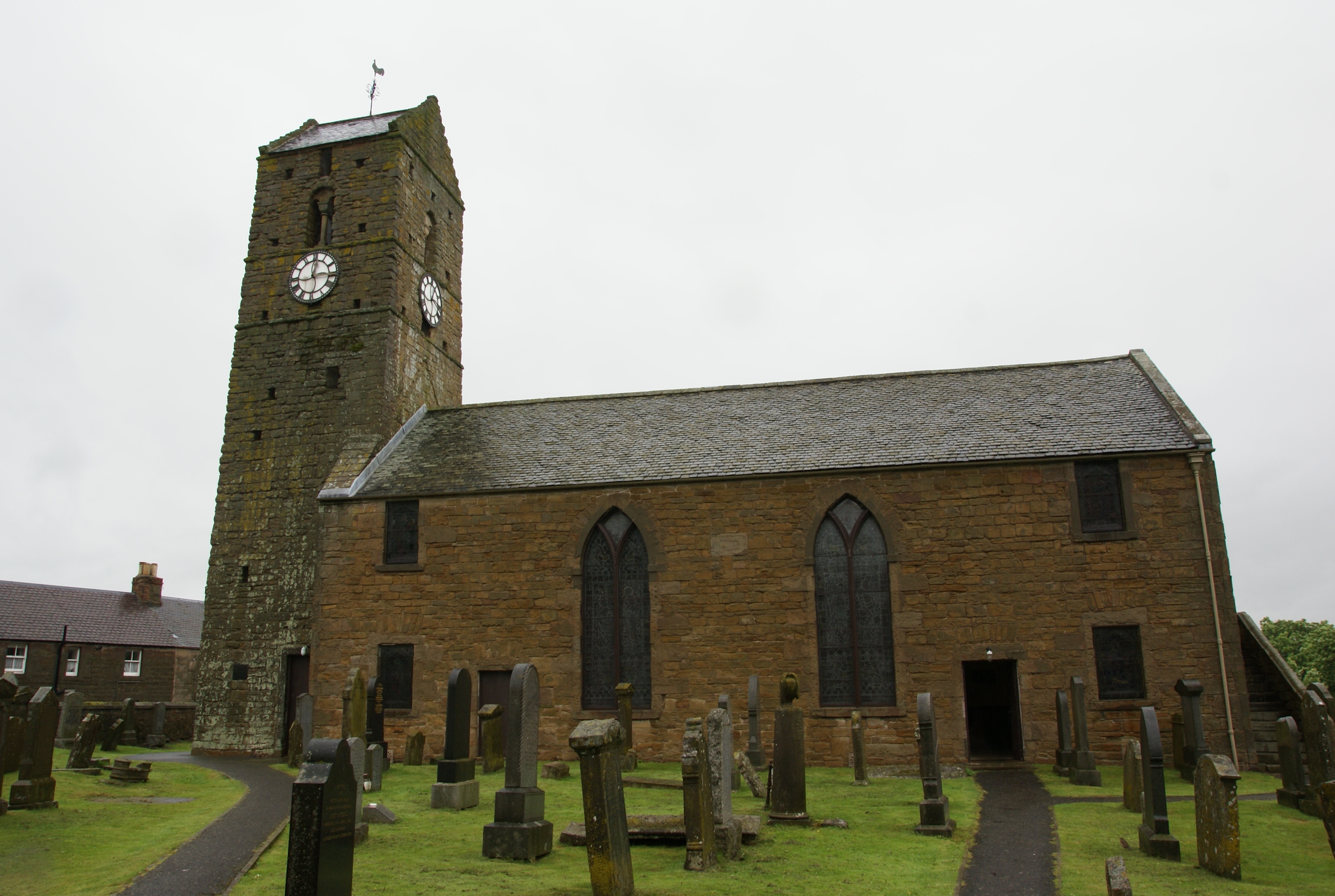
St Serf's Church, Dunning

St Serf's Church in the Scottish village of Dunning, Perth and Kinross is a Category A listed building largely dating to the early 19th century, but incorporating...

Aberuthven

Aberuthven (; Gaelic: Obar Ruadhainn) is a small village in Perth and Kinross, Scotland. It lies approximately 2+1⁄2 miles (4 kilometres) northeast of...

Nearby Amenities

Located within 500m of 56.298288,-3.6192641
Turf Hill
Natural: peak
Lat/Long: 56.2985926/-3.6189742
The data included in this document is from www.openstreetmap.org. The data is made available under ODbL.

Have you been to Turf Hill?

Leave your review of Turf Hill below (or comments, questions and feedback).