Back Hill

Hill, Mountain in West Lothian

Scotland

Back Hill

Bo'ness Dock Looking from the footbridge linking the north and south sides of the dock. The lock gates are disused and in poor condition. A concrete dam (with sluices) has been built on the seaward side of the gates, maintaining the water level in the dock. 

The dock closed to commercial trade in 1959. It is currently maintained by Falkirk Council.
Bo'ness Dock Credit: Richard Sutcliffe

Back Hill is a prominent hill located in West Lothian, a historical county in central Scotland. Situated approximately 3 miles south of the town of Linlithgow, the hill rises to an elevation of around 220 meters (720 feet) above sea level.

The hill is characterized by its distinctive shape, with a steep and rugged slope on one side and a gentler incline on the other. It is composed of various rock types, including sandstone and shale, and is covered with a mixture of grass, heather, and scattered trees.

Back Hill offers stunning panoramic views of the surrounding countryside, including the picturesque town of Linlithgow, the rolling hills of West Lothian, and even glimpses of the distant Forth Bridges. Due to its elevation and relatively isolated location, it provides a peaceful and tranquil setting for visitors to enjoy.

The hill is a popular destination for outdoor enthusiasts, offering opportunities for walking, hiking, and nature observation. The area is home to a diverse range of flora and fauna, with various bird species, butterflies, and wildflowers being commonly spotted.

Additionally, Back Hill holds historical significance, with remains of an Iron Age hillfort known as "Maiden Castle" situated on its summit. This ancient fortification is believed to have been occupied between 500 BC and 500 AD, providing an intriguing glimpse into the region's past.

Overall, Back Hill in West Lothian offers a blend of natural beauty, recreational activities, and historical interest, making it an appealing destination for both locals and visitors alike.

If you have any feedback on the listing, please let us know in the comments section below.
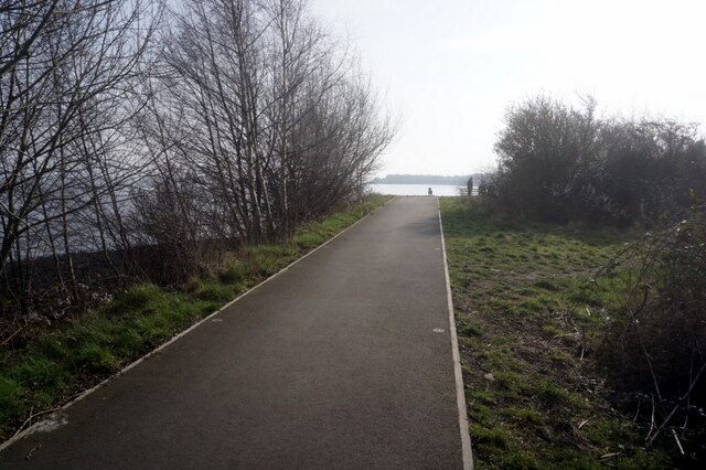
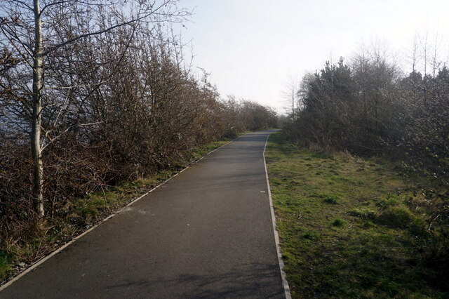
Back Hill Images

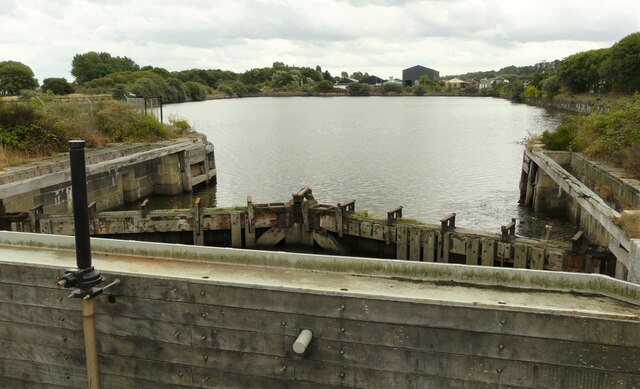
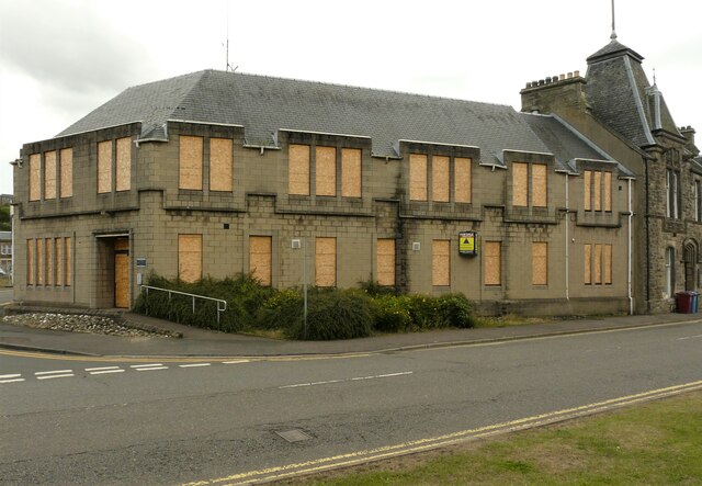
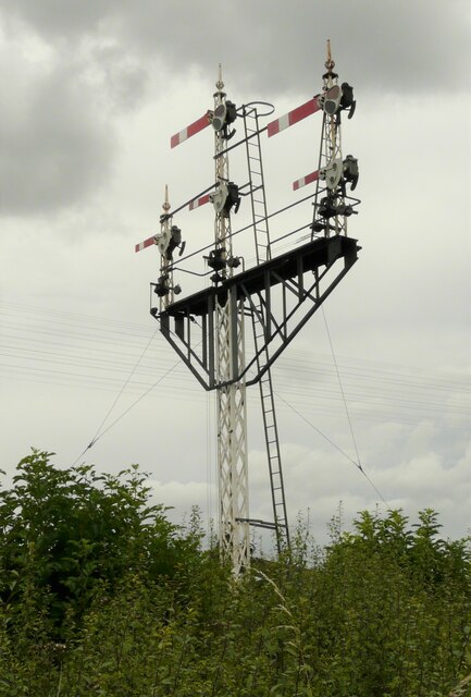
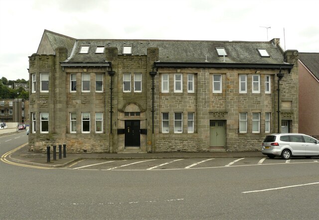
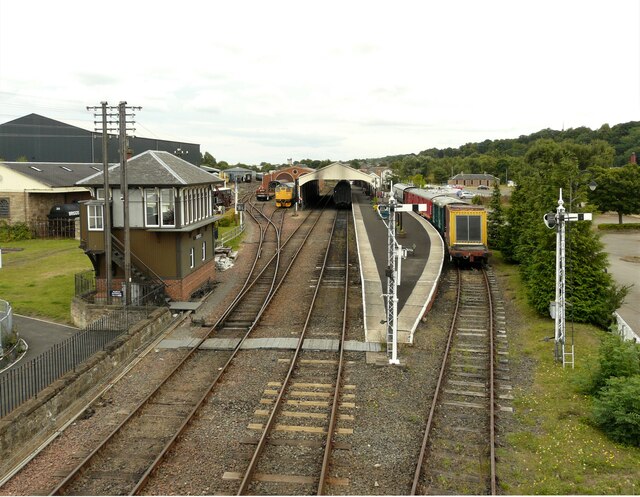
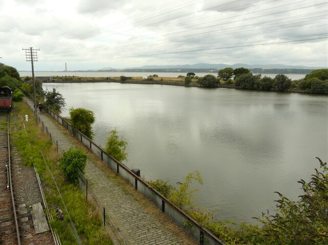
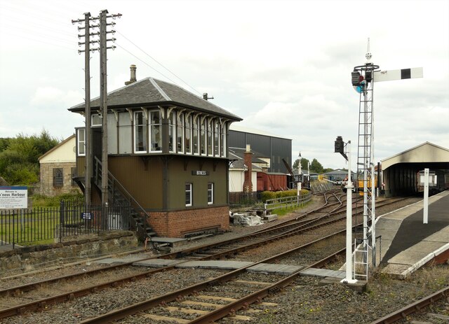
Images are sourced within 2km of 56.015873/-3.6117074 or Grid Reference NS9981. Thanks to Geograph Open Source API. All images are credited.

Bo'ness Dock Looking from the footbridge linking the north and south sides of the dock. The lock gates are disused and in poor condition. A concrete dam (with sluices) has been built on the seaward side of the gates, maintaining the water level in the dock. 

The dock closed to commercial trade in 1959. It is currently maintained by Falkirk Council.
Bo'ness Dock
Looking from the footbridge linking the north and south sides of the dock. The lock gates are disused and in poor condition. A concrete dam (with sluices) has been built on the seaward side of the gates, maintaining the water level in the dock. The dock closed to commercial trade in 1959. It is currently maintained by Falkirk Council.
Former Police Station, Bo'ness The former police station at the corner of Commissioner Street and Union Street. The doors and windows are all boarded up and it has been up for sale since 2018.
Former Police Station, Bo'ness
The former police station at the corner of Commissioner Street and Union Street. The doors and windows are all boarded up and it has been up for sale since 2018.
Signal gantry On the Bo'ness and Kinneil Railway just outside Bo'ness Station.
Signal gantry
On the Bo'ness and Kinneil Railway just outside Bo'ness Station.
Former foundry offices, Union Street, Bo'ness Built for the Bo'ness Iron Company. Designed by local architect Matthew Steele, the building dates from 1908 and is Category B listed <span class="nowrap"><a title="http://portal.historicenvironment.scot/designation/LB22401" rel="nofollow ugc noopener" href="http://portal.historicenvironment.scot/designation/LB22401">Link</a><img style="margin-left:2px;" alt="External link" title="External link - shift click to open in new window" src="https://s1.geograph.org.uk/img/external.png" width="10" height="10"/></span>.
Former foundry offices, Union Street, Bo'ness
Built for the Bo'ness Iron Company. Designed by local architect Matthew Steele, the building dates from 1908 and is Category B listed LinkExternal link.
Bo'ness Station Terminus of the Bo'ness and Kinneil Railway. 

According to the railway's website <span class="nowrap"><a title="https://www.bkrailway.co.uk/," rel="nofollow ugc noopener" href="https://www.bkrailway.co.uk/,">Link</a><img style="margin-left:2px;" alt="External link" title="External link - shift click to open in new window" src="https://s1.geograph.org.uk/img/external.png" width="10" height="10"/></span> 'Bo’ness station has been built since 1979 on a landscaped site which had previously been occupied by railway sidings, timber yards and coal mines. Buildings have been designed to reflect a traditional railway style, or moved from other locations. The station building was originally at Wormit, the train shed is from Haymarket, the signal box from Garnqueen South Junction and the footbridge from Murthly. The ‘new’ station opened in 1981.'

This is an image to replicate <a href="https://www.geograph.org.uk/photo/30645">NT0081 : Bo'ness Railway Station</a>, the first image submitted for this square in 2005.
Bo'ness Station
Terminus of the Bo'ness and Kinneil Railway. According to the railway's website LinkExternal link 'Bo’ness station has been built since 1979 on a landscaped site which had previously been occupied by railway sidings, timber yards and coal mines. Buildings have been designed to reflect a traditional railway style, or moved from other locations. The station building was originally at Wormit, the train shed is from Haymarket, the signal box from Garnqueen South Junction and the footbridge from Murthly. The ‘new’ station opened in 1981.' This is an image to replicate NT0081 : Bo'ness Railway Station, the first image submitted for this square in 2005.
Bo'ness Dock Photographed from the footbridge over the railway. The dock closed to commercial trade in 1959. It is currently maintained by Falkirk Council.
Bo'ness Dock
Photographed from the footbridge over the railway. The dock closed to commercial trade in 1959. It is currently maintained by Falkirk Council.
Points Just outside Bo'ness Station. Seen from the footbridge.
Points
Just outside Bo'ness Station. Seen from the footbridge.
Signal box, Bo'ness Station The signal box was originally at Garnqueen South Junction where the Caledonian Railway joined the Monkland and Kirkintilloch Railway. The box was dismantled and rebuilt at Bo'ness.
Signal box, Bo'ness Station
The signal box was originally at Garnqueen South Junction where the Caledonian Railway joined the Monkland and Kirkintilloch Railway. The box was dismantled and rebuilt at Bo'ness.
Vapour X Vapourizer shop on the corner of Dock Street and Main Street, Bo'ness.
Vapour X
Vapourizer shop on the corner of Dock Street and Main Street, Bo'ness.
Lidl supermarket On Main Street, Bo'ness.
Lidl supermarket
On Main Street, Bo'ness.
The Bog, Bo'ness Not a wetland - this is the name of the road that leads off Main Street.
The Bog, Bo'ness
Not a wetland - this is the name of the road that leads off Main Street.
Road sign for The Bog At the junction with Main Street <a href="https://www.geograph.org.uk/photo/6932759">NT0081 : The Bog, Bo'ness</a>
Road sign for The Bog
At the junction with Main Street NT0081 : The Bog, Bo'ness
Two former public houses The building on the left was at one time Ye Old Carriers Quarters. It is dated 1905, but incorporates fabric dating back to 1647. It is attributed to local architect James Thomson and is Category C listed <span class="nowrap"><a title="http://portal.historicenvironment.scot/designation/LB49703" rel="nofollow ugc noopener" href="http://portal.historicenvironment.scot/designation/LB49703">Link</a><img style="margin-left:2px;" alt="External link" title="External link - shift click to open in new window" src="https://s1.geograph.org.uk/img/external.png" width="10" height="10"/></span>. It now appears to be converted to residential use.

The building on the right is also attributed to James Thomson. It is late 19th century in date and is also Category C listed <span class="nowrap"><a title="http://portal.historicenvironment.scot/designation/LB22364" rel="nofollow ugc noopener" href="http://portal.historicenvironment.scot/designation/LB22364">Link</a><img style="margin-left:2px;" alt="External link" title="External link - shift click to open in new window" src="https://s1.geograph.org.uk/img/external.png" width="10" height="10"/></span>. It has been known as the Gardener's Arms and also the Bo'ness Tavern. It is now the Lucky Chen Chinese takeaway and home delivery.
Two former public houses
The building on the left was at one time Ye Old Carriers Quarters. It is dated 1905, but incorporates fabric dating back to 1647. It is attributed to local architect James Thomson and is Category C listed LinkExternal link. It now appears to be converted to residential use. The building on the right is also attributed to James Thomson. It is late 19th century in date and is also Category C listed LinkExternal link. It has been known as the Gardener's Arms and also the Bo'ness Tavern. It is now the Lucky Chen Chinese takeaway and home delivery.
South Street and North Street South Street is on the left, North Street on the right. The Matty Steele Building in the centre was a coffee shop and the Bo'ness Bakery, but looks to be closed just now.
South Street and North Street
South Street is on the left, North Street on the right. The Matty Steele Building in the centre was a coffee shop and the Bo'ness Bakery, but looks to be closed just now.
John Muir Way at Bo'ness Harbour
John Muir Way towards Grangepans
Jon Muir Way towards Grangepans
John Muir Way towards Grangepans
Show me another place!

Back Hill is located at Grid Ref: NS9981 (Lat: 56.015873, Lng: -3.6117074)

Unitary Authority: Falkirk

Police Authority: Forth Valley

What 3 Words

///vaulting.nicknames.starfish. Near Bo’ness, Falkirk

Related Wikis

Bo'ness

Borrowstounness (commonly known as Bo'ness ( boh-NESS)) is a town and former burgh and seaport on the south bank of the Firth of Forth in the Central Lowlands...
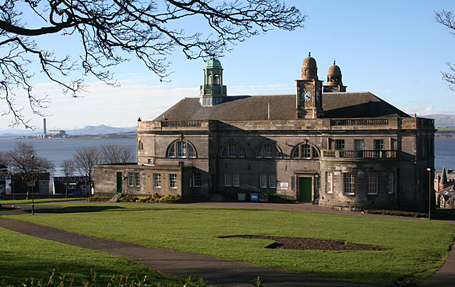
Bo'ness Town Hall

Bo'ness Town Hall is a municipal building in Stewart Avenue, Bo'ness, Scotland. The structure, which was the meeting place of Bo'ness Burgh Council, is...

Hippodrome Cinema, Bo'ness

The Hippodrome Cinema in Bo'ness near Falkirk is an early example of a purpose-built cinema and thought to be the oldest such building surviving in Scotland...

Bo'ness Hospital

Bo'ness Hospital is a community hospital in Dean Road, Bo'ness, Scotland. It is managed by NHS Forth Valley. == History == The facility was established...

Nearby Amenities

Located within 500m of 56.015873,-3.6117074
Created By: almien_coastlines
Lat/Long: 56.016207/-3.6194624
Bo'ness
Alt Name: Borrowstounness
Alt Name Sco: Borrowstounness
Name En: Bo'ness
Name Gd: Ceann Fhàil
Place: town
Population: 14490
Source: npe
Wikidata: Q896424
Wikipedia: en:Bo'ness
Lat/Long: 56.0176867/-3.6073601
Railway: crossing
Lat/Long: 56.0162151/-3.6130175
Barrier: cycle_barrier
Bicycle: yes
Foot: yes
Lat/Long: 56.0159458/-3.6076202
Library
Bo'ness Library
Addr City: Bo'ness
Addr Postcode: EH51 0AH
Addr Street: Scotland's Close
Digital Access: printer;photocopier;computer
Digital Access Membership: yes
Internet Access: yes
Internet Access Fee: no
Opening Hours: Mo,Th 10:00-20:00; Tu,Fr 10:00-17:00; We 10:00-16:00; Sa 10:00-15:00
Phone: +44 1506 778520
Website: http://www.falkirkcommunitytrust.org/venues/boness-library/
Wheelchair: yes
Lat/Long: 56.0179902/-3.6087915
Barrier: bollard
Lat/Long: 56.0161109/-3.6077218
Railway: crossing
Lat/Long: 56.017449/-3.6112184
Fairground Crossing
Railway: level_crossing
Lat/Long: 56.0185759/-3.6088545
Railway: crossing
Lat/Long: 56.0188948/-3.6070869
Turning Circle
Lat/Long: 56.0187539/-3.608932
Railway: crossing
Lat/Long: 56.0152239/-3.6164527
Barrier: bollard
Lat/Long: 56.0183733/-3.605801
Crossing
Crossing: unmarked
Crossing Island: no
Tactile Paving: yes
Lat/Long: 56.0171731/-3.6096463
Historic: memorial
Memorial: war_memorial
Lat/Long: 56.0150745/-3.6107299
Bench
Lat/Long: 56.0151824/-3.6104698
Barrier: bollard
Lat/Long: 56.0152004/-3.6072714
Entrance: main
Lat/Long: 56.0116492/-3.6135723
Barrier: bollard
Bicycle: yes
Bollard: removable
Foot: yes
Lat/Long: 56.0149704/-3.6072989
Waste Basket
Lat/Long: 56.01499/-3.6072733
Waste Basket
Lat/Long: 56.0153656/-3.6094108
Telephone
Booth: K6
Covered: booth
Fee: yes
Listed Status: Category B
Source: survey;local knowledge
Lat/Long: 56.0177479/-3.6076763
Man Made: planter
Lat/Long: 56.0184273/-3.6074482
Scotbet
Shop: bookmaker
Lat/Long: 56.0171086/-3.6083183
Check Date: 2023-06-15
Covered: no
Leisure: picnic_table
Material: wood
Lat/Long: 56.0159239/-3.6172642
Post Box
Collection Times: Mo-Fr 09:00; Sa 07:00
Operator: Royal Mail
Operator Wikidata: Q638098
Post Box Type: pillar
Ref: EH51 16D
Royal Cypher: GR
Royal Cypher Wikidata: Q33102273
Lat/Long: 56.0171228/-3.6081694
Fuel
Hastons of Bo'ness
Lat/Long: 56.0159743/-3.6116885
Pharmacy
Rowlands Pharmacy
Brand: Rowlands Pharmacy
Brand Wikidata: Q62663235
Healthcare: pharmacy
Website: https://rowlandspharmacy.co.uk/find-local-pharmacy#!/l/bo'ness/5-south-street/1315
Lat/Long: 56.0171899/-3.6091879
Bus Stop
Bench: no
Bus: yes
Naptan AtcoCode: 66902350007
Naptan NaptanCode: 32523967
Public Transport: platform
Shelter: no
Lat/Long: 56.0146377/-3.6160118
Bus Stop
Bench: no
Bus: yes
Public Transport: platform
Shelter: no
Lat/Long: 56.0147346/-3.6147174
Bank
TSB
Brand: TSB
Brand Wikidata: Q7671560
Brand Wikipedia: en:TSB Bank (United Kingdom)
Opening Hours: 24/7
Operator: TSB
Lat/Long: 56.0170789/-3.6090619
Crossing
Crossing: uncontrolled
Crossing Ref: zebra
Lat/Long: 56.0177742/-3.6073802
Cafe
Corvi's
Cuisine: fish_and_chips
Lat/Long: 56.0168493/-3.6098352
Car Wash
Lat/Long: 56.015924/-3.6118628
Pub
The Corbie Inn
Addr Housenumber: 84
Addr Postcode: EH51 0AS
Addr Street: Corbiehall
Cuisine: burger;chicken;coffee_shop;fish_and_chips;local;regional
Email: gail@corbieinn.co.uk
Internet Access: wlan
Opening Hours: Mo-We 12:00-21:00; Th 12:00-22:00; Fr,Sa 12:00-23:00; Su 12:30-21:00
Phone: +44 1506825307
Lat/Long: 56.0148532/-3.6152058
Railway: signal
Railway Signal Direction: forward
Lat/Long: 56.017325/-3.611369
Railway: signal
Railway Signal Direction: forward
Lat/Long: 56.015483/-3.6149956
Railway: level_crossing
Lat/Long: 56.0152342/-3.6163891
Office: estate_agent
Lat/Long: 56.0171806/-3.6093414
Shop: optician
Lat/Long: 56.0170369/-3.6094063
The Pet Store
Shop: pet
Lat/Long: 56.0172161/-3.6090246
Cafe
Lat/Long: 56.0172463/-3.6087684
Shop: hardware
Lat/Long: 56.0170779/-3.6086092
Pharmacy
Boots
Brand: Boots
Brand Wikidata: Q6123139
Brand Wikipedia: en:Boots UK
Dispensing: yes
Healthcare: pharmacy
Website: https://www.boots.com/stores/5870-opticians-ness-south-street-eh51-9ha
Lat/Long: 56.0172023/-3.6074193
Office: estate_agent
Lat/Long: 56.0171853/-3.6075822
The Salvation Army
Brand: The Salvation Army
Brand Wikidata: Q188307
Brand Wikipedia: en:The Salvation Army
Shop: charity
Lat/Long: 56.0171784/-3.6077122
Bus Stop
Bus: yes
Public Transport: platform
Shelter: yes
Lat/Long: 56.0181698/-3.6076424
Bus Stop
Bus: yes
Public Transport: platform
Shelter: yes
Lat/Long: 56.0182224/-3.6076155
Bus Stop
Bus: yes
Public Transport: platform
Shelter: yes
Lat/Long: 56.0182755/-3.607585
Bus Stop
Bus: yes
Naptan AtcoCode: 669023000011
Naptan NaptanCode: 3258423
Public Transport: platform
Shelter: no
Lat/Long: 56.0183326/-3.6075495
Bo'ness Mining Memorial
Historic: memorial
Material: metal
Memorial: sculpture
Lat/Long: 56.017473/-3.6101863
Fast Food
Pier Pizza
Cuisine: pizza
Lat/Long: 56.01803/-3.6072606
William Hill
Brand: William Hill
Brand Wikidata: Q4053147
Brand Wikipedia: en:William Hill (bookmaker)
Shop: bookmaker
Lat/Long: 56.0178367/-3.6072721
Ross Fraser Funeral Directors
Shop: funeral_directors
Lat/Long: 56.0177684/-3.6069845
Dentist
The Dental Practice
Healthcare: dentist
Operator: Long & Gilmour Dental Care
Lat/Long: 56.0177178/-3.6067532
Fountain
Lat/Long: 56.017706/-3.6074716
Noexit: yes
Lat/Long: 56.0177908/-3.6078806
Bicycle Parking
Access: yes
Capacity: 3
Fee: no
Lat/Long: 56.0177582/-3.6077137
Crossing
Crossing: unmarked
Tactile Paving: yes
Lat/Long: 56.0177296/-3.6075823
Bench
Lat/Long: 56.0174904/-3.6061563
Bench
Lat/Long: 56.017497/-3.6061246
Bench
Lat/Long: 56.0174739/-3.6061722
Crossing
Crossing: unmarked
Crossing Island: no
Tactile Paving: yes
Lat/Long: 56.017293/-3.6075787
Crossing
Crossing: unmarked
Crossing Island: no
Tactile Paving: yes
Lat/Long: 56.0172644/-3.6074593
Crossing
Crossing: unmarked
Crossing Island: no
Tactile Paving: yes
Lat/Long: 56.0175742/-3.608533
Crossing
Crossing: unmarked
Crossing Island: no
Tactile Paving: yes
Lat/Long: 56.0172421/-3.6083661
Crossing
Crossing: unmarked
Crossing Island: no
Tactile Paving: yes
Lat/Long: 56.0176215/-3.6054332
Crossing
Crossing: unmarked
Crossing Island: yes
Tactile Paving: yes
Lat/Long: 56.0175088/-3.6044981
Bicycle Rental
Forth Bike
Phone: +44 800 3688093
Website: www.forthbike.co.uk
Lat/Long: 56.0188257/-3.6058873
Charging Station
Authentication Membership Card: yes
Fee: yes
Operator: ChargePlace Scotland
Operator Wikidata: Q105359316
Ref: 52060
Lat/Long: 56.0186244/-3.607616
Charging Station
Authentication Membership Card: yes
Fee: yes
Operator: ChargePlace Scotland
Operator Wikidata: Q105359316
Ref: 52059
Lat/Long: 56.0186177/-3.6076904
Barrier: cycle_barrier
Lat/Long: 56.0147829/-3.6054429
Entrance: staircase
Lat/Long: 56.0153342/-3.6115679
Entrance: staircase
Lat/Long: 56.0156814/-3.6117336
Entrance: staircase
Lat/Long: 56.015508/-3.6116115
Entrance: staircase
Lat/Long: 56.015384/-3.6118577
Entrance: staircase
Lat/Long: 56.0155057/-3.6121335
Give Way
Direction: forward
Lat/Long: 56.014711/-3.61151
Stop
Direction: forward
Lat/Long: 56.0147508/-3.6113182
Turning Circle
Lat/Long: 56.0139681/-3.6107777
Give Way
Direction: backward
Lat/Long: 56.0137575/-3.6102775
Give Way
Direction: forward
Lat/Long: 56.01419/-3.6094929
Entrance: main
Lat/Long: 56.0147154/-3.6078857
Give Way
Direction: forward
Lat/Long: 56.0127004/-3.6137134
Post Box
Brand: Royal Mail
Brand Wikidata: Q638098
Collection Times: Mo-Fr 17:15; Sa 12:15
Operator: Royal Mail
Operator Wikidata: Q638098
Lat/Long: 56.018518/-3.6070008
Bo'Ness
Historic Railway: station
Railway: site
Wikidata: Q4931027
Wikipedia: en:Bo'ness railway station
Lat/Long: 56.0170122/-3.6117602
Leisure: picnic_table
Lat/Long: 56.0158595/-3.6169141
Leisure: picnic_table
Lat/Long: 56.0159741/-3.6174853
Leisure: picnic_table
Lat/Long: 56.016004/-3.6172079
Place Of Worship
The Salvation Army - Bo'ness
Addr City: Bo'ness
Addr Country: GB
Addr Postcode: EH51 0AP
Addr Street: Corbiehall
Denomination: salvation_army
Email: boness@salvationarmy.org.uk
Phone: 01506 828502
Religion: christian
Website: https://www.salvationarmy.org.uk/boness
Lat/Long: 56.0163895/-3.6112136
The data included in this document is from www.openstreetmap.org. The data is made available under ODbL.

Have you been to Back Hill?

Leave your review of Back Hill below (or comments, questions and feedback).