Elrick More

Hill, Mountain in Perthshire

Scotland

Elrick More

Rough track, Creagvinean Forest The track leads up to a rifle range.  From the target it is a short but very rough heather plod to the summit of Creag an Uamhaidh.
Rough track, Creagvinean Forest Credit: Richard Webb

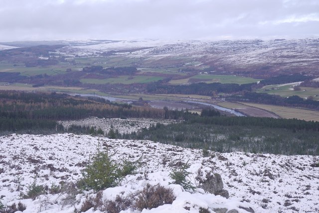
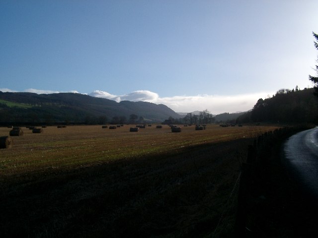
Elrick More is a prominent hill located in Perthshire, Scotland. Standing at an elevation of 780 meters (2,559 feet) above sea level, it is a popular destination for hikers and outdoor enthusiasts seeking stunning views of the surrounding countryside.

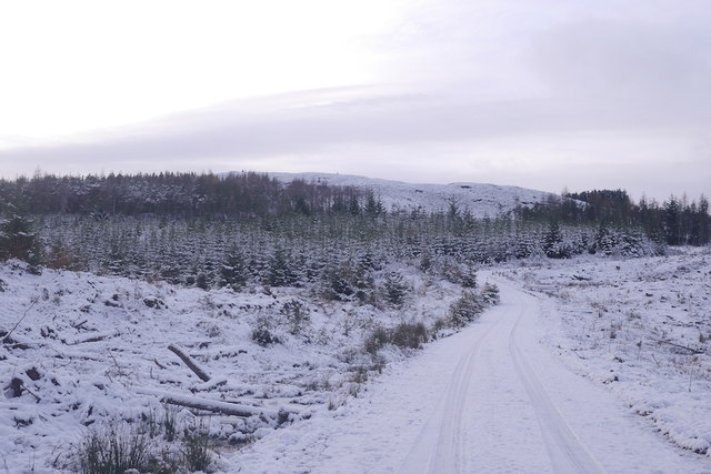
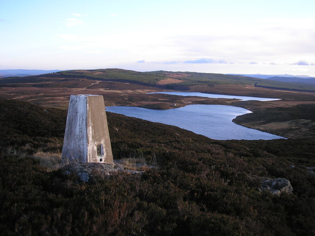
The hill is characterized by its steep slopes and rocky terrain, making it a challenging but rewarding climb for experienced walkers. At the summit, visitors are treated to panoramic vistas of the rolling hills and valleys of Perthshire, as well as distant views of the Highlands to the north.

Elrick More is home to a diverse range of flora and fauna, including heather, bracken, and a variety of bird species. The hill is also steeped in history, with ancient ruins and standing stones scattered throughout the landscape, providing a glimpse into the area's rich past.

Access to Elrick More is primarily via well-marked hiking trails, with parking available at the base of the hill. Visitors are advised to come prepared with appropriate footwear and clothing, as weather conditions can change rapidly at higher elevations.

If you have any feedback on the listing, please let us know in the comments section below.

Elrick More Images

Images are sourced within 2km of 56.599449/-3.6870553 or Grid Reference NN9646. Thanks to Geograph Open Source API. All images are credited.

Rough track, Creagvinean Forest The track leads up to a rifle range.  From the target it is a short but very rough heather plod to the summit of Creag an Uamhaidh.
Rough track, Creagvinean Forest
The track leads up to a rifle range. From the target it is a short but very rough heather plod to the summit of Creag an Uamhaidh.
Rifle range, Creagvinean Forest A short bit of relief from the lace tugging heather and Sitka on Creag an Uamhaidh.
Rifle range, Creagvinean Forest
A short bit of relief from the lace tugging heather and Sitka on Creag an Uamhaidh.
Creagvinean Forest View from the west side of Creag an Uamhaidh over the plantations. This bit of the forest is mapped for orienteering, but beware if you intend to run here, this is one mean, tough, steep forest.  

The moorland in the foreground is under constant threat of invasion by self seeded Sitka spruce trees and these have been cut down. The dead branches do not help progress at all, especially under snow.
Creagvinean Forest
View from the west side of Creag an Uamhaidh over the plantations. This bit of the forest is mapped for orienteering, but beware if you intend to run here, this is one mean, tough, steep forest. The moorland in the foreground is under constant threat of invasion by self seeded Sitka spruce trees and these have been cut down. The dead branches do not help progress at all, especially under snow.
Rough moorland, Creag an Uamhaidh Really evil terrain - deep heather and the mortal remains of Sitka spruce saplings compete with hidden boulders to make your life a misery.  There is now a path up from the north side of the hill, a better ploy perhaps, only today it was too icy to use.
Rough moorland, Creag an Uamhaidh
Really evil terrain - deep heather and the mortal remains of Sitka spruce saplings compete with hidden boulders to make your life a misery. There is now a path up from the north side of the hill, a better ploy perhaps, only today it was too icy to use.
Strath Tay View over Creagvinean Forest from the west top of Creag an Uamhaidh above Dalguise.
Strath Tay
View over Creagvinean Forest from the west top of Creag an Uamhaidh above Dalguise.
Creag an Uamhaidh A hill sticking out of the forest above Dalguise.  There is now a path, missing off the 2012 orienteering map. It runs up from the logging road to the north.
Creag an Uamhaidh
A hill sticking out of the forest above Dalguise. There is now a path, missing off the 2012 orienteering map. It runs up from the logging road to the north.
Summit, Creag an Uamhaidh A rocky summit with a big cairn. Probably gets a lot of visits from Dalguise PGL.   It is a fine viewpoint.
Summit, Creag an Uamhaidh
A rocky summit with a big cairn. Probably gets a lot of visits from Dalguise PGL. It is a fine viewpoint.
Creag an Uamhaidh The southeastern ridge, with a long view from the summit.
Creag an Uamhaidh
The southeastern ridge, with a long view from the summit.
Creagvinean Forest View over the woods above Dalguise from the slopes of Creag an Uamhaidh
Creagvinean Forest
View over the woods above Dalguise from the slopes of Creag an Uamhaidh
Young trees, Creagvinean Forest The northern part of the forest, looking over what is a big block of green on the orienteering map.  The River Tay is in the background, 400m lower and flanked by arable land.
Young trees, Creagvinean Forest
The northern part of the forest, looking over what is a big block of green on the orienteering map. The River Tay is in the background, 400m lower and flanked by arable land.
Creagvinean Forest High above Dalguise.  There is a large boulder just inside the cleared bit and a line of small crags within the larch. I have had the misfortune to cross this bit of wood 11 years earlier in what was probably my toughest ever orienteering race.  There were trees standing in the foreground back then.   

Just before taking this I had watched a fox run down the logging road.
Creagvinean Forest
High above Dalguise. There is a large boulder just inside the cleared bit and a line of small crags within the larch. I have had the misfortune to cross this bit of wood 11 years earlier in what was probably my toughest ever orienteering race. There were trees standing in the foreground back then. Just before taking this I had watched a fox run down the logging road.
Logging road, Creagvinean Forest A fox was running down it.  I followed, this is a fun descent in the snow.
Logging road, Creagvinean Forest
A fox was running down it. I followed, this is a fun descent in the snow.
Elrick More A hill above Creagvinean Forest.
Elrick More
A hill above Creagvinean Forest.
Overgrown track, Creagvinean Forest The track was shown as a vehicle track on the 2012 orienteering map, but is now very overgrown.  There is still a good path though.
Overgrown track, Creagvinean Forest
The track was shown as a vehicle track on the 2012 orienteering map, but is now very overgrown. There is still a good path though.
Young trees, Creagvinean Forest Planted around 2006 above Dalguise.
Young trees, Creagvinean Forest
Planted around 2006 above Dalguise.
Overgrown track, Creagvinean Forest Still passable as a narrow path, dodging the self seeded Sitka spruce.
Overgrown track, Creagvinean Forest
Still passable as a narrow path, dodging the self seeded Sitka spruce.
Logging road above Dalguise Enjoying a descent in the northern bit of Creagvinean Forest.
Logging road above Dalguise
Enjoying a descent in the northern bit of Creagvinean Forest.
Young trees, Creagvinean Forest Above Dalguise.
Young trees, Creagvinean Forest
Above Dalguise.
Show me another place!

Elrick More is located at Grid Ref: NN9646 (Lat: 56.599449, Lng: -3.6870553)

Unitary Authority: Perth and Kinross

Police Authority: Tayside

What 3 Words

///jogging.ruby.simulates. Near Aberfeldy, Perth & Kinross

Nearby Locations

Elrick More

Related Wikis

Loch Skiach

Loch Skiach is a small freshwater loch in Perth and Kinross, Scotland, situated 4 miles (6.4 km) southwest of Ballinluig. Directly south of Loch Skiach...

Tay Forest Park

Tay Forest Park is a forest park in the council area of Perth and Kinross in Scotland. It consists of a network of forests managed by Forestry and Land...

Dalguise

Dalguise (Scottish Gaelic Dàil Ghiuthais) is a settlement in Perth and Kinross, Scotland. It is situated on the western side of the River Tay on the B898...

Dalguise railway station

Dalguise railway station served the Scottish settlement of Dalguise, Perth and Kinross, from 1863 to 1965 on the Inverness and Perth Junction Railway....

Nearby Amenities

Located within 500m of 56.599449,-3.6870553
Elrick More
Ele: 519
Natural: peak
Lat/Long: 56.5991293/-3.6873534
The data included in this document is from www.openstreetmap.org. The data is made available under ODbL.

Have you been to Elrick More?

Leave your review of Elrick More below (or comments, questions and feedback).