Hitteril Hill
Hill, Mountain in Lanarkshire
Scotland
Hitteril Hill

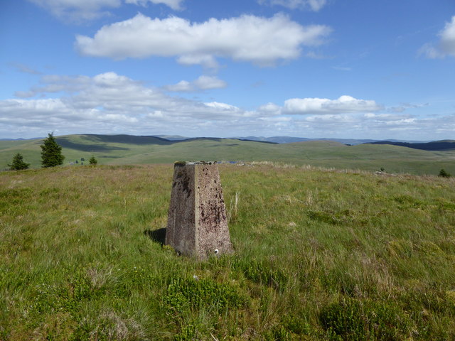
Hitteril Hill is a prominent hill located in Lanarkshire, Scotland. Standing at an elevation of approximately 1,214 feet, it offers stunning panoramic views of the surrounding countryside. The hill is a popular destination for hikers and outdoor enthusiasts, with well-marked trails leading to the summit.
Hitteril Hill is known for its diverse flora and fauna, with many rare plant species thriving in its rocky terrain. The hill is also home to a variety of wildlife, including birds of prey such as kestrels and buzzards.
In addition to its natural beauty, Hitteril Hill has historical significance as well. The hill is dotted with ancient ruins and burial mounds, evidence of human activity dating back to prehistoric times. Visitors can explore these archaeological sites and learn about the area's rich cultural heritage.
Overall, Hitteril Hill is a must-visit destination for those seeking a combination of natural beauty, outdoor adventure, and historical intrigue. Its picturesque landscapes and fascinating history make it a unique and unforgettable location in Lanarkshire.
If you have any feedback on the listing, please let us know in the comments section below.
Hitteril Hill Images
Images are sourced within 2km of 55.35633/-3.6341714 or Grid Reference NS9608. Thanks to Geograph Open Source API. All images are credited.


Hitteril Hill is located at Grid Ref: NS9608 (Lat: 55.35633, Lng: -3.6341714)
Unitary Authority: South Lanarkshire
Police Authority: Lanarkshire
What 3 Words
///cute.remaining.rails. Near Moffat, Dumfries & Galloway
Nearby Locations
Related Wikis
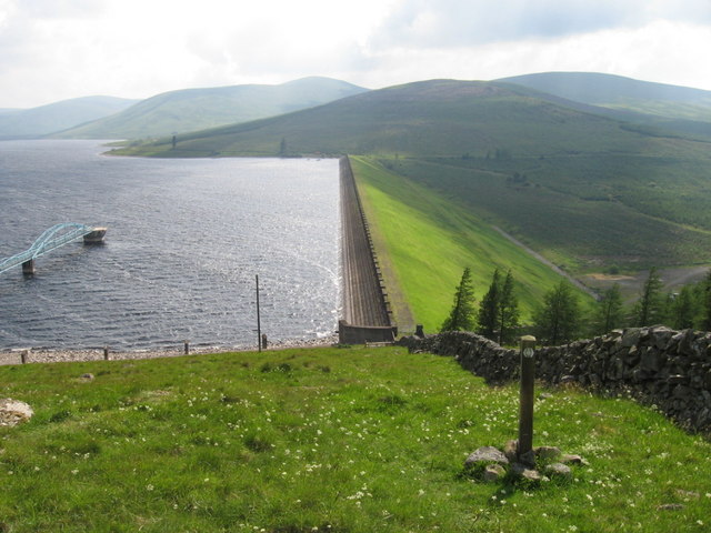
Daer Reservoir
Daer Reservoir is a man-made waterbody created by the damming of the Daer Water, a tributary of the River Clyde in the Southern Uplands of Scotland. It...

Daer Water
Daer Water (Scots: daer; IPA: [døːɾ] and IPA: [deːɾ], northern Scotland IPA: [diːɾ]) is one of the streams located in the watershed region which surrounds...

East Kilbride, Strathaven and Lesmahagow (UK Parliament constituency)
East Kilbride, Strathaven and Lesmahagow is a county constituency of the House of Commons of the Parliament of the United Kingdom, which was first used...

Ballencleuch Law
Ballencleuch Law is a hill in the Lowther Hills range, part of the Southern Uplands of Scotland. Surrounded on most sides by tracks or roads, there are...
Nearby Amenities
Located within 500m of 55.35633,-3.6341714Have you been to Hitteril Hill?
Leave your review of Hitteril Hill below (or comments, questions and feedback).