Airlich

Hill, Mountain in Perthshire

Scotland

Airlich

Ruined building at Rosecraig The main building at Rosecraig (also a ruin) has the date 1827 above its front door, but the building pictured here seems to have an older style of construction.
Ruined building at Rosecraig Credit: Alan O'Dowd

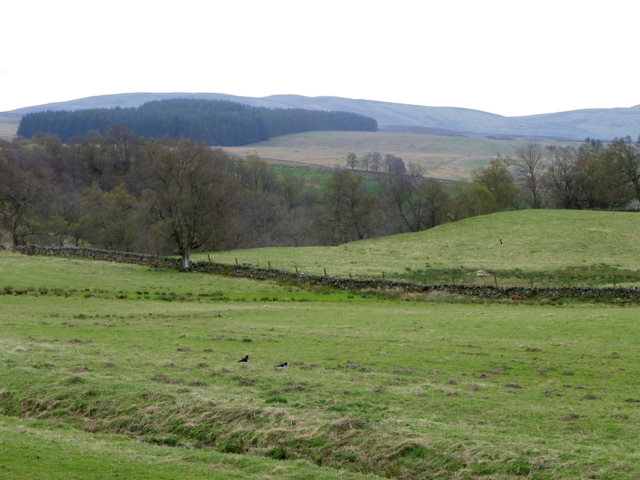
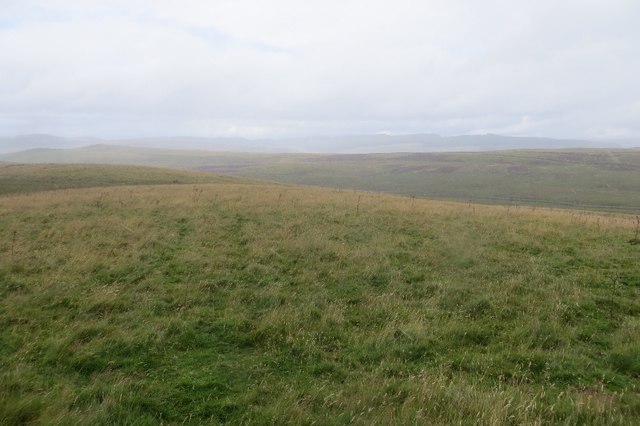
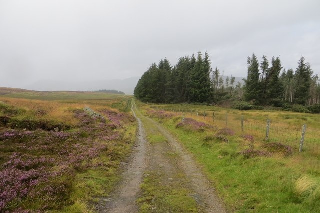
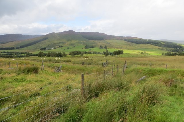
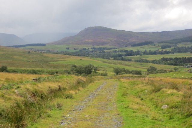
Airlich is a prominent hill located in the region of Perthshire, Scotland. Standing at an elevation of 425 meters (1,394 feet), it offers breathtaking panoramic views of the surrounding countryside. Situated near the village of Amulree, Airlich is a popular destination for outdoor enthusiasts, hikers, and nature lovers.

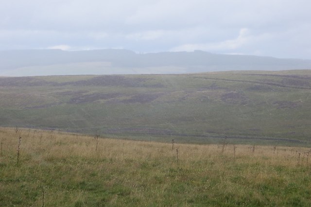
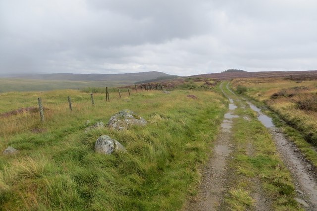
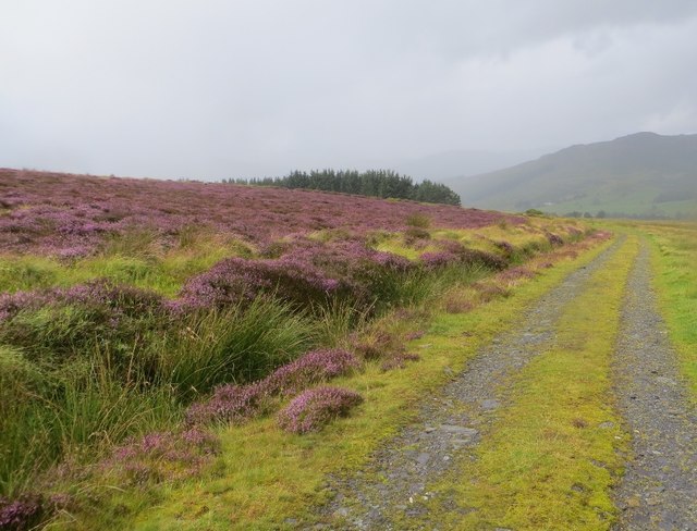
The hill is characterized by its distinct shape, with a gentle slope leading to a rugged and rocky summit. Its terrain is mostly covered in heather and grass, creating a picturesque landscape that changes colors with the seasons. The hill's location within the Perthshire region means it benefits from a relatively mild climate, making it accessible to visitors throughout the year.

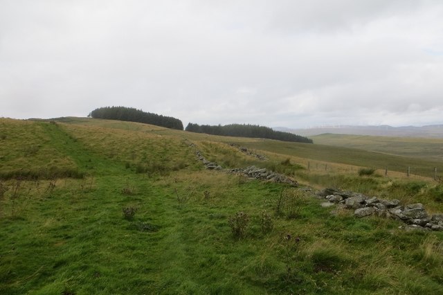
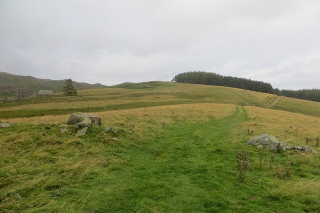
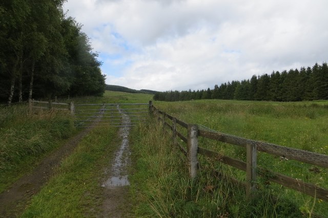
Airlich is part of the larger network of hills and mountains in the area, providing opportunities for longer hikes and exploring the stunning Scottish countryside. The hill is easily accessible via a well-maintained footpath that winds its way up the slope, ensuring a pleasant and safe ascent.

At the summit, visitors are rewarded with breathtaking views of the surrounding Perthshire hills, with glimpses of shimmering lochs and distant mountain ranges. The peaceful and tranquil atmosphere at the top makes it an ideal spot for picnics or simply taking in the natural beauty of the Scottish landscape.

Overall, Airlich's accessibility, diverse terrain, and stunning vistas make it a must-visit destination for those seeking a memorable outdoor experience in Perthshire, Scotland.

If you have any feedback on the listing, please let us know in the comments section below.
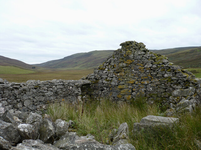
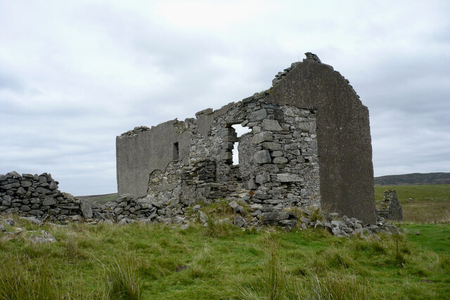
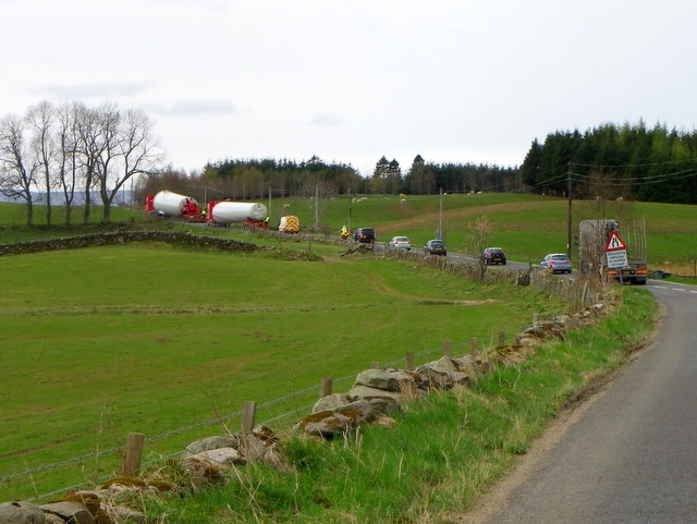
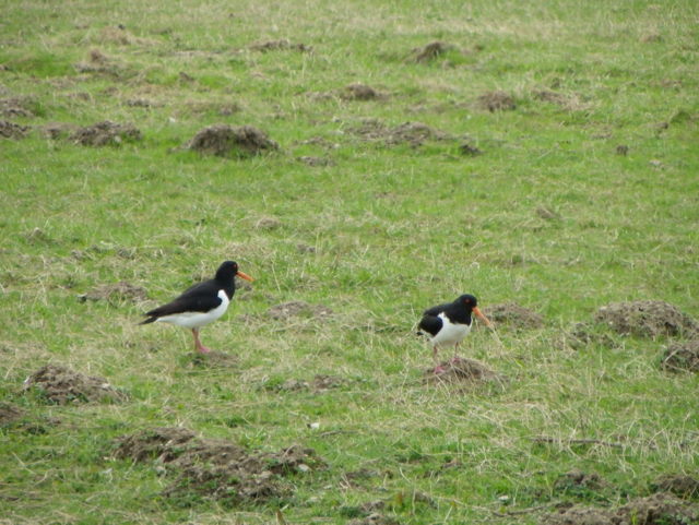
Airlich Images

Images are sourced within 2km of 56.526568/-3.6871465 or Grid Reference NN9638. Thanks to Geograph Open Source API. All images are credited.

Ruined building at Rosecraig The main building at Rosecraig (also a ruin) has the date 1827 above its front door, but the building pictured here seems to have an older style of construction.
Ruined building at Rosecraig
The main building at Rosecraig (also a ruin) has the date 1827 above its front door, but the building pictured here seems to have an older style of construction.
Ruined house at Rosecraig The remains of a two-storey house in an isolated location. The date 1827 appears above the front door.
Ruined house at Rosecraig
The remains of a two-storey house in an isolated location. The date 1827 appears above the front door.
Large loads near Trochry The lorries travelling on the A822 are carrying parts for wind turbines.
Large loads near Trochry
The lorries travelling on the A822 are carrying parts for wind turbines.
Oystercatchers (Haematopus ostralegus) This is a large, gregarious and noisy wader that gathers in great flocks to feed on shellfish, for which it has a specially adapted bill. It lays three camouflaged eggs in summer in a bare scrape on the ground.

In Gaelic folklore the Oystercatcher is known as the Gille Bride.
Oystercatchers (Haematopus ostralegus)
This is a large, gregarious and noisy wader that gathers in great flocks to feed on shellfish, for which it has a specially adapted bill. It lays three camouflaged eggs in summer in a bare scrape on the ground. In Gaelic folklore the Oystercatcher is known as the Gille Bride.
Molehills and Oystercatchers Moles live in loose, easily diggable soil throughout Britain, from sea level to about 3000ft, but there are no moles in Ireland. They do not colonise poor mountain soil or acid, sandy soil because these contain few earthworms. 

Moles belong to the order of mammals called insectivores, and are related to hedgehogs.

Molehills spoil lawns and sports grounds and reduce the value of pasture. They may also damage blades of cutting machines. In addition, moles rob the soil of earthworms. Farmers and gardeners are therefore their chief enemies. Other enemies include owls, foxes, dogs and cats.

The mole's name is possibly a shortened form of 'mouldiwarp', a names still used in northern England, which is derived from Old English 'molde', meaning earth and 'werpen', meaning to throw. But how can they make the hills when the earth is as hard as iron.

For a closer view of the oystercatchers <a href="https://www.geograph.org.uk/photo/2759101">NN9539 : Oystercatchers (Haematopus ostralegus)</a>
Molehills and Oystercatchers
Moles live in loose, easily diggable soil throughout Britain, from sea level to about 3000ft, but there are no moles in Ireland. They do not colonise poor mountain soil or acid, sandy soil because these contain few earthworms. Moles belong to the order of mammals called insectivores, and are related to hedgehogs. Molehills spoil lawns and sports grounds and reduce the value of pasture. They may also damage blades of cutting machines. In addition, moles rob the soil of earthworms. Farmers and gardeners are therefore their chief enemies. Other enemies include owls, foxes, dogs and cats. The mole's name is possibly a shortened form of 'mouldiwarp', a names still used in northern England, which is derived from Old English 'molde', meaning earth and 'werpen', meaning to throw. But how can they make the hills when the earth is as hard as iron. For a closer view of the oystercatchers NN9539 : Oystercatchers (Haematopus ostralegus)
Drumour Schoolhouse Converted to a residence; by the A822.
Drumour Schoolhouse
Converted to a residence; by the A822.
Drumour Bridge carries the A822 across the River Braan
Grassland above Strath Braan By the watershed with Glen Shee, amongst the headwaters of the Corrody Burn.  The land here is improved, contrasting with the heather moorland to the south.  It was raining heavily.
Grassland above Strath Braan
By the watershed with Glen Shee, amongst the headwaters of the Corrody Burn. The land here is improved, contrasting with the heather moorland to the south. It was raining heavily.
Corrody Burn Rain falls on improved hill pasture on the south side of Strath Braan.
Corrody Burn
Rain falls on improved hill pasture on the south side of Strath Braan.
Glen Shee road, Rosecraig The old road is a bit rutted and waterlogged here, so the old tradition of taking a new route beside the gully is still in use. Unlike downstream, the land here is improved grazing.
Glen Shee road, Rosecraig
The old road is a bit rutted and waterlogged here, so the old tradition of taking a new route beside the gully is still in use. Unlike downstream, the land here is improved grazing.
Rosecraig A field at the head of Glen Shee. The track in the photograph is not the road to Strath Braan, that is rough and gullied here. Traffic, including myself preferred the path through the field.
Rosecraig
A field at the head of Glen Shee. The track in the photograph is not the road to Strath Braan, that is rough and gullied here. Traffic, including myself preferred the path through the field.
Rosecraig Ruins, of different ages, at the head of Glen Shee.
Rosecraig
Ruins, of different ages, at the head of Glen Shee.
Little Glen Shee to Strath Braan Road The gentle descent to Strath Braan passes a wind thrown plantation.
Little Glen Shee to Strath Braan Road
The gentle descent to Strath Braan passes a wind thrown plantation.
Strath Braan to Little Glenshee road A well built but now little used road crosses moorland between Strath Braan and lowland Perthshire.
Strath Braan to Little Glenshee road
A well built but now little used road crosses moorland between Strath Braan and lowland Perthshire.
Little Glenshee to Strathbraan road A well built road crosses from Strath Braan to lowland Perthshire through Glen Shee.  It is best explored by bike, or if on foot from the south as the locals have gone to enormous lengths to prevent parking in Strath Braan.  Good parking by the ford near Little Glenshee though.
Little Glenshee to Strathbraan road
A well built road crosses from Strath Braan to lowland Perthshire through Glen Shee. It is best explored by bike, or if on foot from the south as the locals have gone to enormous lengths to prevent parking in Strath Braan. Good parking by the ford near Little Glenshee though.
Strath Braan A view across the glen from the Little Glenshee road.  The road follows a lade for some distance as it climbs away from Strath Braan.
Strath Braan
A view across the glen from the Little Glenshee road. The road follows a lade for some distance as it climbs away from Strath Braan.
Little Glen Shee to Strath Braan Road The descent into Strath Braan, looking towards Meall Mòr.
Little Glen Shee to Strath Braan Road
The descent into Strath Braan, looking towards Meall Mòr.
Field access, Tomnagrew Farmland in Strath Braan.
Field access, Tomnagrew
Farmland in Strath Braan.
Show me another place!

Airlich is located at Grid Ref: NN9638 (Lat: 56.526568, Lng: -3.6871465)

Unitary Authority: Perth and Kinross

Police Authority: Tayside

What 3 Words

///admit.waggled.pokers. Near Bankfoot, Perth & Kinross

Nearby Locations

Airlich

Related Wikis

Falls of the Braan

Falls of the Braan is a waterfall of Scotland located in the Hermitage at the National Trust for Scotland-protected site in Dunkeld, Perth and Kinross...

Hermitage Douglas-fir

The Hermitage Douglas-fir (also known as Ossian's Douglas-fir) was a Douglas-fir tree which stood in The Hermitage pleasure ground, in Dunkeld, Scotland...

The Hermitage, Dunkeld

The Hermitage (officially The Hermitage pleasure ground) is a National Trust for Scotland-protected site in Dunkeld, Perth and Kinross. Located just to...

Black Linn Falls

Black Linn Falls is a waterfall on the River Braan in The Hermitage, Dunkeld, Scotland. After the falls, the river passes beneath the Hermitage Bridge...

Ossian's Hall of Mirrors

Ossian's Hall of Mirrors is a Georgian structure located at The Hermitage in Dunkeld, Scotland. == History of the site == === The original view-house... ===

Hermitage Bridge (Dunkeld, Scotland)

The Hermitage Bridge is an ancient, single-arch stone pedestrian bridge crossing the River Braan near Dunkeld, Perth and Kinross, Scotland. A Category...

Craigvinean Forest

Craigvinean Forest is located 1 mile (1.6 km) west of Dunkeld, Perth and Kinross, Scotland, on the A9. It is accessed through a track at the foot of Deuchary...

Niel Gow's Oak

Niel Gow's Oak is a 300-year-old tree near Dunkeld and Birnam, Perth and Kinross, Scotland. It is closely associated with the Scottish fiddler and composer...

Nearby Amenities

Located within 500m of 56.526568,-3.6871465
The data included in this document is from www.openstreetmap.org. The data is made available under ODbL.

Have you been to Airlich?

Leave your review of Airlich below (or comments, questions and feedback).