Bràigh Coire Caochan nan Laogh
Hill, Mountain in Aberdeenshire
Scotland
Bràigh Coire Caochan nan Laogh

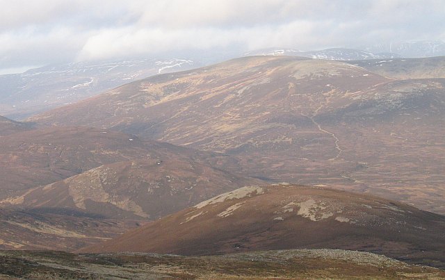
Bràigh Coire Caochan nan Laogh is a prominent hill located in Aberdeenshire, Scotland. Standing at an elevation of approximately 825 meters (2,707 feet), it offers breathtaking panoramic views of the surrounding countryside and is a popular destination for hikers and outdoor enthusiasts.
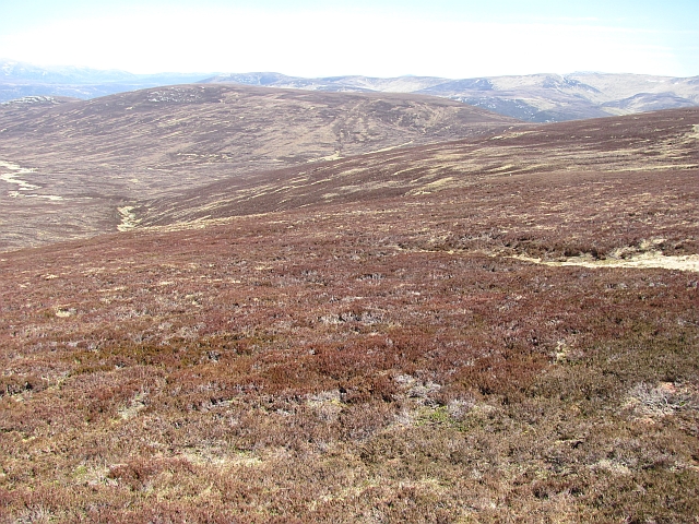
The hill is part of the Cairngorms National Park, known for its stunning landscapes and diverse wildlife. Bràigh Coire Caochan nan Laogh is characterized by its rugged terrain, with steep slopes and rocky outcrops. Its summit is marked by a large cairn, providing a picturesque spot for visitors to rest and take in the scenery.
The hill is accessible via various trails, with the most popular route starting from the nearby village of Braemar. The ascent can be challenging, particularly during inclement weather conditions, so proper hiking gear and navigation skills are essential.
The surrounding area is rich in flora and fauna, with heather moorland and scattered pine forests. Wildlife enthusiasts may be lucky enough to spot red deer, golden eagles, and mountain hares during their ascent.
Bràigh Coire Caochan nan Laogh offers a rewarding hiking experience for those seeking adventure and natural beauty. Whether it's the breathtaking views from the summit or the tranquil atmosphere of the Cairngorms National Park, this hill is a must-visit destination for nature lovers and outdoor enthusiasts in Aberdeenshire.
If you have any feedback on the listing, please let us know in the comments section below.
Bràigh Coire Caochan nan Laogh Images
Images are sourced within 2km of 56.915829/-3.7092236 or Grid Reference NN9681. Thanks to Geograph Open Source API. All images are credited.


Bràigh Coire Caochan nan Laogh is located at Grid Ref: NN9681 (Lat: 56.915829, Lng: -3.7092236)
Unitary Authority: Perth and Kinross
Police Authority: Tayside
What 3 Words
///trucked.incensed.quest. Near Inverey, Aberdeenshire
Nearby Locations
Related Wikis
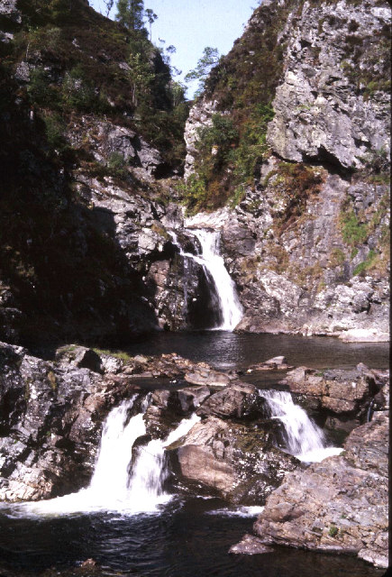
Falls of Tarf
The Falls of Tarf is a waterfall on the Tarf Water in the eastern Highlands of Scotland. Immediately downstream of the falls the Tarf is joined by a second...

Loch Tilt
Loch Tilt is a small mountain freshwater loch that sits at the end of Glen Tilt and is located in north-east Perth and Kinross, Scotland. Loch Tilt has...
An Sgarsoch
An Sgarsoch (1,006.5m) is a mountain in the Grampian Mountains of Scotland. It lies north of Blair Atholl in a very remote part of the Highlands, on the...

Carn an Fhidhleir
Carn an Fhidhleir (994 m) is a mountain in the Grampian Mountains of Scotland. It lies on the border of Inverness-shire, Perthshire and Aberdeenshire,...

Carn a' Chlamain
Càrn a' Chlamain (Gaelic: Càrn a' Chlamhain) is a Scottish mountain situated roughly 12 kilometres north of Blair Atholl in the Forest of Atholl. It is...

Loch Loch
Loch Loch is a remote freshwater loch, located in Glen Loch in Perth and Kinross, some 9.5 miles north of Pitlochry, Scotland and is within the Forest...
Chest of Dee
Chest of Dee is a waterfall of Scotland. == See also == Waterfalls of Scotland == References ==

Places, place names, and structures on Mar Lodge Estate
Mar Lodge Estate is the largest remnant of the ancient Earldom of Mar in Aberdeenshire, Scotland and is now owned by the National Trust for Scotland....
Have you been to Bràigh Coire Caochan nan Laogh?
Leave your review of Bràigh Coire Caochan nan Laogh below (or comments, questions and feedback).