Ben Salachill

Hill, Mountain in Perthshire

Scotland

Ben Salachill

Road cutting, Meall Reamhar Service road on the Griffin wind farm. There were conifers here briefly from the 1980s to around 2010.
Road cutting, Meall Reamhar Credit: Richard Webb

Ben Salachill is a prominent hill located in the county of Perthshire, Scotland. Situated in the southern region of the Cairngorms National Park, it forms part of the Grampian Mountains and stands at an impressive height of 1,010 meters (3,314 feet). The hill is a popular destination for outdoor enthusiasts, offering stunning panoramic views of the surrounding landscape.

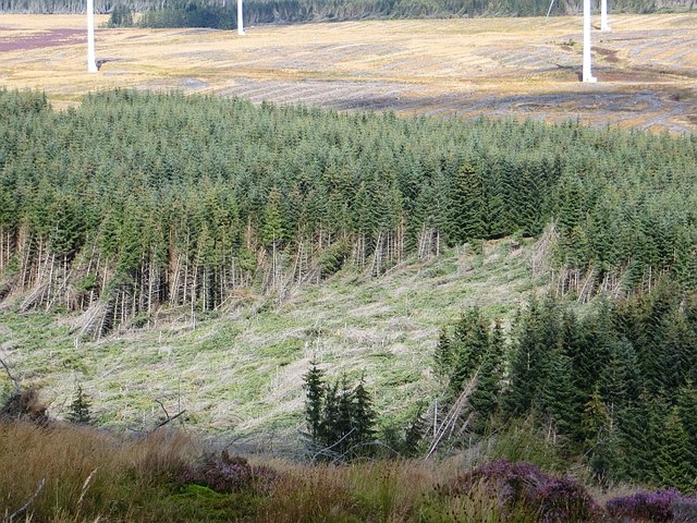
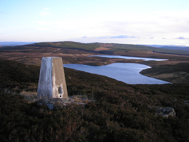
Ben Salachill is characterized by its rugged terrain, with steep slopes and rocky outcrops. Its summit provides a challenging climb for experienced hikers and mountaineers, who are rewarded with breathtaking vistas of the Cairngorms and the glens below. The hill is known for its diverse flora and fauna, with heather-clad slopes and scattered woodland supporting a range of plant species and providing habitats for various wildlife, including deer and birds of prey.

The hill is easily accessible from nearby towns and villages, with various routes available for different levels of fitness and experience. The most popular approach is from the village of Kirkmichael, which allows visitors to traverse through scenic forests and open moorland before reaching the summit. Alternatively, more adventurous hikers can explore the hill as part of longer multi-day treks, such as the Cateran Trail or the Cairngorms National Park trail network.

Overall, Ben Salachill offers a thrilling outdoor experience for nature lovers and hiking enthusiasts, combining challenging climbs with breathtaking views of the stunning Scottish countryside.

If you have any feedback on the listing, please let us know in the comments section below.

Ben Salachill Images

Images are sourced within 2km of 56.58047/-3.7141643 or Grid Reference NN9444. Thanks to Geograph Open Source API. All images are credited.

Road cutting, Meall Reamhar Service road on the Griffin wind farm. There were conifers here briefly from the 1980s to around 2010.
Road cutting, Meall Reamhar
Service road on the Griffin wind farm. There were conifers here briefly from the 1980s to around 2010.
Moorland, Meall Reamhar A bit missed by the wind farmers.
Moorland, Meall Reamhar
A bit missed by the wind farmers.
Moorland, Meall Reamhar Moorland which has escaped the forestry and wind farm.
Moorland, Meall Reamhar
Moorland which has escaped the forestry and wind farm.
Wind farm, Griffin The Sitka spruce has gone here, making way for a wind farm.
Wind farm, Griffin
The Sitka spruce has gone here, making way for a wind farm.
Clear fell, Griffin The forest was cut down here to make room for the wind farm.
Clear fell, Griffin
The forest was cut down here to make room for the wind farm.
Spill kit, Griffin wind farm There are quite a few of these bins distributed around the site.
Spill kit, Griffin wind farm
There are quite a few of these bins distributed around the site.
Road and turbines on Ben Salachill Griffin wind farm, near the former edge of the forest.
Road and turbines on Ben Salachill
Griffin wind farm, near the former edge of the forest.
Ben Salachill Surviving moorland amongst the wind turbines.
Ben Salachill
Surviving moorland amongst the wind turbines.
Griffin wind farm There was a brief spell when that other curse of the uplands, Sitka spruce, ruled here. That got shifted to make room for the wind farm.
Griffin wind farm
There was a brief spell when that other curse of the uplands, Sitka spruce, ruled here. That got shifted to make room for the wind farm.
Logging road, Griffin Forest A road crosses a remnant of the forest which survived cutting down to make room for a wind farm.
Logging road, Griffin Forest
A road crosses a remnant of the forest which survived cutting down to make room for a wind farm.
Griffin wind farm Road to some of the many turbines on the site of the eastern part of Griffin Forest and nearby moorland.
Griffin wind farm
Road to some of the many turbines on the site of the eastern part of Griffin Forest and nearby moorland.
Windthrow, Griffin Forest Some of the eastern part of the forest survived the wind farm, but this bit fell foul of the weather.
Windthrow, Griffin Forest
Some of the eastern part of the forest survived the wind farm, but this bit fell foul of the weather.
Wind turbine, Griffin
Griffin wind farm Much of Griffin Forest, a 1980s eyesore, has been felled to make way for today's curse.
Griffin wind farm
Much of Griffin Forest, a 1980s eyesore, has been felled to make way for today's curse.
Turbines, Griffin A lot of them, all stacked up. How does turbulence from the upwind turbine affect the generating ability of the others behind?  Does not matter, they still make money even when the weather is against them.
Turbines, Griffin
A lot of them, all stacked up. How does turbulence from the upwind turbine affect the generating ability of the others behind? Does not matter, they still make money even when the weather is against them.
Turbine blade, Griffin A blade parked up beside a functioning turbine.
Turbine blade, Griffin
A blade parked up beside a functioning turbine.
Turbine blade, Griffin A huge blade parked by an operational turbine.
Turbine blade, Griffin
A huge blade parked by an operational turbine.
Clear fell, Griffin The eastern part of the forest has been cut down to make way for aa wind farm.
Clear fell, Griffin
The eastern part of the forest has been cut down to make way for aa wind farm.
Show me another place!

Ben Salachill is located at Grid Ref: NN9444 (Lat: 56.58047, Lng: -3.7141643)

Unitary Authority: Perth and Kinross

Police Authority: Tayside

What 3 Words

///mallets.princely.secret. Near Aberfeldy, Perth & Kinross

Nearby Locations

Ben Salachill

Related Wikis

Tay Forest Park

Tay Forest Park is a forest park in the council area of Perth and Kinross in Scotland. It consists of a network of forests managed by Forestry and Land...

Loch Skiach

Loch Skiach is a small freshwater loch in Perth and Kinross, Scotland, situated 4 miles (6.4 km) southwest of Ballinluig. Directly south of Loch Skiach...

Loch Kennard

Loch Kennard is freshwater loch located south-east of Aberfeldy, situated on Grandtully Hill in Perth and Kinross within Griffin Forest in Scotland....

Loch Scoly

Loch Scoly is a small hill loch, lying to the north-east of Loch Kennard and west of Loch Skiach, on Grandtully Hill within Perth and Kinross, Scotland...

Dalguise

Dalguise (Scottish Gaelic Dàil Ghiuthais) is a settlement in Perth and Kinross, Scotland. It is situated on the western side of the River Tay on the B898...

Dalguise railway station

Dalguise railway station served the Scottish settlement of Dalguise, Perth and Kinross, from 1863 to 1965 on the Inverness and Perth Junction Railway....

Dalguise Viaduct

The Dalguise Viaduct is a lattice girder viaduct in Dalguise, Perth and Kinross, Scotland. It carries the Highland Main Line railway across the River Tay...

Hermitage Douglas-fir

The Hermitage Douglas-fir (also known as Ossian's Douglas-fir) was a Douglas-fir tree which stood in The Hermitage pleasure ground, in Dunkeld, Scotland...

Nearby Amenities

Located within 500m of 56.58047,-3.7141643
Generator Method: wind_turbine
Generator Output Electricity: 2.3 MW
Generator Source: wind
Generator Type: horizontal_axis
Manufacturer: Siemens
Operator: SSE Renewables
Operator Wikidata: Q7392992
Power: generator
Lat/Long: 56.580809/-3.7208681
Generator Method: wind_turbine
Generator Output Electricity: 2.3 MW
Generator Source: wind
Generator Type: horizontal_axis
Manufacturer: Siemens
Operator: SSE Renewables
Operator Wikidata: Q7392992
Power: generator
Lat/Long: 56.5781374/-3.7177352
Ben Salachill
Ele: 422
Natural: peak
Lat/Long: 56.5798976/-3.7138718
Generator Method: wind_turbine
Generator Output Electricity: 2.3 MW
Generator Source: wind
Generator Type: horizontal_axis
Manufacturer: Siemens
Operator: SSE Renewables
Operator Wikidata: Q7392992
Power: generator
Lat/Long: 56.5807864/-3.712565
The data included in this document is from www.openstreetmap.org. The data is made available under ODbL.

Have you been to Ben Salachill?

Leave your review of Ben Salachill below (or comments, questions and feedback).