Warberry Hill

Hill, Mountain in Devon

England

Warberry Hill

Rain, Lymington Road, Torquay Heavy rain batters a puddle beside the Torbay Business Centre.
Rain, Lymington Road, Torquay Credit: Derek Harper

The requested URL returned error: 429 Too Many Requests

If you have any feedback on the listing, please let us know in the comments section below.

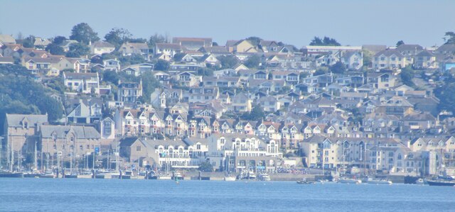
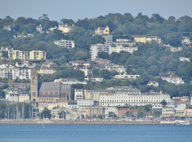
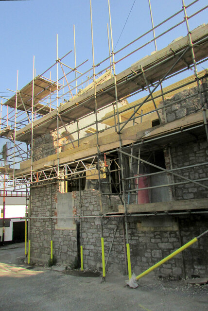
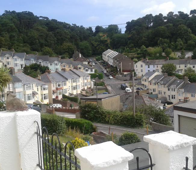
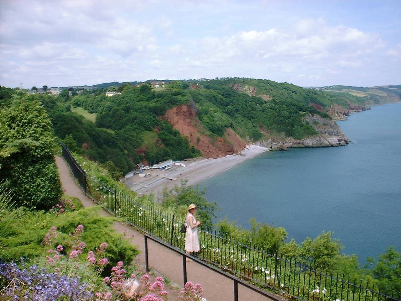
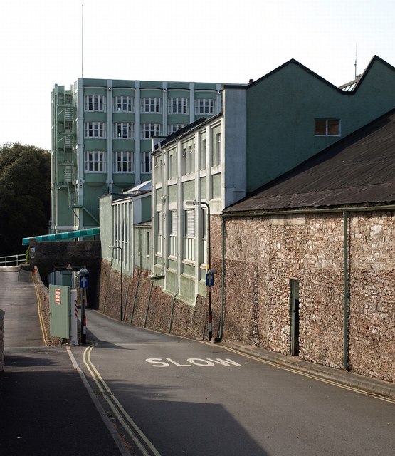
Warberry Hill Images

Images are sourced within 2km of 50.469633/-3.5143681 or Grid Reference SX9264. Thanks to Geograph Open Source API. All images are credited.

Rain, Lymington Road, Torquay Heavy rain batters a puddle beside the Torbay Business Centre.
Rain, Lymington Road, Torquay
Heavy rain batters a puddle beside the Torbay Business Centre.
Scaffolding, Town Hall, Torquay The clock tower is undergoing work. <span class="nowrap"><a title="https://historicengland.org.uk/listing/the-list/list-entry/1208247" rel="nofollow ugc noopener" href="https://historicengland.org.uk/listing/the-list/list-entry/1208247">Link</a><img style="margin-left:2px;" alt="External link" title="External link - shift click to open in new window" src="https://s1.geograph.org.uk/img/external.png" width="10" height="10"/></span> . On the left is the spire of  St Mary Magdalene church <span class="nowrap"><a title="https://www.historicengland.org.uk/listing/the-list/list-entry/1219197" rel="nofollow ugc noopener" href="https://www.historicengland.org.uk/listing/the-list/list-entry/1219197">Link</a><img style="margin-left:2px;" alt="External link" title="External link - shift click to open in new window" src="https://s1.geograph.org.uk/img/external.png" width="10" height="10"/></span> .
Scaffolding, Town Hall, Torquay
The clock tower is undergoing work. LinkExternal link . On the left is the spire of St Mary Magdalene church LinkExternal link .
Upton Park The eastern entrance from the foot of Trematon Avenue.
Upton Park
The eastern entrance from the foot of Trematon Avenue.
Play apparatus, Uptpn Park A play gym has recently been installed among the basketball and tennis courts.
Play apparatus, Uptpn Park
A play gym has recently been installed among the basketball and tennis courts.
Artwork, Upton Park Some chalk designs, including a "BE HAPPY" rainbow, between the table tennis tables.
Artwork, Upton Park
Some chalk designs, including a "BE HAPPY" rainbow, between the table tennis tables.
Torquay View across Torbay of Torquay's waterfront, seen from Preston Sands in Paignton.
Torquay
View across Torbay of Torquay's waterfront, seen from Preston Sands in Paignton.
Torquay Seen across Tor Bay from the end of Paignton Pier.
Torquay
Seen across Tor Bay from the end of Paignton Pier.
Torquay Seen across Tor Bay from the end of Paignton Pier.
Torquay
Seen across Tor Bay from the end of Paignton Pier.
Riviera Heights, Laburnum Row, Torre Transformed from <a href="https://www.geograph.org.uk/photo/1297747">SX9064 : Laburnum Row, Torre</a>, but only quite recently. The former B&Q store at the top has been largely rebuilt; the development is a mixture of flats and commercial premises.
Riviera Heights, Laburnum Row, Torre
Transformed from SX9064 : Laburnum Row, Torre, but only quite recently. The former B&Q store at the top has been largely rebuilt; the development is a mixture of flats and commercial premises.
Laburnum Row, Torre The side of the street opposite <a href="https://www.geograph.org.uk/photo/6930458">SX9064 : Riviera Heights, Laburnum Row, Torre</a>. Domestic Bliss <a href="https://www.geograph.org.uk/photo/3036704">SX9064 : Domestic Bliss, Torquay</a> has vanished; it appears in several other photos I took of the terrace <a title="https://www.geograph.org.uk/search.php?i=138295666" href="https://www.geograph.org.uk/search.php?i=138295666">Link</a> .
Laburnum Row, Torre
The side of the street opposite SX9064 : Riviera Heights, Laburnum Row, Torre. Domestic Bliss SX9064 : Domestic Bliss, Torquay has vanished; it appears in several other photos I took of the terrace Link .
House on Zion Road, Torre The elegant Stiniel is opposite the former Zion church <a href="https://www.geograph.org.uk/photo/4306942">SX9064 : Former chapel, Torre</a>, under scaffolding.
House on Zion Road, Torre
The elegant Stiniel is opposite the former Zion church SX9064 : Former chapel, Torre, under scaffolding.
Zion chapel under scaffolding The former chapel and garage, also shown in <a href="https://www.geograph.org.uk/photo/4306942">SX9064 : Former chapel, Torre</a>, has planning permission "for 6 x two Bed Flats plus 1 x two bed House" <span class="nowrap"><a title="http://www.noonroberts.co.uk/wp-content/uploads/2019/01/0487-Development-Site-Garage-Premises-Zion-Church-Tor-Torquay-Devon-09012019.pdf" rel="nofollow ugc noopener" href="http://www.noonroberts.co.uk/wp-content/uploads/2019/01/0487-Development-Site-Garage-Premises-Zion-Church-Tor-Torquay-Devon-09012019.pdf">Link</a><img style="margin-left:2px;" alt="External link" title="External link - shift click to open in new window" src="https://s1.geograph.org.uk/img/external.png" width="10" height="10"/></span> .
Zion chapel under scaffolding
The former chapel and garage, also shown in SX9064 : Former chapel, Torre, has planning permission "for 6 x two Bed Flats plus 1 x two bed House" LinkExternal link .
Zion chapel under scaffolding A view of the south side of the former chapel shown in <a href="https://www.geograph.org.uk/photo/6930522">SX9064 : Zion chapel under scaffolding</a>.
Zion chapel under scaffolding
A view of the south side of the former chapel shown in SX9064 : Zion chapel under scaffolding.
Zion chapel under scaffolding A view from the north side of the chapel shown in <a href="https://www.geograph.org.uk/photo/6930522">SX9064 : Zion chapel under scaffolding</a> and <a href="https://www.geograph.org.uk/photo/6930532">SX9064 : Zion chapel under scaffolding</a>. The extension mentioned in <a href="https://www.geograph.org.uk/photo/4306942">SX9064 : Former chapel, Torre</a> seems to have largely been removed, thank goodness.
Zion chapel under scaffolding
A view from the north side of the chapel shown in SX9064 : Zion chapel under scaffolding and SX9064 : Zion chapel under scaffolding. The extension mentioned in SX9064 : Former chapel, Torre seems to have largely been removed, thank goodness.
Scene by Zion Road, Torre In the background is the house shown in <a href="https://www.geograph.org.uk/photo/3754725">SX9064 : Zion Road, Torquay</a>. In the foreground is a pile of rubble, perhaps the remains of the extension mentioned at <a href="https://www.geograph.org.uk/photo/6930541">SX9064 : Zion chapel under scaffolding</a> and <a href="https://www.geograph.org.uk/photo/4306942">SX9064 : Former chapel, Torre</a>. On the right is the rebuilt former premises of B&Q.
Scene by Zion Road, Torre
In the background is the house shown in SX9064 : Zion Road, Torquay. In the foreground is a pile of rubble, perhaps the remains of the extension mentioned at SX9064 : Zion chapel under scaffolding and SX9064 : Former chapel, Torre. On the right is the rebuilt former premises of B&Q.
Former B&Q store, Torre Now redesigned to become offices and flats.
Former B&Q store, Torre
Now redesigned to become offices and flats.
Former B&Q, Torre A year on from <a href="https://www.geograph.org.uk/photo/6433262">SX9064 : Former B&Q, Torre</a>, and now revealed in its curvaceous finery.
Former B&Q, Torre
A year on from SX9064 : Former B&Q, Torre, and now revealed in its curvaceous finery.
Arch, East Street, Torre The archway must be a remnant of the primary school that stood here before <a href="https://www.geograph.org.uk/photo/257523">SX9065 : Torre Church of England Primary School</a> was built.
Arch, East Street, Torre
The archway must be a remnant of the primary school that stood here before SX9065 : Torre Church of England Primary School was built.
Show me another place!

Warberry Hill is located at Grid Ref: SX9264 (Lat: 50.469633, Lng: -3.5143681)

Unitary Authority: Torbay

Police Authority: Devon and Cornwall

What 3 Words

///oldest.rich.loses. Near Torquay, Devon

Nearby Locations

Warberry Hill Ellacombe

Related Wikis

Ellacombe, Devon

Ellacombe is a district of Torquay, Devon. Ellacombe is home to Ellacombe Primary school, which is known to be the only place in Torquay that still has...

Babbacombe

Babbacombe is a district of Torquay, Devon, England. It is notable for Babbacombe Model Village, the Babbacombe Theatre and its clifftop green, Babbacombe...

RAF Hospital Torquay

The RAF Hospital Torquay (also known as the RAF Officer's Convalescent Hospital), was a medical facility run by the Royal Air Force (RAF) in the Torquay...

Gleneagles Hotel, Torquay

The Gleneagles Hotel was a hotel in Torquay, Devon, England. The 41-bed establishment, which opened in the 1960s, was the inspiration for Fawlty Towers...

Nearby Amenities

Located within 500m of 50.469633,-3.5143681
Wellswood
Is In: Devon, England, UK
Place: suburb
Lat/Long: 50.4678225/-3.5094362
Barrier: yes
Lat/Long: 50.467042/-3.510073
Disused Amenity: post_box
Note: Post box is still in situ but the slot is blocked and collection plate is missing (survey: Dec 2021)
Ref: TQ1 8
Royal Cypher: GR
Source: survey
Lat/Long: 50.4668071/-3.5154346
Lower Warberry Road
Naptan AtcoCode: 1190TOA01056
Naptan Bearing: NE
Naptan BusStopType: CUS
Naptan CommonName: Lower Warberry Road
Naptan NaptanCode: tbyjatp
Naptan PlusbusZoneRef: NABT
Naptan Street: Lower Warberry Road
Naptan Verified: no
Source: naptan_import
Lat/Long: 50.4661855/-3.514114
Bus Stop
Warberry Copse
Bus: yes
Naptan AtcoCode: 1190TOA10847
Naptan Bearing: S
Naptan CommonName: Warberry Copse
Naptan Crossing: Cedars Road
Naptan NaptanCode: tbygjpa
Naptan PlusbusZoneRef: NABT
Naptan Street: Quinta Road
Naptan Verified: yes
Public Transport: platform
Source: naptan_import
Lat/Long: 50.4710981/-3.5137037
Bus Stop
Warberry Copse
Bus: yes
Naptan AtcoCode: 1190TOA10848
Naptan Bearing: N
Naptan CommonName: Warberry Copse
Naptan Crossing: Cedars Road
Naptan NaptanCode: tbygjmw
Naptan PlusbusZoneRef: NABT
Naptan Street: Quinta Road
Naptan Verified: yes
Public Transport: platform
Source: naptan_import
Lat/Long: 50.4711695/-3.5138894
Bus Stop
Windsor Road
Bus: yes
Naptan AtcoCode: 1190TOA10849
Naptan Bearing: SE
Naptan CommonName: Windsor Road
Naptan Crossing: Willoughby Road
Naptan NaptanCode: tbygjdg
Naptan PlusbusZoneRef: NABT
Naptan Street: Congella Road
Naptan Verified: no
Public Transport: platform
Source: naptan_import
Lat/Long: 50.4719651/-3.5157642
Bus Stop
Windsor Road
Bus: yes
Naptan AtcoCode: 1190TOA10850
Naptan Bearing: SE
Naptan CommonName: Windsor Road
Naptan Crossing: Congella Road
Naptan NaptanCode: tbygjat
Naptan PlusbusZoneRef: NABT
Naptan Street: Willoughby Road
Naptan Verified: no
Public Transport: platform
Source: naptan_import
Lat/Long: 50.4718829/-3.5158603
Bus Stop
Windsor Road
Bus: yes
Naptan AtcoCode: 1190TOA10851
Naptan Bearing: SE
Naptan CommonName: Windsor Road
Naptan Crossing: Quinta Road
Naptan NaptanCode: tbygdpw
Naptan PlusbusZoneRef: NABT
Naptan Street: Ellacombe Church Road
Naptan Verified: no
Public Transport: platform
Source: naptan_import
Lat/Long: 50.47315/-3.5180148
Bus Stop
Ellacombe Church Road
Bus: yes
Naptan AtcoCode: 1190TOA10853
Naptan Bearing: S
Naptan CommonName: Ellacombe Church Road
Naptan Crossing: Carlton Road
Naptan NaptanCode: tbygdmj
Naptan PlusbusZoneRef: NABT
Naptan Street: Ellacombe Church Road
Naptan Verified: no
Public Transport: platform
Source: naptan_import
Lat/Long: 50.4728758/-3.5183442
Bus Stop
Ellacombe Church Road
Bus: yes
Naptan AtcoCode: 1190TOA10854
Naptan Bearing: N
Naptan CommonName: Ellacombe Church Road
Naptan Crossing: Carlton Road
Naptan NaptanCode: tbygdma
Naptan PlusbusZoneRef: NABT
Naptan Street: Ellacombe Church Road
Naptan Verified: no
Public Transport: platform
Source: naptan_import
Lat/Long: 50.4728272/-3.5184424
Bus Stop
The Warberries
Bus: yes
Naptan AtcoCode: 1190TOA10895
Naptan Bearing: W
Naptan CommonName: The Warberries
Naptan NaptanCode: tbygdwp
Naptan PlusbusZoneRef: NABT
Naptan Street: Middle Warberry Road
Naptan Verified: yes
Public Transport: platform
Source: naptan_import
Lat/Long: 50.4666794/-3.515553
Bus Stop
Sorrento
Bus: yes
Naptan AtcoCode: 1190TOA10896
Naptan Bearing: E
Naptan CommonName: Sorrento
Naptan Crossing: Higher Warberry Road
Naptan NaptanCode: tbygdmw
Naptan PlusbusZoneRef: NABT
Naptan Street: Middle Warberry Road
Naptan Verified: yes
Public Transport: platform
Source: naptan_import
Lat/Long: 50.4663997/-3.519279
Bus Stop
The Warberries
Bus: yes
Naptan AtcoCode: 1190TOZ00852
Naptan Bearing: E
Naptan CommonName: The Warberries
Naptan NaptanCode: tbygjag
Naptan PlusbusZoneRef: NABT
Naptan Street: Lower Warberry Road
Naptan Verified: yes
Public Transport: platform
Source: naptan_import
Lat/Long: 50.4659808/-3.5160238
Barrier: bollard
Lat/Long: 50.4663881/-3.5127651
Generator Method: photovoltaic
Generator Output Electricity: yes
Generator Source: solar
Generator Type: solar_photovoltaic_panel
Location: roof
Power: generator
Lat/Long: 50.4674107/-3.5104894
Generator Method: photovoltaic
Generator Output Electricity: yes
Generator Source: solar
Generator Type: solar_photovoltaic_panel
Location: roof
Power: generator
Lat/Long: 50.4702208/-3.5105189
Generator Method: photovoltaic
Generator Output Electricity: yes
Generator Source: solar
Generator Type: solar_photovoltaic_panel
Location: roof
Power: generator
Lat/Long: 50.4683609/-3.5211261
Generator Method: photovoltaic
Generator Output Electricity: yes
Generator Source: solar
Generator Type: solar_photovoltaic_panel
Location: roof
Power: generator
Lat/Long: 50.46896/-3.5114139
Generator Method: photovoltaic
Generator Output Electricity: yes
Generator Source: solar
Generator Type: solar_photovoltaic_panel
Location: roof
Power: generator
Lat/Long: 50.4732133/-3.5124157
Generator Method: photovoltaic
Generator Output Electricity: yes
Generator Source: solar
Generator Type: solar_photovoltaic_panel
Location: roof
Power: generator
Lat/Long: 50.4713338/-3.5100192
Generator Method: photovoltaic
Generator Output Electricity: yes
Generator Source: solar
Generator Type: solar_photovoltaic_panel
Location: roof
Power: generator
Lat/Long: 50.4716172/-3.5097268
Generator Method: photovoltaic
Generator Output Electricity: yes
Generator Source: solar
Generator Type: solar_photovoltaic_panel
Location: roof
Power: generator
Lat/Long: 50.4714806/-3.5095122
Generator Method: photovoltaic
Generator Output Electricity: yes
Generator Source: solar
Generator Type: solar_photovoltaic_panel
Location: roof
Power: generator
Lat/Long: 50.4728412/-3.514768
Generator Method: photovoltaic
Generator Output Electricity: yes
Generator Source: solar
Generator Type: solar_photovoltaic_panel
Location: roof
Power: generator
Lat/Long: 50.4698025/-3.5167556
Generator Method: photovoltaic
Generator Output Electricity: yes
Generator Source: solar
Generator Type: solar_photovoltaic_panel
Location: roof
Power: generator
Lat/Long: 50.4697786/-3.5168226
Post Box
Brand: Royal Mail
Brand Wikidata: Q638098
Brand Wikipedia: en:Royal Mail
Collection Times: Mo-Fr 09:00; Sa 07:00; Su off
Operator: Royal Mail
Operator Wikidata: Q638098
Post Box Mounting: stone_wall
Post Box Type: wall
Ref: TQ1 218D
Royal Cypher: GR
Royal Cypher Wikidata: Q33102273
Source: survey;streetlevel imagery;aerial imagery
Lat/Long: 50.4700488/-3.5203996
Post Box
Brand: Royal Mail
Brand Wikidata: Q638098
Brand Wikipedia: en:Royal Mail
Collection Times: Mo-Fr 09:00; Sa 07:00; Su off
Operator: Royal Mail
Operator Wikidata: Q638098
Post Box Design: type_c
Post Box Mounting: stone_wall
Post Box Type: wall
Ref: TQ1 56D
Royal Cypher: GR
Royal Cypher Wikidata: Q33102273
Source: survey;streetlevel imagery;aerial imagery
Lat/Long: 50.4694271/-3.512066
The data included in this document is from www.openstreetmap.org. The data is made available under ODbL.

Have you been to Warberry Hill?

Leave your review of Warberry Hill below (or comments, questions and feedback).