Blaen Pathiog

Hill, Mountain in Montgomeryshire

Wales

Blaen Pathiog
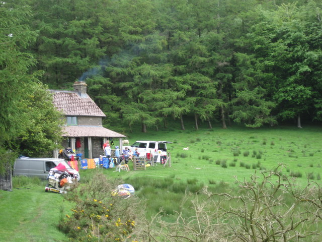
Marsh's Pool near Llanidloes Summer house with opportunities for water sport
Marsh's Pool near Llanidloes Credit: Adrian Smith

The requested URL returned error: 429 Too Many Requests

If you have any feedback on the listing, please let us know in the comments section below.

Blaen Pathiog Images

Images are sourced within 2km of 52.425757/-3.5805955 or Grid Reference SN9282. Thanks to Geograph Open Source API. All images are credited.
Marsh's Pool near Llanidloes Summer house with opportunities for water sport
Marsh's Pool near Llanidloes
Summer house with opportunities for water sport
Bridleway signage, Llangurig Overgrown with thorns and lichens. Jubilee Bank Holiday June 2012
Bridleway signage, Llangurig
Overgrown with thorns and lichens. Jubilee Bank Holiday June 2012
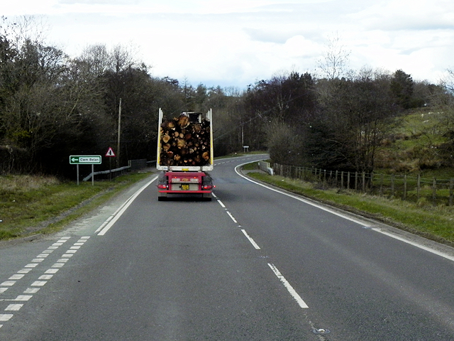
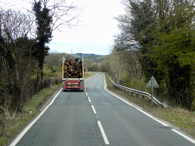
Northbound A470 between Llangurig and Cwmbelan The A470, also known as the Cardiff to Glan Conwy Trunk Road, is the major long-distance road in Wales, from Cardiff on the south coast to Llandudno on the north coast. It is 185 miles long, and has undergone considerable road improvement in the last two decades. While previously one had to navigate the narrow roads of Llanidloes and Dolgellau, both these market towns are now bypassed due to extensive road modernisation.

The road travels through two of Wales's national parks, the Brecon Beacons in the South and Snowdonia National Park, starting just south of Dinas Mawddwy in the North. It is a primary trunk route throughout its length, and the southernmost 26 miles, from Cardiff Bay to Merthyr Tydfil, is mainly direct and good quality dual carriageway, but most of the route from north of Merthyr to Llandudno is single carriageway.
<span class="nowrap"><a title="http://www.sabre-roads.org.uk/wiki/index.php?title=A470" rel="nofollow ugc noopener" href="http://www.sabre-roads.org.uk/wiki/index.php?title=A470">Link</a><img style="margin-left:2px;" alt="External link" title="External link - shift click to open in new window" src="https://s1.geograph.org.uk/img/external.png" width="10" height="10"/></span>  SABRE
Northbound A470 between Llangurig and Cwmbelan
The A470, also known as the Cardiff to Glan Conwy Trunk Road, is the major long-distance road in Wales, from Cardiff on the south coast to Llandudno on the north coast. It is 185 miles long, and has undergone considerable road improvement in the last two decades. While previously one had to navigate the narrow roads of Llanidloes and Dolgellau, both these market towns are now bypassed due to extensive road modernisation. The road travels through two of Wales's national parks, the Brecon Beacons in the South and Snowdonia National Park, starting just south of Dinas Mawddwy in the North. It is a primary trunk route throughout its length, and the southernmost 26 miles, from Cardiff Bay to Merthyr Tydfil, is mainly direct and good quality dual carriageway, but most of the route from north of Merthyr to Llandudno is single carriageway. LinkExternal link SABRE
Layby on Southbound A470 between Cwmbelan and Llangurig The A470, also known as the Cardiff to Glan Conwy Trunk Road, is the major long-distance road in Wales, from Cardiff on the south coast to Llandudno on the north coast. It is 185 miles long, and has undergone considerable road improvement in the last two decades. While previously one had to navigate the narrow roads of Llanidloes and Dolgellau, both these market towns are now bypassed due to extensive road modernisation.

The road travels through two of Wales's national parks, the Brecon Beacons in the South and Snowdonia National Park, starting just south of Dinas Mawddwy in the North. It is a primary trunk route throughout its length, and the southernmost 26 miles, from Cardiff Bay to Merthyr Tydfil, is mainly direct and good quality dual carriageway, but most of the route from north of Merthyr to Llandudno is single carriageway.
<span class="nowrap"><a title="http://www.sabre-roads.org.uk/wiki/index.php?title=A470" rel="nofollow ugc noopener" href="http://www.sabre-roads.org.uk/wiki/index.php?title=A470">Link</a><img style="margin-left:2px;" alt="External link" title="External link - shift click to open in new window" src="https://s1.geograph.org.uk/img/external.png" width="10" height="10"/></span>  SABRE
Layby on Southbound A470 between Cwmbelan and Llangurig
The A470, also known as the Cardiff to Glan Conwy Trunk Road, is the major long-distance road in Wales, from Cardiff on the south coast to Llandudno on the north coast. It is 185 miles long, and has undergone considerable road improvement in the last two decades. While previously one had to navigate the narrow roads of Llanidloes and Dolgellau, both these market towns are now bypassed due to extensive road modernisation. The road travels through two of Wales's national parks, the Brecon Beacons in the South and Snowdonia National Park, starting just south of Dinas Mawddwy in the North. It is a primary trunk route throughout its length, and the southernmost 26 miles, from Cardiff Bay to Merthyr Tydfil, is mainly direct and good quality dual carriageway, but most of the route from north of Merthyr to Llandudno is single carriageway. LinkExternal link SABRE
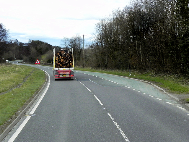
Northbound A470 near to Cwmbelan, The A470, also known as the Cardiff to Glan Conwy Trunk Road, is the major long-distance road in Wales, from Cardiff on the south coast to Llandudno on the north coast. It is 185 miles long, and has undergone considerable road improvement in the last two decades. While previously one had to navigate the narrow roads of Llanidloes and Dolgellau, both these market towns are now bypassed due to extensive road modernisation.

The road travels through two of Wales's national parks, the Brecon Beacons in the South and Snowdonia National Park, starting just south of Dinas Mawddwy in the North. It is a primary trunk route throughout its length, and the southernmost 26 miles, from Cardiff Bay to Merthyr Tydfil, is mainly direct and good quality dual carriageway, but most of the route from north of Merthyr to Llandudno is single carriageway.
<span class="nowrap"><a title="http://www.sabre-roads.org.uk/wiki/index.php?title=A470" rel="nofollow ugc noopener" href="http://www.sabre-roads.org.uk/wiki/index.php?title=A470">Link</a><img style="margin-left:2px;" alt="External link" title="External link - shift click to open in new window" src="https://s1.geograph.org.uk/img/external.png" width="10" height="10"/></span>  SABRE
Northbound A470 near to Cwmbelan,
The A470, also known as the Cardiff to Glan Conwy Trunk Road, is the major long-distance road in Wales, from Cardiff on the south coast to Llandudno on the north coast. It is 185 miles long, and has undergone considerable road improvement in the last two decades. While previously one had to navigate the narrow roads of Llanidloes and Dolgellau, both these market towns are now bypassed due to extensive road modernisation. The road travels through two of Wales's national parks, the Brecon Beacons in the South and Snowdonia National Park, starting just south of Dinas Mawddwy in the North. It is a primary trunk route throughout its length, and the southernmost 26 miles, from Cardiff Bay to Merthyr Tydfil, is mainly direct and good quality dual carriageway, but most of the route from north of Merthyr to Llandudno is single carriageway. LinkExternal link SABRE
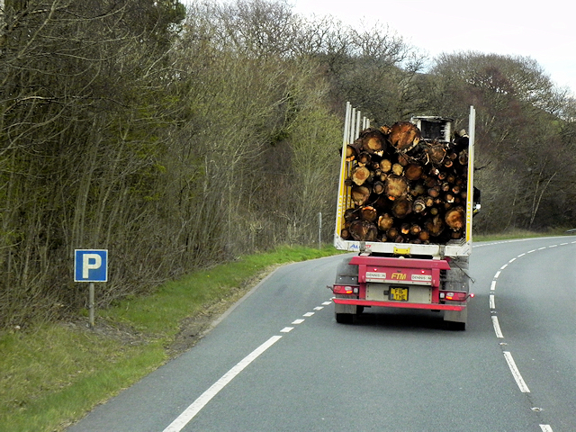
Layby on Northbound A470 near to Cwmbelan The A470, also known as the Cardiff to Glan Conwy Trunk Road, is the major long-distance road in Wales, from Cardiff on the south coast to Llandudno on the north coast. It is 185 miles long, and has undergone considerable road improvement in the last two decades. While previously one had to navigate the narrow roads of Llanidloes and Dolgellau, both these market towns are now bypassed due to extensive road modernisation.

The road travels through two of Wales's national parks, the Brecon Beacons in the South and Snowdonia National Park, starting just south of Dinas Mawddwy in the North. It is a primary trunk route throughout its length, and the southernmost 26 miles, from Cardiff Bay to Merthyr Tydfil, is mainly direct and good quality dual carriageway, but most of the route from north of Merthyr to Llandudno is single carriageway.
<span class="nowrap"><a title="http://www.sabre-roads.org.uk/wiki/index.php?title=A470" rel="nofollow ugc noopener" href="http://www.sabre-roads.org.uk/wiki/index.php?title=A470">Link</a><img style="margin-left:2px;" alt="External link" title="External link - shift click to open in new window" src="https://s1.geograph.org.uk/img/external.png" width="10" height="10"/></span>  SABRE
Layby on Northbound A470 near to Cwmbelan
The A470, also known as the Cardiff to Glan Conwy Trunk Road, is the major long-distance road in Wales, from Cardiff on the south coast to Llandudno on the north coast. It is 185 miles long, and has undergone considerable road improvement in the last two decades. While previously one had to navigate the narrow roads of Llanidloes and Dolgellau, both these market towns are now bypassed due to extensive road modernisation. The road travels through two of Wales's national parks, the Brecon Beacons in the South and Snowdonia National Park, starting just south of Dinas Mawddwy in the North. It is a primary trunk route throughout its length, and the southernmost 26 miles, from Cardiff Bay to Merthyr Tydfil, is mainly direct and good quality dual carriageway, but most of the route from north of Merthyr to Llandudno is single carriageway. LinkExternal link SABRE
Road to Cwmbelan
Road to Cwmbelan
Lay-by on the A470 at Cwmbelan The A470 is the main link from South to North Wales and passes through some of the best countryside that Wales has to offer. This route is always busy and in some parts hazardous in bad weather.
Lay-by on the A470 at Cwmbelan
The A470 is the main link from South to North Wales and passes through some of the best countryside that Wales has to offer. This route is always busy and in some parts hazardous in bad weather.
A470 near Coed y Geli
A470 west of Coed y Geli
Ordnance Survey Cut Mark This OS cut mark can be found on No1 Wesley Terrace. It marks a point 216.451m above mean sea level.
Ordnance Survey Cut Mark
This OS cut mark can be found on No1 Wesley Terrace. It marks a point 216.451m above mean sea level.
The lane to Blaen-y-glyn farm
The minor road near Blaen-y-glyn The roof of a large chicken shed is visible on the right of the road.
The minor road near Blaen-y-glyn
The roof of a large chicken shed is visible on the right of the road.
The large chicken shed near Blaen-y-glyn
A fine tree near the minor road
Looking towards Blaen Pathiog
A hayfield near Rhyd-yr onen This translates as the ash tree ford. Ordnance Survey seems to have missed a hyphen from the Welsh name.
A hayfield near Rhyd-yr onen
This translates as the ash tree ford. Ordnance Survey seems to have missed a hyphen from the Welsh name.
A field near Afon Brochan
Show me another place!

Blaen Pathiog is located at Grid Ref: SN9282 (Lat: 52.425757, Lng: -3.5805955)

Unitary Authority: Powys

Police Authority: Dyfed Powys

What 3 Words

///cools.amplified.barmaid. Near Llanidloes, Powys

Nearby Locations

Blaen Pathiog Glyn Brochan

Related Wikis

Blaen-y-glyn

Blaen-y-glyn is an area in the community of Llangurig, Powys, Wales, which is 67 miles (108 km) from Cardiff and 160 miles (258 km) from London. Cadw-listed...

Llangurig branch

The Llangurig branch was a part of a proposed scheme by the Manchester and Milford Railway (M&MR) to connect industrialised Northwest England with the...

Afon Dulas, Llanidloes

The Afon Dulas is a river in Powys, Wales (Afon is Welsh for river). It is a headwater tributary of the River Severn, which it joins at Llanidloes opposite...

Llangurig railway station

Llangurig railway station was intended to serve the village and rural locale of Llangurig in the Welsh county of Powys. The station, which was on the Llangurig...

Nearby Amenities

Located within 500m of 52.425757,-3.5805955
Blaen Pathiog
Natural: peak
Lat/Long: 52.4254526/-3.5783113
Place: farm
Lat/Long: 52.4270897/-3.5875017
Direction: SSE
Generator Method: photovoltaic
Generator Output Electricity: yes
Generator Solar Modules: 15
Generator Source: solar
Generator Type: solar_photovoltaic_panel
Location: roof
Power: generator
Lat/Long: 52.4271008/-3.5871045
The data included in this document is from www.openstreetmap.org. The data is made available under ODbL.

Have you been to Blaen Pathiog?

Leave your review of Blaen Pathiog below (or comments, questions and feedback).