Botich

Hill, Mountain in Perthshire

Scotland

Botich

Track Through the Forest
Track Through the Forest Credit: Peter Gamble

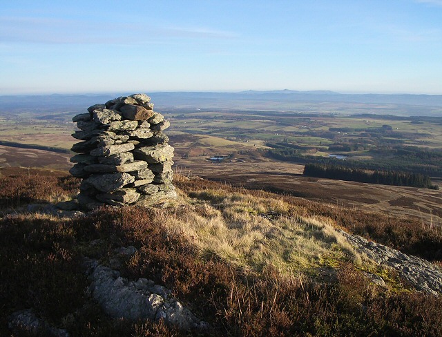
Botich is a small hill located in the region of Perthshire, Scotland. It is situated in the southern part of the Highlands, approximately 10 miles south of the town of Pitlochry. Rising to an elevation of around 1,968 feet (600 meters), Botich is considered a relatively modest hill in comparison to the towering mountains that surround it.

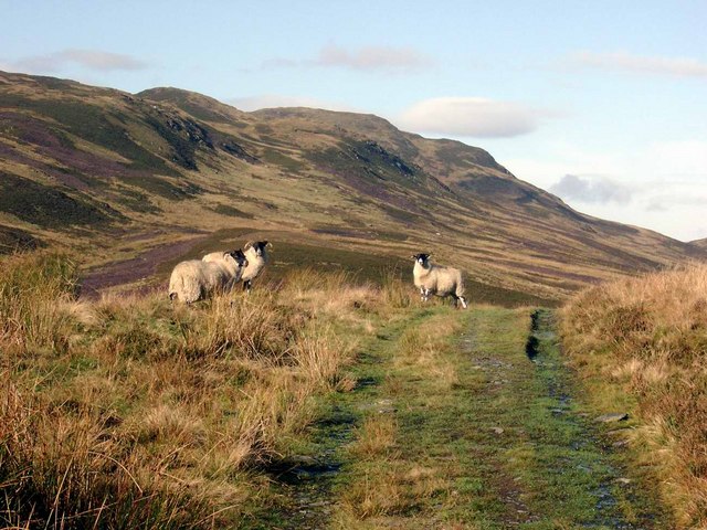
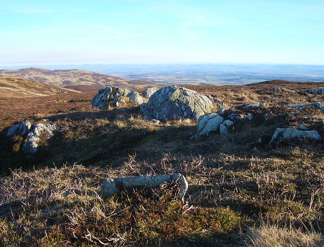
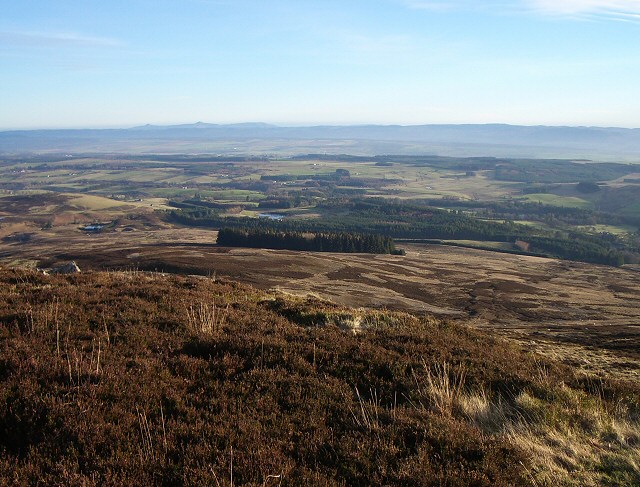
The hill is characterized by its gentle slopes, covered in heather and grasses, making it a popular destination for hikers and nature enthusiasts. The ascent to the summit of Botich is relatively straightforward, offering stunning panoramic views of the surrounding landscape. On a clear day, hikers can enjoy breathtaking vistas of the nearby Loch Tummel and the distant peaks of the Grampian Mountains.

Botich is part of a larger network of hills and mountains in the area, providing ample opportunities for outdoor activities such as hillwalking, birdwatching, and photography. The surrounding area is also home to a variety of wildlife, including red deer, golden eagles, and red squirrels.

Despite its relatively modest size, Botich holds a special place in the hearts of locals and visitors alike. Its tranquil atmosphere, combined with its accessibility and stunning views, make it a popular destination for those seeking a peaceful escape in the heart of Scotland's picturesque countryside.

If you have any feedback on the listing, please let us know in the comments section below.
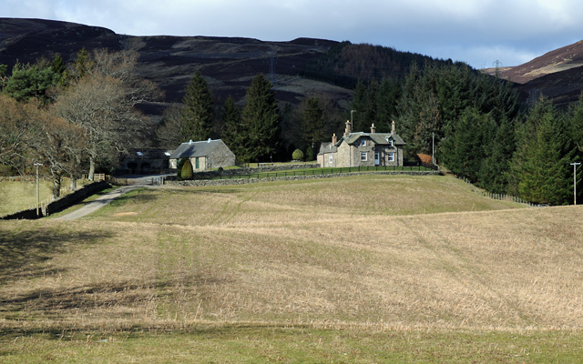
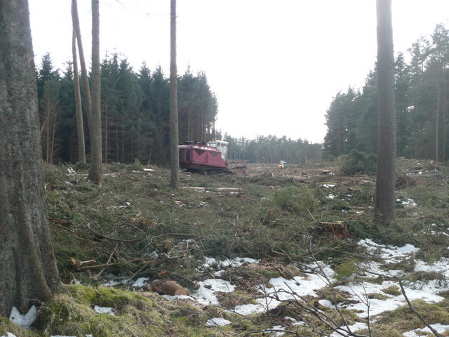
Botich Images

Images are sourced within 2km of 56.460733/-3.7455094 or Grid Reference NN9231. Thanks to Geograph Open Source API. All images are credited.

Track Through the Forest
Little Dunie
Little Dunie
Clear felling beside Greenfield House The recent gales also felled some trees.
Clear felling beside Greenfield House
The recent gales also felled some trees.
Forestry operations Clear fell near Greenfield House.
Forestry operations
Clear fell near Greenfield House.
Shooting butt on Creagan Soilleir
"You lookin' at me?"
Oval plantation This roughly oval forestry plantation makes a striking object seen in the distance from Stroness hill. Larches in the centre are surrounded by a ring of darker trees.
Oval plantation
This roughly oval forestry plantation makes a striking object seen in the distance from Stroness hill. Larches in the centre are surrounded by a ring of darker trees.
Moorland fence Looking along the ridge which runs south-east from Meall Reamhar. The two bumps on the distant horizon to the right of the picture are East and West Lomond.
Moorland fence
Looking along the ridge which runs south-east from Meall Reamhar. The two bumps on the distant horizon to the right of the picture are East and West Lomond.
Looking back along the fence This fence runs along the ridge past Meall Reamhar, seen in the distance on the right.
Looking back along the fence
This fence runs along the ridge past Meall Reamhar, seen in the distance on the right.
Rocky outcrop A fence follows the high ground along this ridge, but passes below outcrops like this.
Rocky outcrop
A fence follows the high ground along this ridge, but passes below outcrops like this.
Craig na Hash Not so much a crag, more like a jumble of rocks around the 559 spot height. The view across Strathearn and beyond is extensive, and the rocks provide somewhere dry to sit and enjoy it.
Craig na Hash
Not so much a crag, more like a jumble of rocks around the 559 spot height. The view across Strathearn and beyond is extensive, and the rocks provide somewhere dry to sit and enjoy it.
Boggy patch Even ridges have their boggy bits which are skirted by the prudent.
Boggy patch
Even ridges have their boggy bits which are skirted by the prudent.
Botich The ground drops steeply towards Glen Almond from here, with Strathearn beyond. The twin tops of East and West Lomond <a href="https://www.geograph.org.uk/gridref/NO2406">NO2406</a> and <a href="https://www.geograph.org.uk/gridref/NO1906">NO1906</a> can be seen on the distant horizon, with the steep bank of Bishop Hill <a href="https://www.geograph.org.uk/gridref/NO1804">NO1804</a> to their right.
Botich
The ground drops steeply towards Glen Almond from here, with Strathearn beyond. The twin tops of East and West Lomond NO2406 and NO1906 can be seen on the distant horizon, with the steep bank of Bishop Hill NO1804 to their right.
View from Botich Looking down from Botich you can see the plantation which stands out from across Glen Almond <a href="https://www.geograph.org.uk/photo/324446">NN9330 : Oval plantation</a>
View from Botich
Looking down from Botich you can see the plantation which stands out from across Glen Almond NN9330 : Oval plantation
Quarry The main quarry to the north is disused, but it looks as if vehicles still access the level area at the top of the spoil heap.
Quarry
The main quarry to the north is disused, but it looks as if vehicles still access the level area at the top of the spoil heap.
Access to plantation This plantation has been extended recently, and this is one of its access points. The top section can be swung upwards to leave a section of fence just low enough to step over. There were a lot of pheasants nearby which probably are reared in the shelter of the trees.
Access to plantation
This plantation has been extended recently, and this is one of its access points. The top section can be swung upwards to leave a section of fence just low enough to step over. There were a lot of pheasants nearby which probably are reared in the shelter of the trees.
Dunie Burn A track crosses the burn by a rough bridge. In the late afternoon the lower slopes are in shade, but the sunlight picks out the trees further up the hill.
Dunie Burn
A track crosses the burn by a rough bridge. In the late afternoon the lower slopes are in shade, but the sunlight picks out the trees further up the hill.
Steep slopes The ground rises steeply to the north east from the track which follows the power lines.
Steep slopes
The ground rises steeply to the north east from the track which follows the power lines.
Show me another place!

Botich is located at Grid Ref: NN9231 (Lat: 56.460733, Lng: -3.7455094)

Unitary Authority: Perth and Kinross

Police Authority: Tayside

What 3 Words

///promising.design.frogs. Near Crieff, Perth & Kinross

Nearby Locations

Craig na Hash Botich

Related Wikis

Glenalmond

Glenalmond or Glen Almond (Scottish Gaelic: Gleann Amain) is a glen which stretches for several miles to the west of the city of Perth in Perth and Kinross...
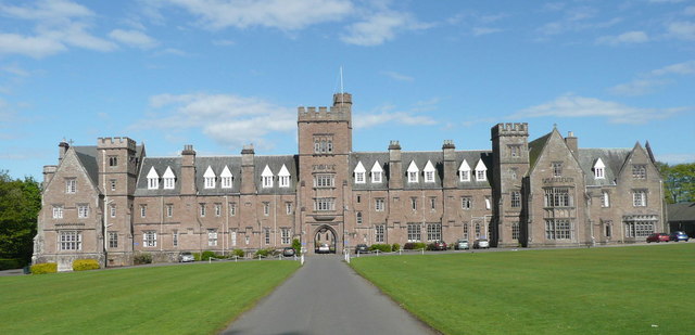
Glenalmond College

Glenalmond College is a co-educational independent boarding school in Perth and Kinross, Scotland, for children aged between 12 and 18 years. It is situated...

Amulree

Amulree (Scottish Gaelic: Àth Maol Ruibhe, 'Ford of [St.] Maelrubha') is a small hamlet in Perth and Kinross, Scotland. It lies in hilly country on the...

Harrietfield

Harrietfield is a village near Glenalmond in Perth and Kinross. It is about 9 miles (14 km) north-west of Perth. It has been suggested that the village...

Achnafauld

Achnafauld (, Scottish Gaelic: Achadh na Follt) is a settlement in the Scottish Highlands, about 15 miles (24 km) northwest of Perth. It is located in...

Fowlis Wester

Fowlis Wester is a small village in Perth and Kinross, Scotland. It is around 6 kilometres (3.7 mi) east of Crieff and 19 kilometres (12 mi) west of Perth...

A822 road

The A822 is a road which runs through Perthshire in Scotland. It runs from the A9 road at Greenloaning, and rejoins the A9 at Dunkeld. It goes through...

Monzie Castle

Monzie Castle is a castellated mansion, near Monzie in Perth and Kinross, Scotland that incorporates an L-plan, early 17th-century building that was enlarged...

Nearby Amenities

Located within 500m of 56.460733,-3.7455094
Botich
Ele: 534
Natural: peak
Lat/Long: 56.4602145/-3.745652
The data included in this document is from www.openstreetmap.org. The data is made available under ODbL.

Have you been to Botich?

Leave your review of Botich below (or comments, questions and feedback).