Foel y Groes
Hill, Mountain in Merionethshire
Wales
Foel y Groes

Foel y Groes is a prominent hill located in the county of Merionethshire, Wales. Situated in the Snowdonia National Park, it forms part of the Rhinogydd mountain range, which is renowned for its stunning natural beauty and rugged landscapes. With an elevation of 415 meters (1,361 feet), Foel y Groes offers breathtaking panoramic views of the surrounding countryside and beyond.
The hill is characterized by its gentle sloping sides, covered in heather and grasses, which provide a habitat for a variety of wildlife including birds, small mammals, and insects. It is also home to a diverse range of plant species, adding to its ecological significance.
Foel y Groes is a popular destination for outdoor enthusiasts, hikers, and nature lovers. Its relatively moderate gradient and well-defined paths make it accessible to walkers of all abilities. The summit rewards visitors with stunning vistas of the nearby Rhinog Fawr and Rhinog Fach peaks, as well as the sweeping valleys below.
The hill's location within the Snowdonia National Park means it is surrounded by an array of recreational activities and attractions. Nearby, visitors can explore picturesque villages, historic sites, and ancient woodlands. The surrounding area also offers opportunities for mountain biking, horse riding, and fishing in the numerous lakes and rivers.
Foel y Groes is not only a scenic destination but also a place of cultural significance. It is steeped in Welsh history and folklore, with tales of old battles and mythical creatures. Visitors to the hill can immerse themselves in this rich heritage, adding an extra layer of intrigue and fascination to their experience.
Overall, Foel y Groes is a captivating and accessible hill, offering both natural beauty and cultural significance to those who venture to its summit.
If you have any feedback on the listing, please let us know in the comments section below.
Foel y Groes Images
Images are sourced within 2km of 52.798343/-3.6057628 or Grid Reference SH9123. Thanks to Geograph Open Source API. All images are credited.


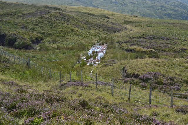
![Gwaun yr Hen-Luest [Moor of the Old Hut] To the right of the photo is an ancient & boggy track, not shown on the map.](https://s3.geograph.org.uk/geophotos/04/61/70/4617043_79449d1c.jpg)

![Bog and sheep Inhospitable ground, with just a few sheep [the white dot in the distance].](https://s2.geograph.org.uk/geophotos/04/61/70/4617054_7e82bbc3.jpg)


Foel y Groes is located at Grid Ref: SH9123 (Lat: 52.798343, Lng: -3.6057628)
Unitary Authority: Gwynedd
Police Authority: North Wales
What 3 Words
///mergers.campers.decoded. Near Llanuwchllyn, Gwynedd
Nearby Locations
Related Wikis

Bwlch y Groes
Bwlch y Groes (translates from Welsh as pass of the cross) is the second highest public road mountain pass in Wales, with a summit altitude of 545 metres...
Esgeiriau Gwynion
Esgeiriau Gwynion (Welsh for "white shanks") is a mountain in north Wales. It is the smallest of the three Marilyns that form the Aran range, the others...

Foel y Geifr
Foel y Geifr is a subsidiary summit of Esgeiriau Gwynion, and included in a group of hills known as the Hirnantau. These hills rise from the south east...

Rhiwargor
Rhiwargor is a hamlet in Powys, Wales. It is located north of Lake Vyrnwy. The hamlet is made up of a few houses with no amenities. It does however, lie...
Nearby Amenities
Located within 500m of 52.798343,-3.6057628Have you been to Foel y Groes?
Leave your review of Foel y Groes below (or comments, questions and feedback).