Bonerick Hill
Hill, Mountain in Kirkcudbrightshire
Scotland
Bonerick Hill

Bonerick Hill is a prominent hill located in the region of Kirkcudbrightshire, Scotland. Standing at an elevation of approximately 380 meters (1,250 feet), it forms part of the Galloway Hills, which are known for their picturesque landscapes and stunning vistas.
The hill is situated in close proximity to the town of Gatehouse of Fleet, making it easily accessible for hikers and nature enthusiasts. It offers a relatively moderate ascent, making it a popular destination for walkers of various skill levels.
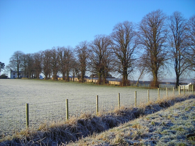
Bonerick Hill is characterized by its rolling slopes, covered in a diverse range of vegetation including grasses, heather, and scattered trees. Its summit provides panoramic views of the surrounding countryside, with the Solway Firth and the Galloway Forest Park visible in the distance.
The hill is also known for its historical significance, as it was once the site of an Iron Age fort. Visitors can still see the remnants of the fort's earthworks and defensive ditches, providing a glimpse into the area's ancient past.
Wildlife enthusiasts will also appreciate Bonerick Hill, as it is home to a variety of bird species, including buzzards, kestrels, and peregrine falcons. The hillside is also frequented by red deer, rabbits, and other small mammals.
Overall, Bonerick Hill offers a combination of natural beauty, historical interest, and recreational opportunities, making it a must-visit for those exploring the Kirkcudbrightshire region of Scotland.
If you have any feedback on the listing, please let us know in the comments section below.
Bonerick Hill Images
Images are sourced within 2km of 55.075116/-3.7137544 or Grid Reference NX9076. Thanks to Geograph Open Source API. All images are credited.


Bonerick Hill is located at Grid Ref: NX9076 (Lat: 55.075116, Lng: -3.7137544)
Unitary Authority: Dumfries and Galloway
Police Authority: Dumfries and Galloway
What 3 Words
///doubt.cookbooks.breeze. Near Dumfries, Dumfries & Galloway
Nearby Locations
Related Wikis

Terregles
Terregles () is a village and civil parish near Dumfries, in Dumfries and Galloway, Scotland. It lies in the former county of Kirkcudbrightshire. The name...

Hallhill Covenanter Martyrs Memorial
The Hallhill Covenanter Martyrs Memorial at Irongray (NX 910797) near Kirkpatrick Irongray Church in the old county of Kirkcudbrightshire, now Dumfries...

Terregles House
Terregles House was a late 18th-century country house, located near Terregles, in the historical county of Kirkcudbrightshire around 2 miles west of Dumfries...

Easthill stone circle
Easthill stone circle (grid reference NX91937388), also known as the Seven Grey Stanes, is a small oval stone circle 3¾ miles south-west of Dumfries. Eight...
Nearby Amenities
Located within 500m of 55.075116,-3.7137544Have you been to Bonerick Hill?
Leave your review of Bonerick Hill below (or comments, questions and feedback).