Wellgrain Dod

Hill, Mountain in Lanarkshire

Scotland

Wellgrain Dod

Summer evening view towards the Lowther Hills A view across heather moorland south of Bulmer Moss on a late-June evening.
Summer evening view towards the Lowther Hills Credit: Alan O'Dowd

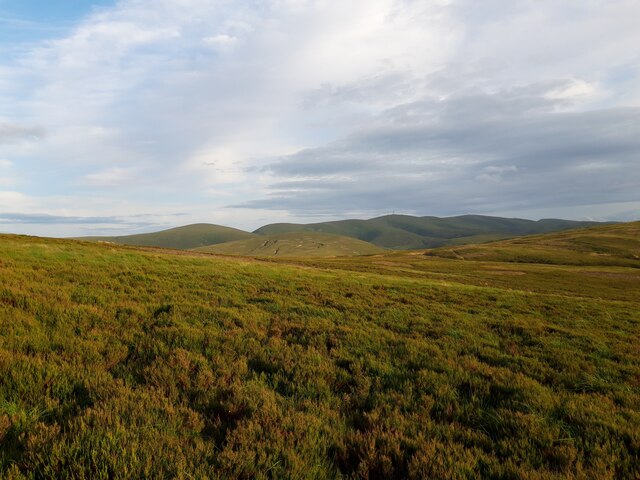
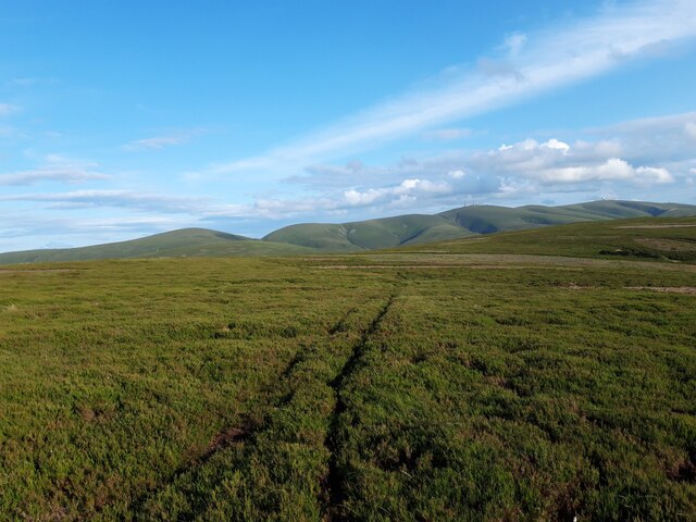
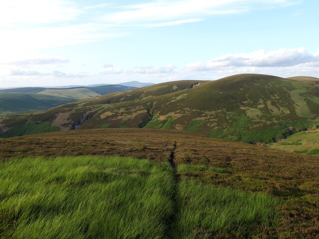
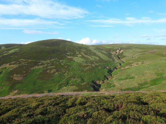
Wellgrain Dod is a prominent hill located in Lanarkshire, Scotland. Situated in the southern part of the country, it forms part of the beautiful landscape that characterizes the region. Wellgrain Dod stands at an elevation of approximately 600 meters (1,969 feet) above sea level, making it a notable landmark in the area.

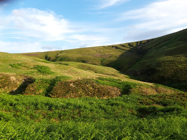
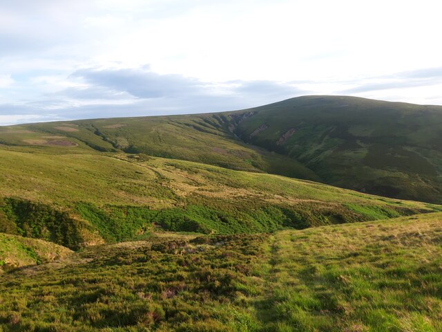
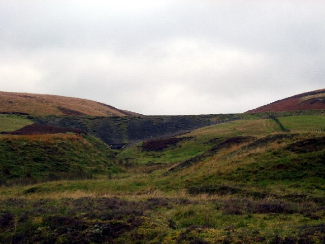
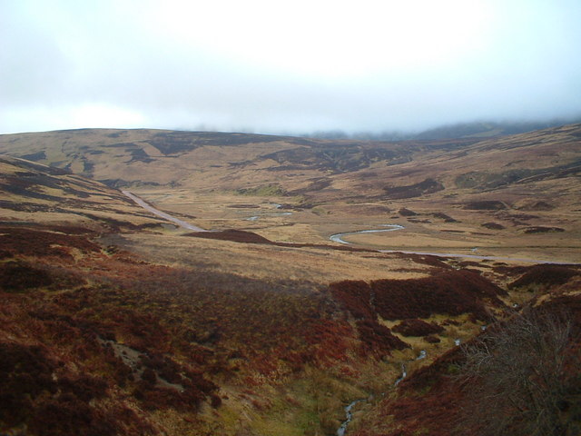
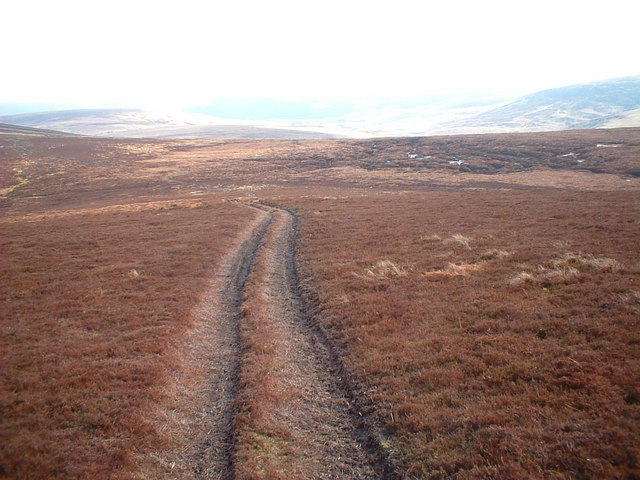
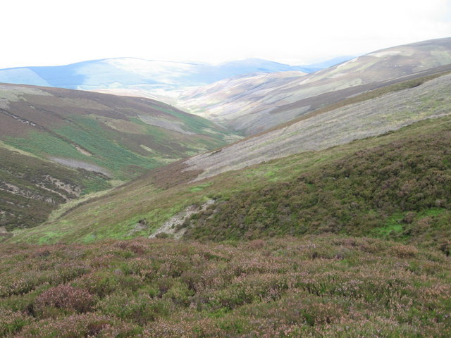
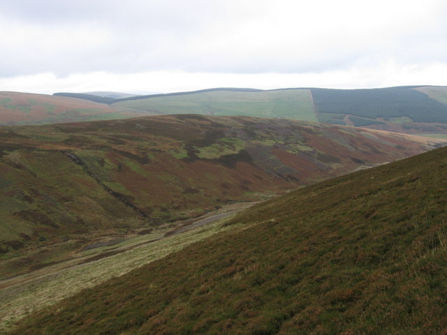
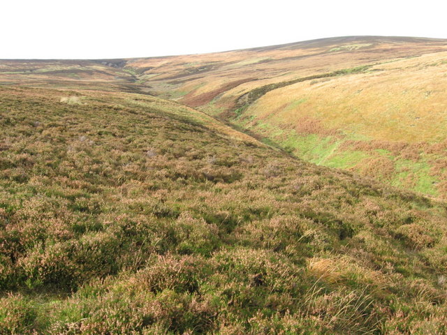
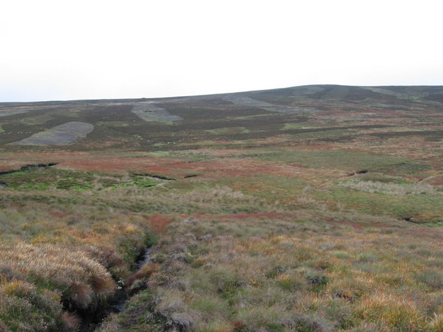
The hill is known for its picturesque views, offering visitors and hikers stunning panoramas of the surrounding countryside. Its position provides a vantage point to observe the nearby towns and villages, as well as the rolling hills and lush green valleys that stretch out into the distance.

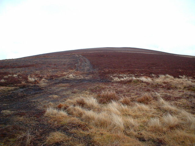
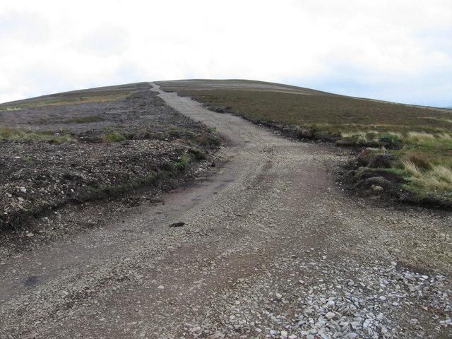
Wellgrain Dod is an attractive destination for outdoor enthusiasts and nature lovers, providing ample opportunities for hiking, walking, and exploring the natural environment. The hill is accessible via footpaths and trails that wind their way through the surrounding countryside, offering various routes for different levels of difficulty.

The area surrounding Wellgrain Dod is abundant in flora and fauna, with heather, grasses, and wildflowers covering its slopes. The hill also supports a diverse range of wildlife, including birds of prey, such as buzzards and kestrels, as well as smaller mammals like rabbits and hares.

Overall, Wellgrain Dod is a captivating hill in Lanarkshire, offering visitors a chance to immerse themselves in the natural beauty of the Scottish countryside. Its accessibility, stunning views, and rich biodiversity make it a popular destination for outdoor activities and a must-visit location for those seeking to experience the charm of the region.

If you have any feedback on the listing, please let us know in the comments section below.

Wellgrain Dod Images

Images are sourced within 2km of 55.442994/-3.7388684 or Grid Reference NS9017. Thanks to Geograph Open Source API. All images are credited.

Summer evening view towards the Lowther Hills A view across heather moorland south of Bulmer Moss on a late-June evening.
Summer evening view towards the Lowther Hills
A view across heather moorland south of Bulmer Moss on a late-June evening.
Junction on the B797
Wheel ruts on Wool Law Looking towards Dun Law, Dungrain Law and the Lowther Hills on a late-June evening.
Wheel ruts on Wool Law
Looking towards Dun Law, Dungrain Law and the Lowther Hills on a late-June evening.
Faint path on the north-eastern spur of Wool Law Looking towards Clowgill Dod and Wellgrain Dod, on the opposite side of the Bellgill Burn.
Faint path on the north-eastern spur of Wool Law
Looking towards Clowgill Dod and Wellgrain Dod, on the opposite side of the Bellgill Burn.
View into Well Grain Various paths, erosion scars and signs of old lead-mining workings are visible on these hillsides.
View into Well Grain
Various paths, erosion scars and signs of old lead-mining workings are visible on these hillsides.
Grains (stream valleys) at the head of the Bellgill Burn The various gullies visible here are named Well Grain, Middle Grain and Rushy Grain. 'Grain' is a Scots word meaning 'the branch or fork of a stream or river'. It usually describes small branches at the upper reaches of a burn.
Grains (stream valleys) at the head of the Bellgill Burn
The various gullies visible here are named Well Grain, Middle Grain and Rushy Grain. 'Grain' is a Scots word meaning 'the branch or fork of a stream or river'. It usually describes small branches at the upper reaches of a burn.
Looking towards Wool Law from slopes near Well Grain A view of the hillsides around the headwaters of the Bellgill Burn on a late-June evening.
Looking towards Wool Law from slopes near Well Grain
A view of the hillsides around the headwaters of the Bellgill Burn on a late-June evening.
Old railway embankment near Leadhills This is looking up Scapcleugh Burn but really just shows the old railway embankment and typical Leadhills hills.
Old railway embankment near Leadhills
This is looking up Scapcleugh Burn but really just shows the old railway embankment and typical Leadhills hills.
Elvan Water
Elvan Water
Wellgrain Dod
Wellgrain Dod
Coom Dod
Coom Dod
Laggen  Gill below Wellgrain Dod
Laggen Gill below Wellgrain Dod
New track on Coom Dod
Laggen Gill
Laggen Gill
Long Cleuch from Middle Wood
Coom Dod ridge from Dun Moss
Meander on the Shortcleuch Water A spectacular bend on the river. The B7040 can be seen on the left hand side. The high hill to the right is Lousie Wood Law <a href="https://www.geograph.org.uk/gridref/NS9316">NS9316</a>.
Meander on the Shortcleuch Water
A spectacular bend on the river. The B7040 can be seen on the left hand side. The high hill to the right is Lousie Wood Law NS9316.
Heather cutting patterns on Ravengill Dod A light snow cover reveals unusual patterns on grass, bracken and heather
Heather cutting patterns on Ravengill Dod
A light snow cover reveals unusual patterns on grass, bracken and heather
Show me another place!

Wellgrain Dod is located at Grid Ref: NS9017 (Lat: 55.442994, Lng: -3.7388684)

Unitary Authority: South Lanarkshire

Police Authority: Lanarkshire

What 3 Words

///slim.toggle.implanted. Near Douglas, South Lanarkshire

Related Wikis

Leadhills

Leadhills, originally settled for the accommodation of miners, is a village in South Lanarkshire, Scotland, 5+3⁄4 miles (9.3 km) WSW of Elvanfoot. The...

Scots Mining Company House

The Scots Mining Company House, also known as Woodlands Hall, is an early-18th-century mansion house in Leadhills, South Lanarkshire, Scotland. The house...

Leadhills railway station

Leadhills railway station was opened on 1 October 1901 as the intermediate stop on the Leadhills and Wanlockhead Light Railway and served the lead mining...

Leadhills and Wanlockhead Railway

The Leadhills and Wanlockhead Railway is a 2 ft (610 mm) narrow gauge railway in South Lanarkshire, Scotland. It is laid on the trackbed of the former...

Nearby Amenities

Located within 500m of 55.442994,-3.7388684
Wellgrain Dod
Natural: peak
Lat/Long: 55.4437895/-3.7360827
Old lead mine
Historic: mine
Lat/Long: 55.439245/-3.7387774
Old lead mine
Historic: mine
Lat/Long: 55.4417402/-3.7369106
Old lead mine
Historic: mine
Lat/Long: 55.4413142/-3.7357948
The data included in this document is from www.openstreetmap.org. The data is made available under ODbL.

Have you been to Wellgrain Dod?

Leave your review of Wellgrain Dod below (or comments, questions and feedback).