Rosehill

Hill, Mountain in Dumfriesshire

Scotland

Rosehill

Coldside Road
Coldside Road Credit: Steven Brown

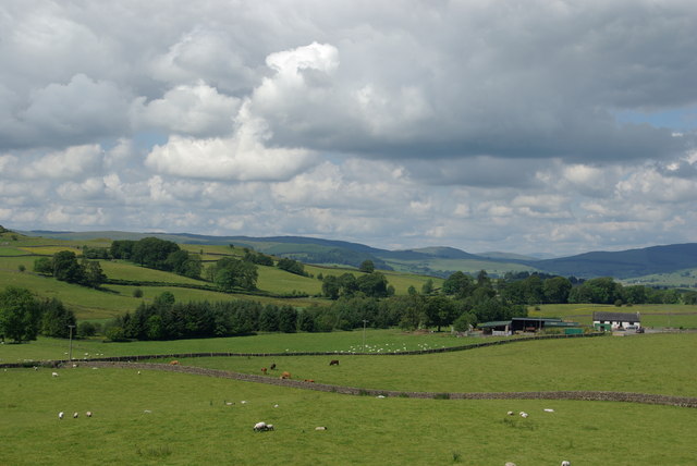
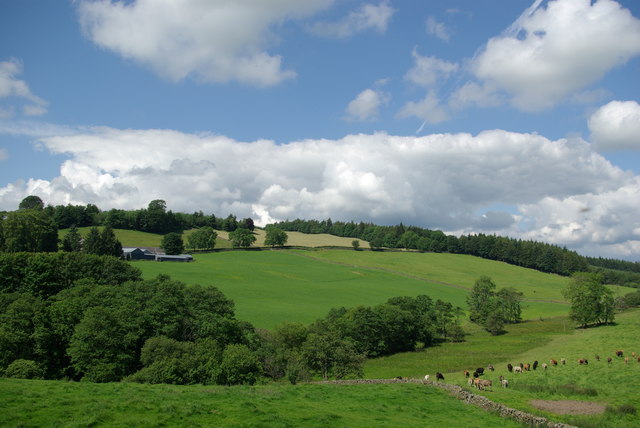
Rosehill is a prominent hill located in the region of Dumfriesshire, in the southwestern part of Scotland. Rising to a height of approximately 358 meters, it offers breathtaking panoramic views of the surrounding landscapes. It is situated within the rolling hills of the beautiful Scottish countryside, providing visitors with an idyllic and serene setting.

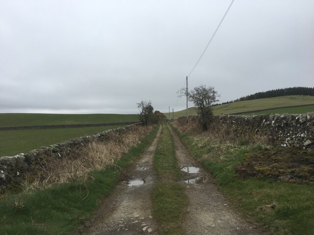
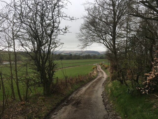
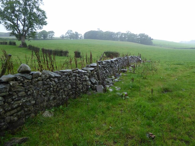
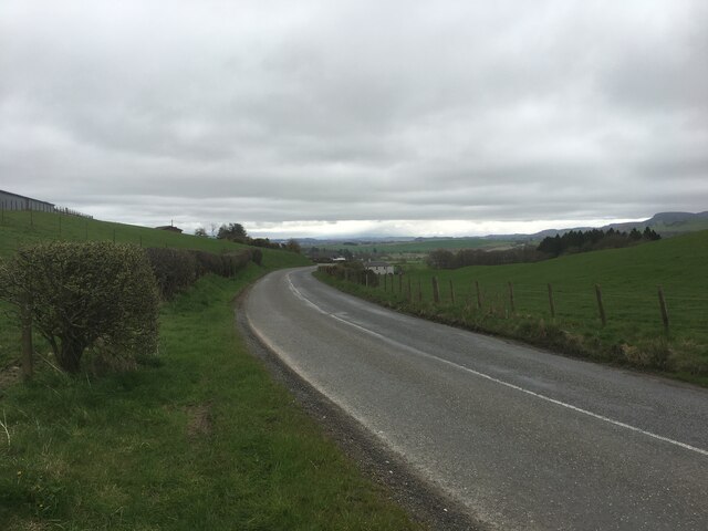
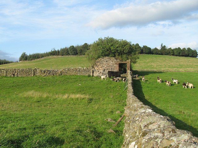
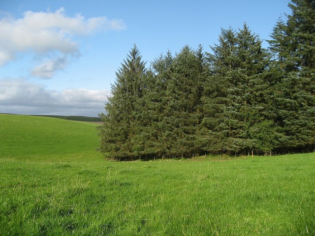
The hill is covered in lush green vegetation, with patches of heather and wildflowers adding splashes of color to the landscape. The diverse flora and fauna found on Rosehill make it a haven for nature enthusiasts and hikers. The hill is crisscrossed with well-maintained trails, allowing visitors to explore its slopes and summit at their own pace.

The summit of Rosehill provides an unrivaled vantage point, offering unobstructed views across the region. On clear days, the eye can wander over the undulating hills, picturesque valleys, and meandering rivers that characterize Dumfriesshire. The breathtaking scenery makes Rosehill a popular spot for photographers and artists seeking inspiration.

Apart from its natural beauty, Rosehill also holds historical significance. The hill is said to have played a role in the battles of the past, with remnants of ancient fortifications and stone structures still visible. These relics add an air of mystery and intrigue to the area, attracting history buffs and archaeology enthusiasts.

Overall, Rosehill in Dumfriesshire is a captivating destination that seamlessly blends natural splendor with historical charm. Whether one is seeking a peaceful hike or a scenic spot to admire the beauty of Scotland, Rosehill offers an unforgettable experience for all who visit.

If you have any feedback on the listing, please let us know in the comments section below.

Rosehill Images

Images are sourced within 2km of 55.133545/-3.7288697 or Grid Reference NX8983. Thanks to Geograph Open Source API. All images are credited.

Coldside Road
Coldside Road
Coldside Road
Coldside Road
Minor road towards Throughgate
Mc Murdoston House on eastern slopes of Rosehill.
Mc Murdoston
House on eastern slopes of Rosehill.
Merkland former Church In a small hamlet.
In the rain!
Merkland former Church
In a small hamlet. In the rain!
Bridge over Laggan Burn Near Nether Springfield.
Bridge over Laggan Burn
Near Nether Springfield.
Collapsing stone wall Near Dinning.
Collapsing stone wall
Near Dinning.
Once a tree - now logs! At the road junction by Merkland.
Once a tree - now logs!
At the road junction by Merkland.
Milliganton Beside the Coldside Road.
Milliganton
Beside the Coldside Road.
Kilroy On north side of Coldside Road.
With impressive garden.
Kilroy
On north side of Coldside Road. With impressive garden.
Allanton - World Peace Sanctuary - May Peace Prevail On Earth international -

Allanton Peace Sanctuary is a meeting place of the heart, bringing together people of all faiths & cultures.
Located in the beautiful countryside of Dumfries & Galloway, Scotland.
<span class="nowrap"><a title="https://www.allantonpeacesanctuary.org/" rel="nofollow ugc noopener" href="https://www.allantonpeacesanctuary.org/">Link</a><img style="margin-left:2px;" alt="External link" title="External link - shift click to open in new window" src="https://s1.geograph.org.uk/img/external.png" width="10" height="10"/></span>
Allanton - World Peace Sanctuary
- May Peace Prevail On Earth international - Allanton Peace Sanctuary is a meeting place of the heart, bringing together people of all faiths & cultures. Located in the beautiful countryside of Dumfries & Galloway, Scotland. LinkExternal link
Sign to Allanton World Peace Sanctuary.
<span class="nowrap"><a title="https://www.allantonpeacesanctuary.org/" rel="nofollow ugc noopener" href="https://www.allantonpeacesanctuary.org/">Link</a><img style="margin-left:2px;" alt="External link" title="External link - shift click to open in new window" src="https://s1.geograph.org.uk/img/external.png" width="10" height="10"/></span>
<a title="https://www.geograph.org.uk/photo/6979562" href="https://www.geograph.org.uk/photo/6979562">Link</a>
Sign to Allanton
World Peace Sanctuary. LinkExternal link Link
B729 near Newhouse Farm
Upper Linburn
Upper Linburn
Farmland below Greenhead View towards the farm of Townhead
Farmland below Greenhead
View towards the farm of Townhead
Guarded ruin This ruin was guarded by a black cow and a herd of goats.
Guarded ruin
This ruin was guarded by a black cow and a herd of goats.
Forest edge The boundary between the forest and well tended pasture.
Forest edge
The boundary between the forest and well tended pasture.
Pond at Merkland
Pond at Merkland
Show me another place!

Rosehill is located at Grid Ref: NX8983 (Lat: 55.133545, Lng: -3.7288697)

Unitary Authority: Dumfries and Galloway

Police Authority: Dumfries and Galloway

What 3 Words

///branch.poetic.committed. Near Locharbriggs, Dumfries & Galloway

Nearby Locations

Rosehill Meiklewood Moss

Related Wikis

Nithsdale

Nithsdale (Srath Nid in Scottish Gaelic), also known as Strathnith, Stranith or Stranit, is the strath or dale of the River Nith in southern Scotland....
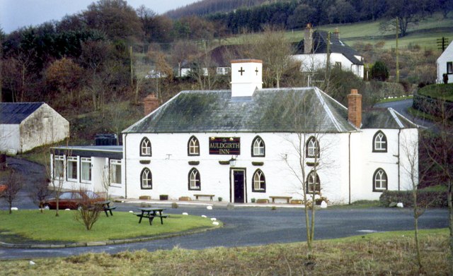
Auldgirth

Auldgirth is a village on the A76 road in Dumfries and Galloway, Scotland. Auldgirth village features 'The Auldgirth Inn' and the former Auldgirth Primary...

Carse Loch

Carse Loch is situated (NX 926 849) in a low-lying area, surrounded by woodland, close to the A76 at Friar's Carse, in Dumfries and Galloway, Parish of...

The Hermitage, Friars Carse

The Hermitage was a folly first built by Captain Robert Riddell of Friars Carse (known as Glenriddell at this time and later returned to its ancient name...

Nearby Amenities

Located within 500m of 55.133545,-3.7288697
Power: pole
Lat/Long: 55.1292272/-3.7273908
Power: pole
Lat/Long: 55.1296811/-3.7285039
Power: pole
Lat/Long: 55.1300859/-3.7295097
Power: pole
Lat/Long: 55.1304923/-3.7305343
Power: pole
Lat/Long: 55.1309232/-3.7316287
Power: pole
Lat/Long: 55.1313265/-3.7326452
Power: pole
Lat/Long: 55.1317666/-3.7337503
Power: pole
Lat/Long: 55.1321929/-3.734799
Power: pole
Lat/Long: 55.1326084/-3.7358585
The data included in this document is from www.openstreetmap.org. The data is made available under ODbL.

Have you been to Rosehill?

Leave your review of Rosehill below (or comments, questions and feedback).