Carn a' Gharbh-ghlaic
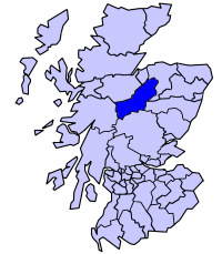
Hill, Mountain in Nairnshire
Scotland
Carn a' Gharbh-ghlaic

Carn a' Gharbh-ghlaic, located in Nairnshire, Scotland, is a prominent hill/mountain that offers breathtaking views and a challenging hiking experience. Rising to an elevation of approximately 700 meters (2,297 feet), it is part of the Grampian Mountains range.
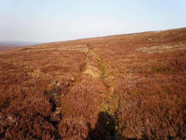
The hill is characterized by its rugged terrain, rocky slopes, and heather-covered moorland. It is a popular destination for outdoor enthusiasts, particularly hikers, who are drawn to its natural beauty and panoramic vistas. The ascent to the summit requires a moderate level of physical fitness and navigational skills, as there are no defined trails.
At the top, visitors are rewarded with stunning views of the surrounding countryside, including the Moray Firth, the Cairngorms National Park, and the nearby Cromdale Hills. On a clear day, it is even possible to catch a glimpse of the distant Ben Nevis, the highest peak in the British Isles.
Wildlife is abundant in the area, with red deer, mountain hares, and various bird species commonly spotted. The hill is also home to rare alpine plants, adding to its ecological significance.
Carn a' Gharbh-ghlaic is easily accessible from the nearby town of Nairn, with various starting points available for hikers. It is advisable to check weather conditions and plan accordingly, as the hill can be subject to rapid weather changes and high winds.
Overall, Carn a' Gharbh-ghlaic offers a memorable outdoor experience, combining stunning scenery, physical challenge, and a chance to immerse oneself in the natural beauty of Nairnshire.
If you have any feedback on the listing, please let us know in the comments section below.
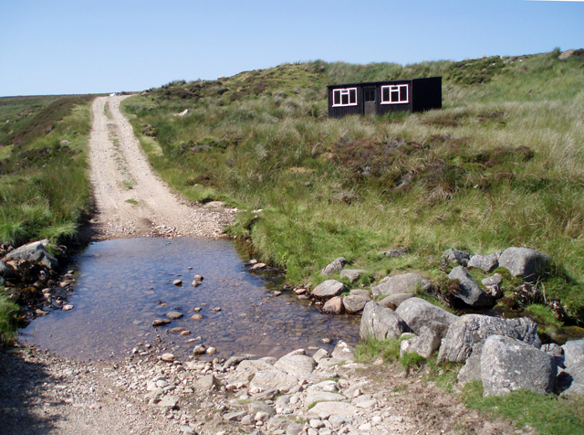
Carn a' Gharbh-ghlaic Images
Images are sourced within 2km of 57.392967/-3.8417547 or Grid Reference NH8935. Thanks to Geograph Open Source API. All images are credited.


Carn a' Gharbh-ghlaic is located at Grid Ref: NH8935 (Lat: 57.392967, Lng: -3.8417547)
Unitary Authority: Highland
Police Authority: Highlands and Islands
What 3 Words
///invents.doghouse.darting. Near Grantown-on-Spey, Highland
Nearby Locations
Related Wikis

Diocese of Moray
The Diocese of Moray was one of the most important of the medieval dioceses of the Roman Catholic Church in Scotland. Its territory was in central northern...
Carn Glas-choire
Càrn Glas is a mountain with the Ardgoil Peninsula and the Arrochar Alps near Lochgoilhead. It reaches a height of over 502 metres (1,647 ft).

Dunearn
Dunearn is a hill fort located 15 kilometres (9.3 mi) south south east of Nairn in Highland, Scotland. It is situated on a steep-sided hill called Doune...
Balvraid
Balvraid (Scottish Gaelic: Baile a' Bhràghaid) is a small remote settlement, located 8 miles south east of Inverness in Inverness-shire, Scottish Highlands...

Inverness, Nairn, Badenoch and Strathspey (UK Parliament constituency)
Inverness, Nairn, Badenoch and Strathspey is a constituency of the House of Commons of the UK Parliament. As with all seats since 1950 it elects one Member...

Lochindorb
Lochindorb (from the Scottish Gaelic: Loch nan Doirb meaning "loch of the minnows") is a freshwater loch north of Grantown on Spey in the Highland council...
Badenoch and Strathspey
Badenoch and Strathspey is a former district of Highland region in Scotland. The district was created under the Local Government (Scotland) Act 1973 as...
Have you been to Carn a' Gharbh-ghlaic?
Leave your review of Carn a' Gharbh-ghlaic below (or comments, questions and feedback).