Honington

Settlement in Lincolnshire South Kesteven

England

Honington

Heath Lane approaching Minnet's Wood Running towards the edge of the escarpment of Jurassic Lincolnshire Limestone
Heath Lane approaching Minnet's Wood Credit: Tim Heaton

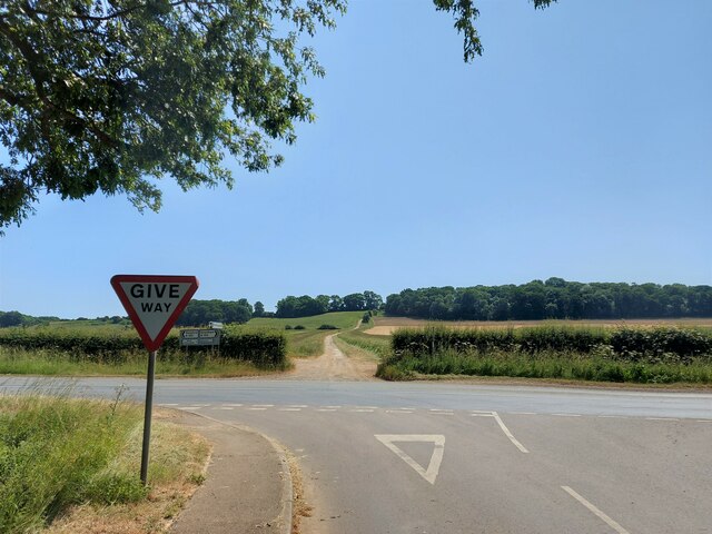
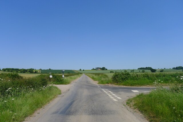
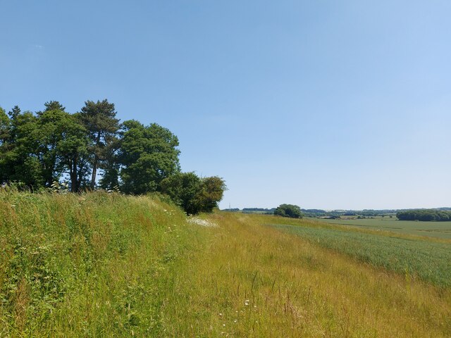
Honington is a small village located in Lincolnshire, England. Situated approximately 5 miles north of Grantham, it is a rural community with a population of around 300 residents. The village is nestled in the scenic countryside, characterized by rolling hills and picturesque landscapes.

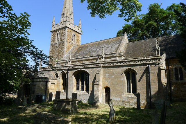
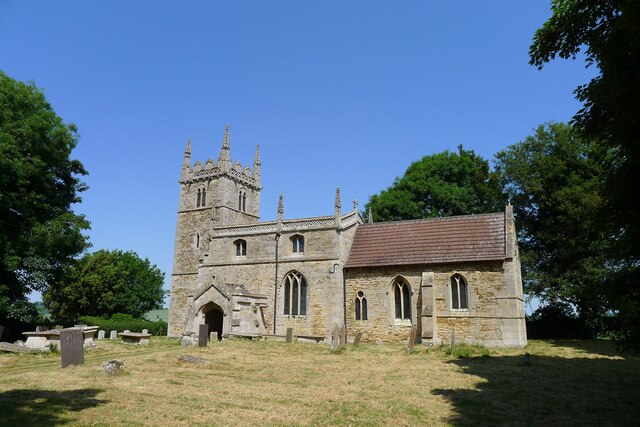
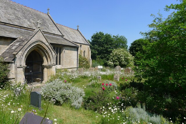
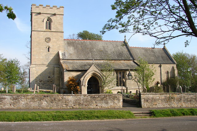
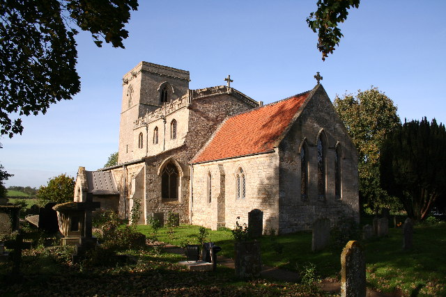
Honington is known for its historical significance, with evidence of settlement dating back to the Roman period. It is home to the Grade I listed All Saints Church, a stunning architectural gem that dates back to the 12th century. The church features intricate stained glass windows and a remarkable Norman tower, attracting visitors with an interest in history and architecture.

In terms of amenities, Honington offers limited facilities. There is a village hall that serves as a social hub for the community, hosting various events and activities throughout the year. However, residents typically rely on nearby towns for everyday services such as shopping and healthcare.

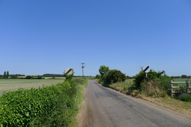
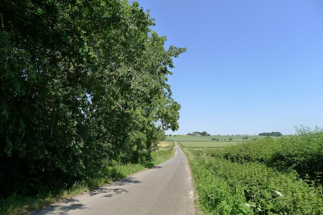
The village benefits from its tranquil and idyllic setting, making it a popular choice for those seeking a peaceful countryside lifestyle. The surrounding countryside provides ample opportunities for outdoor activities, including walking, cycling, and horseback riding.

Honington enjoys good transport links, with the A1 road running nearby, providing easy access to larger towns and cities. The village also benefits from a regular bus service, connecting it to neighboring areas.

Overall, Honington offers a charming and peaceful retreat for those looking to embrace the beauty of Lincolnshire's countryside while still having access to nearby amenities.

If you have any feedback on the listing, please let us know in the comments section below.

Honington Images

Images are sourced within 2km of 52.977368/-0.595021 or Grid Reference SK9443. Thanks to Geograph Open Source API. All images are credited.

Heath Lane approaching Minnet's Wood Running towards the edge of the escarpment of Jurassic Lincolnshire Limestone
Heath Lane approaching Minnet's Wood
Running towards the edge of the escarpment of Jurassic Lincolnshire Limestone
North Lodge at the top of Minnett's Hill Once part of the former Syston Park estate. The hill drops down the Jurassic limestone escarpment towards the River Witham.
North Lodge at the top of Minnett's Hill
Once part of the former Syston Park estate. The hill drops down the Jurassic limestone escarpment towards the River Witham.
Bridleway by a field of oats The bridleway leads towards Honington
Bridleway by a field of oats
The bridleway leads towards Honington
Honington Camp hill fort Part of the defensive earth banks of an Iron Age hill fort or settlement <span class="nowrap"><a title="https://heritage-explorer.lincolnshire.gov.uk/Monument/MLI30366" rel="nofollow ugc noopener" href="https://heritage-explorer.lincolnshire.gov.uk/Monument/MLI30366">Link</a><img style="margin-left:2px;" alt="External link" title="External link - shift click to open in new window" src="https://s1.geograph.org.uk/img/external.png" width="10" height="10"/></span> <span class="nowrap"><a title="http://www.stone-circles.org.uk/stone/honington.htm" rel="nofollow ugc noopener" href="http://www.stone-circles.org.uk/stone/honington.htm">Link</a><img style="margin-left:2px;" alt="External link" title="External link - shift click to open in new window" src="https://s1.geograph.org.uk/img/external.png" width="10" height="10"/></span> . It sits close to the top of the Jurassic limestone escarpment overlooking the Witham valley and Vale of Belvoir.
Honington Camp hill fort
Part of the defensive earth banks of an Iron Age hill fort or settlement LinkExternal link LinkExternal link . It sits close to the top of the Jurassic limestone escarpment overlooking the Witham valley and Vale of Belvoir.
Church of St Nicholas, Barkston Listed Grade I. "Norman to Perpendicular church. Mainly of 12th century date, of which tower with 14th century spire and south arcade remain, with 14th and 15th century alterations" <span class="nowrap"><a title="https://heritage-explorer.lincolnshire.gov.uk/Monument/MLI30411" rel="nofollow ugc noopener" href="https://heritage-explorer.lincolnshire.gov.uk/Monument/MLI30411">Link</a><img style="margin-left:2px;" alt="External link" title="External link - shift click to open in new window" src="https://s1.geograph.org.uk/img/external.png" width="10" height="10"/></span>
Church of St Nicholas, Barkston
Listed Grade I. "Norman to Perpendicular church. Mainly of 12th century date, of which tower with 14th century spire and south arcade remain, with 14th and 15th century alterations" LinkExternal link
Hough Road leading north from Barkston Start of a pleasant cycle run towards Hough-on-the-Hill
Hough Road leading north from Barkston
Start of a pleasant cycle run towards Hough-on-the-Hill
Hough Lane Level Crossing Crossing the 'Poacher Line' running from Grantham to Skegness via Sleaford and Boston. The crossing is signed Hough Lane, OS map calls this Hough Road
Hough Lane Level Crossing
Crossing the 'Poacher Line' running from Grantham to Skegness via Sleaford and Boston. The crossing is signed Hough Lane, OS map calls this Hough Road
Hough Road from the north side of Grove Plantations
Church of St Wilfred, Honington Listed Grade I, from the 11th century.
Church of St Wilfred, Honington
Listed Grade I, from the 11th century.
Main Street leaving the south side of Honington
Main Street, Honington, joining the A607 Across the road a Restricted Byway, Heath Lane, climbs up the escarpment of  Lincolnshire limestone known as the 'Lincoln Cliff'
Main Street, Honington, joining the A607
Across the road a Restricted Byway, Heath Lane, climbs up the escarpment of Lincolnshire limestone known as the 'Lincoln Cliff'
Heath Lane running down to Honington View west from the limestone escarpment of the 'Lincoln Cliff'
Heath Lane running down to Honington
View west from the limestone escarpment of the 'Lincoln Cliff'
View north-east from Heath Lane Looking along the shallow limestone escarpment known as the 'Lincoln Cliff'
View north-east from Heath Lane
Looking along the shallow limestone escarpment known as the 'Lincoln Cliff'
Frinkley Lane crossing Hough Road The Viking Way comes down Hough Road from the north (ahead), and turns left along Frinkley Lane
Frinkley Lane crossing Hough Road
The Viking Way comes down Hough Road from the north (ahead), and turns left along Frinkley Lane
Footpath running along the ridge below The Red House The footpath runs to Carlton Scroop. It is probably little used as Howdale Lane immediately to the north offers an easier traffic-free route
Footpath running along the ridge below The Red House
The footpath runs to Carlton Scroop. It is probably little used as Howdale Lane immediately to the north offers an easier traffic-free route
Grantham Road (A607) entering Carlton Scroop 'Carlton' means the settlement of freemen or peasants ('karl' + 'ton'). Scroop derives from the Scrope family who held the manor
Grantham Road (A607) entering Carlton Scroop
'Carlton' means the settlement of freemen or peasants ('karl' + 'ton'). Scroop derives from the Scrope family who held the manor
Church of St Nicholas, Carlton Scroop Listed Grade I. With a flower rich 'God's Acre' <a href="https://www.geograph.org.uk/photo/7524836">SK9444 : God's Acre, Church of St Nicholas, Carlton Scroop</a>
Church of St Nicholas, Carlton Scroop
Listed Grade I. With a flower rich 'God's Acre' SK9444 : God's Acre, Church of St Nicholas, Carlton Scroop
God's Acre, Church of St Nicholas, Carlton Scroop "This churchyard has been managed for its botanical diversity since 1996.  The different habitats within the churchyard attract many different species of wildlife between 2015 and 2018 over 200 species of plants, invertebrates, mammals and birds have been recorded here." <span class="nowrap"><a title="https://www.caringforgodsacre.org.uk/churchyard/carlton-scroop-st-nicholas/" rel="nofollow ugc noopener" href="https://www.caringforgodsacre.org.uk/churchyard/carlton-scroop-st-nicholas/">Link</a><img style="margin-left:2px;" alt="External link" title="External link - shift click to open in new window" src="https://s1.geograph.org.uk/img/external.png" width="10" height="10"/></span>
God's Acre, Church of St Nicholas, Carlton Scroop
"This churchyard has been managed for its botanical diversity since 1996. The different habitats within the churchyard attract many different species of wildlife between 2015 and 2018 over 200 species of plants, invertebrates, mammals and birds have been recorded here." LinkExternal link
Show me another place!

Honington is located at Grid Ref: SK9443 (Lat: 52.977368, Lng: -0.595021)

Division: Parts of Kesteven

Administrative County: Lincolnshire

District: South Kesteven

Police Authority: Lincolnshire

What 3 Words

///cupboards.transcribes.reclaimed. Near Ancaster, Lincolnshire

Related Wikis

Honington, Lincolnshire

Honington is an English village and civil parish in the South Kesteven district of Lincolnshire. It lies just north of the junction between the A153 and...

Honington railway station

Honington railway station was a station in the village of Honington, Lincolnshire. It was located on junction with the line Grantham and Lincoln railway...

Carlton Scroop

Carlton Scroop is a small village and civil parish in the South Kesteven district of Lincolnshire, England. The population of the civil parish (including...

Barkston

Barkston is an English village and civil parish in the South Kesteven district of Lincolnshire. The parish population was 497 at the 2001 census and 493...

Syston, Lincolnshire

Syston is a village and civil parish in the South Kesteven district of Lincolnshire, England. The population of the civil parish was 162 at the 2011 census...

RAF Barkston Heath

Royal Air Force Barkston Heath or RAF Barkston Heath (ICAO: EGYE) is a Royal Air Force Relief Landing Ground under the command of RAF Cranwell near Grantham...

St Nicholas Church, Normanton

St Nicholas Church is a redundant Anglican church in Normanton-on-Cliffe, Lincolnshire, England. It is recorded in the National Heritage List for England...

Sudbrook, Lincolnshire

Sudbrook is a hamlet in the South Kesteven district of Lincolnshire, England. It is situated 12 miles (19 km) south-east of Newark-on-Trent, 6 miles (10...

Nearby Amenities

Located within 500m of 52.977368,-0.595021
Honington
Is In: Lincolnshire, England, UK
Place: village
Lat/Long: 52.9774392/-0.5949147
Bus Stop
Post Office
Naptan AtcoCode: 270000008407
Naptan Bearing: S
Naptan CommonName: Post Office
Naptan Indicator: SE - bound
Naptan Landmark: Post Office
Naptan NaptanCode: lingpwgd
Naptan Street: Main Street
Naptan Verified: no
Source: naptan_import
Lat/Long: 52.9769797/-0.5949813
Bus Stop
Main Street
Naptan AtcoCode: 270000008408
Naptan Bearing: SW
Naptan CommonName: Main Street
Naptan Indicator: adj
Naptan Landmark: Main Street
Naptan NaptanCode: lingpwgj
Naptan Street: Lincoln Road
Naptan Verified: no
Public Transport: platform
Source: naptan_import
Lat/Long: 52.9762264/-0.6004718
Bus Stop
Main Street
Naptan AtcoCode: 270000008409
Naptan Bearing: NE
Naptan CommonName: Main Street
Naptan Indicator: opp
Naptan Landmark: Main Street
Naptan NaptanCode: lingpwgm
Naptan Street: Lincoln Road
Naptan Verified: no
Source: naptan_import
Lat/Long: 52.9761122/-0.6006989
Bus Stop
Frinkley Lane
Naptan AtcoCode: 270002700117
Naptan Bearing: S
Naptan CommonName: Frinkley Lane
Naptan Indicator: opp
Naptan Landmark: Frinkley Lane
Naptan NaptanCode: linjtapw
Naptan Street: Lincoln Road
Naptan Verified: no
Public Transport: platform
Source: naptan_import
Lat/Long: 52.979613/-0.5994835
Bus Stop
Frinkley Lane
Naptan AtcoCode: 270002700118
Naptan Bearing: N
Naptan CommonName: Frinkley Lane
Naptan Indicator: adj
Naptan Landmark: Frinkley Lane
Naptan NaptanCode: linjtata
Naptan Street: Lincoln Road
Naptan Verified: no
Source: naptan_import
Lat/Long: 52.9796692/-0.5996753
Bus Stop
Post Office
Naptan AtcoCode: 2700LHP01462
Naptan Bearing: N
Naptan CommonName: Post Office
Naptan Indicator: N - bound
Naptan Landmark: Post Office
Naptan NaptanCode: linajwjm
Naptan Street: Main Street
Naptan Verified: no
Source: naptan_import
Lat/Long: 52.9770708/-0.5950826
Parking
Lat/Long: 52.9800366/-0.5997937
Hall Farm
Historic Place: farm
Source: Bing
Lat/Long: 52.9779628/-0.5965314
Generator Method: photovoltaic
Generator Output Electricity: yes
Generator Source: solar
Generator Type: solar_photovoltaic_panel
Location: roof
Power: generator
Lat/Long: 52.9790681/-0.5963456
Generator Method: photovoltaic
Generator Output Electricity: yes
Generator Source: solar
Generator Type: solar_photovoltaic_panel
Location: roof
Power: generator
Lat/Long: 52.9782994/-0.5949294
Generator Method: photovoltaic
Generator Output Electricity: yes
Generator Source: solar
Generator Type: solar_photovoltaic_panel
Location: roof
Power: generator
Lat/Long: 52.9778375/-0.5949482
Generator Method: photovoltaic
Generator Output Electricity: yes
Generator Source: solar
Generator Type: solar_photovoltaic_panel
Location: roof
Power: generator
Lat/Long: 52.9777648/-0.5948382
Generator Method: photovoltaic
Generator Output Electricity: yes
Generator Source: solar
Generator Type: solar_photovoltaic_panel
Location: roof
Power: generator
Lat/Long: 52.9768523/-0.5945405
Generator Method: photovoltaic
Generator Output Electricity: yes
Generator Source: solar
Generator Type: solar_photovoltaic_panel
Location: roof
Power: generator
Lat/Long: 52.9764251/-0.5945177
Generator Method: photovoltaic
Generator Output Electricity: yes
Generator Source: solar
Generator Type: solar_photovoltaic_panel
Location: roof
Power: generator
Lat/Long: 52.9765527/-0.594511
Generator Method: photovoltaic
Generator Output Electricity: yes
Generator Source: solar
Generator Type: solar_photovoltaic_panel
Location: roof
Power: generator
Lat/Long: 52.9765753/-0.5946921
Generator Method: photovoltaic
Generator Output Electricity: yes
Generator Source: solar
Generator Type: solar_photovoltaic_panel
Location: roof
Power: generator
Lat/Long: 52.9753425/-0.5981246
Generator Method: photovoltaic
Generator Output Electricity: yes
Generator Source: solar
Generator Type: solar_photovoltaic_panel
Location: roof
Power: generator
Lat/Long: 52.9754895/-0.5967969
Generator Method: photovoltaic
Generator Output Electricity: yes
Generator Source: solar
Generator Type: solar_photovoltaic_panel
Location: roof
Power: generator
Lat/Long: 52.9753409/-0.5967969
Kindergarten
The Old School Nursery
Addr City: Honington
Addr Housename: Dappledown House
Addr Postcode: NG32 2PG
Addr Street: Main Street
Fhrs Authority: South Kesteven
Fhrs Id: 238855
Fhrs Local Authority Id: 7394
Lat/Long: 52.9775647/-0.595724
The data included in this document is from www.openstreetmap.org. The data is made available under ODbL.

Have you been to Honington?

Leave your review of Honington below (or comments, questions and feedback).