Aberyscir

Settlement in Brecknockshire

Wales

Aberyscir

Llwybr i Aberbran / Path to Aberbran Llwybr ceffyl yn dod i lawr o'r ucheldir i gyfeiriad pentre Aberbran.

A bridleway descends the hill in the direction of Aberbran village (trans. confluence of the crow stream).
Llwybr i Aberbran / Path to Aberbran Credit: Alan Richards

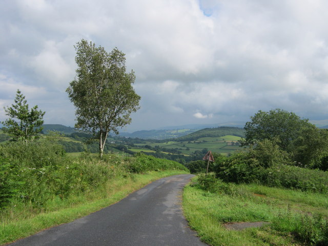
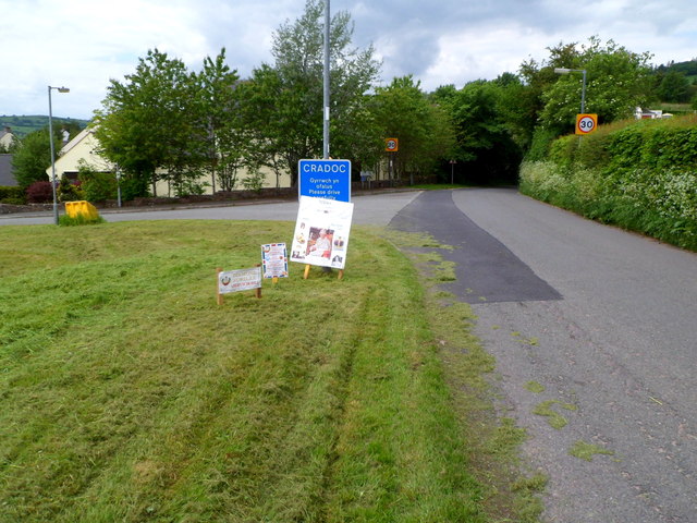
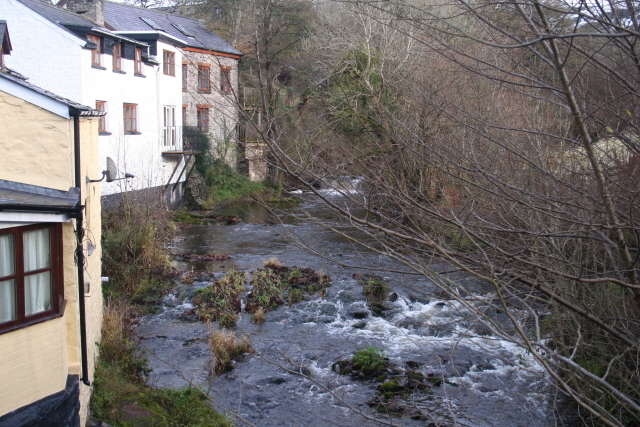
Aberyscir is a small village located in the historic county of Brecknockshire, Wales. Situated near the River Usk, it is nestled in the picturesque countryside, offering breathtaking views of the surrounding hills and valleys. The village is part of the community of Sennybridge, and is approximately 6 miles northwest of the town of Brecon.

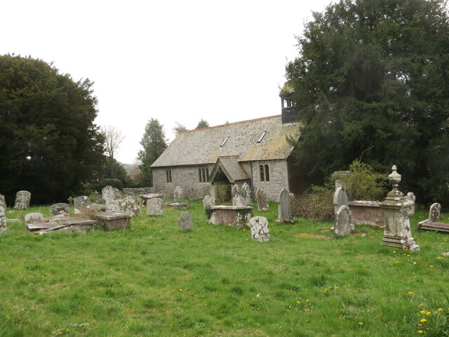
Aberyscir has a rich history, with evidence of human settlement dating back to the Iron Age. The village is known for its ancient church, St. Cynog's Church, which dates back to the 13th century. The church is a Grade II listed building and is well-preserved, showcasing stunning architectural features.

The village is also home to Aberyscir Coach House, a historic building that has been converted into a holiday rental property. The Coach House offers visitors a unique opportunity to experience the charm of rural Wales while enjoying modern amenities.

Nature enthusiasts will find Aberyscir to be a perfect destination, as the village is surrounded by beautiful landscapes and offers ample opportunities for outdoor activities. The nearby Brecon Beacons National Park provides a haven for hikers, mountain bikers, and wildlife enthusiasts alike, with its diverse terrain and abundance of natural wonders.

In terms of amenities, Aberyscir is a small village with limited facilities. However, the town of Brecon is easily accessible and offers a wider range of amenities including shops, restaurants, and leisure facilities.

Overall, Aberyscir is a tranquil and scenic village that appeals to those seeking a peaceful getaway in the heart of the Welsh countryside.

If you have any feedback on the listing, please let us know in the comments section below.

Aberyscir Images

Images are sourced within 2km of 51.957517/-3.458179 or Grid Reference SN9929. Thanks to Geograph Open Source API. All images are credited.

Llwybr i Aberbran / Path to Aberbran Llwybr ceffyl yn dod i lawr o'r ucheldir i gyfeiriad pentre Aberbran.

A bridleway descends the hill in the direction of Aberbran village (trans. confluence of the crow stream).
Llwybr i Aberbran / Path to Aberbran
Llwybr ceffyl yn dod i lawr o'r ucheldir i gyfeiriad pentre Aberbran. A bridleway descends the hill in the direction of Aberbran village (trans. confluence of the crow stream).
Llwybr ger Toryffynnon / Path near Toryffynnon Llwybr ceffyl yn mynd i lawr y waered ger anhedd-dy o'r enw Toryffynnon.

A bridleway descends the hill near a property known as Toryffynnon
Llwybr ger Toryffynnon / Path near Toryffynnon
Llwybr ceffyl yn mynd i lawr y waered ger anhedd-dy o'r enw Toryffynnon. A bridleway descends the hill near a property known as Toryffynnon
Llwybr i'r mynydd / Path to the hill Llwybr ceffyl yn agosau at Fynydd Aberysgir.

A bridleway approaches Mynydd Aberysgir (trans. mountain of the river Yscir confluence).
Llwybr i'r mynydd / Path to the hill
Llwybr ceffyl yn agosau at Fynydd Aberysgir. A bridleway approaches Mynydd Aberysgir (trans. mountain of the river Yscir confluence).
Mynydd Aberysgir Gât yn rhoi mynediad i gomin Fynydd Aberysgir.

A gate gives access to a common known as Mynydd Aberysgir (trans. mountain of the river Yscir confluence).
Mynydd Aberysgir
Gât yn rhoi mynediad i gomin Fynydd Aberysgir. A gate gives access to a common known as Mynydd Aberysgir (trans. mountain of the river Yscir confluence).
Mynydd Aberysgir Llwybr ceffyl ar dir comin a elwir Mynydd Aberysgir.

A bridleway on common land known as Mynydd Aberysgir (trans. mountain of the river Yscir confluence).
Mynydd Aberysgir
Llwybr ceffyl ar dir comin a elwir Mynydd Aberysgir. A bridleway on common land known as Mynydd Aberysgir (trans. mountain of the river Yscir confluence).
Road down from the southern end of Aberysgir Common
Road to Llanfihangel Nant Bran Great care needed by all in this section of bending narrow road with no viewing over the tall hedging
Road to Llanfihangel Nant Bran
Great care needed by all in this section of bending narrow road with no viewing over the tall hedging
Eglwys Sant Cadog, Y Batel / St Cadog's Church, Battle Mae Eglwys Blwyfol Y Batel wedi ei chysegru i Sant Cadog ac fe'i hailadeiladwyd yn 1880. Yn anffodus, mae'r eglwys wed cau ers peth amser.

St Cadog's Parish Church located in the tiny village of Battle. Rebuilt in 1880 the church, sadly, is no longer open for worship.
Eglwys Sant Cadog, Y Batel / St Cadog's Church, Battle
Mae Eglwys Blwyfol Y Batel wedi ei chysegru i Sant Cadog ac fe'i hailadeiladwyd yn 1880. Yn anffodus, mae'r eglwys wed cau ers peth amser. St Cadog's Parish Church located in the tiny village of Battle. Rebuilt in 1880 the church, sadly, is no longer open for worship.
Glanyscir, built 1830 What a devastatingly handsome property, classy, understated and in a beautiful riverside setting. Beautiful gardens and lawns too.
Glanyscir, built 1830
What a devastatingly handsome property, classy, understated and in a beautiful riverside setting. Beautiful gardens and lawns too.
Diamond Jubilee announcements at the SE boundary of Cradoc The road from Brecon reaches the SE boundary of the hamlet of Cradoc.
Three notices announce that Queen Elizabeth II's Diamond Jubilee celebrations
are taking place today, Monday June 4th 2012, in Aberyscir Hill.
Diamond Jubilee announcements at the SE boundary of Cradoc
The road from Brecon reaches the SE boundary of the hamlet of Cradoc. Three notices announce that Queen Elizabeth II's Diamond Jubilee celebrations are taking place today, Monday June 4th 2012, in Aberyscir Hill.
Oakfield Park, Cradoc Oakfield Park is a residential cul-de-sac at the SE edge of the hamlet, bordering fields.
Oakfield Park, Cradoc
Oakfield Park is a residential cul-de-sac at the SE edge of the hamlet, bordering fields.
Signpost and phone box on a grass triangle, Cradoc The signpost points left towards Aberyscir, Pontfaen and Merthyr Cynog, right towards the golf course, Lower Chapel and Upper Chapel. The third arm points past the camera towards Brecon.
Signpost and phone box on a grass triangle, Cradoc
The signpost points left towards Aberyscir, Pontfaen and Merthyr Cynog, right towards the golf course, Lower Chapel and Upper Chapel. The third arm points past the camera towards Brecon.
The Old Smithy, Cradoc Located on the SW side of a grass triangle. <a title="https://www.geograph.org.uk/photo/2980171" href="https://www.geograph.org.uk/photo/2980171">Link</a>
There is a postbox mounted in the wall on the left.
The Old Smithy, Cradoc
Located on the SW side of a grass triangle. Link There is a postbox mounted in the wall on the left.
Road from Cradoc to Aberyscir A signpost arm points ahead towards Aberyscir, Aberbran and Llanfihangel Nant Bran.
The arm pointing right shows Battle, Pontfaen, Merthyr Cynog.
The arm pointing across the line of view is towards Brecon.
Road from Cradoc to Aberyscir
A signpost arm points ahead towards Aberyscir, Aberbran and Llanfihangel Nant Bran. The arm pointing right shows Battle, Pontfaen, Merthyr Cynog. The arm pointing across the line of view is towards Brecon.
20mph speed limit on the road from Cradoc to Battle There is a 20mph speed limit on the approach to Cradoc School. <a title="https://www.geograph.org.uk/photo/2980253" href="https://www.geograph.org.uk/photo/2980253">Link</a>
20mph speed limit on the road from Cradoc to Battle
There is a 20mph speed limit on the approach to Cradoc School. Link
Cradoc School Cradoc School is an English-medium Community Primary school for children aged 4-11. There are about 130 enrolled. The school dates from 1969, replacing five small local village schools (Battle, Llanfihangel Nant Bran, Merthyr Cynog, Trallong and Upper Chapel) where pupil numbers made it essential to amalgamate.
Cradoc School
Cradoc School is an English-medium Community Primary school for children aged 4-11. There are about 130 enrolled. The school dates from 1969, replacing five small local village schools (Battle, Llanfihangel Nant Bran, Merthyr Cynog, Trallong and Upper Chapel) where pupil numbers made it essential to amalgamate.
Lock-up garages, Cradoc Located near Cradoc School. <a title="https://www.geograph.org.uk/photo/2980253" href="https://www.geograph.org.uk/photo/2980253">Link</a> The sign shows PARKING FOR RESIDENTS ONLY. The message is also shown in Welsh above the English text.
Lock-up garages, Cradoc
Located near Cradoc School. Link The sign shows PARKING FOR RESIDENTS ONLY. The message is also shown in Welsh above the English text.
NW boundary of Cradoc The road from Battle reaches Cradoc, a hamlet in Powys 2½ miles NW of Brecon.
A 20mph speed limit applies on the approach to Cradoc School. <a title="https://www.geograph.org.uk/photo/2980253" href="https://www.geograph.org.uk/photo/2980253">Link</a>
NW boundary of Cradoc
The road from Battle reaches Cradoc, a hamlet in Powys 2½ miles NW of Brecon. A 20mph speed limit applies on the approach to Cradoc School. Link
Show me another place!

Aberyscir is located at Grid Ref: SN9929 (Lat: 51.957517, Lng: -3.458179)

Unitary Authority: Powys

Police Authority: Dyfed Powys

Also known as: Aberysgir

What 3 Words

///polar.formal.slack. Near Brecon, Powys

Related Wikis

Aberyscir

Aberyscir (Welsh: Aberysgir) is a village in the community of Yscir, Powys, Wales, which is 4 miles (6.4 km) west of Brecon, 35 miles (56 km) from Cardiff...

Afon Ysgir

The Afon Ysgir is a river which rises on the southern slopes of Mynydd Epynt in Powys, Wales. The tributaries known as Ysgir Fawr and Ysgir Fechan flow...

Aberysgir Castle

Aberysgir Castle is a mound, or motte and bailey castle of the Middle Ages – but is missing the usual protective bailey. It is located at Aberysgir, Powys...

Y Gaer

Y Gaer (Latin: Cicucium) is a Roman fort situated near modern-day Brecon in Mid Wales, United Kingdom. Y Gaer is located at grid reference SO00332966...

Nearby Amenities

Located within 500m of 51.957517,-3.458179
Aberyscir
Place: hamlet
Source: Bing
Wikidata: Q4667218
Lat/Long: 51.9589302/-3.4580963
Post Box
Post Box Type: lamp
Ref: LD3 366
Royal Cypher: EIIR
Royal Cypher Wikidata: Q33102113
Lat/Long: 51.9585654/-3.4575336
Place: farm
Lat/Long: 51.9573995/-3.4520164
Ford: yes
Lat/Long: 51.9541167/-3.4626271
The data included in this document is from www.openstreetmap.org. The data is made available under ODbL.

Have you been to Aberyscir?

Leave your review of Aberyscir below (or comments, questions and feedback).