Carn Gruamach

Hill, Mountain in Nairnshire

Scotland

Carn Gruamach

Watershed for Allt Loisgte
Watershed for Allt Loisgte Credit: Sarah McGuire

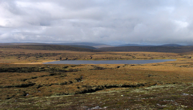
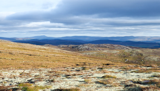
Carn Gruamach is a prominent hill located in the county of Nairnshire, Scotland. Standing at an elevation of approximately 535 meters (1,755 feet), it is considered one of the notable peaks in the area. Situated in the eastern part of the Scottish Highlands, Carn Gruamach offers breathtaking panoramic views of the surrounding landscape.

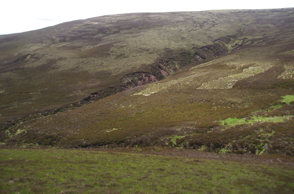
The hill is characterized by its rugged and rocky terrain, with steep slopes and craggy outcrops. It is primarily composed of granite, which has weathered over time, forming distinctive features such as tors and boulder fields. These geological elements add to the hill's allure and provide a challenging environment for outdoor enthusiasts and climbers.

Carn Gruamach is a popular destination for hikers and hillwalkers, offering various routes and trails to explore. The ascent can be demanding, particularly on the steeper sections, but the reward is a magnificent vista from the summit. On clear days, it is possible to see across the Moray Firth, with views extending to the Black Isle and beyond.

The hill is also home to a diverse range of flora and fauna. Heather and grasses cover the lower slopes, while higher up, the landscape becomes more sparse, offering a habitat for mountain birds and small mammals. Visitors may spot species like red grouse, ptarmigan, and mountain hares during their ascent.

Overall, Carn Gruamach is a captivating natural feature of Nairnshire, attracting outdoor enthusiasts, nature lovers, and those seeking awe-inspiring views of the Scottish Highlands.

If you have any feedback on the listing, please let us know in the comments section below.

Carn Gruamach Images

Images are sourced within 2km of 57.348436/-3.8572407 or Grid Reference NH8830. Thanks to Geograph Open Source API. All images are credited.

Watershed for Allt Loisgte
Above watershed for Allt Loisgte
Looking NW from Sgoran Liath
Crossing Allt an Daimh north of Carn Gruamach
Looking NE from Leac an Daimh across Allt an  Daimh
Looking NE from Leac an Daimh across Allt an Daimh
Looking NE across moorland from Leac an Daimh Loch an Ille Mhor can be seen in the distance
Looking NE across moorland from Leac an Daimh
Loch an Ille Mhor can be seen in the distance
Looking SE from Leac an Daimh across Coire Odhar Mòr
Heather moorland west of summit of Carn Glas-choire Carn Glas-choire is a Graham north of Carrbridge; the view is from the summit over the nearby covering of 'wind clipped heath' and peat banks to Loch Bràigh Bhruthaich.
Heather moorland west of summit of Carn Glas-choire
Carn Glas-choire is a Graham north of Carrbridge; the view is from the summit over the nearby covering of 'wind clipped heath' and peat banks to Loch Bràigh Bhruthaich.
Carn Glas-Choire The summit and triangulation pillar.
Carn Glas-Choire
The summit and triangulation pillar.
Carn Glas-Choire Carn Glas-Choire from a track extension that is currently unmarked on the 1:50000 map.
Carn Glas-Choire
Carn Glas-Choire from a track extension that is currently unmarked on the 1:50000 map.
Moorland Track High up on the track that crosses the northern flank of Carn Glas-choire and heads to the River Findhorn. In the distance Ben Rinnes can clearly be seen.
Moorland Track
High up on the track that crosses the northern flank of Carn Glas-choire and heads to the River Findhorn. In the distance Ben Rinnes can clearly be seen.
Perched boulders west of Cnapan a' Choire Odair Mhòir High ground connecting Carn Glas-choire with Creag na h-Iolaire passes over a point at 619m, west of Cnapan a' Choire Odair Mhòir; the boulders here are close to the 619m point. Distantly, to the south-east are the Cairngorms.
Perched boulders west of Cnapan a' Choire Odair Mhòir
High ground connecting Carn Glas-choire with Creag na h-Iolaire passes over a point at 619m, west of Cnapan a' Choire Odair Mhòir; the boulders here are close to the 619m point. Distantly, to the south-east are the Cairngorms.
Pale lichen on slope of Carn Glas-choire The lichen covers quite extensive areas of this slope of Carn Glas-choire, north-west of its summit. Although low to the ground the lichen made for awkward walking with the ground surface beneath being exceedingly slippery.
Pale lichen on slope of Carn Glas-choire
The lichen covers quite extensive areas of this slope of Carn Glas-choire, north-west of its summit. Although low to the ground the lichen made for awkward walking with the ground surface beneath being exceedingly slippery.
Heather twigs on slope of Carn Glas-choire The dead twigs of heather will doubtless be due to burning some time in the past, though there could perhaps be another reason. Tom nan Gabhar is the hill top beyond.
Heather twigs on slope of Carn Glas-choire
The dead twigs of heather will doubtless be due to burning some time in the past, though there could perhaps be another reason. Tom nan Gabhar is the hill top beyond.
Carn Glas Choire Trig Point Flush Bracket S7211 Lovely view
Carn Glas Choire Trig Point Flush Bracket S7211
Lovely view
Moorland, Coire Glas-choire Slopes below Carn Glas-choire with the gully of an un-named burn cutting into the hillside.
Moorland, Coire Glas-choire
Slopes below Carn Glas-choire with the gully of an un-named burn cutting into the hillside.
Carn Glas-choire Summit Cairn and trig point on the highest of the Foregin Hills, which is also a Graham.
Carn Glas-choire Summit
Cairn and trig point on the highest of the Foregin Hills, which is also a Graham.
Loch Braigh Bhruthaich Seen across peat hags from the western slopes of Carn Glas-choire.
Loch Braigh Bhruthaich
Seen across peat hags from the western slopes of Carn Glas-choire.
Show me another place!

Carn Gruamach is located at Grid Ref: NH8830 (Lat: 57.348436, Lng: -3.8572407)

Unitary Authority: Highland

Police Authority: Highlands and Islands

What 3 Words

///assembles.zoned.oxidation. Near Grantown-on-Spey, Highland

Nearby Locations

Carn Gruamach

Related Wikis

Carn Glas-choire

Càrn Glas is a mountain with the Ardgoil Peninsula and the Arrochar Alps near Lochgoilhead. It reaches a height of over 502 metres (1,647 ft).

Diocese of Moray

The Diocese of Moray was one of the most important of the medieval dioceses of the Roman Catholic Church in Scotland. Its territory was in central northern...

Balvraid

Balvraid (Scottish Gaelic: Baile a' Bhràghaid) is a small remote settlement, located 8 miles south east of Inverness in Inverness-shire, Scottish Highlands...
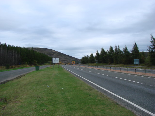
A9 road (Scotland)

The A9 is a major road in Scotland running from the Falkirk council area in central Scotland to Scrabster Harbour, Thurso in the far north, via Stirling...

Slochd Summit

The Slochd Summit (; Scottish Gaelic: An Sloc) is a mountain pass on the A9 road and the Highland Main Line Railway in the Scottish Highlands between Inverness...

Bogroy

Bogroy is a small crofting village, located 0.5 miles northwest of Carrbridge, in Strathspey, in the county of Inverness-shire, Scottish Highlands and...

Inverness, Nairn, Badenoch and Strathspey (UK Parliament constituency)

Inverness, Nairn, Badenoch and Strathspey is a constituency of the House of Commons of the UK Parliament. As with all seats since 1950 it elects one Member...
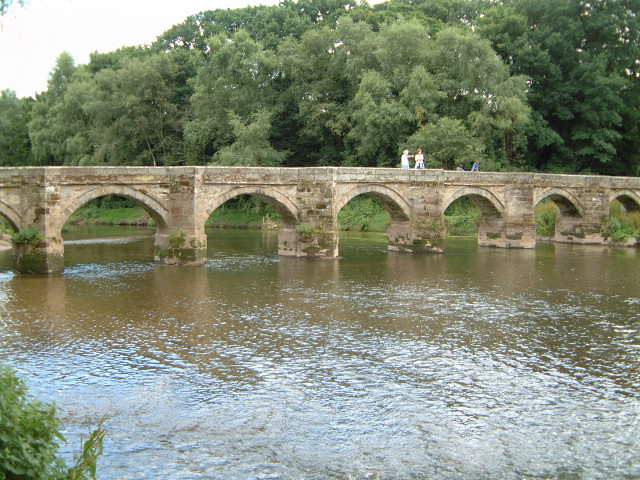
Packhorse bridge

A packhorse bridge is a bridge intended to carry packhorses (horses loaded with sidebags or panniers) across a river or stream. Typically a packhorse bridge...

Nearby Amenities

Located within 500m of 57.348436,-3.8572407
Carn Gruamach
Ele: 633
Natural: peak
Lat/Long: 57.3479691/-3.856464
The data included in this document is from www.openstreetmap.org. The data is made available under ODbL.

Have you been to Carn Gruamach?

Leave your review of Carn Gruamach below (or comments, questions and feedback).