Beinn Eagagach

Hill, Mountain in Perthshire

Scotland

Beinn Eagagach

View from Farragon Hill Looking north towards Lochan a' Chait.
View from Farragon Hill Credit: Richard Webb

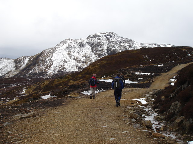
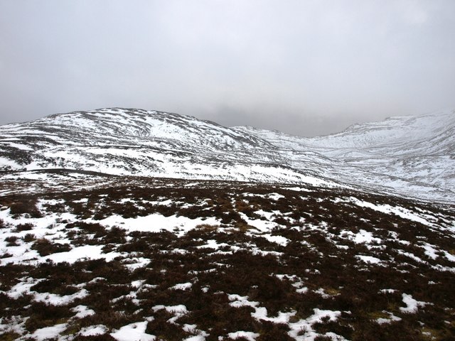
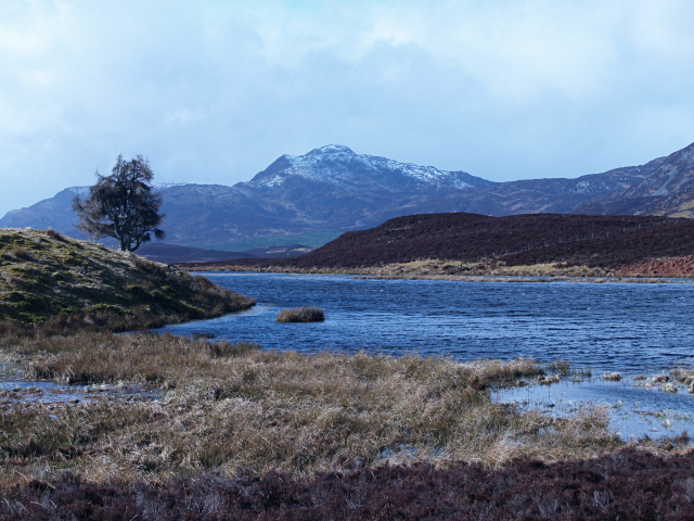
Beinn Eagagach, also known as Ben Lawers, is a mountain located in Perthshire, Scotland. It is part of the Ben Lawers National Nature Reserve and is the 10th highest mountain in Scotland, standing at 1,214 meters (3,983 feet) tall. The mountain is popular among hikers and mountaineers due to its challenging terrain and stunning panoramic views of the surrounding area.

Beinn Eagagach is known for its diverse flora and fauna, with rare alpine plants such as the purple saxifrage and alpine forget-me-nots found along its slopes. The mountain is also home to a variety of wildlife, including red deer, mountain hares, and ptarmigans.

The main route to the summit of Beinn Eagagach starts from the Ben Lawers Visitor Centre and follows a well-marked path that leads to the summit. The climb can be challenging, especially in winter when the mountain is often covered in snow and ice. However, the effort is rewarded with breathtaking views of Loch Tay and the surrounding mountains.

Overall, Beinn Eagagach is a must-visit destination for outdoor enthusiasts looking to experience the beauty and wilderness of the Scottish Highlands.

If you have any feedback on the listing, please let us know in the comments section below.

Beinn Eagagach Images

Images are sourced within 2km of 56.687009/-3.8696726 or Grid Reference NN8556. Thanks to Geograph Open Source API. All images are credited.

View from Farragon Hill Looking north towards Lochan a' Chait.
View from Farragon Hill
Looking north towards Lochan a' Chait.
Summit cairn on Farragon Hill Schiehallion rises into cloud on the left.
Summit cairn on Farragon Hill
Schiehallion rises into cloud on the left.
Barites mine at Beinn Eagagach Deep, blue pool in the old excavations. There are controversial plans to open a new mine about 1 km to the east.
Barites mine at Beinn Eagagach
Deep, blue pool in the old excavations. There are controversial plans to open a new mine about 1 km to the east.
South shore of Lochan a' Chait Rocky shoreline of Lochan a' Chait on the northern slopes of Farragon Hill
South shore of Lochan a' Chait
Rocky shoreline of Lochan a' Chait on the northern slopes of Farragon Hill
Farragon Hill View across Loch Tummel from Allean Forest
Farragon Hill
View across Loch Tummel from Allean Forest
Now a helpful sign This is intended to help hillwalkers who notice the 'Unhelpful sign' Geograph for this square. The sign has been changed since 2007 and there are now at least three other signs much further down the hill to warn you of deer stalking ahead.
Now a helpful sign
This is intended to help hillwalkers who notice the 'Unhelpful sign' Geograph for this square. The sign has been changed since 2007 and there are now at least three other signs much further down the hill to warn you of deer stalking ahead.
Summit cairn on Farragon Hill Schiehallion in the distance to the west.
Summit cairn on Farragon Hill
Schiehallion in the distance to the west.
Looking NE from farragon Hill The track to Netherton on Loch Tummel, to the north, can be seen at the edge of the square.
Looking NE from farragon Hill
The track to Netherton on Loch Tummel, to the north, can be seen at the edge of the square.
Lochan a Chait from the approach to Farragon Hill
Forestry by the Farragon track Loch Derculich in the distance.
Forestry by the Farragon track
Loch Derculich in the distance.
Unhelpful sign On the track we came in on, we were 4 miles from the road before we got this warning.  On other routes we later found much earlier warning signs.  Not a problem at this time of year (April) but could be very annoying later on in the year.
Unhelpful sign
On the track we came in on, we were 4 miles from the road before we got this warning. On other routes we later found much earlier warning signs. Not a problem at this time of year (April) but could be very annoying later on in the year.
Sheep and quartzite boulder Looking SW from the track near Loch Derculich.
Sheep and quartzite boulder
Looking SW from the track near Loch Derculich.
The Farragon track Near Loch Derculich.
The Farragon track
Near Loch Derculich.
Duntanlich Loch Fishing lochan above Loch Tummel with derelict boat house.
Duntanlich Loch
Fishing lochan above Loch Tummel with derelict boat house.
Beinn Eagagach track Walkers on the track past the old mines on Beinn Eagagach, Farragon Hill beyond
Beinn Eagagach track
Walkers on the track past the old mines on Beinn Eagagach, Farragon Hill beyond
Boggy Hillside south of Sron Mhor The hillside around these parts is characterised by many small lochans, but this bit of bog hasn't quite yet attained that status!
Boggy Hillside south of Sron Mhor
The hillside around these parts is characterised by many small lochans, but this bit of bog hasn't quite yet attained that status!
Quarry beside the Beinn Eagagach track A water filled quarry coloured by dissolved minerals found just off the track.
Quarry beside the Beinn Eagagach track
A water filled quarry coloured by dissolved minerals found just off the track.
Wild landscape South of Loch Tummel The view of the upper glen northeast of Farragon Hill. Short heather, both kinds, and tusock grass.
Wild landscape South of Loch Tummel
The view of the upper glen northeast of Farragon Hill. Short heather, both kinds, and tusock grass.
Show me another place!

Beinn Eagagach is located at Grid Ref: NN8556 (Lat: 56.687009, Lng: -3.8696726)

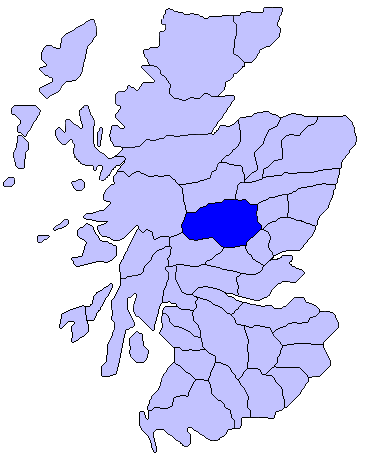
Unitary Authority: Perth and Kinross

Police Authority: Tayside

What 3 Words

///spray.activism.intention. Near Aberfeldy, Perth & Kinross

Related Wikis

Loch Derculich

Loch Derculich is a freshwater loch in central highlands of Scotland, in Perth and Kinross. Loch Tummel is located three miles to the north. == Habitation... ==

Farragon Hill

Farragon Hill (782 m) is a peak in the foothills of the Grampian Mountains of Scotland. It lies above the town of Aberfeldy in Perthshire. The hill is...

Loch Tummel

Loch Tummel (Scottish Gaelic: Loch Teimheil) is a long, narrow loch, seven kilometres (4+1⁄2 miles) northwest of Pitlochry in the council area of Perth...

Atholl

Atholl or Athole (Scottish Gaelic: Athall; Old Gaelic Athfhotla) is a large historical division in the Scottish Highlands, bordering (in anti-clockwise...

Nearby Amenities

Located within 500m of 56.687009,-3.8696726
Beinn Eagagach
Ele: 688
Natural: peak
Lat/Long: 56.6868726/-3.8695377
The data included in this document is from www.openstreetmap.org. The data is made available under ODbL.

Have you been to Beinn Eagagach?

Leave your review of Beinn Eagagach below (or comments, questions and feedback).