Beinn Gharbh

Hill, Mountain in Perthshire

Scotland

Beinn Gharbh

The Atholl Beinn Dearg This hill, although high is often rather retiring in views but really stands out from the south of Glen Errochty. The summit is a light pink in colour due to the granite but I have only ever visited it in Winter.
The Atholl Beinn Dearg Credit: Richard Webb

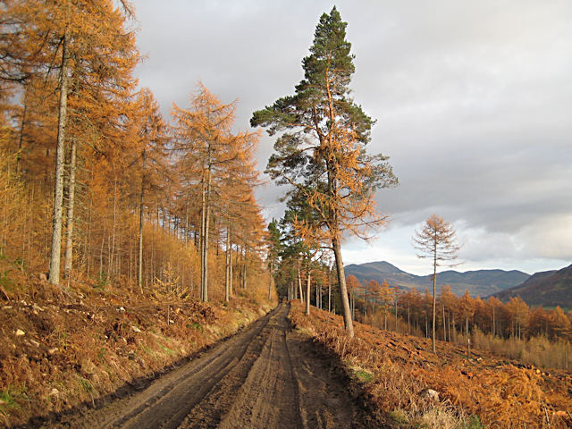
Beinn Gharbh is a prominent hill located in Perthshire, Scotland. It stands at an elevation of 657 meters (2,155 feet) above sea level and is a popular destination for hikers and outdoor enthusiasts. The hill is part of the Ben Lawers range in the southern Highlands of Scotland.

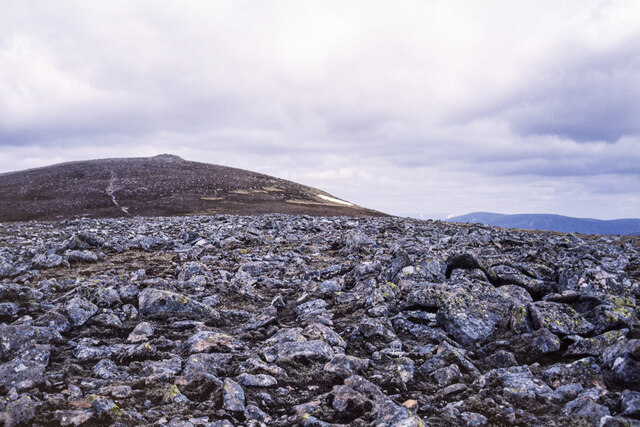
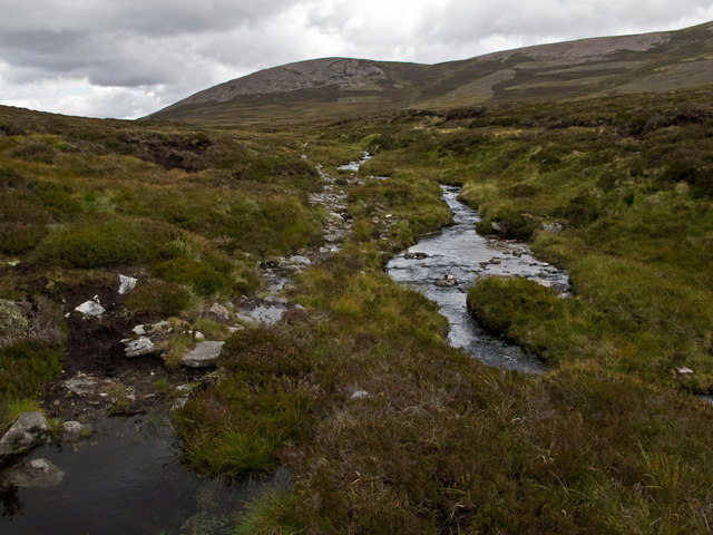
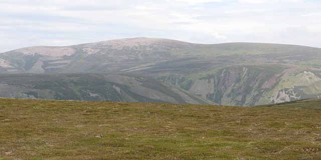
Beinn Gharbh offers stunning panoramic views of the surrounding landscape, including Loch Tay and the nearby mountains. The terrain is rugged and rocky, with heather-covered slopes and patches of woodland scattered throughout. The hill is known for its challenging hiking trails, which vary in difficulty and length.

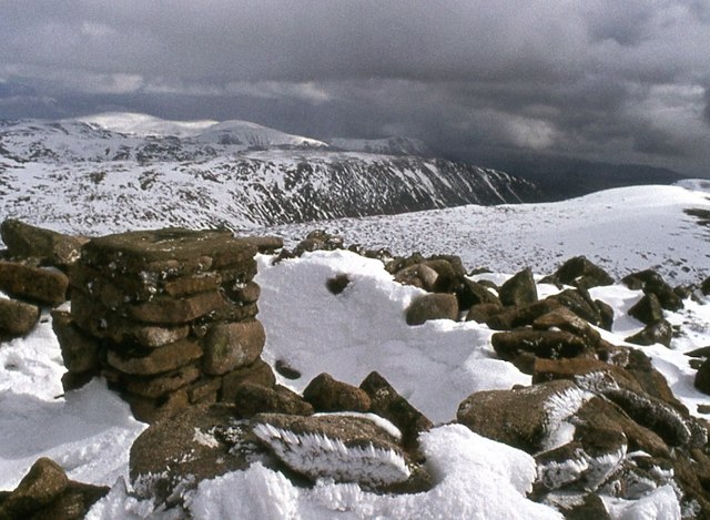
The summit of Beinn Gharbh is marked by a cairn, where hikers can pause to take in the breathtaking views and enjoy a well-deserved rest. On a clear day, it is possible to see as far as Ben Nevis, the highest mountain in Scotland.

Overall, Beinn Gharbh is a must-visit for those seeking a rewarding outdoor adventure in the picturesque Perthshire countryside. Its rugged beauty and stunning vistas make it a popular destination for both experienced hikers and beginners looking to explore the Scottish Highlands.

If you have any feedback on the listing, please let us know in the comments section below.

Beinn Gharbh Images

Images are sourced within 2km of 56.888598/-3.8869387 or Grid Reference NN8579. Thanks to Geograph Open Source API. All images are credited.

The Atholl Beinn Dearg This hill, although high is often rather retiring in views but really stands out from the south of Glen Errochty. The summit is a light pink in colour due to the granite but I have only ever visited it in Winter.
The Atholl Beinn Dearg
This hill, although high is often rather retiring in views but really stands out from the south of Glen Errochty. The summit is a light pink in colour due to the granite but I have only ever visited it in Winter.
Western slopes of Beinn Dearg
Path towards the summit of Beinn Dearg
Trig point atop Beinn Dearg
Rounded boulders at summit area of Beinn Dearg Beinn Dearg, meaning red hill is a fairly common name around the Highland mountains; this example is one of the more remote of them. The name comes from the pink granite boulders which cover the summit area and lie in rashes over the surrounding ground.
In the distance, on the horizon, is the range of Beinn a' Ghlo which has three Munros.
Nearer are two long ridges, those of Carn a' Chlamain and Beinn Mheadhonach.
Rounded boulders at summit area of Beinn Dearg
Beinn Dearg, meaning red hill is a fairly common name around the Highland mountains; this example is one of the more remote of them. The name comes from the pink granite boulders which cover the summit area and lie in rashes over the surrounding ground. In the distance, on the horizon, is the range of Beinn a' Ghlo which has three Munros. Nearer are two long ridges, those of Carn a' Chlamain and Beinn Mheadhonach.
Sliabh na Cloiche Moire
Summit of Beinn Dearg
The summit of Beinn Dearg
Rocks at top of Sliabh na Cloiche Moire The barren rocky top of a minor knoll of Beinn Dearg, south-south-west of the summit, at around 930 metres in height. It appears to be known as Sliabh na Cloiche Moire which apparently translates to English as St. Mary's Mountain. The main mountain is seen in the distance.
Rocks at top of Sliabh na Cloiche Moire
The barren rocky top of a minor knoll of Beinn Dearg, south-south-west of the summit, at around 930 metres in height. It appears to be known as Sliabh na Cloiche Moire which apparently translates to English as St. Mary's Mountain. The main mountain is seen in the distance.
Rounded boulders on Beinn Gharbh Beinn Gharbh is a northern top of the Munro, Beinn Dearg, its summit area is covered with rounded boulders of pink granite.
Rounded boulders on Beinn Gharbh
Beinn Gharbh is a northern top of the Munro, Beinn Dearg, its summit area is covered with rounded boulders of pink granite.
Moorland below Beinn Gharbh Wet moorland below Beinn Gharbh.  Usually hill walkers find the quality of ground underfoot decreases with height and this is certainly the case when dropping north from Beinn Dearg towards the Tarf Water, as close cropped heather gives way to rough grassland, which gives way to deep heather and peat haggs.
Moorland below Beinn Gharbh
Wet moorland below Beinn Gharbh. Usually hill walkers find the quality of ground underfoot decreases with height and this is certainly the case when dropping north from Beinn Dearg towards the Tarf Water, as close cropped heather gives way to rough grassland, which gives way to deep heather and peat haggs.
North of Beinn Dearg North of the summit of Beinn Dearg (Red Hill), showing the reddish granite scree which gives the peak its name.
North of Beinn Dearg
North of the summit of Beinn Dearg (Red Hill), showing the reddish granite scree which gives the peak its name.
Beinn Dearg The summit area of Beinn Dearg (Red Hill), with reddish granite boulders and scree that give the peak its name.
Beinn Dearg
The summit area of Beinn Dearg (Red Hill), with reddish granite boulders and scree that give the peak its name.
Path near Beinn Losgarnaich A path above the Allt Beinn Losgarnaich that can be used for an ascent of Beinn Dearg. Beinn Gharbh and the northern flank of Beinn Dearg can be seen in the background.
Path near Beinn Losgarnaich
A path above the Allt Beinn Losgarnaich that can be used for an ascent of Beinn Dearg. Beinn Gharbh and the northern flank of Beinn Dearg can be seen in the background.
Summit of Beinn Dearg, Atholl At 3307ft, Beinn Dearg is the 124th highest mountain in Scotland.
Summit of Beinn Dearg, Atholl
At 3307ft, Beinn Dearg is the 124th highest mountain in Scotland.
Approaching the summit of Beinn Dearg, Atholl
Lochan Mon an Fhidhain A very dull day at Lochan Mon an Fhidhain. You can just see the hills that the Minigaig Pass crosses in the distance, but soon even this partial view disappeared as the cloud descended and a heavy rain shower arrived.
Lochan Mon an Fhidhain
A very dull day at Lochan Mon an Fhidhain. You can just see the hills that the Minigaig Pass crosses in the distance, but soon even this partial view disappeared as the cloud descended and a heavy rain shower arrived.
Glen on northern side of Beinn Dearg The very remote Corbett, Beinn Bhreac (912m) is the hill in the middle of the photo with the cloud on the summit. The stream in this glen is flowing north, but ends up in the Bruar, then the Garry, next the Tummel and finally the Tay, well to the south!
Glen on northern side of Beinn Dearg
The very remote Corbett, Beinn Bhreac (912m) is the hill in the middle of the photo with the cloud on the summit. The stream in this glen is flowing north, but ends up in the Bruar, then the Garry, next the Tummel and finally the Tay, well to the south!
Show me another place!

Beinn Gharbh is located at Grid Ref: NN8579 (Lat: 56.888598, Lng: -3.8869387)

Unitary Authority: Perth and Kinross

Police Authority: Tayside

What 3 Words

///interviewer.surfacing.laying. Near Blair Atholl, Perth & Kinross

Nearby Locations

Beinn Gharbh

Related Wikis

Beinn Dearg (Blair Atholl)

Beinn Dearg (1,009 m) is a mountain in the Grampian Mountains of Scotland. It lies north of the Perth and Kinross village of Blair Atholl, in the Forest...

Forest of Atholl

The Forest of Atholl (also known as Atholl Forest) is a deer forest near the Scottish village of Blair Atholl, Perth and Kinross, first recorded in the...

Carn a' Chlamain

Càrn a' Chlamain (Gaelic: Càrn a' Chlamhain) is a Scottish mountain situated roughly 12 kilometres north of Blair Atholl in the Forest of Atholl. It is...

Carn an Fhidhleir

Carn an Fhidhleir (994 m) is a mountain in the Grampian Mountains of Scotland. It lies on the border of Inverness-shire, Perthshire and Aberdeenshire,...

Nearby Amenities

Located within 500m of 56.888598,-3.8869387
Beinn Gharbh
Ele: 932
Natural: peak
Lat/Long: 56.8896851/-3.8850442
The data included in this document is from www.openstreetmap.org. The data is made available under ODbL.

Have you been to Beinn Gharbh?

Leave your review of Beinn Gharbh below (or comments, questions and feedback).