Carn na h-Aon-Chraoibhe

Hill, Mountain in Nairnshire

Scotland

Carn na h-Aon-Chraoibhe

Carn a' Mhais Leathain Moorland with bogs and peat hags. Tree stumps are revealed in the peat hags, showing that this area was once forested.  This is part of Cawdor Estate's grouse moors.
Carn a' Mhais Leathain Credit: Dorothy Carse

Carn na h-Aon-Chraoibhe is a prominent hill located in Nairnshire, Scotland. It is part of the Scottish Highlands and stands at an elevation of approximately 661 meters (2,170 feet) above sea level. The hill is situated southeast of the town of Nairn and offers stunning views of the surrounding countryside.

Carn na h-Aon-Chraoibhe is known for its rugged and rocky terrain, making it a popular destination for hikers, mountaineers, and nature enthusiasts. The hill is covered in heather and grasses, creating a picturesque landscape during the summer months. The area is also home to a variety of wildlife, including red deer, mountain hares, and various species of birds.

The ascent to the summit of Carn na h-Aon-Chraoibhe can be challenging, but the effort is rewarded with breathtaking panoramic views of the Moray Firth and the surrounding hills and mountains. On a clear day, it is even possible to see the distant peaks of the Cairngorms National Park.

The hill is accessible via various paths and trails, although it is recommended to have some experience in hillwalking and navigation due to the remote and sometimes treacherous nature of the terrain. It is advisable to check weather conditions and be properly prepared before attempting the ascent.

Overall, Carn na h-Aon-Chraoibhe offers outdoor enthusiasts a chance to experience the beauty and tranquility of the Scottish Highlands, with its striking landscape and stunning vistas.

If you have any feedback on the listing, please let us know in the comments section below.

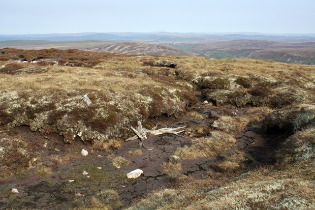
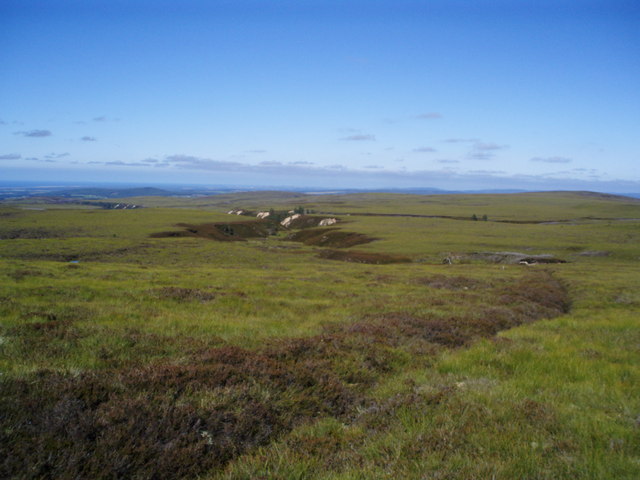
Carn na h-Aon-Chraoibhe Images

Images are sourced within 2km of 57.450921/-3.9280024 or Grid Reference NH8441. Thanks to Geograph Open Source API. All images are credited.

Carn a' Mhais Leathain Moorland with bogs and peat hags. Tree stumps are revealed in the peat hags, showing that this area was once forested.  This is part of Cawdor Estate's grouse moors.
Carn a' Mhais Leathain
Moorland with bogs and peat hags. Tree stumps are revealed in the peat hags, showing that this area was once forested. This is part of Cawdor Estate's grouse moors.
Small lochan west of Carn a' Mhais Leathain An area of moorland on Cawdor Estate, with peat hags and bogs, looking towards the Moray Firth.
Small lochan west of Carn a' Mhais Leathain
An area of moorland on Cawdor Estate, with peat hags and bogs, looking towards the Moray Firth.
Peat hag in Coire Odhar Beag Looking towards Carn a' Mhais Leathain.
Peat hag in Coire Odhar Beag
Looking towards Carn a' Mhais Leathain.
Boggy ground in Coire Odhar Beag Moorland with lichen, bog pools and peat hags on Cawdor Estate.
Boggy ground in Coire Odhar Beag
Moorland with lichen, bog pools and peat hags on Cawdor Estate.
Moorland on Carn Odhar by Allt Creag a' Chait
Moorland on lower slopes of Carn Odhar by Allt Creag a' Chait
Moorland North of Carn Odhar by Allt Creag a' Chait
Looking East across Moorland by Allt Creag a' Chait
Waterfall on the Allt Carn a' Mhàis Leathain Looking up at the old wooden footbridge above the waterfall, the new steel footbridge just visible behind. The Allt Carn a' Mhàis Leathain now has water abstracted though an intake weir above  the waterfall to power a micro hydro-electric scheme to provide power to Drynachan Lodge.
Waterfall on the Allt Carn a' Mhàis Leathain
Looking up at the old wooden footbridge above the waterfall, the new steel footbridge just visible behind. The Allt Carn a' Mhàis Leathain now has water abstracted though an intake weir above the waterfall to power a micro hydro-electric scheme to provide power to Drynachan Lodge.
Intake Weir on the Allt Carn a' Mhàis Leathain Intake weir just above the waterfall, part of a micro hydro electric power scheme supplying Drynachan Lodge. The wooden building in the background is a bothy used by beaters and estate workers.
Intake Weir on the Allt Carn a' Mhàis Leathain
Intake weir just above the waterfall, part of a micro hydro electric power scheme supplying Drynachan Lodge. The wooden building in the background is a bothy used by beaters and estate workers.
Footbridge over the Allt Carn a' Mhàis Leathain New metal footbridge over the Allt Carn a' Mhàis Leathain. The old wooden dilapidated bridge is still in place behind the new one.
Footbridge over the Allt Carn a' Mhàis Leathain
New metal footbridge over the Allt Carn a' Mhàis Leathain. The old wooden dilapidated bridge is still in place behind the new one.
Moorland above the Drynachan Burn Upland Nairnshire, part of the vast Cawdor Estate.
Moorland above the Drynachan Burn
Upland Nairnshire, part of the vast Cawdor Estate.
Cawdor Grouse Moor A large area of moorland on Cawdor Estate north of Drynachan Lodge.  Looking towards Carn a' Mhais Leathain.
Cawdor Grouse Moor
A large area of moorland on Cawdor Estate north of Drynachan Lodge. Looking towards Carn a' Mhais Leathain.
Track with Bridge On Cawdor Estate grouse moors.  The bridge crosses an un-named tributary of the Carnoch Burn.
Track with Bridge
On Cawdor Estate grouse moors. The bridge crosses an un-named tributary of the Carnoch Burn.
Moorland Track On Cawdor Estate grouse moors north of Drynachan Lodge.
Moorland Track
On Cawdor Estate grouse moors north of Drynachan Lodge.
Track Through Moorland Crossing grouse moors on Cawdor Estate.  The track drops down to cross a ford before climbing again.
Track Through Moorland
Crossing grouse moors on Cawdor Estate. The track drops down to cross a ford before climbing again.
Ford on Moorland Track An estate track crossing an un-named tributary of the Carnach Burn.
Ford on Moorland Track
An estate track crossing an un-named tributary of the Carnach Burn.
Track across Grouse Moors Track descending towards Riereach Burn which it then follows to meet the road at Glengeoullie.
Track across Grouse Moors
Track descending towards Riereach Burn which it then follows to meet the road at Glengeoullie.
Show me another place!

Carn na h-Aon-Chraoibhe is located at Grid Ref: NH8441 (Lat: 57.450921, Lng: -3.9280024)

Unitary Authority: Highland

Police Authority: Highlands and Islands

What 3 Words

///racing.shocks.blotches. Near Balloch, Highland

Related Wikis

Dun Evan

Dun Evan or the Doune of Cawdor is a hill fort located 2.5 kilometres (1.6 mi) south west of Cawdor in the Highland area of Scotland. It is situated on...

Cawdor

Cawdor (Scottish Gaelic: Caladair) is a village and parish in the Highland council area, Scotland. The village is 5 miles (8 kilometres) south-southwest...

Cawdor (Roman fort)

Cawdor (Roman Fort), located near the small village of Easter Galcantray (15 miles or 24 kilometres east of Inverness), is suspected of being one of the...

County of Nairn

The County of Nairn (also called Nairnshire) (Scottish Gaelic: Siorrachd Inbhir Narann) is a historic county, registration county and lieutenancy area...

Nearby Amenities

Located within 500m of 57.450921,-3.9280024
Hunting Stand
Hunting Stand: grouse_butt
Lat/Long: 57.4519916/-3.9232032
Hunting Stand
Hunting Stand: grouse_butt
Lat/Long: 57.452338/-3.9226209
Hunting Stand
Hunting Stand: grouse_butt
Lat/Long: 57.4526795/-3.9220509
Hunting Stand
Hunting Stand: grouse_butt
Lat/Long: 57.452963/-3.9215949
Hunting Stand
Hunting Stand: grouse_butt
Lat/Long: 57.4533392/-3.9209756
The data included in this document is from www.openstreetmap.org. The data is made available under ODbL.

Have you been to Carn na h-Aon-Chraoibhe?

Leave your review of Carn na h-Aon-Chraoibhe below (or comments, questions and feedback).