Grinnan Hill

Hill, Mountain in Perthshire

Scotland

Grinnan Hill

Bridge of Keir
Bridge of Keir Credit: Alan Reid

Grinnan Hill is a prominent hill located in Perthshire, Scotland. It stands at an elevation of 184 meters (604 feet) above sea level and offers stunning panoramic views of the surrounding countryside. The hill is a popular destination for hikers and nature enthusiasts, with a well-maintained trail that leads to the summit.

At the top of Grinnan Hill, visitors can enjoy breathtaking views of the rolling hills and valleys of Perthshire, as well as the nearby town of Dunkeld. On a clear day, it is possible to see as far as the Cairngorms and the Grampian Mountains in the distance.

The hill is covered in lush green vegetation, including heather, grasses, and scattered trees, providing habitat for a variety of wildlife such as birds, rabbits, and deer. The area is also rich in history, with ancient ruins and burial cairns dotting the landscape.

Overall, Grinnan Hill is a beautiful and tranquil spot to enjoy nature and take in the picturesque scenery of Perthshire.

If you have any feedback on the listing, please let us know in the comments section below.
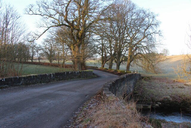
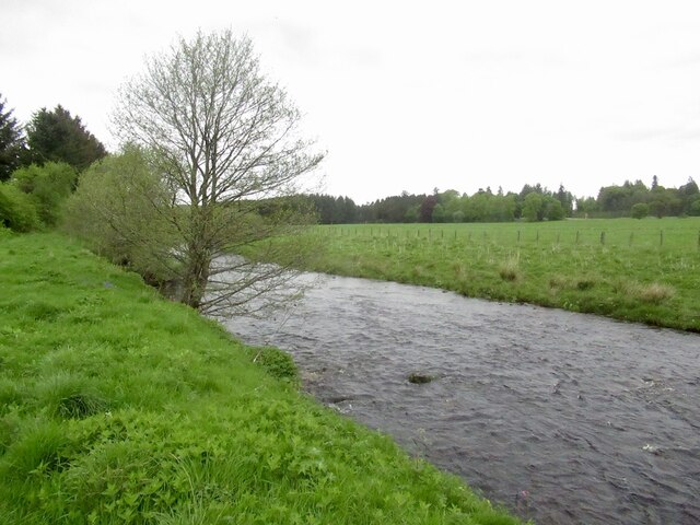
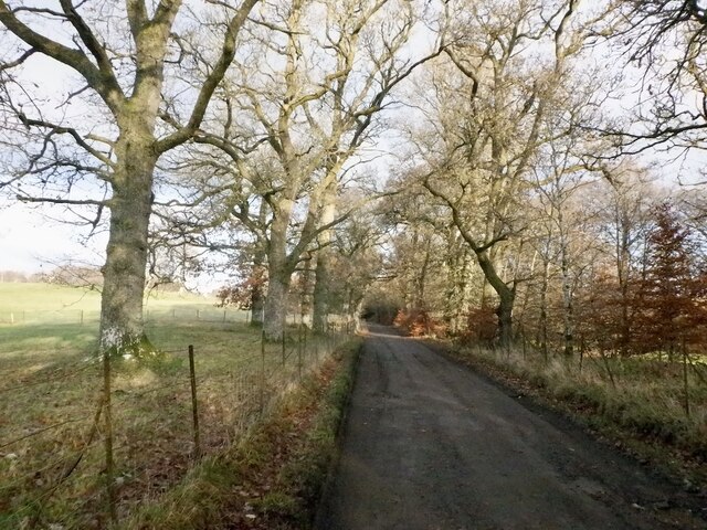
Grinnan Hill Images

Images are sourced within 2km of 56.262364/-3.8838945 or Grid Reference NN8309. Thanks to Geograph Open Source API. All images are credited.

Bridge of Keir
Bridge of Keir
Roadworks on the B8033
Floodplain by the River Knaik Close to the confluence between the Knaik and the Allan Water.
Floodplain by the River Knaik
Close to the confluence between the Knaik and the Allan Water.
Banks of the River Knaik Taken from close to the path running between Braco and Greenloaning.

The Knaik is a secondary tributary of the Forth, via the Allan Water.
Banks of the River Knaik
Taken from close to the path running between Braco and Greenloaning. The Knaik is a secondary tributary of the Forth, via the Allan Water.
Path by Braco New Cemetery Leads to a riverside path. Popular with dog walkers so watch your step.
Path by Braco New Cemetery
Leads to a riverside path. Popular with dog walkers so watch your step.
Rolled grass, Braco The site of a Roman road.
Rolled grass, Braco
The site of a Roman road.
River Knaik, Braco
River Knaik, Braco
River Knaik Downstream view taken whilst fording the river.
River Knaik
Downstream view taken whilst fording the river.
Field, Ardoch A corner between a lade and the River Knaik.
Field, Ardoch
A corner between a lade and the River Knaik.
Lade and hollow tree
Lade, Ardoch
Lade, Ardoch
Field drain at Easter Rottearns
Duck pond at Easter Rottearns
The junction of the B827 and the A822 Just by the Black Hill Roman Camp.
The junction of the B827 and the A822
Just by the Black Hill Roman Camp.
The B827 at Black Hill Roman Camp
Road to Braco Castle
Playing field, Braco
Road to Braco Castle
Show me another place!

Grinnan Hill is located at Grid Ref: NN8309 (Lat: 56.262364, Lng: -3.8838945)

Unitary Authority: Perth and Kinross

Police Authority: Tayside

What 3 Words

///composer.shopper.proposals. Near Dunblane, Stirling

Nearby Locations

Grinnan Hill Braco

Related Wikis

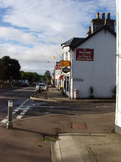
Braco, Perth and Kinross

Braco ( BRAY-koh) is a village in Perth and Kinross, Scotland, with a population of 515. It is located 5 miles (8 kilometres) north of Dunblane towards...

Greenloaning railway station

Greenloaning railway station served the village of Greenloaning, Perth and Kinross, Scotland from 1848 to 1956 on the Scottish Central Railway. == History... ==

Black Hill Roman Camps

Black Hill Roman Camps are two Roman camps that are part of an extensive complex of Roman military sites centred around the fort at Ardoch, Perth and...

Greenloaning

Greenloaning is a village in Perth and Kinross, Perthshire, Scotland. It lies by the Allan Water and the Stirling-Perth Railway line. It is 1 mile (1...

Nearby Amenities

Located within 500m of 56.262364,-3.8838945
Braco
Name Gd: Breac-achadh
Place: village
Population: 540
Wikidata: Q1011140
Wikipedia: en:Braco
Lat/Long: 56.2639946/-3.8796938
Mini Roundabout
Direction: clockwise
Lat/Long: 56.2626104/-3.8791935
Disused Amenity: post_office
Lat/Long: 56.264092/-3.8791231
Restaurant
Poomjai Thai Kitchen Ltd
Addr City: Braco
Addr Housenumber: 16
Addr Postcode: FK15 9PL
Addr Street: Commander's Grove
Cuisine: thai
Delivery: yes
Diet Gluten Free: yes
Diet Non-vegetarian: yes
Diet Vegetarian: yes
Opening Hours: Tu-Su 17:00-20:00 "pre-order delivery only"
Website: https://poomjai-thai-kitchen.com
Lat/Long: 56.2612799/-3.8823525
Crossing
Crossing: uncontrolled
Crossing Markings: yes
Lat/Long: 56.2658285/-3.8800366
Power: pole
Lat/Long: 56.2666577/-3.8832357
Power: pole
Lat/Long: 56.2661127/-3.8830777
Power: pole
Lat/Long: 56.2582372/-3.8816022
Power: pole
Lat/Long: 56.2582465/-3.8826418
Power: pole
Lat/Long: 56.2582616/-3.8837672
Power: pole
Lat/Long: 56.2582651/-3.8851164
Power: pole
Lat/Long: 56.2582732/-3.8862124
Power: pole
Lat/Long: 56.2649579/-3.8775192
Power: pole
Lat/Long: 56.2642935/-3.8775987
Power: pole
Lat/Long: 56.2636441/-3.8776698
Power: pole
Lat/Long: 56.2632038/-3.8780965
Power: pole
Lat/Long: 56.2627716/-3.8785127
Power: pole
Lat/Long: 56.2623499/-3.8789353
Material: wood
Power: pole
Lat/Long: 56.2621292/-3.8791591
Material: wood
Power: pole
Lat/Long: 56.2614391/-3.87927
Material: wood
Power: pole
Lat/Long: 56.2607548/-3.8793829
Power: pole
Lat/Long: 56.2606793/-3.8798933
Power: pole
Lat/Long: 56.2598591/-3.8800293
Power: pole
Lat/Long: 56.2590783/-3.880161
Power: pole
Lat/Long: 56.2628623/-3.8891472
Power: pole
Lat/Long: 56.2623976/-3.889258
Power: pole
Lat/Long: 56.261891/-3.8893814
Power: pole
Lat/Long: 56.2614089/-3.8895237
Power: pole
Lat/Long: 56.2606967/-3.8896701
Power: pole
Lat/Long: 56.2600171/-3.8898583
Entrance: yes
Lat/Long: 56.2659057/-3.8800578
Defibrillator
Access: yes
Defibrillator Location: outside Braco Village Hall
Emergency: defibrillator
Indoor: no
Lat/Long: 56.2658723/-3.8801381
Bench
Lat/Long: 56.2660335/-3.8798248
Recycling
Recycling Type: container
Lat/Long: 56.2657212/-3.8806232
Post Box
Collection Plate: CP1
Collection Plate Date: 2022-02-28
Collection Times: Mo-Fr 16:00; Sa 10:30
Manufacturer: Machan Eng Scotland
Operator: Royal Mail
Post Box Type: pillar
Ref: FK15 152
Royal Cypher: scottish_crown
Source: survey
Lat/Long: 56.2641499/-3.8790333
The data included in this document is from www.openstreetmap.org. The data is made available under ODbL.

Have you been to Grinnan Hill?

Leave your review of Grinnan Hill below (or comments, questions and feedback).