Bolfracks Hill
Hill, Mountain in Perthshire
Scotland
Bolfracks Hill
Bolfracks Hill is a prominent landmark located in Perthshire, Scotland. Situated near the village of Aberfeldy, it is part of the wider Bolfracks Estate, which encompasses over 2,000 acres of picturesque countryside.
Standing at an elevation of approximately 535 meters (1,755 feet), Bolfracks Hill offers breathtaking views of the surrounding Perthshire landscape. Its summit provides a panoramic vista, making it a popular destination for hikers, nature enthusiasts, and photographers alike.
The hill is covered in a rich tapestry of vegetation, including heather, grasses, and scattered woodlands, which contribute to its scenic beauty. This diverse habitat also supports a range of wildlife, including birds, rabbits, and deer, making it an excellent spot for birdwatching and wildlife observation.
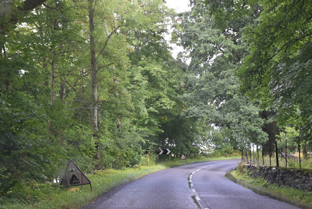
Bolfracks Hill is easily accessible, with a well-maintained footpath leading to the summit. The trail meanders through the estate's rolling hills, offering visitors the opportunity to immerse themselves in the tranquil Scottish countryside.
In addition to its natural beauty, Bolfracks Hill also holds historical significance. The Bolfracks Estate has been owned by the Stewart family for over a century, and the hill serves as a reminder of the area's rich cultural heritage.
Overall, Bolfracks Hill is a captivating destination that showcases the stunning landscapes and biodiversity of Perthshire. Whether for a leisurely stroll or a more challenging hike, this picturesque hill offers an unforgettable experience for all who visit.
If you have any feedback on the listing, please let us know in the comments section below.
Bolfracks Hill Images
Images are sourced within 2km of 56.601762/-3.9110399 or Grid Reference NN8247. Thanks to Geograph Open Source API. All images are credited.


Bolfracks Hill is located at Grid Ref: NN8247 (Lat: 56.601762, Lng: -3.9110399)
Unitary Authority: Perth and Kinross
Police Authority: Tayside
What 3 Words
///yourself.luring.profited. Near Aberfeldy, Perth & Kinross
Nearby Locations
Related Wikis
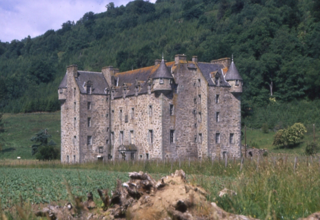
Castle Menzies
Castle Menzies in Scotland is the ancestral seat of the Clan Menzies and the Menzies Baronets. It is located a little to the west of the small village...

Falls of Moness
Falls of Moness is a waterfall of Scotland. The Falls of Moness located in Aberfeldy, Perthshire, Scotland is a 150m high waterfall tucked away in the...
Dull, Perth and Kinross
Dull (Scottish Gaelic: Dul, pronounced [t̪ul̪ˠ]) is a village in Perth and Kinross, Scotland. It is paired with Boring, Oregon. Bland, New South Wales...
Harpswell Cattle Pound
The Harpswell Cattle Pound is a stone enclosure in Harpswell, Maine, United States. It was used to hold stray animals until they could be reunited with...

Croft Moraig Stone Circle
Croft Moraig Stone Circle (also Croftmoraig) is a prehistoric stone circle situated four miles southwest of Aberfeldy, Scotland (grid reference NN79754726...
Breadalbane Academy
Breadalbane Academy is a 2–18 mixed, state all-through school in Aberfeldy, Perth and Kinross, Scotland. It has a Gaelic Medium provision in the primary...

Weem
Weem (Scottish Gaelic: Baile a' Chlachain) is a village on the B846 near Aberfeldy in Perthshire, Scotland. The name Weem is derived from the Gaelic uamh...
Weem Castle
Weem Castle is a former castle near Weem, Scotland. The castle was located near Castle Menzies. The castle became the seat of the Menzies family after...
Nearby Amenities
Located within 500m of 56.601762,-3.9110399Have you been to Bolfracks Hill?
Leave your review of Bolfracks Hill below (or comments, questions and feedback).