Elsworthy

Hill, Mountain in Somerset Somerset West and Taunton

England

Elsworthy

Ordnance Survey Cut Mark This OS cut mark can be found on the gatepost SE side of the road. It marks a point 417.302m above mean sea level.
Ordnance Survey Cut Mark Credit: Adrian Dust

Elsworthy, Somerset is a small hill located in the county of Somerset, England. With an elevation of approximately 200 meters (656 feet) above sea level, it is considered more of a hill than a mountain. Elsworthy is situated in the beautiful countryside, offering stunning views of the surrounding landscape.

The hill is characterized by its gentle slopes and lush greenery, making it a popular destination for hikers and nature enthusiasts. The area is known for its rich biodiversity, with various plant and animal species thriving in the diverse habitats found on Elsworthy.

At the summit of Elsworthy, visitors can enjoy panoramic views of the Somerset countryside, including rolling hills, farmland, and scattered woodlands. On a clear day, it is even possible to catch a glimpse of the distant coastline.

The hill is easily accessible by foot, with several footpaths and trails leading to the top. These routes vary in difficulty, catering to both leisurely walkers and more experienced hikers. Along the way, visitors may encounter an array of flora and fauna, including wildflowers, birds, and even grazing livestock.

Elsworthy, Somerset is a peaceful and tranquil location, providing an escape from the hustle and bustle of everyday life. It is a place where visitors can connect with nature, enjoy scenic views, and experience the beauty of the Somerset countryside.

If you have any feedback on the listing, please let us know in the comments section below.

Elsworthy Images

Images are sourced within 2km of 51.160508/-3.7000206 or Grid Reference SS8141. Thanks to Geograph Open Source API. All images are credited.
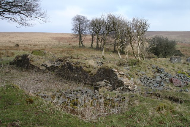
Ordnance Survey Cut Mark This OS cut mark can be found on the gatepost SE side of the road. It marks a point 417.302m above mean sea level.
Ordnance Survey Cut Mark
This OS cut mark can be found on the gatepost SE side of the road. It marks a point 417.302m above mean sea level.
Entrance of Red Deer Mine Completely overgrown, the entrance of Red Deer Mine is hardly visible, but it was too dangerous to get any nearer. The iron mine was set up by Plymouth Mining Company in the 1850s, but it soon closed. From the mine a small stream flows into the Exe.
Entrance of Red Deer Mine
Completely overgrown, the entrance of Red Deer Mine is hardly visible, but it was too dangerous to get any nearer. The iron mine was set up by Plymouth Mining Company in the 1850s, but it soon closed. From the mine a small stream flows into the Exe.
Pheasant Exmoor National Park is teeming with pheasants. This bird was clearly ill: it didn't even try to run or fly away. Dinner for fox or badger.
Pheasant
Exmoor National Park is teeming with pheasants. This bird was clearly ill: it didn't even try to run or fly away. Dinner for fox or badger.
River Exe flows along Westermill Campsite
Long Combe
Long Combe
Beckham Hill prehistoric stone row A triple stone row measuring 12.78m long, including nine medium-sized stones situated on a gentle north west facing slope. The row is orientated east to west. <span class="nowrap"><a title="https://stonerows.wordpress.com/gazetteer/region/exmoor/beckham-hill/" rel="nofollow ugc noopener" href="https://stonerows.wordpress.com/gazetteer/region/exmoor/beckham-hill/">Link</a><img style="margin-left:2px;" alt="External link" title="External link - shift click to open in new window" src="https://s1.geograph.org.uk/img/external.png" width="10" height="10"/></span>
Beckham Hill prehistoric stone row
A triple stone row measuring 12.78m long, including nine medium-sized stones situated on a gentle north west facing slope. The row is orientated east to west. LinkExternal link
Exmoor: Warren Farm Looking across the Exe valley from the access lane at the top of Three Combe Hill. Warren Farm was one of the estates established by John Knight and his son Frederic in the mid nineteenth century. It now offers bed and breakfast
Exmoor: Warren Farm
Looking across the Exe valley from the access lane at the top of Three Combe Hill. Warren Farm was one of the estates established by John Knight and his son Frederic in the mid nineteenth century. It now offers bed and breakfast
Warren Farm Exmoor At one time this was a very remote moorland farm, it now has a very good service road.
Warren Farm Exmoor
At one time this was a very remote moorland farm, it now has a very good service road.
Grass moorland near Dry Hill A view which typifies much of the square; gently sloping grassland interspersed with patches of reeds where the ground is wetter.
Grass moorland near Dry Hill
A view which typifies much of the square; gently sloping grassland interspersed with patches of reeds where the ground is wetter.
Grass moorland, Pinford The tussocky grassland slopes north, with two stream valleys. This is a rather bleak square.
Grass moorland, Pinford
The tussocky grassland slopes north, with two stream valleys. This is a rather bleak square.
Larkbarrow. Beech hedge near the ruins of a moorland farm.
Larkbarrow.
Beech hedge near the ruins of a moorland farm.
Exmoor: by Larkbarrow Gate Looking north east; trees on the skyline stand near Alderman’s Barrow
Exmoor: by Larkbarrow Gate
Looking north east; trees on the skyline stand near Alderman’s Barrow
Exmoor: by Larkbarrow Gate Looking north west; Swap Hill is to the left
Exmoor: by Larkbarrow Gate
Looking north west; Swap Hill is to the left
Exmoor: bridlepath near Elsworthy This is thought to be the formation of the Simonsbath – Porlock Weir railway, planned by John Knight in 1826 but never completed. It runs along a contour at about 427m above sea level; the bridleway utilising it today links Warren Farm and Larkbarrow Corner. [The formation shows up clearly in an aerial view: Figure 5.26 in ‘The Field Archaeology of Exmoor’, English Heritage, 2001]. See also <a href="https://www.geograph.org.uk/photo/80168">SS7840 : Exmoor: above Three Combe Hill</a>.
Exmoor: bridlepath near Elsworthy
This is thought to be the formation of the Simonsbath – Porlock Weir railway, planned by John Knight in 1826 but never completed. It runs along a contour at about 427m above sea level; the bridleway utilising it today links Warren Farm and Larkbarrow Corner. [The formation shows up clearly in an aerial view: Figure 5.26 in ‘The Field Archaeology of Exmoor’, English Heritage, 2001]. See also SS7840 : Exmoor: above Three Combe Hill.
Exmoor: south east from Elsworthy Moorland and pasture near the head of the Sparcombe Water. Seen from the Larkbarrow Corner – Warren Farm bridleway
Exmoor: south east from Elsworthy
Moorland and pasture near the head of the Sparcombe Water. Seen from the Larkbarrow Corner – Warren Farm bridleway
Larkbarrow  (Ruin) The 19th C. farmhouse was used for artillery target practice during WWII, hence the ruin.  Surrounding land has yielded much evidence of prior occupation, including the eponymous bronze-age barrow, flint working and standing stones.  The farm is supposed to have been the inspiration for 'Plover's Barrows Farm', the home of John Ridd in Lorna Doone.
Larkbarrow (Ruin)
The 19th C. farmhouse was used for artillery target practice during WWII, hence the ruin. Surrounding land has yielded much evidence of prior occupation, including the eponymous bronze-age barrow, flint working and standing stones. The farm is supposed to have been the inspiration for 'Plover's Barrows Farm', the home of John Ridd in Lorna Doone.
E Pinford Stell - stone sheepfold Taken from within the sheepfold, the image shows two memorial plaques that have been recently set into the stone wall.
E Pinford Stell - stone sheepfold
Taken from within the sheepfold, the image shows two memorial plaques that have been recently set into the stone wall.
Memorial One of two
Memorial
One of two
Show me another place!

Elsworthy is located at Grid Ref: SS8141 (Lat: 51.160508, Lng: -3.7000206)

Administrative County: Somerset

District: Somerset West and Taunton

Police Authority: Avon and Somerset

What 3 Words

///muddle.shelved.twinkling. Near Porlock, Somerset

Nearby Locations

Elsworthy

Related Wikis

North Exmoor SSSI

North Exmoor (grid reference SS800430) is a 12,005.3-hectare (29,666-acre) biological Site of Special Scientific Interest (SSSI) in Devon and Somerset...

Alderman's Barrow

Alderman's Barrow is a bowl barrow on Exmoor. It was created as a burial chamber in the Bronze Age and subsequently became a marker for the boundary of...

Lanacombe

Lanacombe is an area of Exmoor in Somerset, South West England. It is the site of several standing stones and cairns which have been scheduled as ancient...

Almsworthy Common

Almsworthy Common is a small area of unenclosed land in Exmoor, south-western England. It contains a number of archaeological sites. It is about 2 miles...

St Luke's Church, Simonsbath

St Luke's Church is a Church of England church in Simonsbath, Exmoor, Somerset, England. The church, which was designed by Henry Clutton and built in 1855...

Simonsbath

Simonsbath () is a small village high on Exmoor in the English county of Somerset. It is the principal settlement in the Exmoor civil parish, which is...

Wheal Eliza Mine

Wheal Eliza Mine was an unsuccessful copper and iron mine on the River Barle near Simonsbath on Exmoor in the English county of Somerset. The first mining...

Oare, Somerset

Oare is a village and civil parish on Oare Water on Exmoor in the Somerset West and Taunton district of Somerset, England. It is located 6 miles (10 km...

Nearby Amenities

Located within 500m of 51.160508,-3.7000206
Elsworthy
Ele: 444
Natural: peak
Lat/Long: 51.1606322/-3.7000794
The data included in this document is from www.openstreetmap.org. The data is made available under ODbL.

Have you been to Elsworthy?

Leave your review of Elsworthy below (or comments, questions and feedback).